French map of Africa, by Jean-Denis Barbié du Bocage (c.1852)
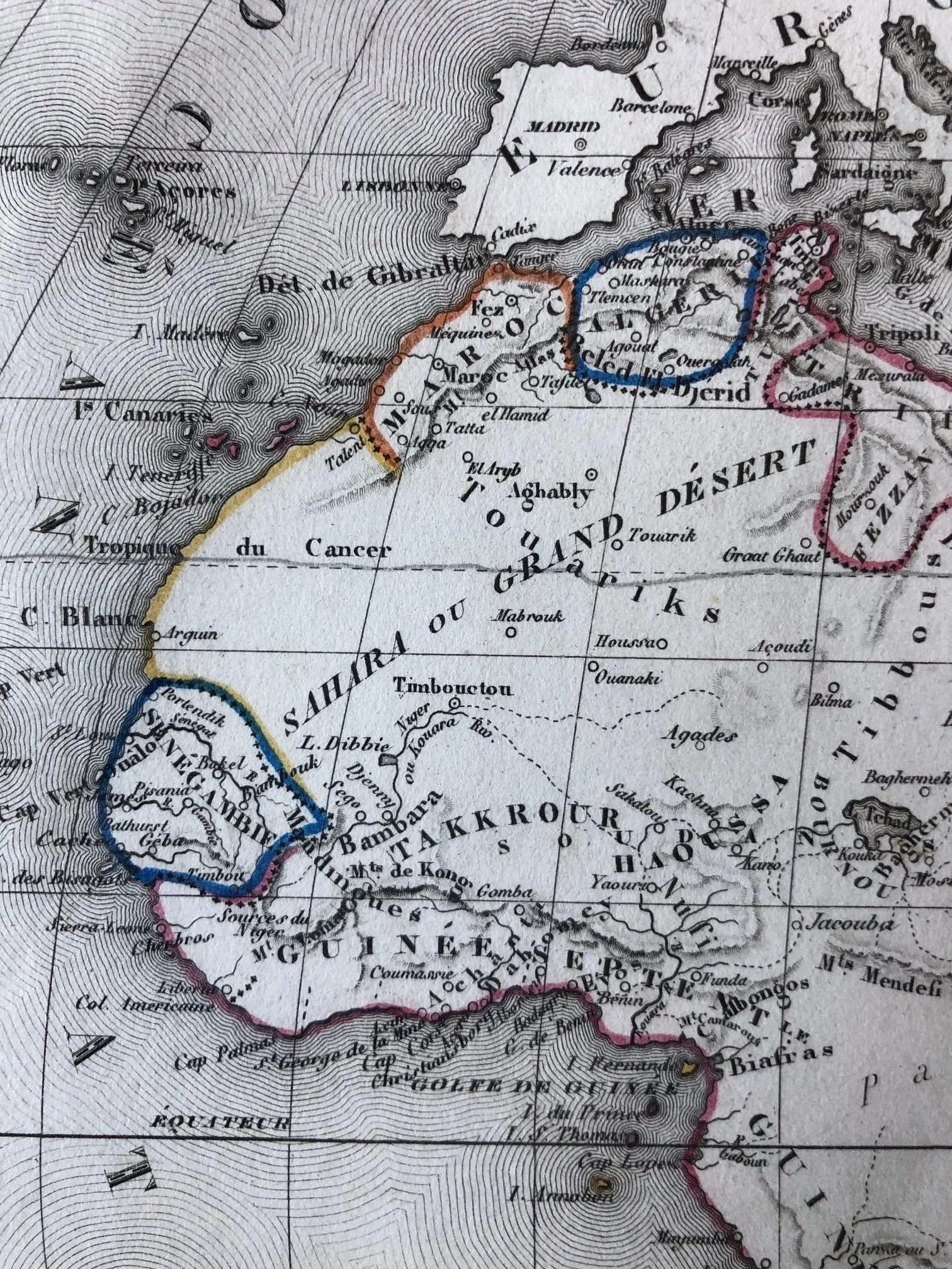
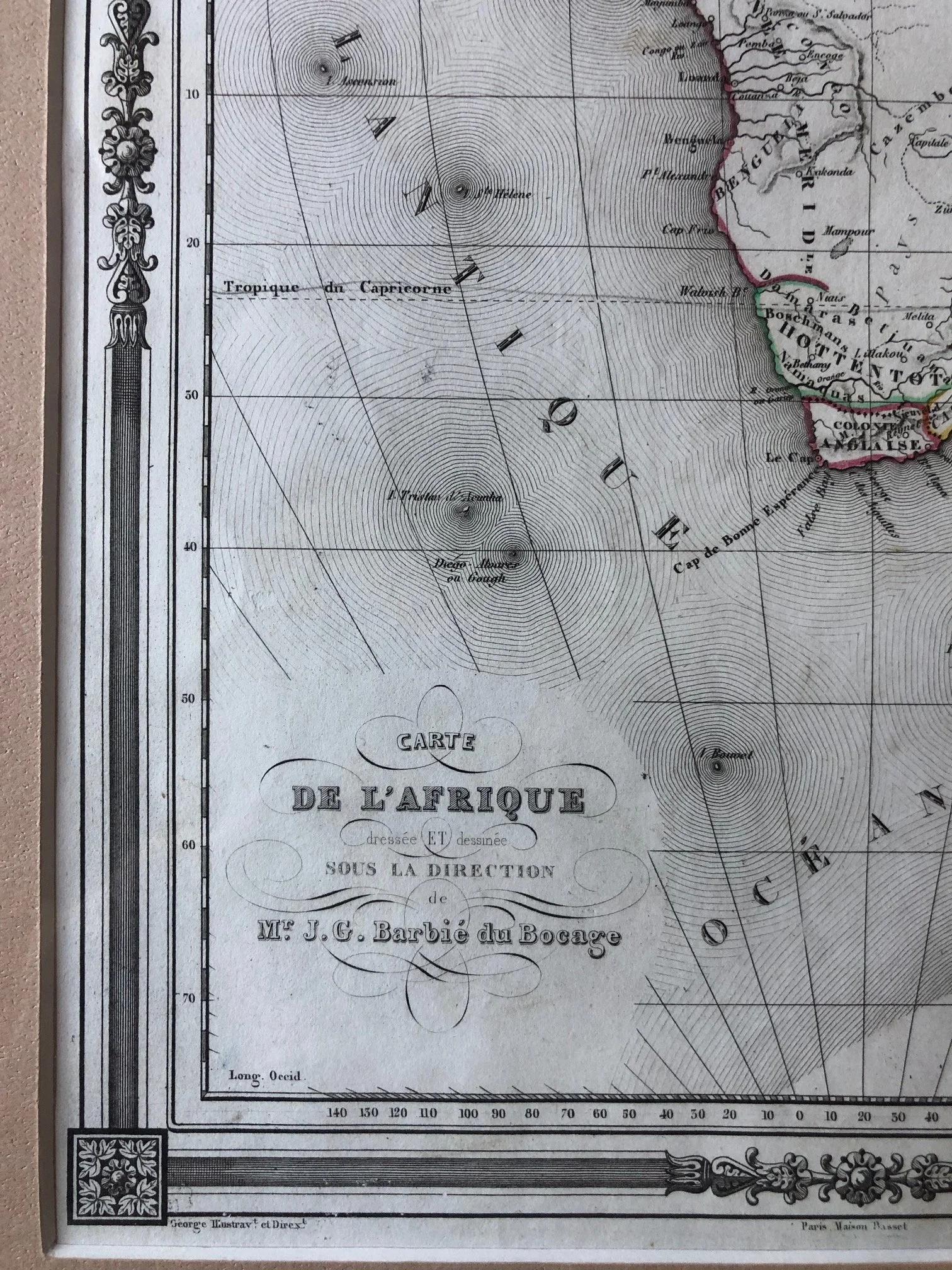
This 19th-century French map of Africa, produced under the direction of the prominent cartographer Jean-Denis Barbié du Bocage (as seen in the cartouche), contains a fascinating mix of accurate coastal geography and legendary cartographic blunders.
The Mythical "Mountains of Kong"
If you look closely at the West African interior (just below the word Takkrour and above Guinee), you will see a mountain range labeled Mts. de Kong.
The History: The Mountains of Kong are one of the greatest geographical hoaxes in history. First established on a map by English cartographer James Rennell in 1798, they were believed to be a massive, unbroken mountain range stretching across West Africa.
The Reality: They didn’t exist at all. For nearly a century, mapmaker after mapmaker copied the error from one another without verification. It wasn't until 1889, when French explorer Louis-Gustave Binger actually traveled to the region, that the mountains were officially proven to be a myth and finally removed from world maps.
"Pays Inconnus" (The Unknown Lands)
Spanning right across the entire center of the continent is the massive label Pays Inconnus.
The History: This blank space reflects Africa before the "Scramble for Africa" and the late-19th-century European expeditions. While coastal trading posts had been established for centuries by Europeans, Arabs, and local kingdoms, the deep interior remained completely unmapped and speculative to European cartographers. Instead of filling it with mythical creatures or kingdoms (as medieval mapmakers did), 19th-century mapmakers took a more scientific—but brutally honest—approach by simply labeling it "Unknown."
"Colonie Anglaise" and Local Tribes
At the southern tip of Africa, the map shows the Colonie Anglaise (Cape Colony under British rule) bordered by territories labeled Hottentots and Cafrerie (Caffraria). These terms reflect the colonial-era terminology used by Europeans to classify the indigenous Khoikhoi and Xhosa populations before the borders of modern South Africa were fully drawn.
250mm x 330mm
Hand coloured copperplate engraving.
R2,500