Antique and vintage maps of Southern Africa, including Angola, Botswana, Lesotho, Malawi, Mozambique, Namibia, South Africa, Eswatini (formerly Swaziland), Zambia, and Zimbabwe.
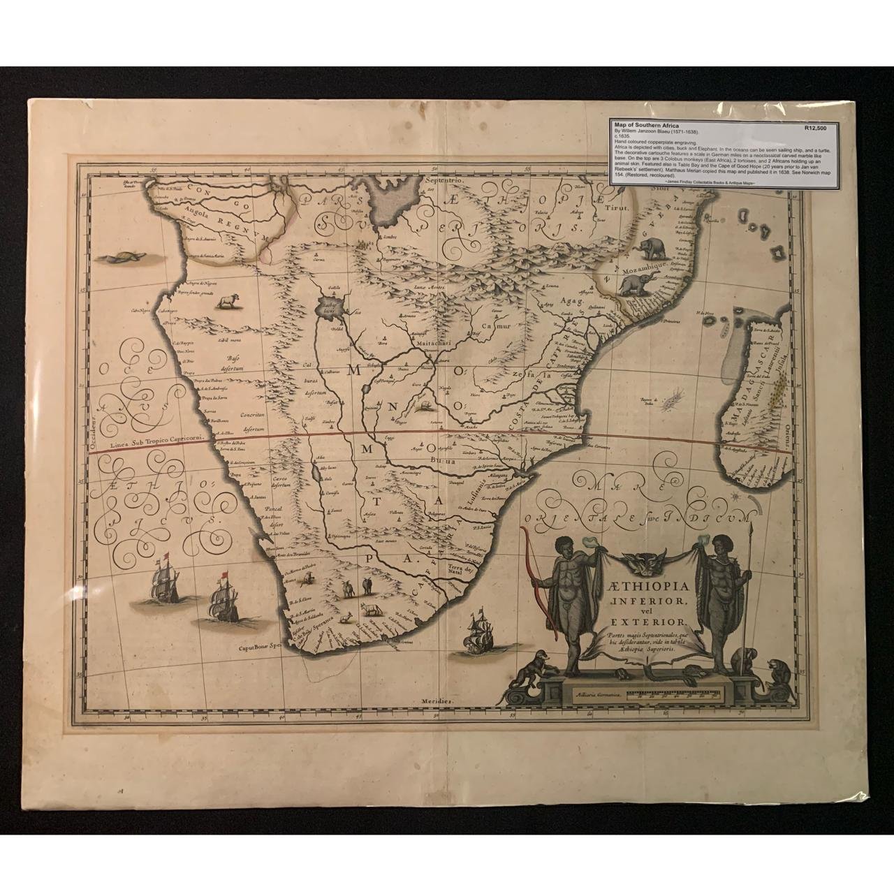
Blaeu Map of Southern Africa, unrestored (1635) R12,500
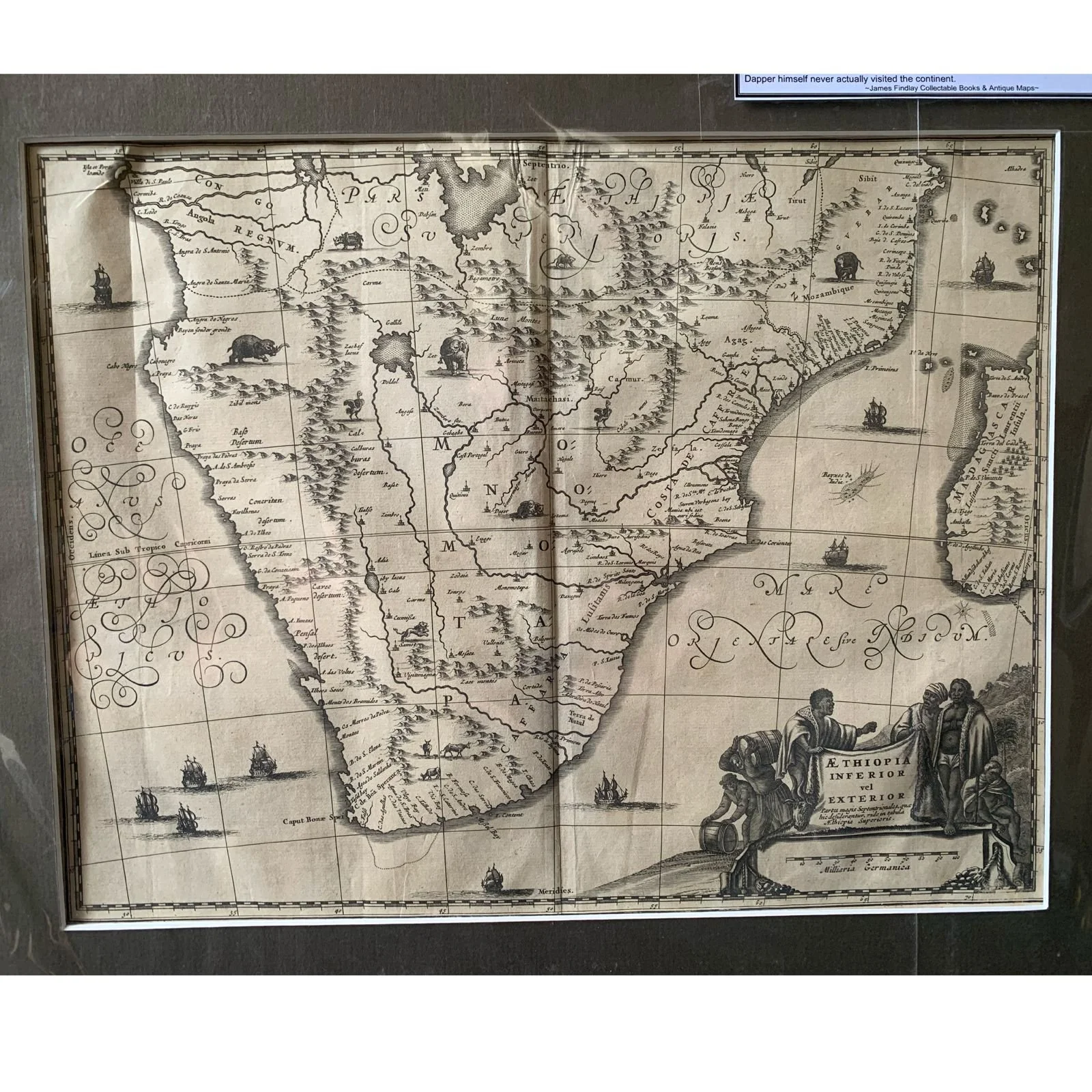
Lower & Exterior Ethiopia by Olfert Dapper (1670) R12,500

A New Map of the Southern Parts of Africa by Emanuel Bowen (c.1747 ) R10,000
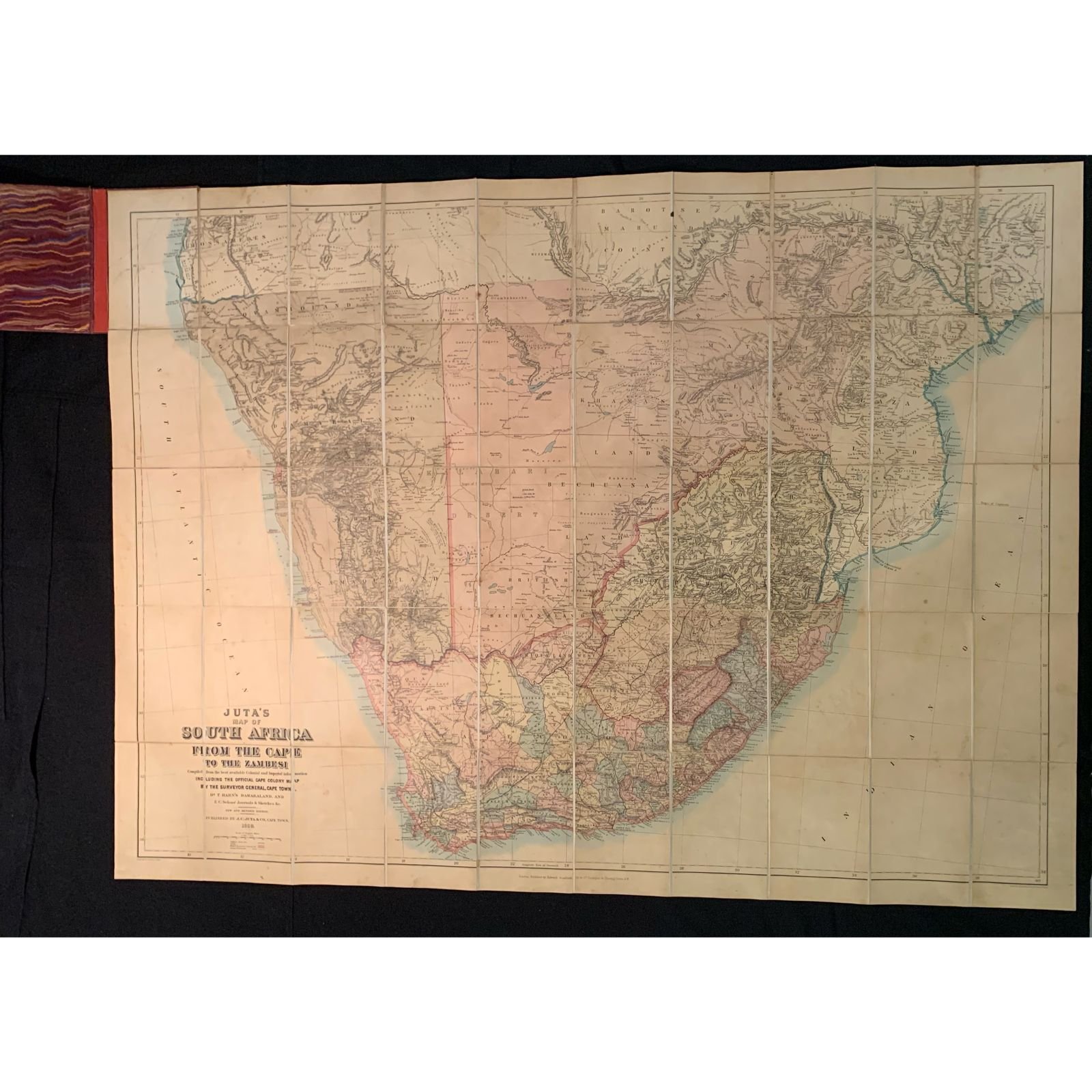
Juta’s Map of South Africa From the Cape to the Zambesi (1889) R10,000

Southern Africa by Petrus Bertius (c.1618) R7,500

Carte du Pays des Bassoutos (Map of the Basotho Country) by Hamilton Moore Dyke (1847) R7,500

Map of The Cape of Good Hope & Natal (c.1858) R5,000
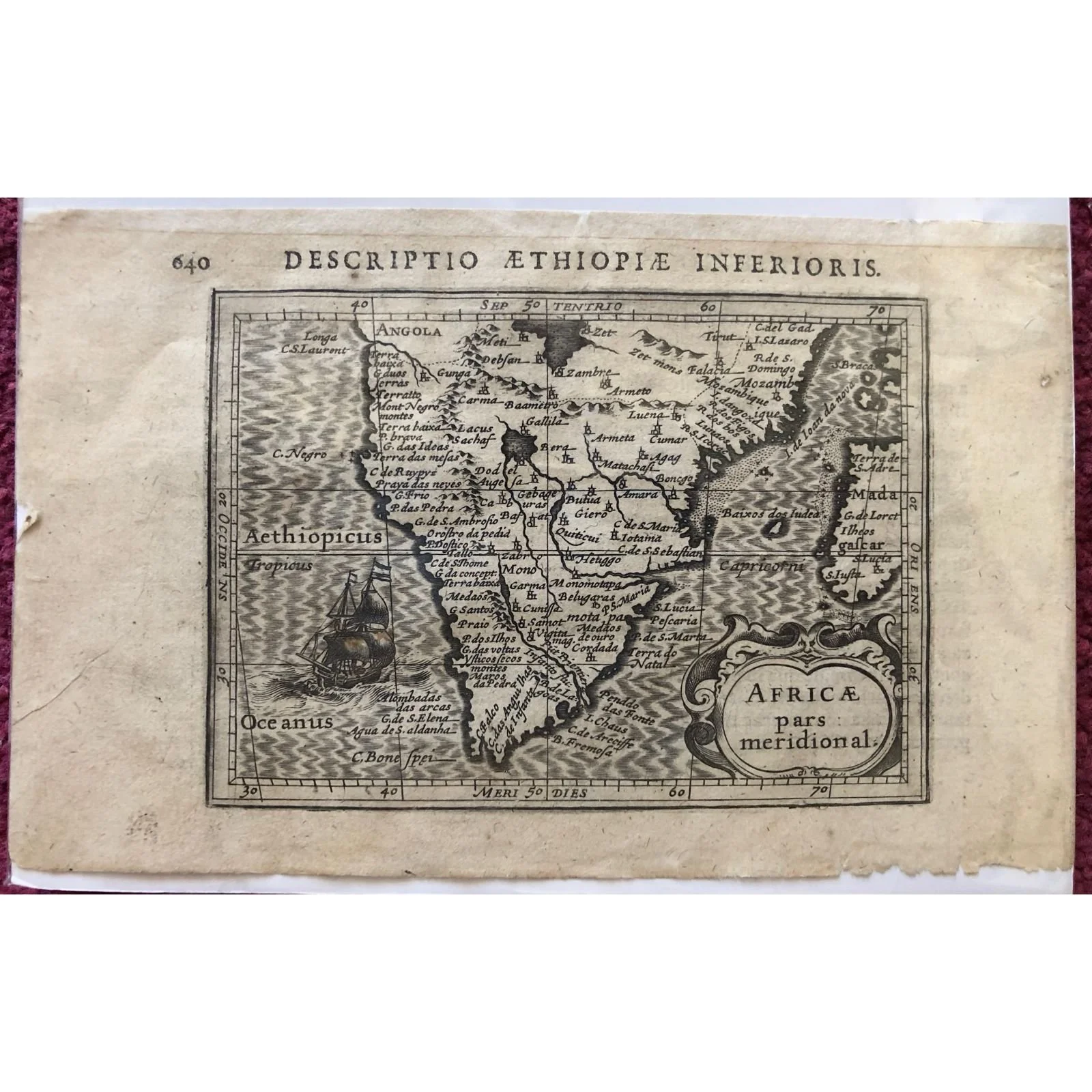
Southern Africa by Petrus Bertius (c.1618) R4,500

Le Canal De Mosambique by Rigobert Bonne (c.1780) R4,500
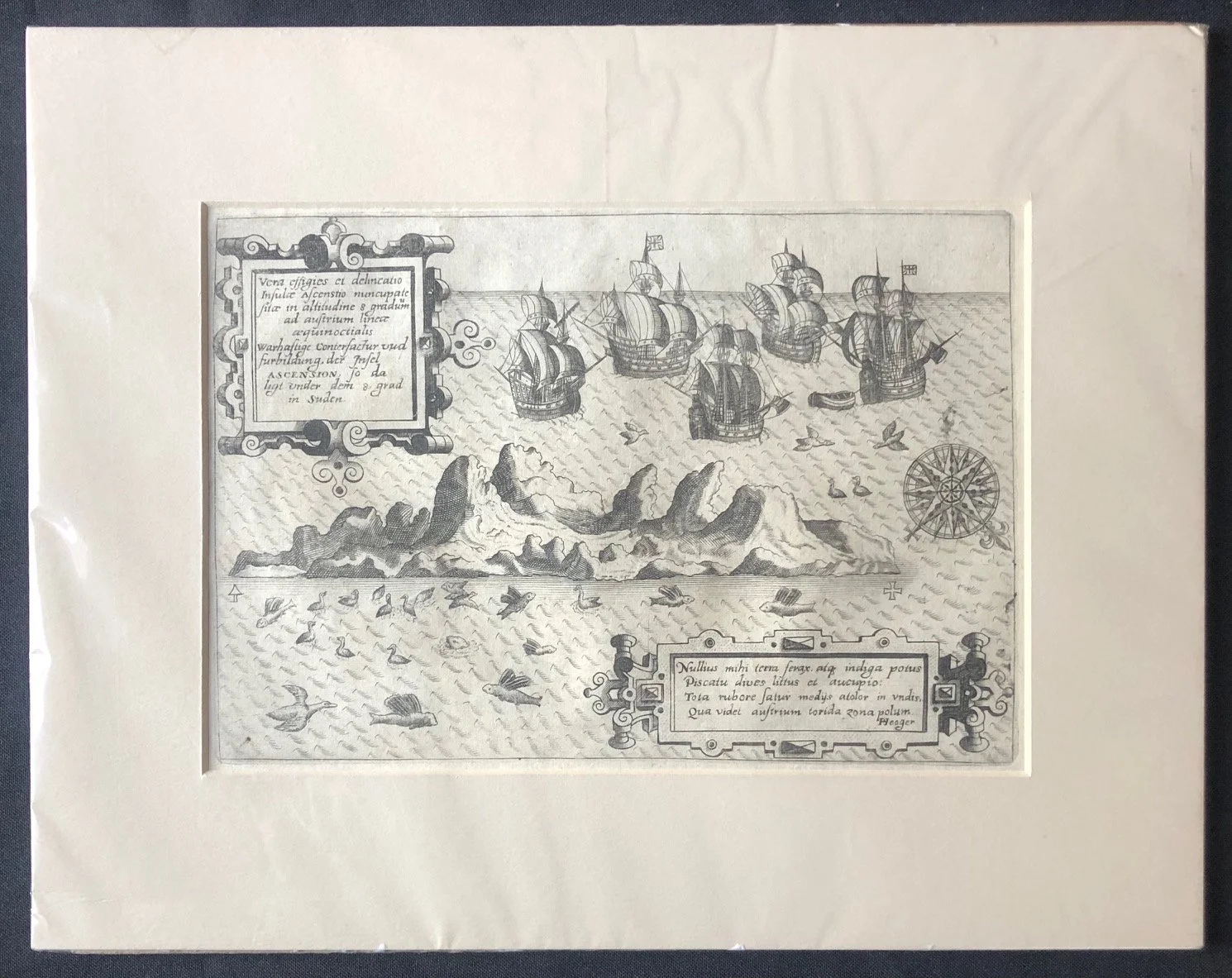
Engraving of Ascension Island by Jan Huyghen van Linschoten (c.1598) R3,000
Map of Southern Africa, Annexation of the ZAR (c.1881) R3,000

Coast of South Africa, Namibia and Angola (c1757) R2,500

Carte des Isles Maldives (1750) R1,500

Part of the East Coast of Africa with the Island of Madagascar (1784) R1,500

Map Illustrating the Journey of Major Serpa Pinto from Benguella to Natal (1879) R1,250
