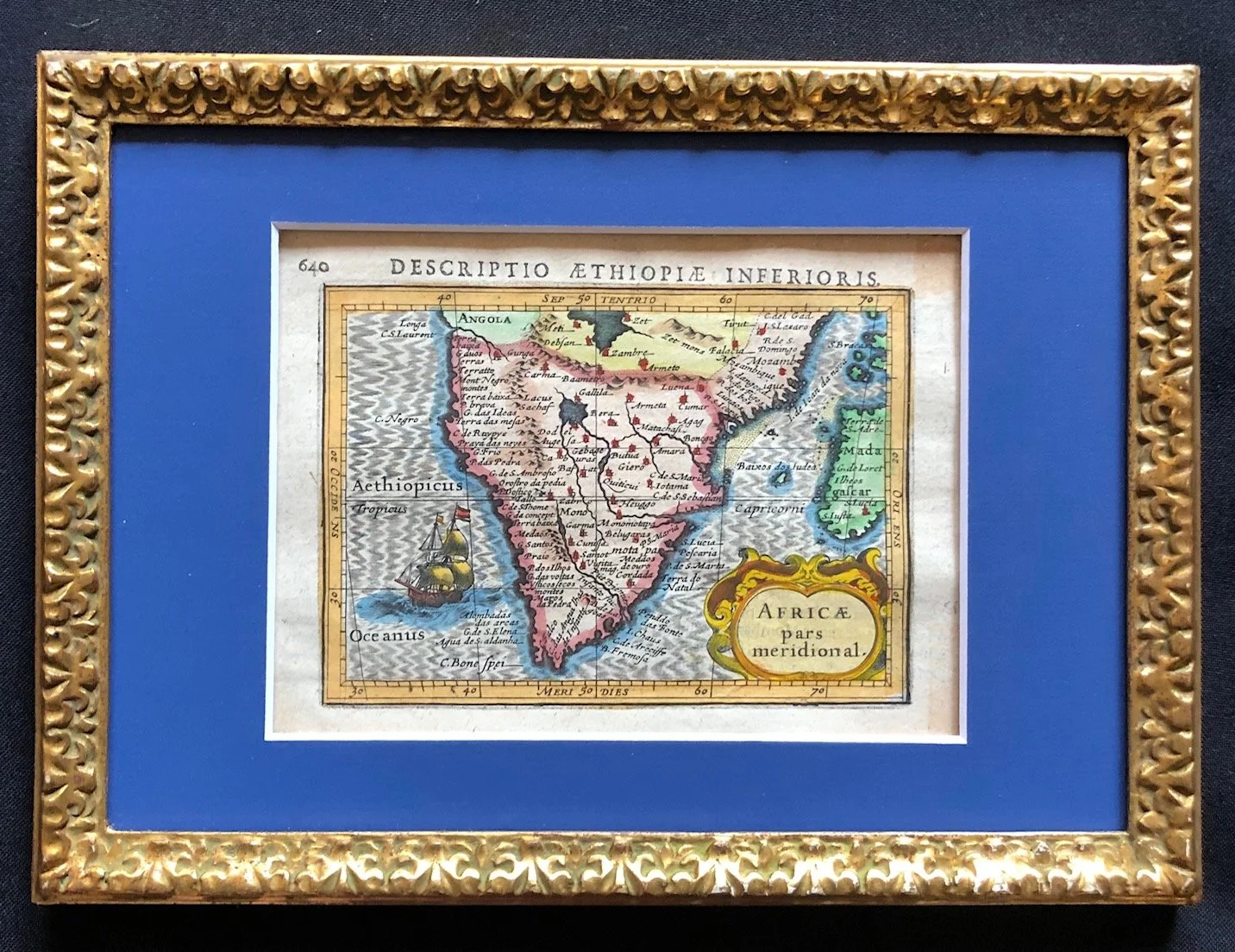
Southern Africa by Petrus Bertius c.1618 (Archival framing)
Hand coloured copperplate engraving by Petrus Bertius (1565-1629).
Bertius was a Flemish theologian, mathematician, and royal cartographer to Louis XIII of France. He was brother-in-law to both Jodocus Hondius and Pieter van den Keere, two of the finest engravers of the era.
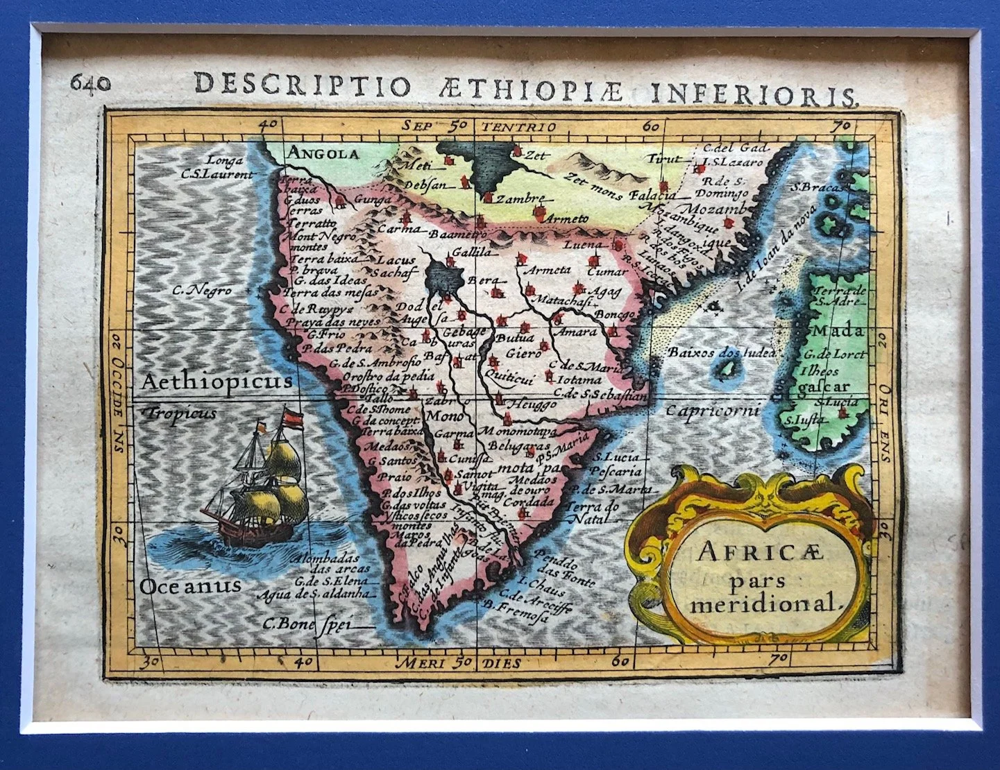
This is an exceptional example of early 17th-century miniature cartography. This is the "Africa pars meridional" (Southern Africa) plate, under the header "Descriptio Æthiopiæ Inferioris", engraved by Petrus Bertius (Pieter Bert) for his celebrated pocket atlas, the Tabularum Geographicarum Contractarum.
Given the page number 640 visible in the top-left corner, this specific leaf comes from the 1616 Latin edition published in Amsterdam by Jodocus Hondius.
The maps in this edition are celebrated for their remarkably crisp, detailed engraving despite their tiny size.
The Cartographer and the "Pocket Atlas" Boom
At the turn of the 17th century, Amsterdam was experiencing a golden age of mapmaking. While grand, folio-sized atlases by Mercator and Ortelius were luxury showpieces for the wealthy, a massive market emerged for compact, "pocket" versions.
A Snapshot of the Cape Before Permanent Settlement
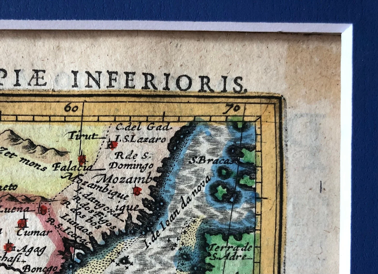
Because this map was published in 1618—more than three decades before Jan van Riebeeck arrived in 1652—the coastal nomenclature relies almost entirely on Portuguese maritime exploration rather than Dutch or English names:
C. Bone Spei: At the very tip, you can see the classic rendering of the Cape of Good Hope.
Agua de S. Aldanha: Just above it on the west coast is a reference to Saldanha Bay (originally named after António de Saldanha, though the name later shifted down the coast from modern-day Table Bay).
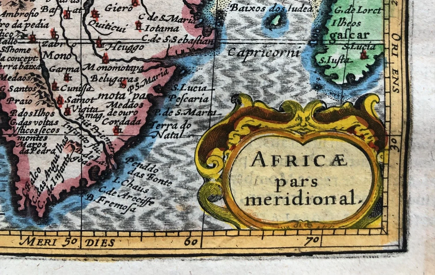
Terra do Natal & Infanto flu.: On the east coast, you can see the "Land of Christmas" (Natal, named by Vasco da Gama) and the Rio do Infante (Great Fish River).
The interior geography is where early African cartography gets incredibly wild and fascinating. Because Europeans had not penetrated the interior, cartographers relied on Ptolemaic tradition, rumors, and sheer imagination to fill the blank spaces:
"Æthiopia Inferior": In the 17th century, "Ethiopia" did not just refer to the modern Horn of Africa; Aethiopia Inferior (Lower Ethiopia) was the standard European term for the entire southern half of the African continent.
The Great Lakes Myth: Look closely at the top center. You will see Lacus Sachaf and Zambre, with a massive river system flowing northward. This reflects the deep-seated contemporary belief that the Nile, the Congo, and the Zambezi rivers all originated from a shared, massive central lake network in the heart of Africa.
The Empire of Monomotapa: Scattered across the interior are fictional kingdoms and towns like Monomotapa, Butua, and Vigiti Magna. Monomotapa (Mutapa) was an actual historic Shona kingdom in modern-day Zimbabwe, but European mapmakers romanticized it into an El Dorado-like empire of golden cities, shifting its borders far down into the Kalahari and Karoo regions.
Despite the miniature scale, Bertius and Hondius didn't skimp on the classic elements of the Dutch Golden Age style:
The Galleon: A prominent European ship braves the Aethiopicus Oceanus (South Atlantic), complete with a hand-colored flag.
The Cartouche: The title "AFRICÆ pars meridional" is nestled inside a beautiful, classic strapwork border with yellow and red hand-coloring that mimics hammered gold and enamel work.
Slightly mellowed paper; stain top right.
198mm x 120mm
R7,500