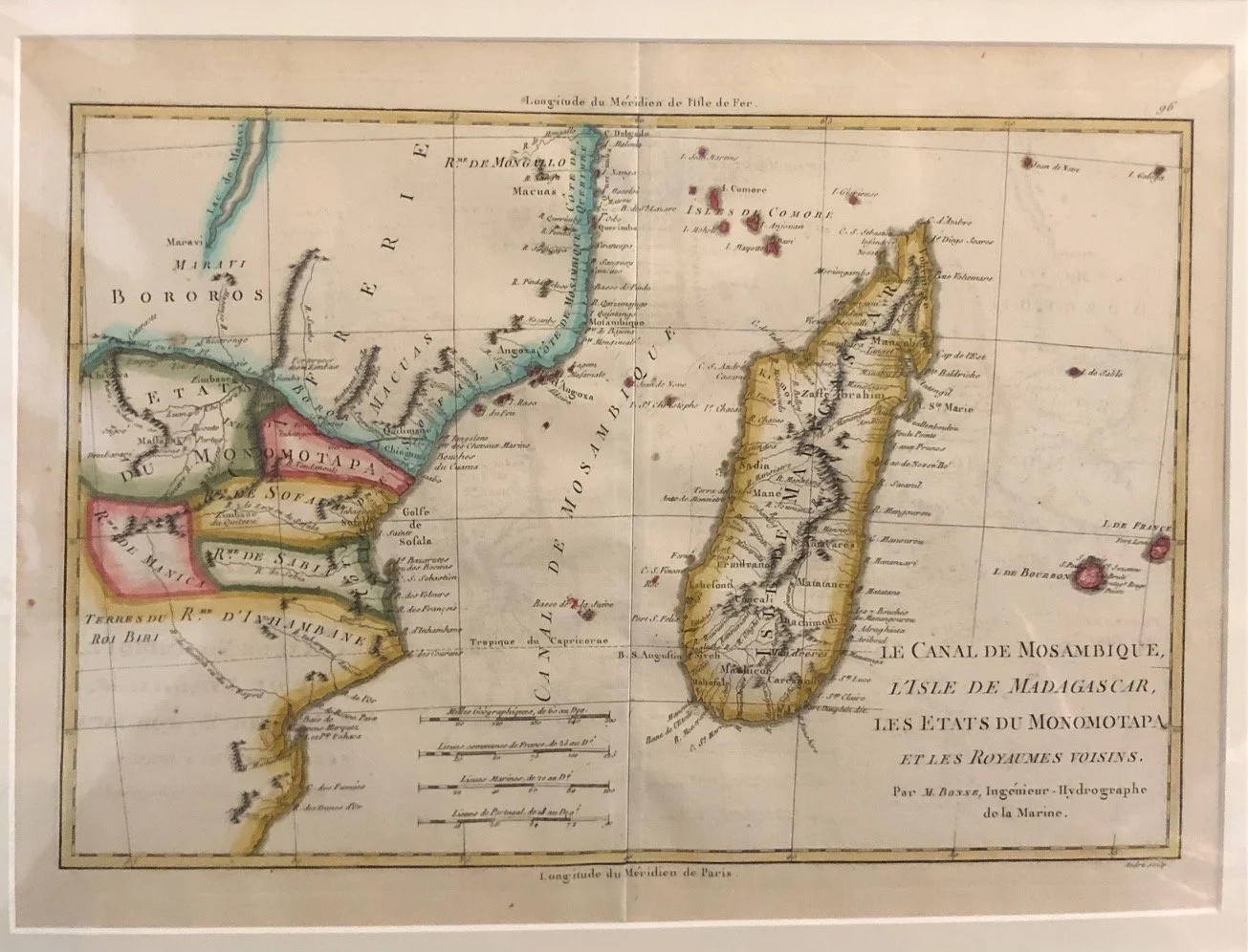
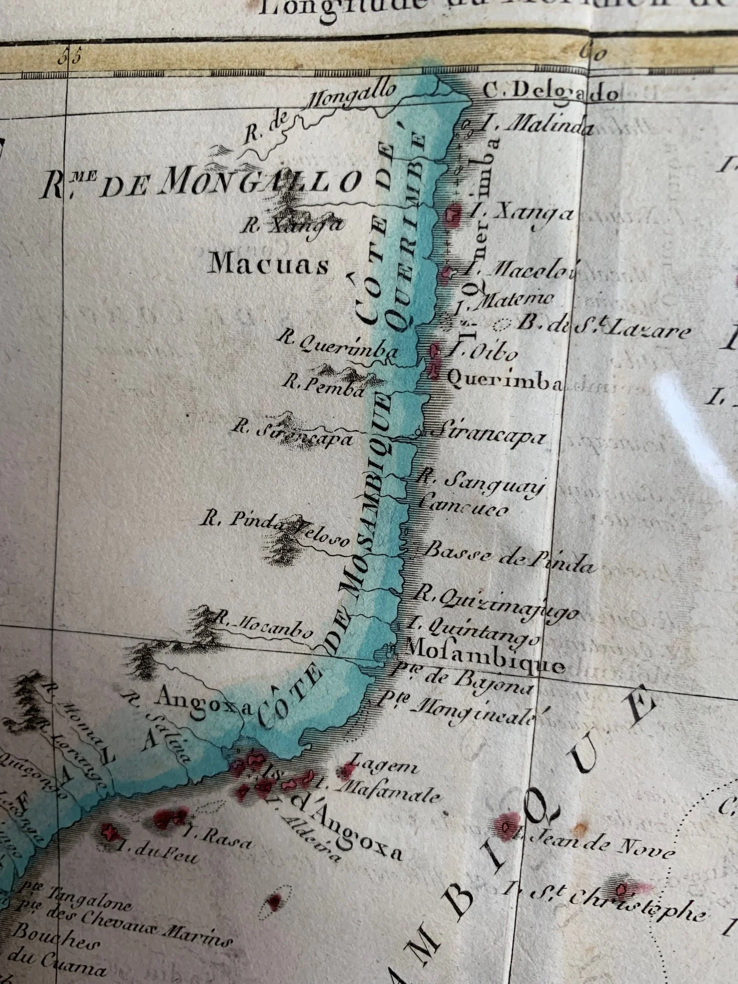
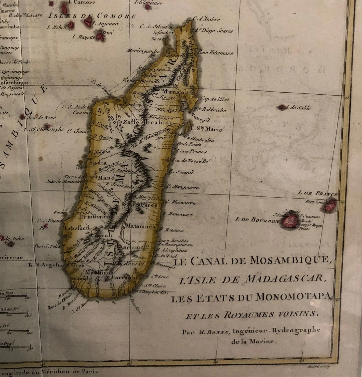
Le Canal De Mosambique, L’Isle De Madagascar, Les Etats Du Monomotapa et les Royaumes Voisins by Rigobert Bonne (c.1780)
This map of the Swahili Coast is by Rigobert Bonne (c.1780) capturing the Mozambique Channel, Madagascar, and the southeastern coast of the African mainland.
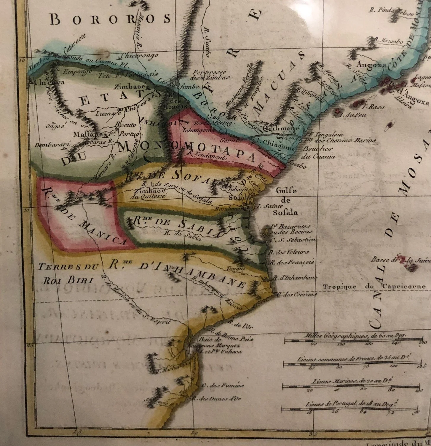
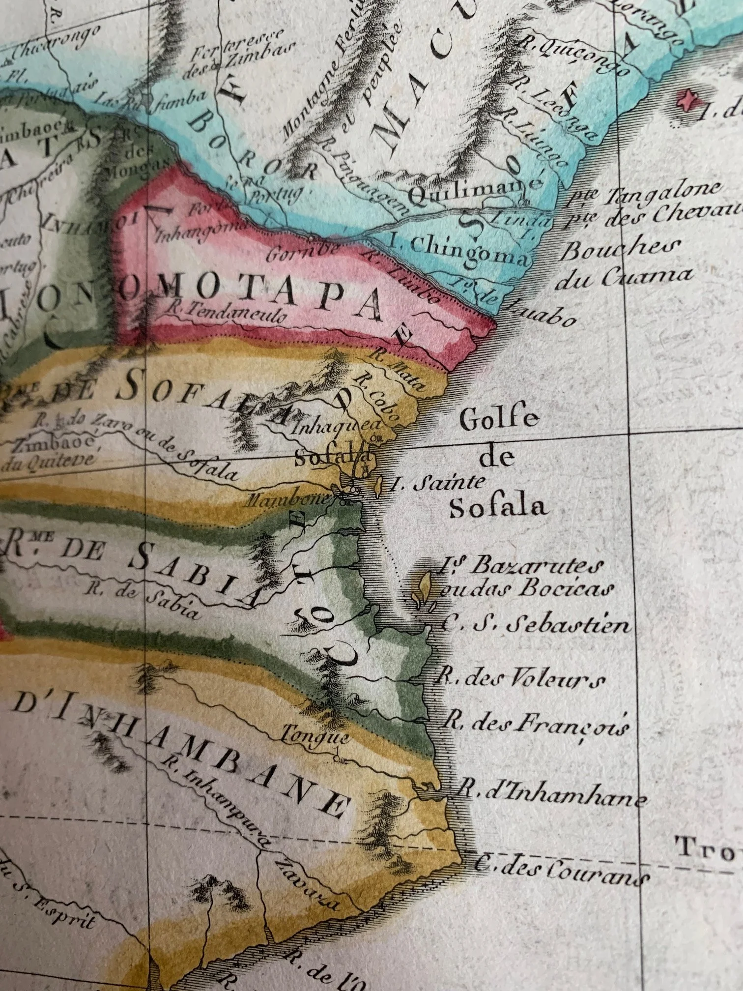
The Ghost of Zimbabwe: L'Etat du Monomotapa
On the mainland (present-day Zimbabwe and Mozambique), Bonne prominent maps "Les Etats du Monomotapa" (The Mutapa Empire) and "Rme. de Sofala".
• By 1780, the historic Mutapa Kingdom—the great Shona successor state to Great Zimbabwe—had largely collapsed under the weight of internal civil wars and Portuguese military incursions.
• This map captures a classic cartographic phenomenon where European mapmakers continued to print the grand titles of legendary African empires long after those empires had fractured on the ground, partly because their interior intelligence relied on outdated 16th and 17th-century Portuguese chronicles.
The Great Inland Sea: Lac de Maravi
In the upper-left corner, you can see a long, narrow body of water labeled "Lac de Maravi" with the note "on ne connait pas l'etendue" (its extent is unknown).
• This is a fascinating pre-colonial depiction of Lake Malawi (Lake Nyasa).
• For nearly a century before British explorer David Livingstone "discovered" the lake for the Western world in 1859, European hydrographers knew something massive was inland based on reports from Swahili and Yao trade routes. Bonne accurately captures its orientation but leaves the northern tip completely open, showcasing that empirical restraint where he refuses to guess what he cannot prove.
Madagascar's Pirates and the "Zaffe Ibrahim"
Look closely at the northeastern coast of Madagascar, near the island of St. Marie. Bonne notes regional ethnic or political divisions like "Zaffe Ibrahim" (Zafy Ibrahim).
• During the late 17th and early 18th centuries, this exact northeastern coast and Île Sainte-Marie were notorious global hubs for piracy. Figures like Captain Avery and Thomas Tew operated out of here, capitalizing on the nearby shipping lanes of the East India Companies.
• By 1780, the piracy golden age had waned, but the region was undergoing a massive consolidation under the Betsimisaraka Confederation, heavily fueled by trade with the French.
The Stepping Stones to India: Bourbon and Isle de France
On the far right edge of the map, you can see I. de Bourbon (Réunion) and I. de France (Mauritius).
• In 1780, these islands were absolutely vital to the French Navy and the French East India Company. They served as crucial military staging grounds and replenishment stations for French fleets competing against the British for dominance over India.
• Isle de France (Mauritius) in particular was a highly strategic naval base under the governorship of figures like Mahé de La Bourdonnais. The map beautifully illustrates how French hydrographers viewed Madagascar and the Mozambique Channel—not just as landmasses, but as the critical maritime highway guarding their route to the East.
Very slight offsetting and surface wear.
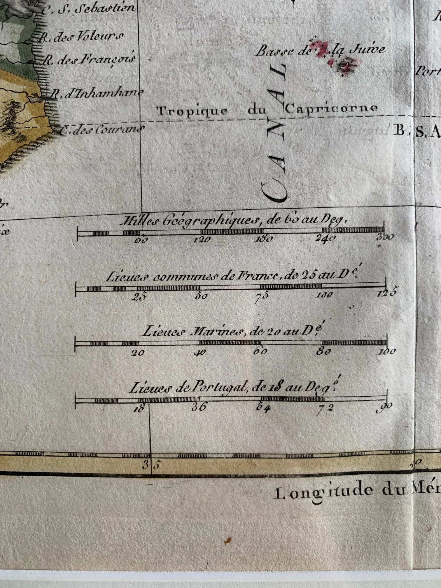
270mm x 370mm
R4.500