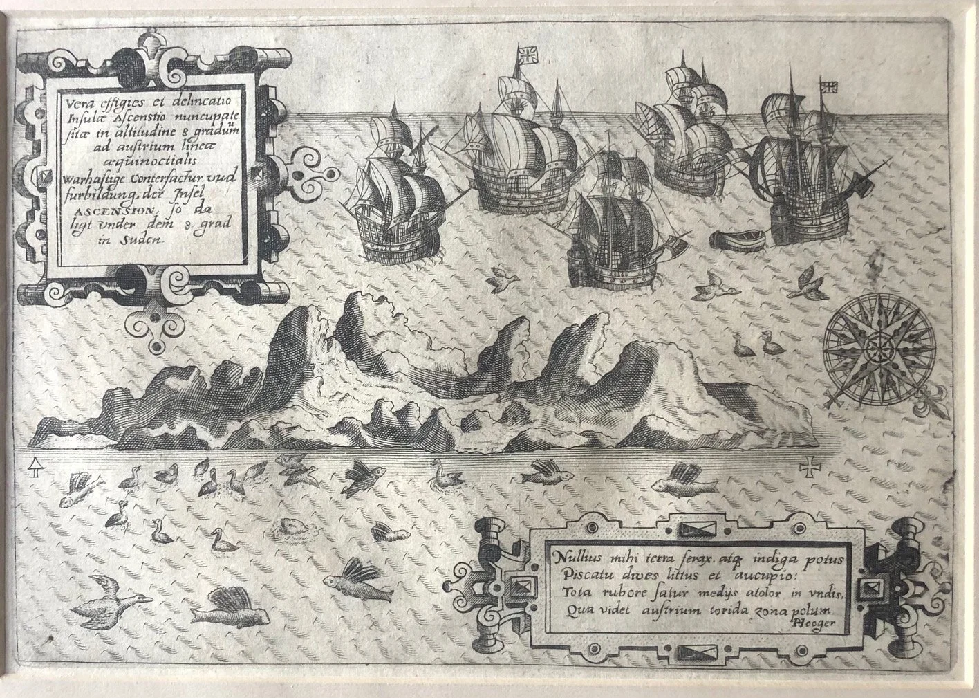
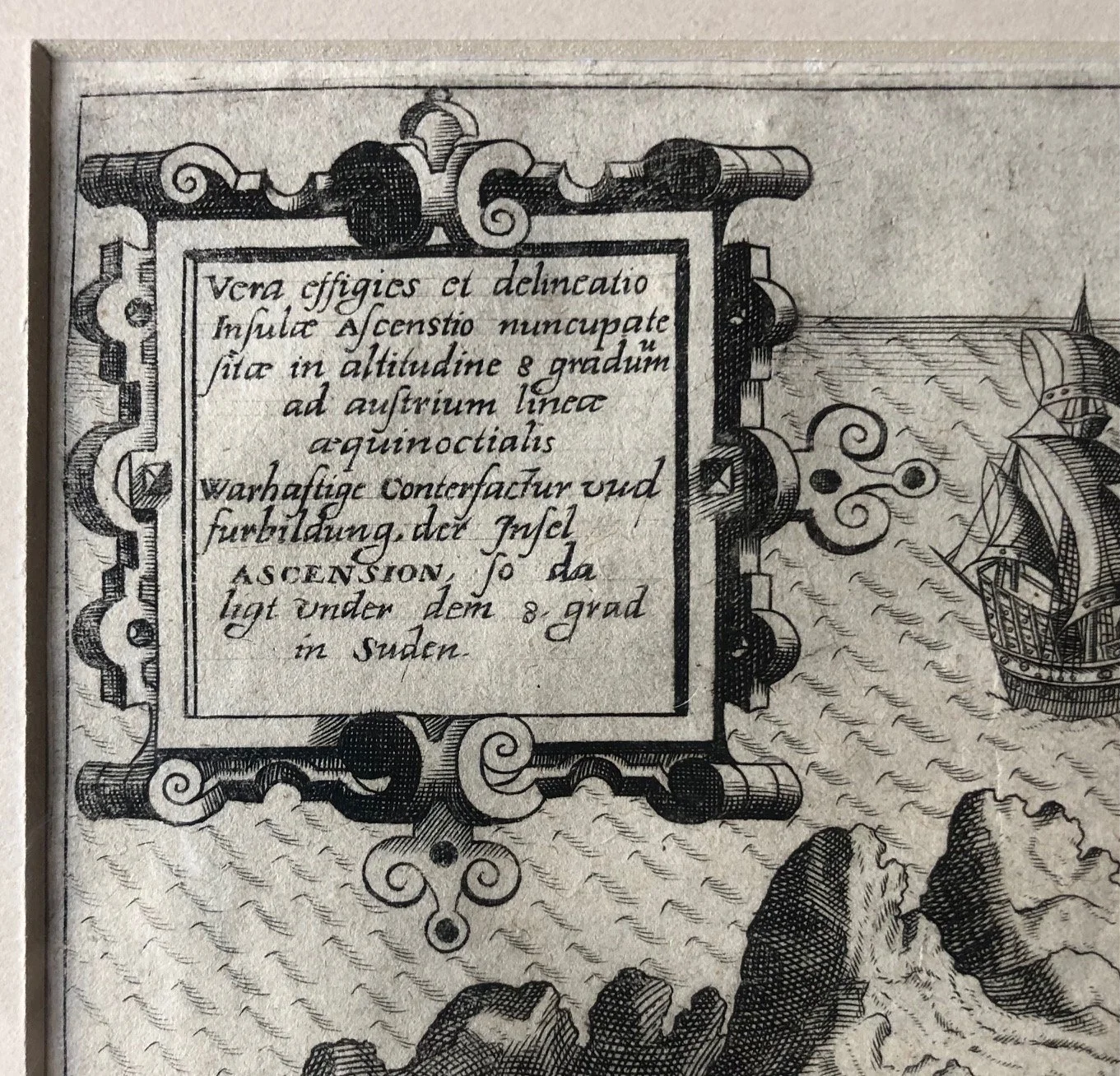
Engraving of Ascension Island, by Jan Huyghen van Linschoten (c.1598)
Copperplate engraving.
This engraving is a depiction of Ascension Island, originally drawn by the Dutch explorer and merchant Jan Huyghen van Linschoten for his monumental travelogue, the Itinerario (first published in 1596). This specific, slightly smaller plate with bilingual text (Latin and German) in the cartouches was engraved by Theodore de Bry for his famous collection of voyages, Petits Voyages (Indiae Orientalis), beginning around 1598.
The Ultimate Act of Corporate Espionage
The information that allowed this map to be printed was essentially stolen. Van Linschoten spent years serving as the secretary to the Portuguese Archbishop of Goa in India. While holding this position of immense trust, he secretly copied highly guarded, top-secret Portuguese maritime charts, pilot guides (roteiros), and commercial data page by page.
When he returned to the Netherlands and published his findings alongside maps like this one, he shattered the century-long Portuguese monopoly on the trade routes to the East Indies. The Itinerario became the literal blueprint that allowed the Dutch and British East India Companies (VOC and EIC) to launch their empires.
The Atlantic "Post Office" and Provisioning Stop
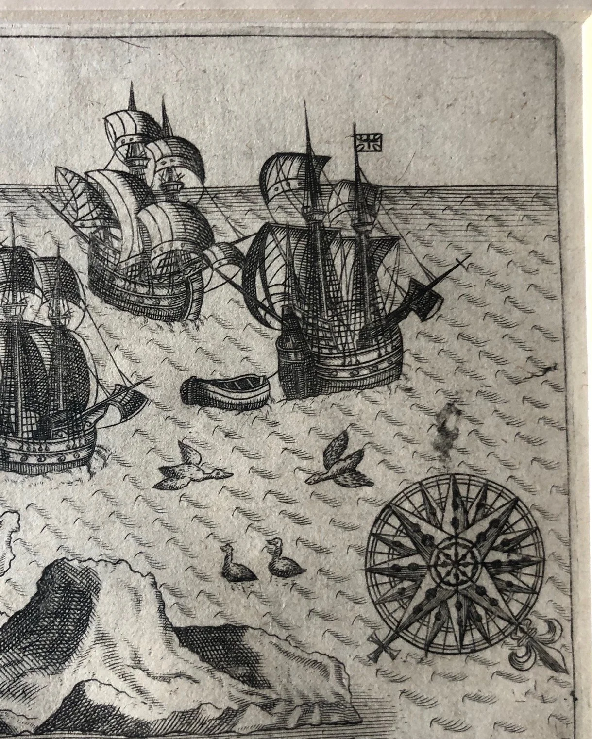
The map illustrates a returning spice fleet navigating past the barren volcanic peaks of Ascension Island. Because the island was isolated in the middle of the South Atlantic, it served two vital geopolitical purposes during the Age of Sail:
The Post Office: Passing sailors would leave letters tucked under specific rocks or trees, which would then be collected and carried home by vessels traveling in the opposite direction.
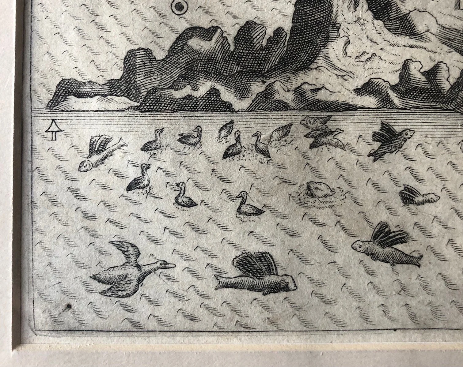
The Fleet Larder: As beautifully animated at the bottom of the print by the abundance of seabirds and unique flying fish, Ascension was crucial for fresh rations. Sailors anchored here primarily to hunt green sea turtles and catch fish to combat scurvy on the grueling journey back to Europe.
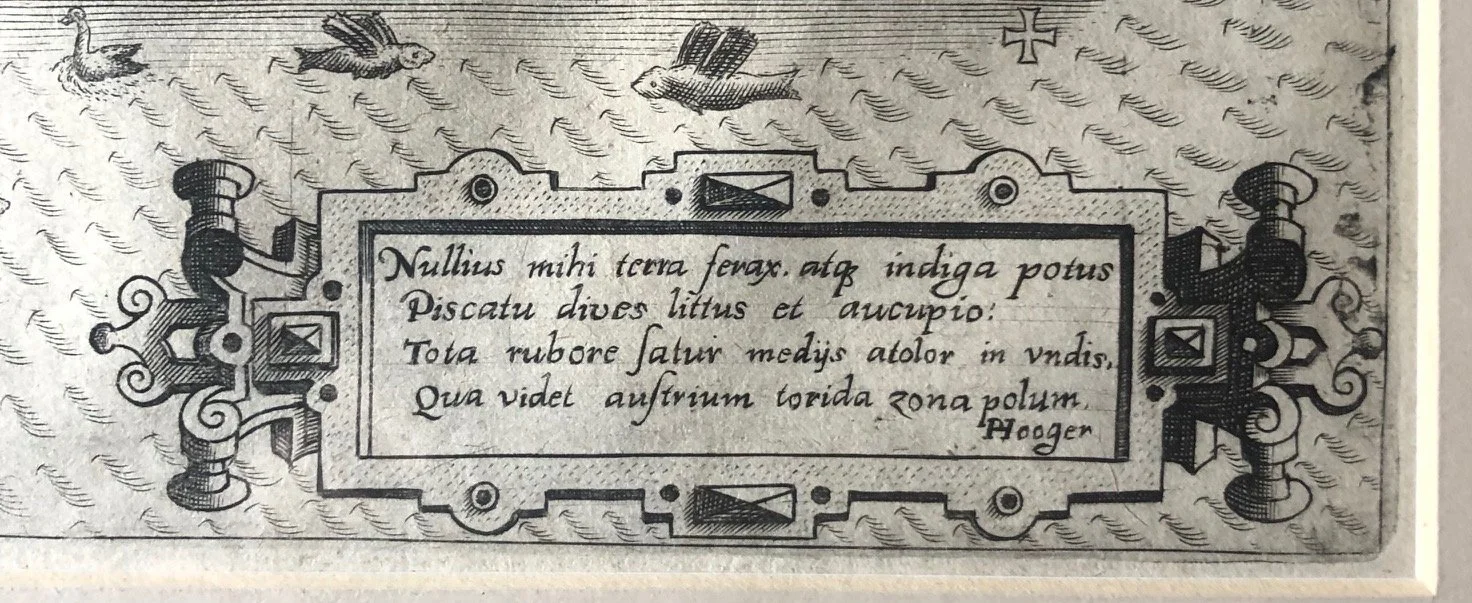
The Poetic Riddle
The bottom-right cartouche features an elegiac Latin verse penned by the Dutch scholar Bernardus Paludanus (a close friend of Linschoten). Writing from the perspective of the island itself, the text opens with:
"Nullius mihi terra ferax, atque indiga potus..."
(To no one am I a fertile land, and I am in want of water...)
It goes on to boast that despite its arid, barren, and volcanic nature ("tota rubore satur"—completely filled with redness), it is rich in fish and fowl, standing proudly in the middle of the burning southern waves as an essential beacon for weary sailors.
Very good condition.
Plate size: 230mm x 162mm
R3,000