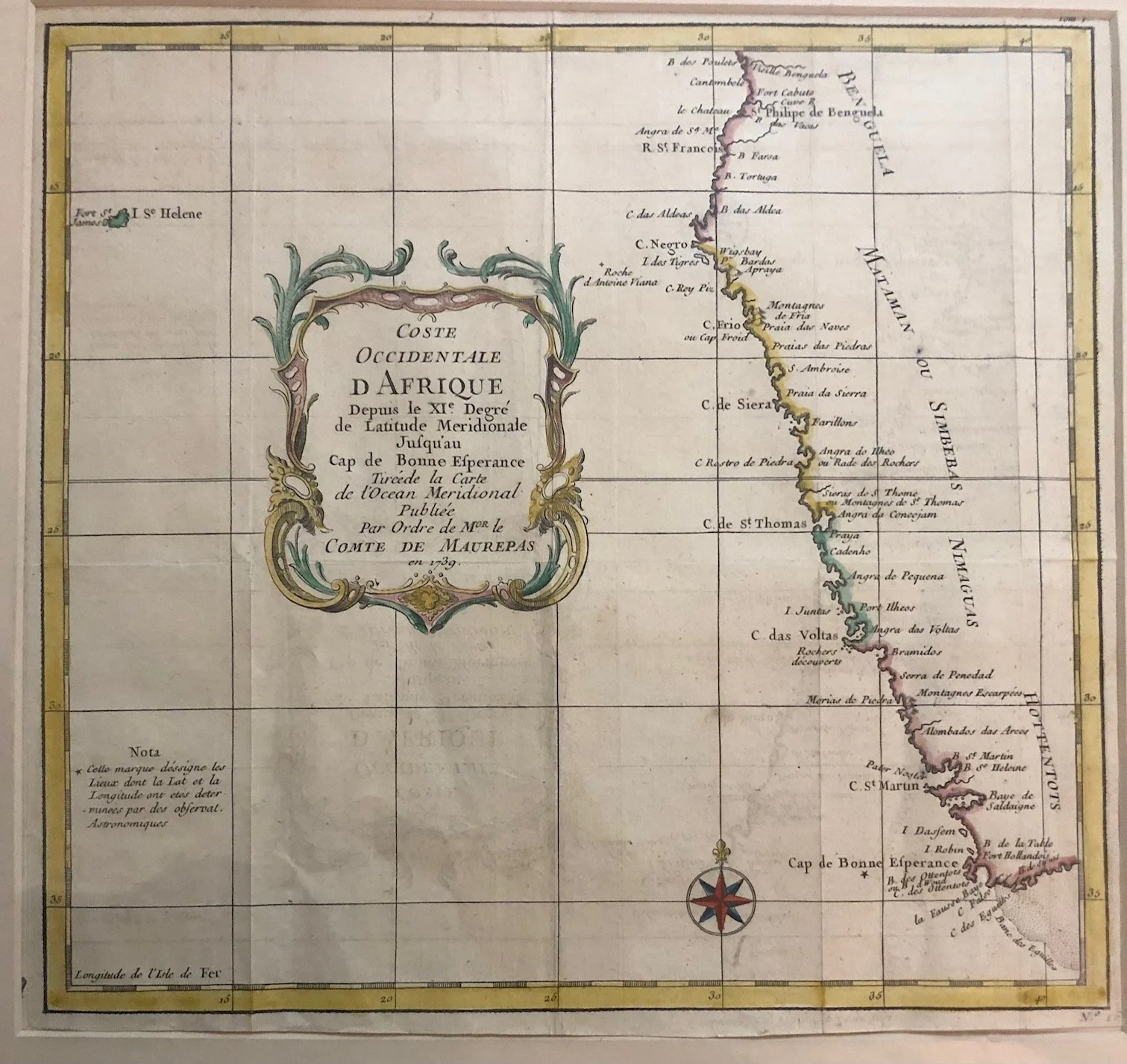
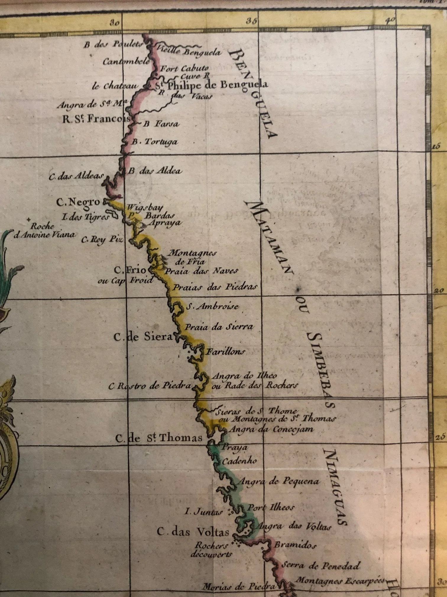
Coast of South Africa, Namibia and Angola (c.1739)
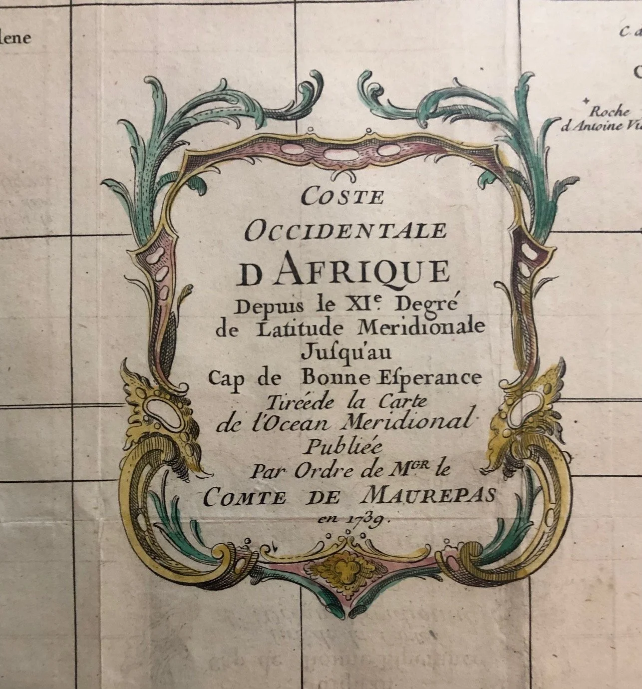
COSTE OCCIDENTALE D AFRIQUE Depuis le XI° Degré de Latitude Meridionale Jusqu'au Cap de Bonne Esperance Tiréede la Carte de l'Ocean Meridional Publiée par ordre de Mgr. le Comte de Maurepas en 1739
By Jacques-Nicolas Bellin (1703-1772)
Published in Paris.
Hand coloured copperplate engraving.
Bellin was among the most important mapmakers of the eighteenth century. In 1721, at only the age of 18, he was appointed Hydrographer to the French Navy.
In August 1741, he became the first Ingénieur de la Marine of the Dépôt des cartes et plans de la Marine (the French Hydrographic Office) and was named Official Hydrographer of the French King.
275mm x 255mm
R2,500