"Carte des Isles Maldives" by Jacques-Nicolas Bellin (1750)
Hand coloured copperplate engraving.
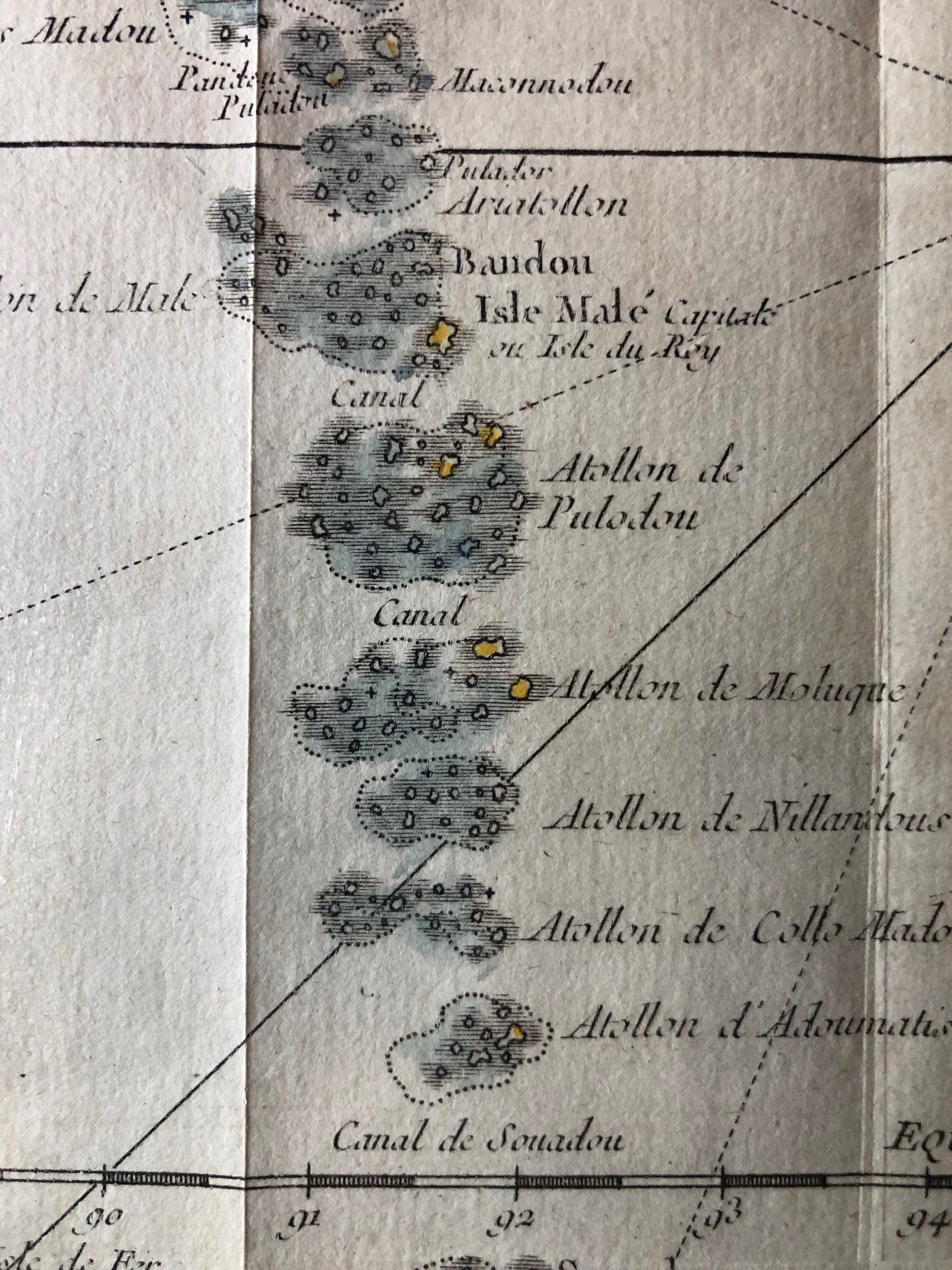
This original antique map is a mid-18th-century French copperplate engraving titled "Carte des Isles Maldives", dated 1750. It was produced by the preeminent French Royal Hydrographer Jacques-Nicolas Bellin for Abbé Prévost’s monumental Histoire Générale des Voyages.
Beyond its striking decorative cartouche and prominent compass rose, this chart captures several fascinating chapters in maritime and colonial history:
The Perilous Needle of the Indian Ocean
For 18th-century sailing vessels navigating between Europe, Africa, and the East Indies, the Maldives were both a critical milestone and a terrifying navigational hazard. Spanning nearly 900 kilometers north-to-south but rising barely a few meters above sea level, these low-lying atolls were virtually invisible until a ship was practically on top of them.
Bellin’s chart specifically emphasizes the major navigable gaps between the coral clusters, marking them with the word "Canal" (such as the Canal de Souadou near the equator). Finding these exact channels was a matter of life and death for captains trying to cross from the Arabian Sea into the Bay of Bengal without running aground on the treacherous reefs.
The Island of the King and the Cowrie Currency
Near the center of the chain, the map marks "Isle Malé, Capitale ou Isle du Roy" (Malé, Capital or Island of the King). During this period, the Sultanate of the Maldives maintained a delicate independence by playing European powers off one another, serving as a vital trading hub.
The most historically interesting commodity controlled from this "Island of the King" was the cowrie shell (Monetaria moneta). Extensively harvested from the shallow Maldivian lagoons, these shells were purchased in massive quantities by French, Dutch, and English traders. They were used as a global currency, tragically serving as the primary medium of exchange used by European merchants along the West African coast.
The Prime Meridian of "L'Isle de Fer"
If you look at the bottom left border, the longitude is explicitly labeled:
"Longitude de l'Isle de Fer" (Longitude from Ferro Island).
Before the international adoption of the Greenwich Meridian in 1884, nations chose their own starting points for longitude. Following a 1634 decree by King Louis XIII (on the advice of Cardinal Richelieu), French cartographers used El Hierro (Isla del Meridiano), the westernmost island of the Canaries, as the benchmark. This kept all of Europe in the Eastern Hemisphere and standardized French naval charts for over two centuries.
Maldivian Etymology Through a European Lens
The nomenclature used on the map highlights how early European hydrographers struggled to translate the local Dhivehi language. The map groups the northernmost islands under the name "Isles Divandorou". This is an early European corruption of Dhivehi Raajje (the Maldivian name for the Maldives) combined with Andaman or early regional trading terms, capturing the linguistic evolution of Western encounters with the Indian Ocean's complex geography.
Creased.
Plate size: 170mm x 245mm
R1,500