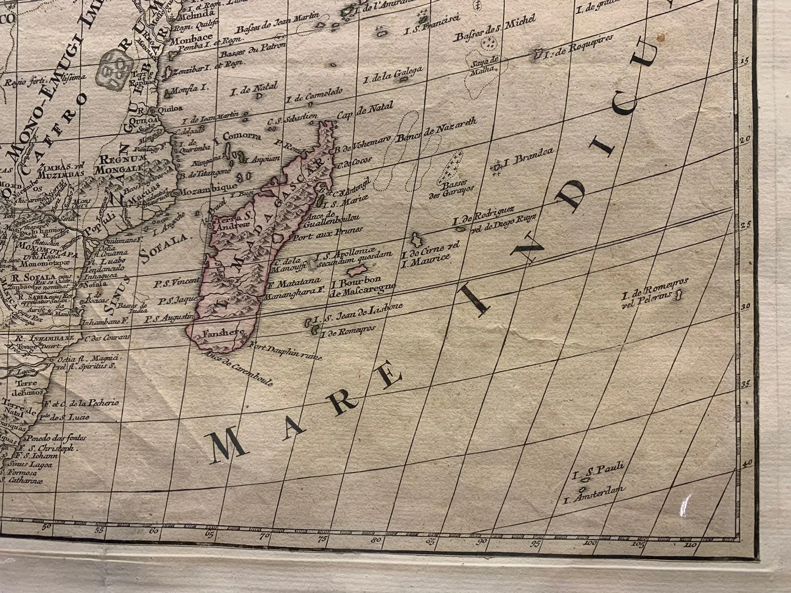
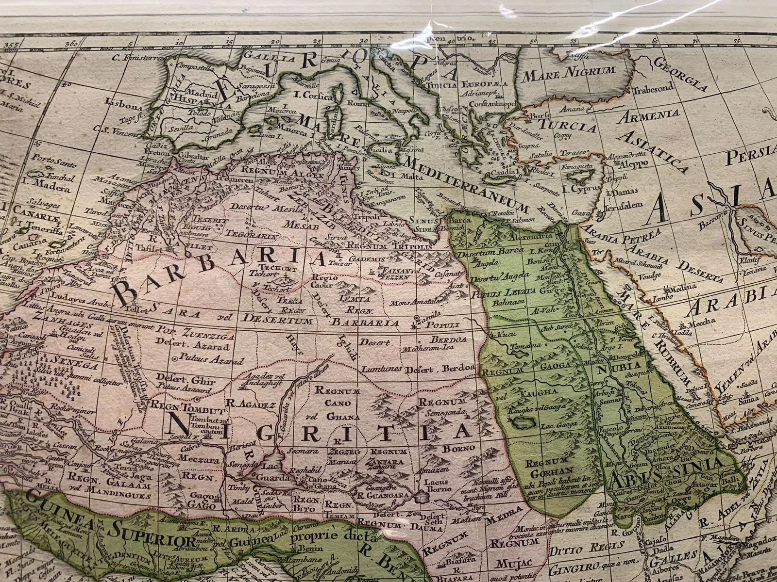
Map of Africa c.1750
Copperplate engraving c.1750
Tobias Conrad Lotter (1717–1777) was an engraver , cartographer and publisher in Augsburg .
Lotter, the son of an Augsburg baker and city guard, worked in Matthäus Seutter's workshop as a map engraver from at least 1740, the year of his marriage to Seutter's eldest daughter, and became Seutter's most productive collaborator. Largely independently (but still under Seutter's supervision), Lotter created the 'Atlas Minor,' the production of which took place between 1740 and 1744. Lotter's atlas ( Atlas minor. Praecipua orbis terrarum imperia, regna et provincias, Germania potissimum tabelli 80 exactae delineatis sistens usui militiae ducum ac peregrinantium maxime accommodatus opera ) consists of the 63 maps from Seutter's Atlas Minor—most of which he engraved himself, adding his name as publisher's address at the bottom—and 16 new maps created by Lotter.
After Seutter's death in 1757, his son Albrecht Karl (1722–1762) continued to run the company alone. When he too died a few years later, the publishing stock was acquired roughly equally by Tobias Conrad Lotter and the closely related art publisher Johann Michael Probst the Elder (1727–1776). Both removed Seutter's name from the majority of the original plates and replaced it with their own. With the support of his sons Matthäus Albrecht (1741–1810), Georg Friedrich (1744–1801), and Gustav Conrad (1746–1776), Tobias Conrad Lotter succeeded in building on the economic success and professional reputation of his father-in-law. However, under the leadership of the two eldest sons, the company began its gradual decline. After Matthäus Albrecht's death (1810), the publishing house, under his sons Gabriel (1776–1857) and Georg Friedrich (1787–1864), eventually declined into insignificance until it ceased to exist entirely in the mid-19th century. The publishing estate of Tobias Conrad Lotter's prematurely deceased son Gustav Conrad was acquired in 1789 by the Augsburg art publisher Johann Martin Will and his son-in-law Johann Walch , who thereby laid the foundation for his own burgeoning map publishing company.
The Cartouche
Positioned in the upper-right corner, the decorative cartouche is a quintessential example of Baroque map illustration. It features rich allegorical iconography surrounding the Latin title block:
Fauna & Flora: A prominent African elephant crowns the top of the frame, balanced by an ostrich, a man catching a crocodile, and tropical palm foliage.
Allegorical Figure: An African figure sits beside the pedestal, holding a parasol or bow, symbolizing the European view of the continent's exotic wealth and mystery.
Latin Inscription: The text explicitly notes that the map was drawn Secundum Observationes Membr. Acad. Regal. Scientiarum ("According to the observations of the members of the Royal Academy of Sciences") by G. de L'Isle and sold at the shop of Tobias Conrad Lotter in Augustae Vindelicorum (Augsburg).
Tip of Africa, Quirky Geometry, and Longitude
For centuries, European cartographers depicted the southern tip of Africa with an overly broad, bulbous, or hook-like shape because calculating longitude at sea remained an unsolved problem until John Harrison invented the marine chronometer in the mid-18th century. Navigators could easily determine latitude via the stars, but calculating east-west distance relied on dead reckoning, causing massive longitudinal distortion on early charts.
Although De L'Isle significantly corrected Africa’s longitudinal width—slimming the continent down to far more accurate dimensions than those drawn by Mercator or Blaeu—the southern coastline around the Cape of Good Hope still retains a slightly squared, flattened, and angular profile in this plate, characteristic of early 18th-century European mapping conventions.
Cape Agulhas
Visible near the southernmost point on the map, Cape Agulhas (Cabo das Agulhas, Portuguese for "Cape of Needles") was named by Portuguese navigators around 1500. They chose the name because, at that specific geographic point during the Age of Discovery, magnetic north aligned perfectly with true geographic north—meaning the needle of a ship’s magnetic compass pointed due north without magnetic declination. Geographically, Cape Agulhas—not the Cape of Good Hope—marks the true southernmost tip of the African continent and the dividing boundary between the Atlantic and Indian Oceans.
Sofala and the Biblical Ophir
Along the southeastern coast in the area of modern-day Mozambique, the map clearly labels the region and port of Sofala, as well as the interior kingdoms of Monomotapa and Mono-Emugi.
Sofala: Historically one of the most vital Swahili coast trading ports, Sofala was originally controlled by the Kilwa Sultanate before being captured by the Portuguese in 1505, who built Fort San Gaetano there. Sofala served as the coastal outlet for the lucrative gold trade mined in the Zimbabwean interior (Great Zimbabwe and the Mutapa Empire).
Ophir: Because of Sofala's immense gold exports, Renaissance scholars, Portuguese chroniclers (such as João de Barros), and early cartographers firmly believed that this region was the legendary biblical land of Ophir. According to the Old Testament, King Solomon received regular shipments of gold, silver, ivory, and precious stones from Ophir. On 16th- and 17th-century maps, the region inland from Sofala was frequently annotated as the location of Solomon's mines.
The Treaty of Tordesillas
Why is Brazil so close to Africa? The presence of Portuguese naming conventions along the entirety of the African coastline directly stems from the Treaty of Tordesillas (1494). Signed between Spain and Portugal under papal sanction, the treaty drew an imaginary meridian line 370 leagues west of the Cape Verde islands. Spain gained rights to all non-Christian lands discovered to the west of the line (most of the Americas), while Portugal was granted exclusive rights to the lands to the east—giving them sole European domain over Africa and the ocean trade routes leading into the Indian Ocean (Mare Indicum). This monopoly allowed Portuguese mariners to systematically chart the African coastline, establish fortified trading posts like Sofala, and dominate early European cartographic knowledge of the continent. The Portuguese were fraudulent in their claims as to the more Westerly proximity of South America and so were awarded Brazil as a colony.
615mm x 490mm excluding mountboard (unframed)
Sold July 2026