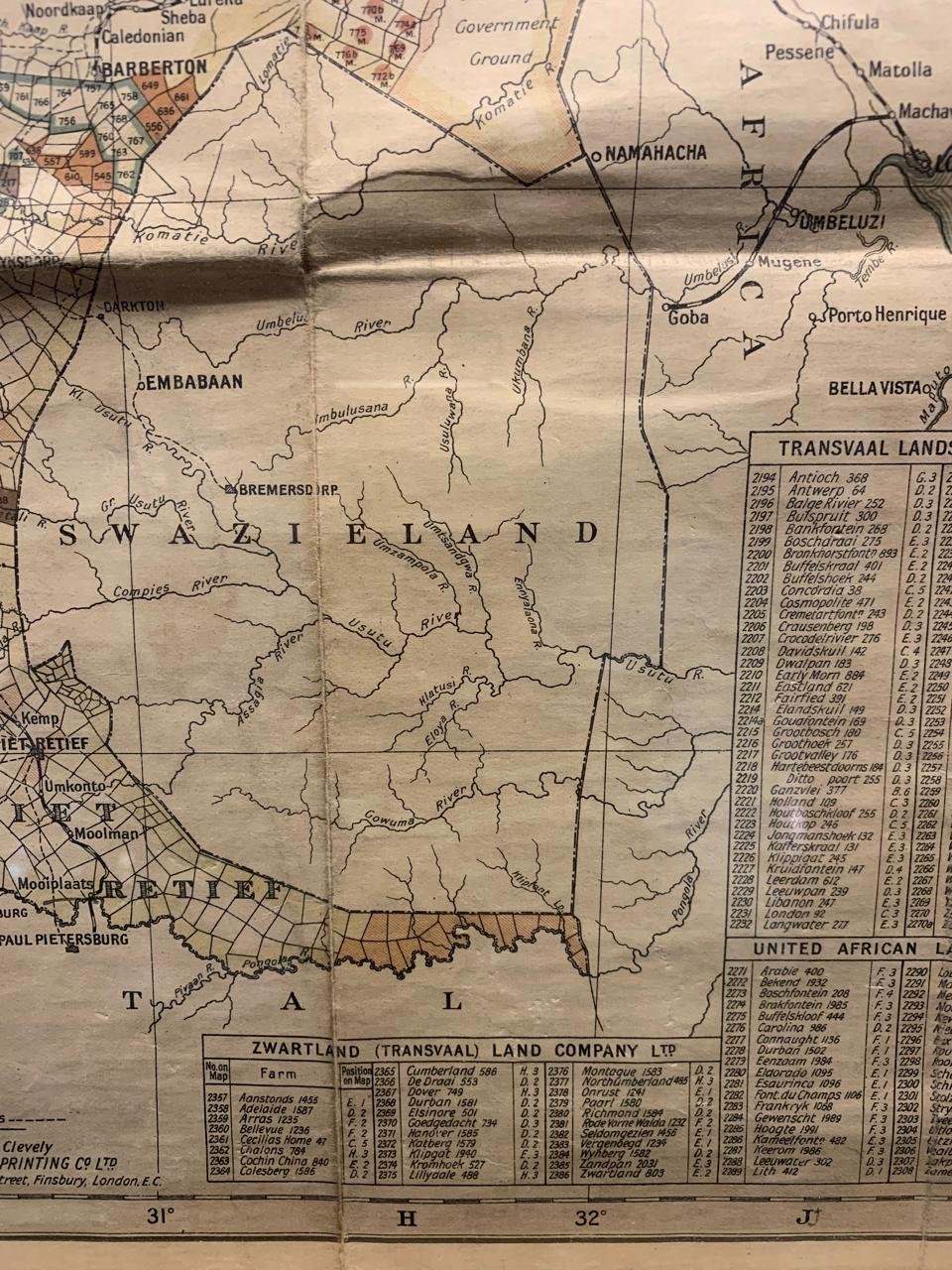
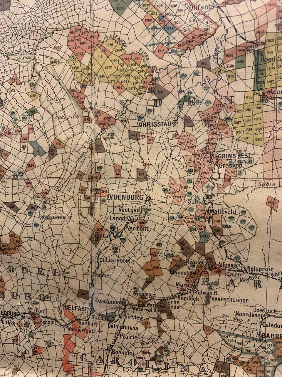
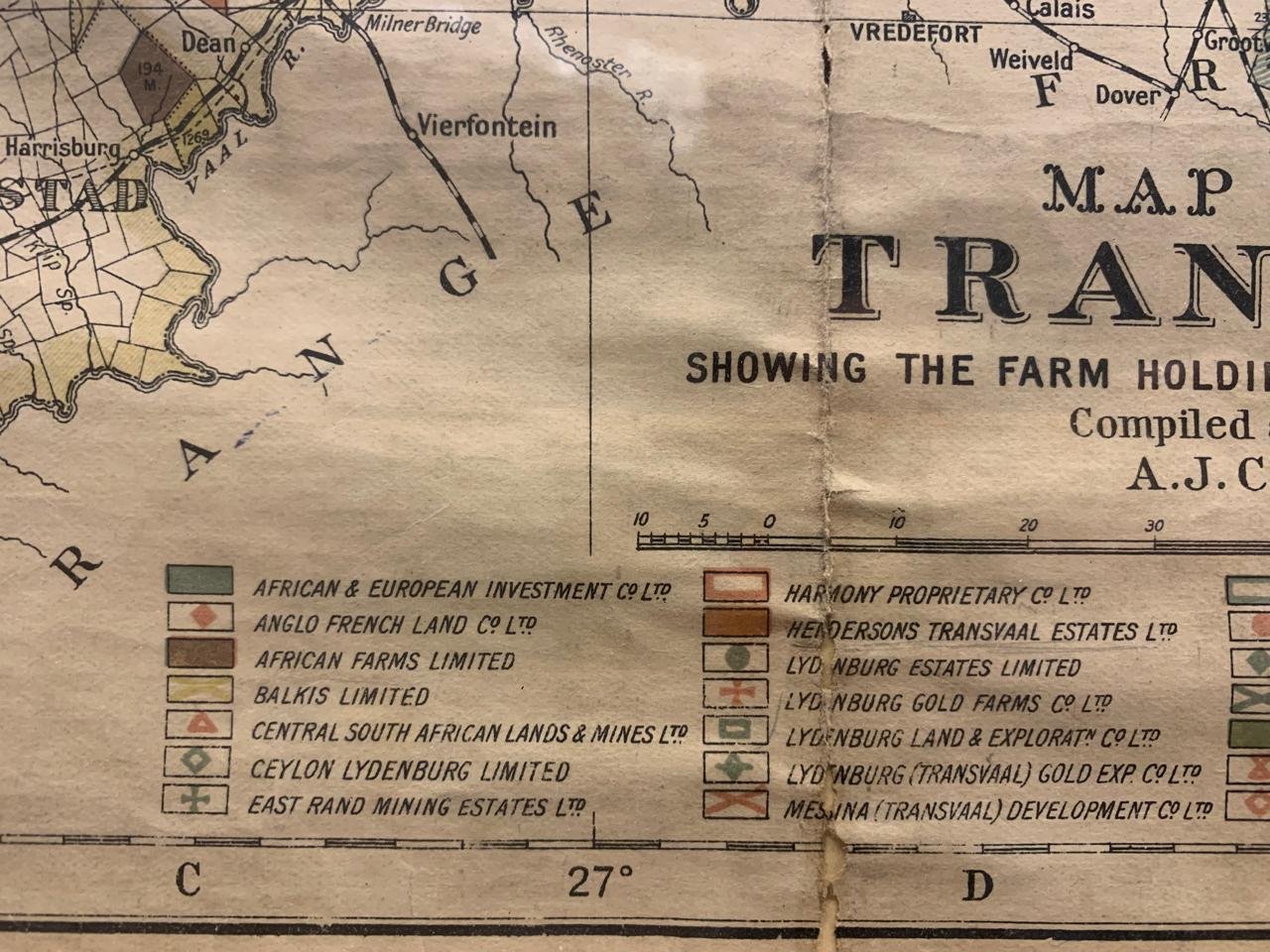
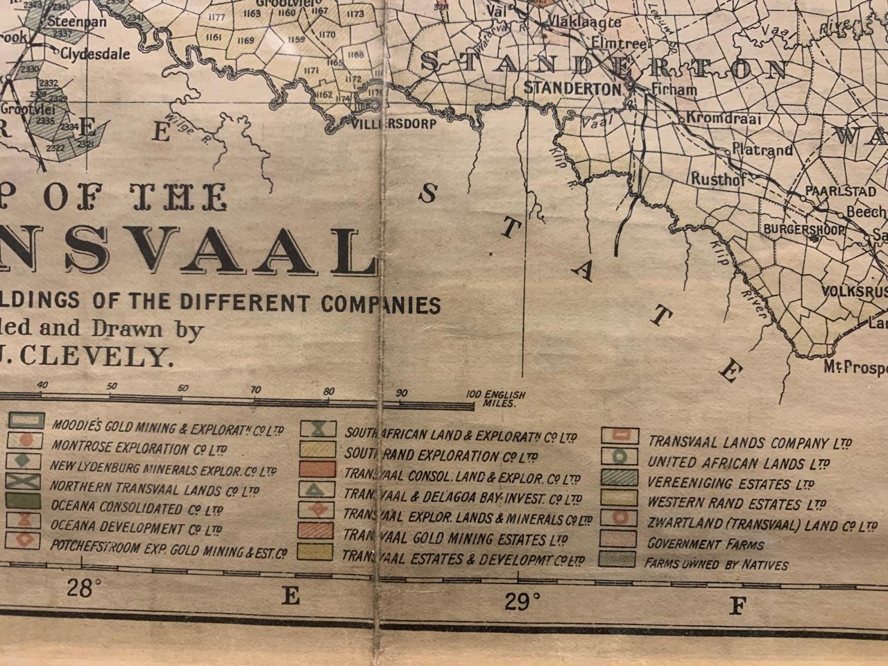
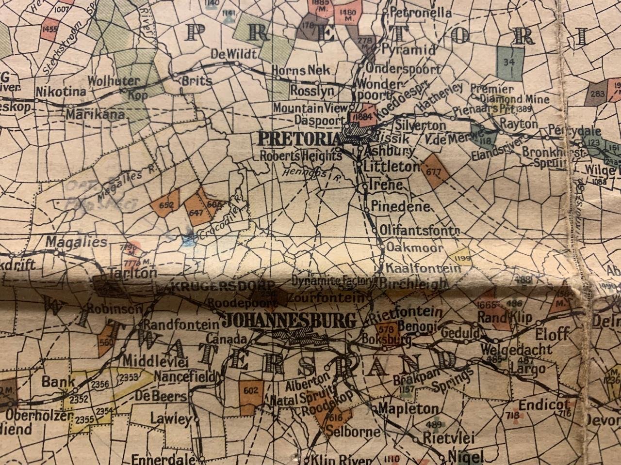
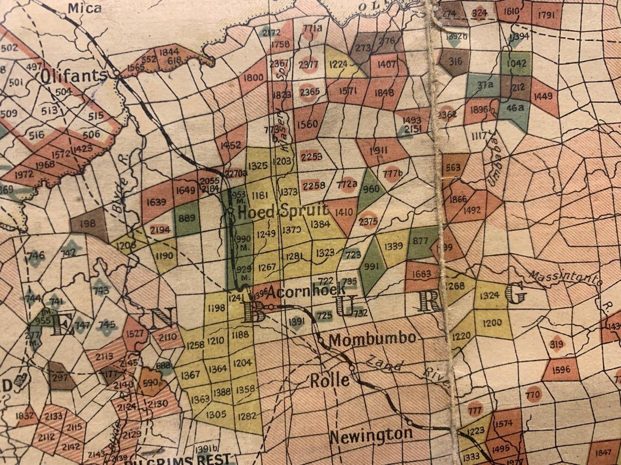
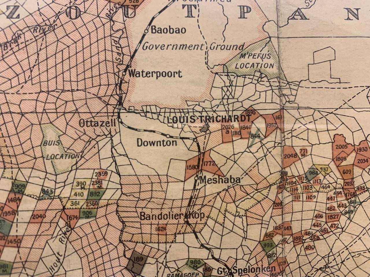
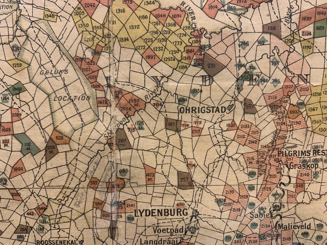
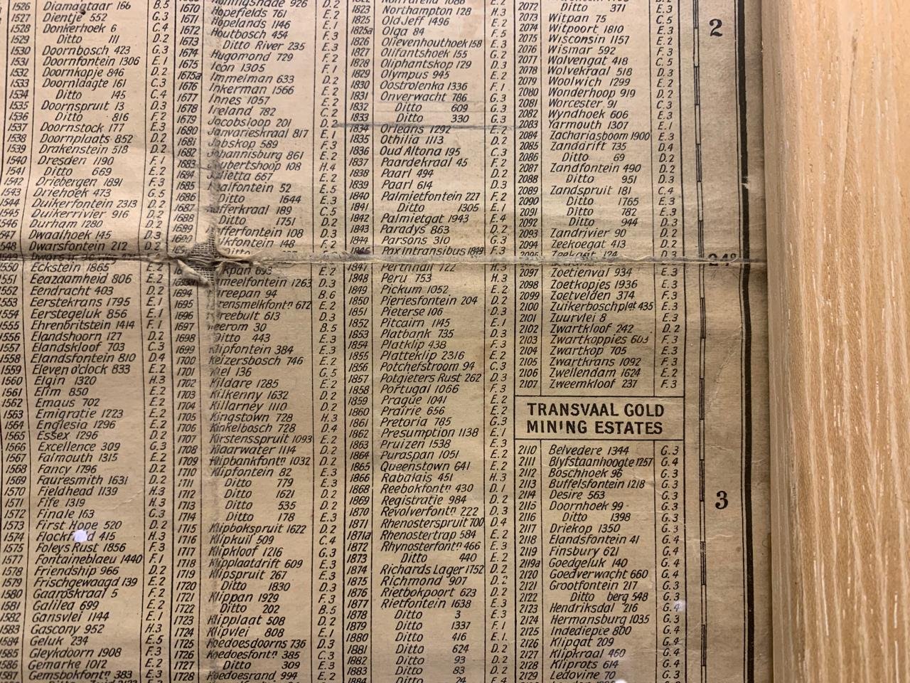
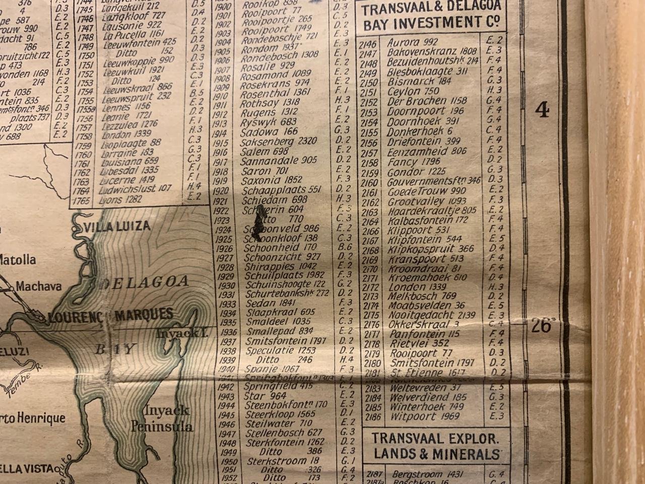
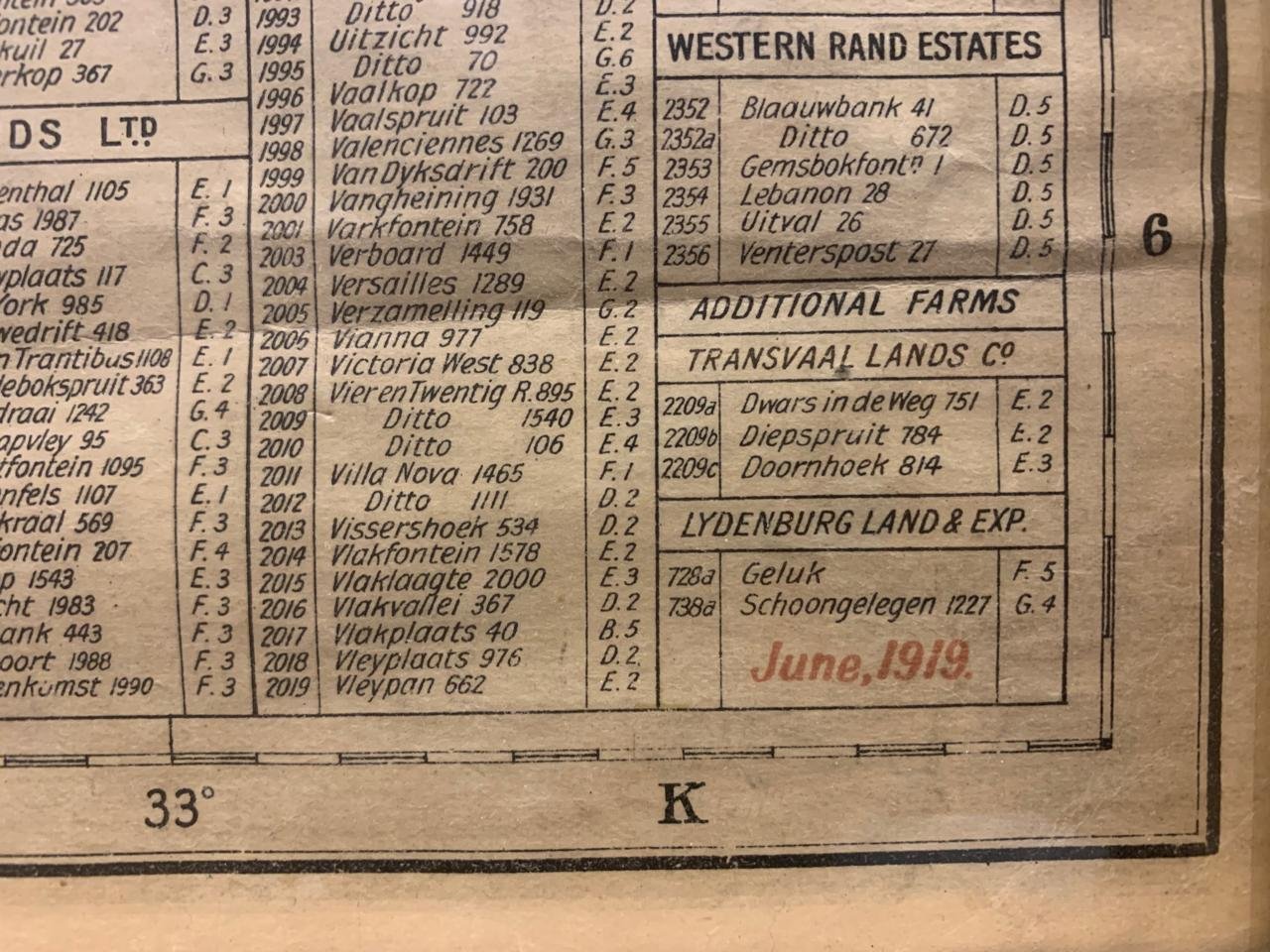
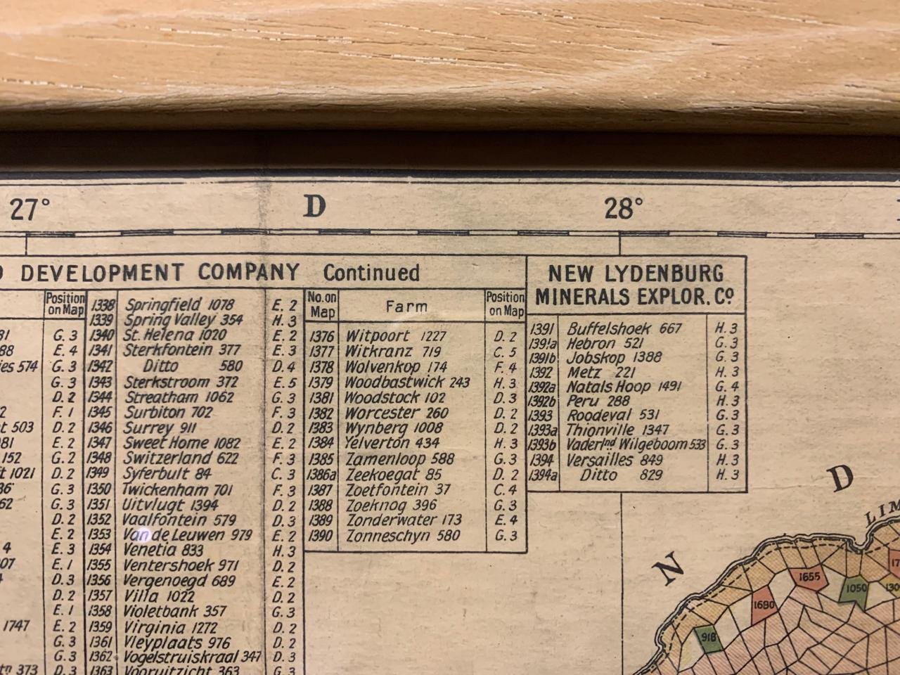
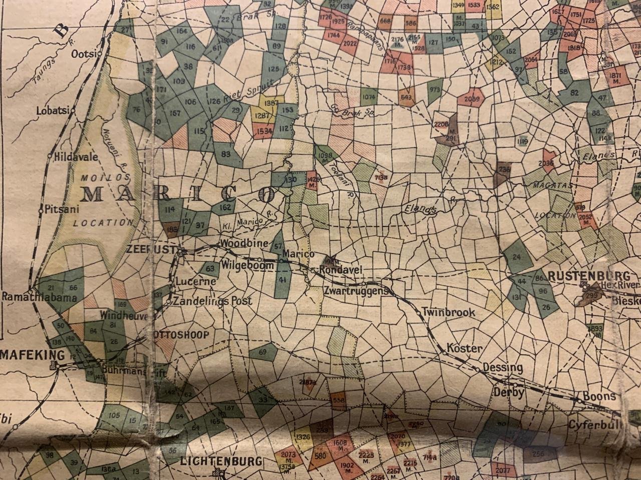
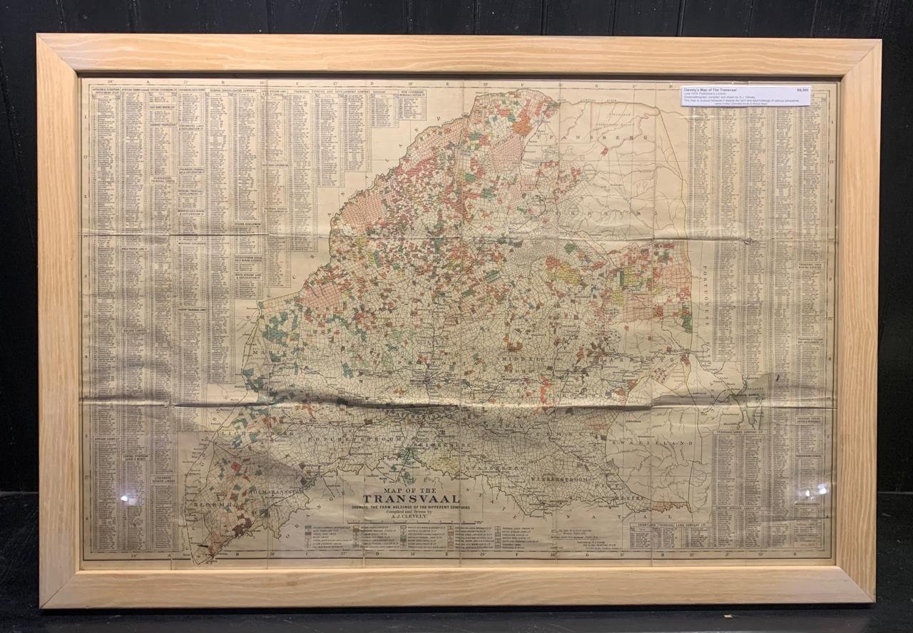
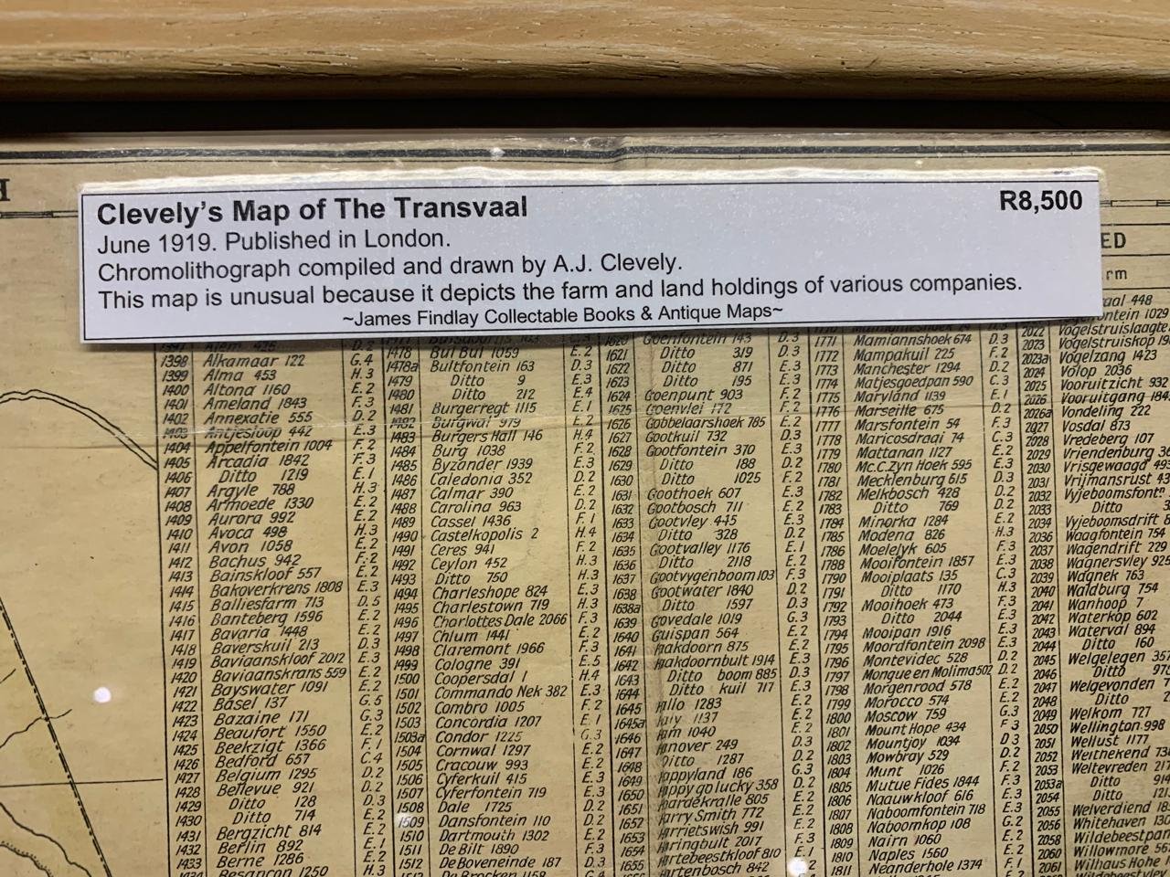
Clevely's Map of the Transvaal 1919
June 1919, published in London.
Chromolithograph compiled and drawn by A.J Clevely.
This map is unusual because it depicts the farm and land holdings of various companies.
630mm x 930mm (framed)
SOLD November 2025
June 1919, published in London.
Chromolithograph compiled and drawn by A.J Clevely.
This map is unusual because it depicts the farm and land holdings of various companies.
630mm x 930mm (framed)
SOLD November 2025