Antique Maps & Atlases

Map of Africa with All Its States by Samuel Boulton (1794) R100,000
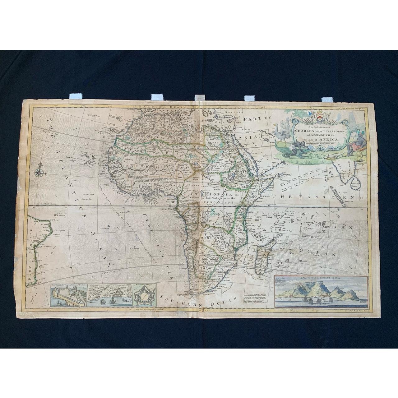
Herman Moll Map of Africa (1720) R45,000
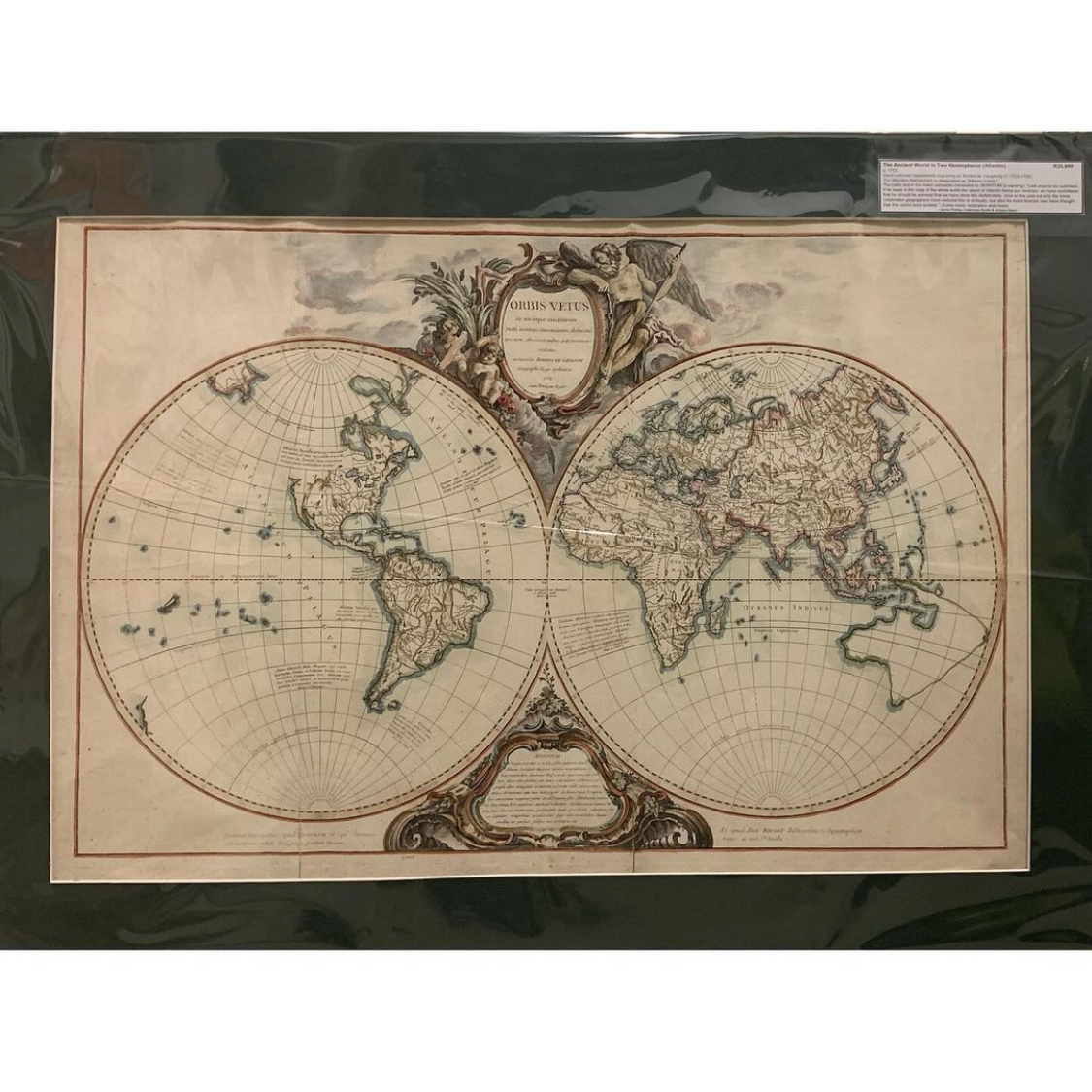
Ancient World in Two Hemispheres by Robert de Vaugondy c.1752 R35,000
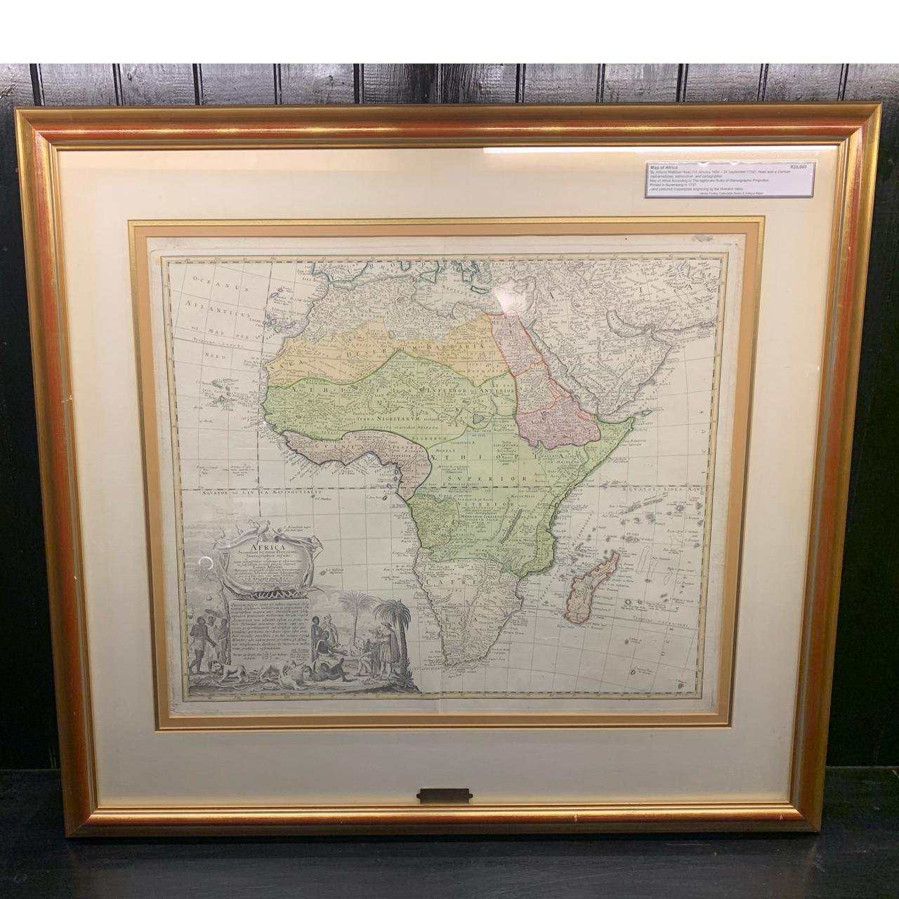
Map of Africa by Johann Matthias Haas (1773) R25,000
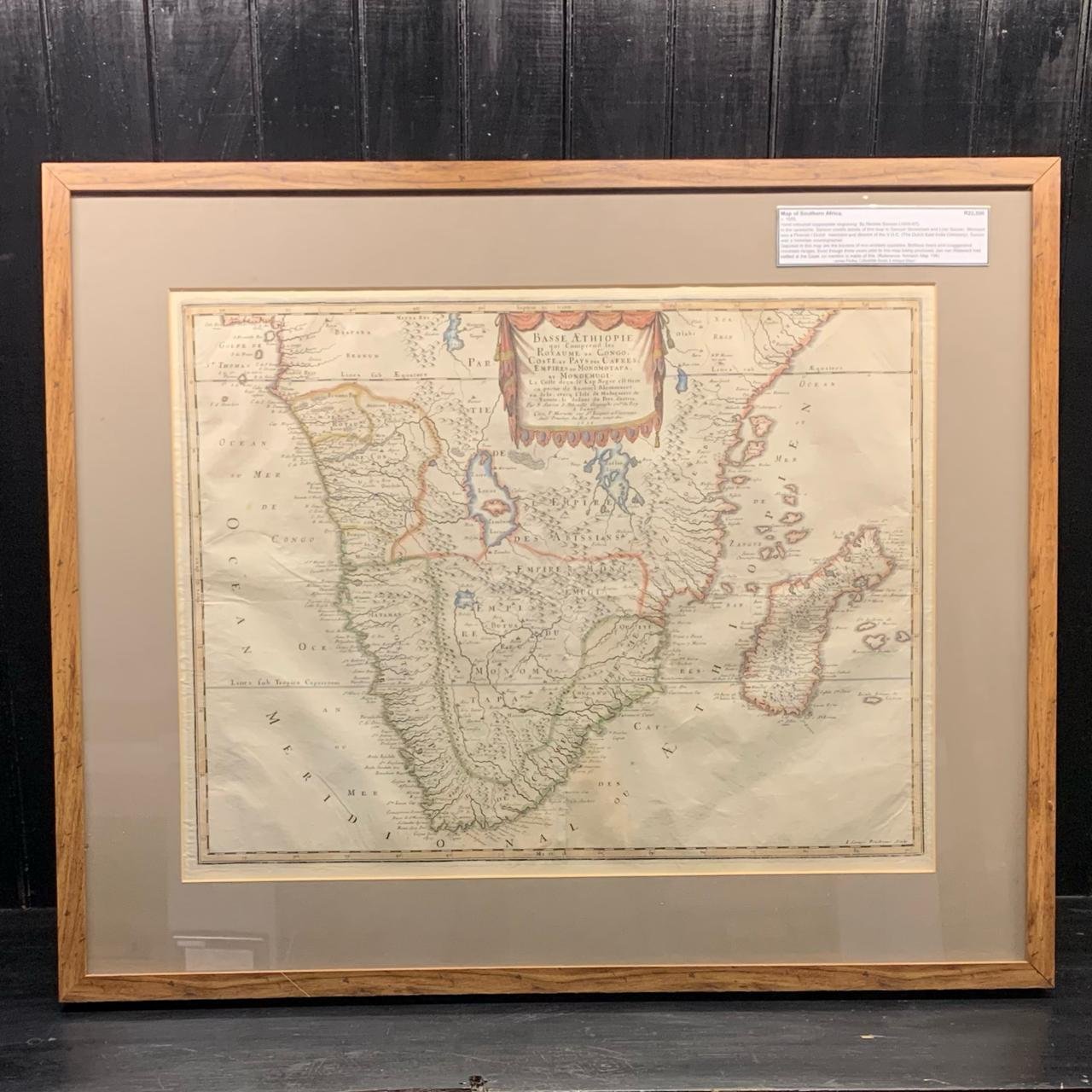
Southern Africa by Nicolas Sanson c.1655 R22,500
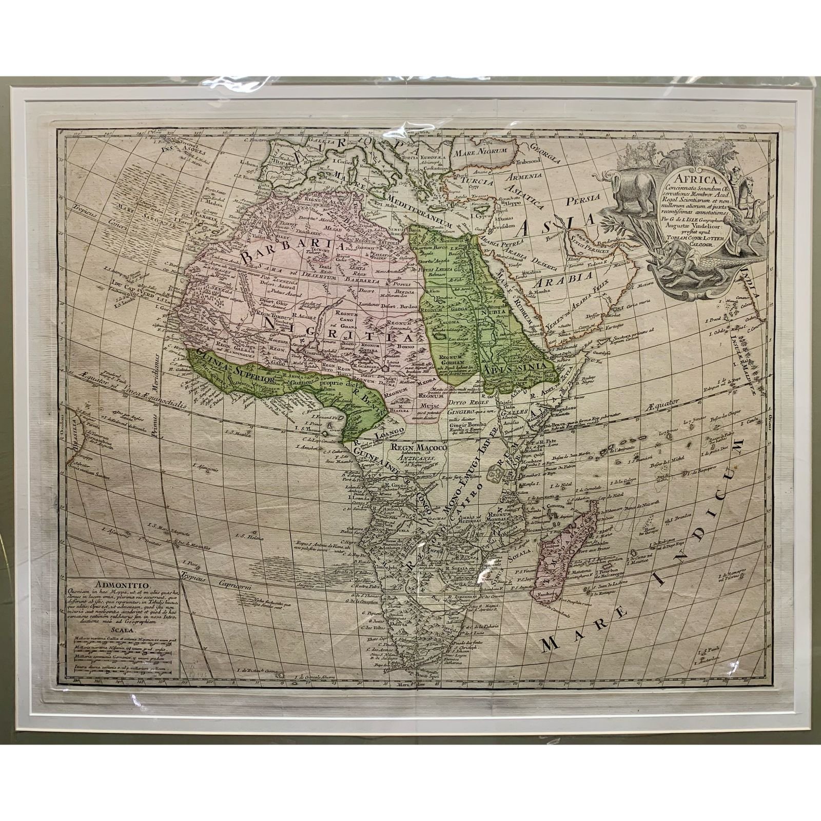
Map of Africa by Tobias Lotter c.1750 R20,000
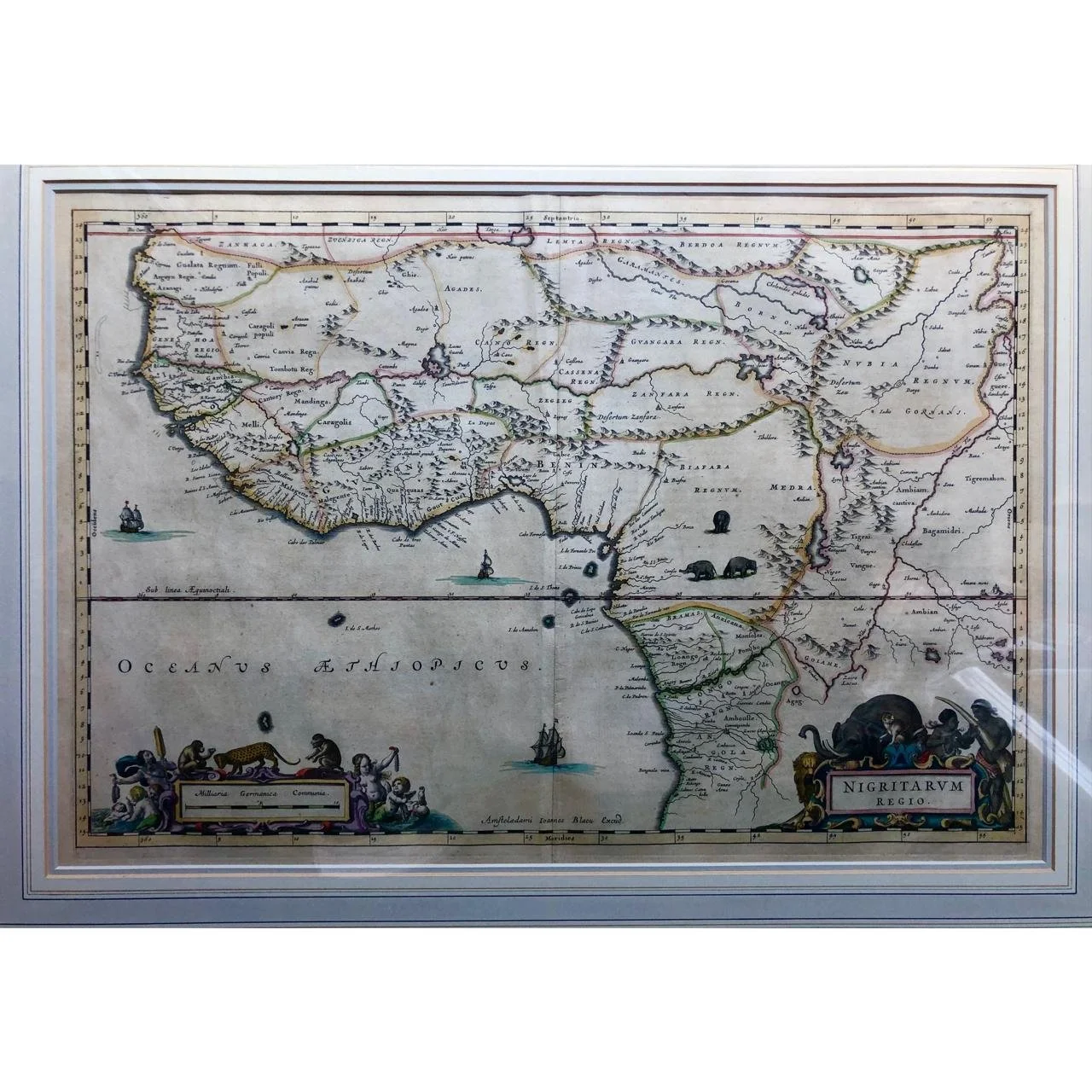
Kingdom of Nigeria (1635) R15,000
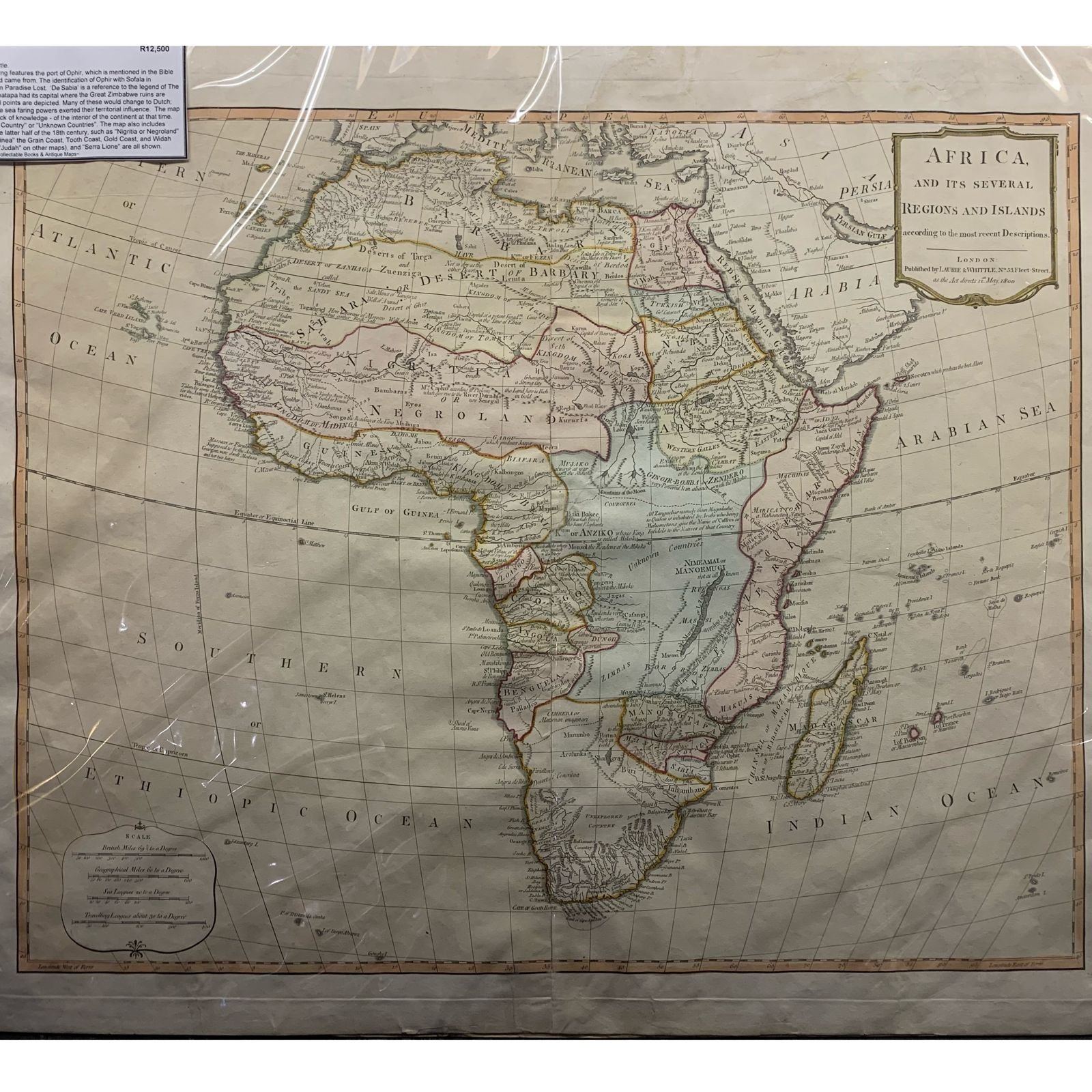
Map of Africa with Phantom Island by Robert Laurie and James Whittle 1800 R15,000
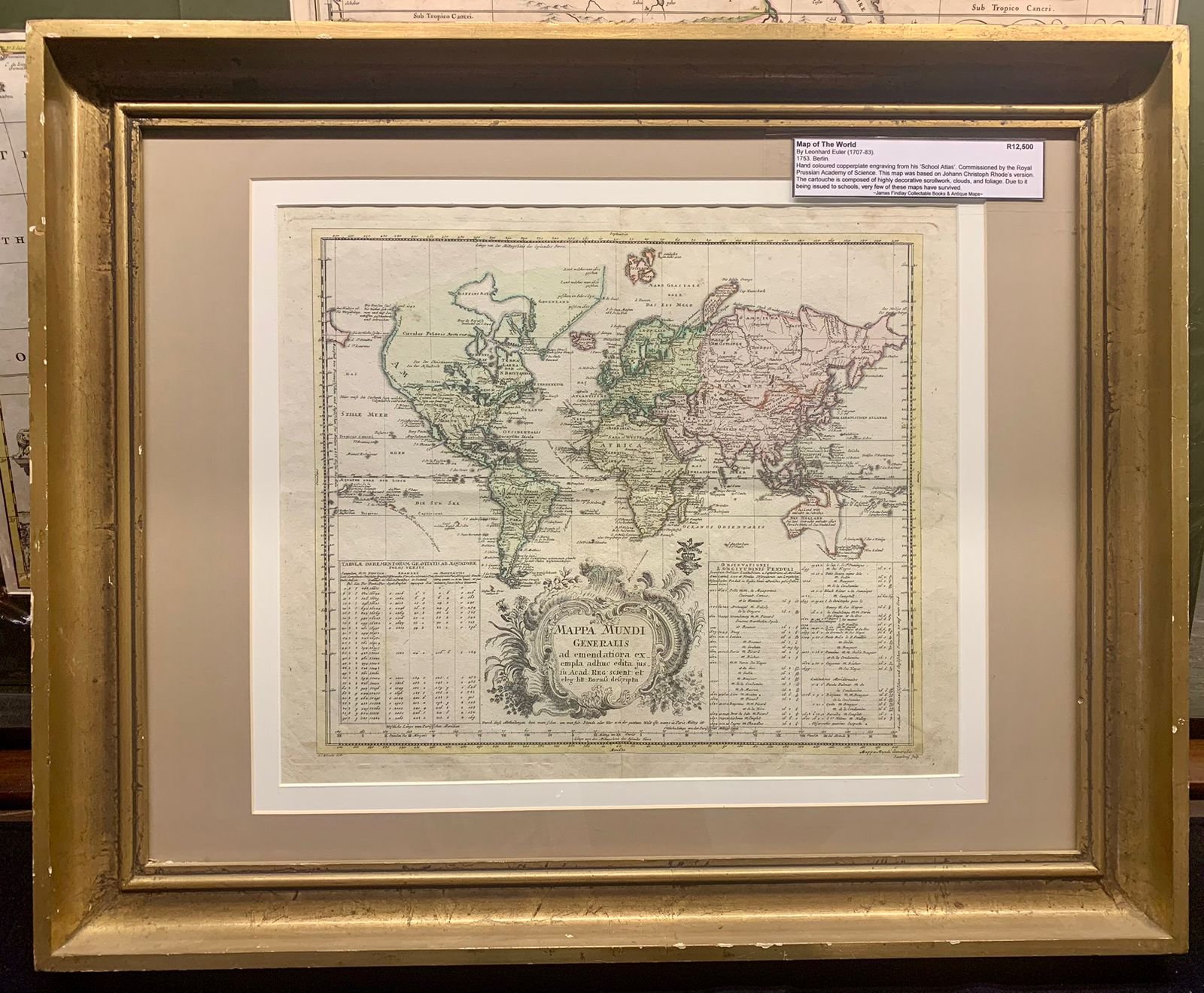
Map of the World by Leonhard Euler 1753 R12,500
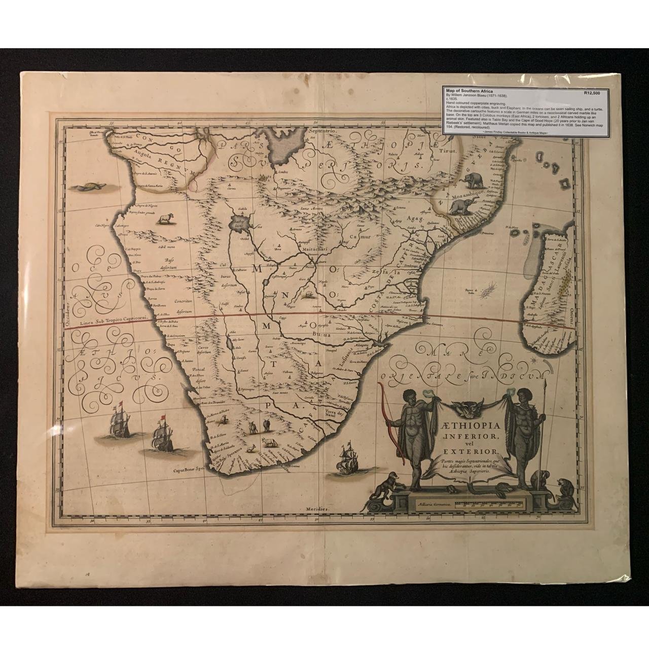
Map of Southern Africa by Willem Blaeu c.1635 (unrestored) R12,500
Map of Southern Africa by Willem Blaeu c.1635 R12,500

French Map of Africa By the Sanson Family 1669 R12,500
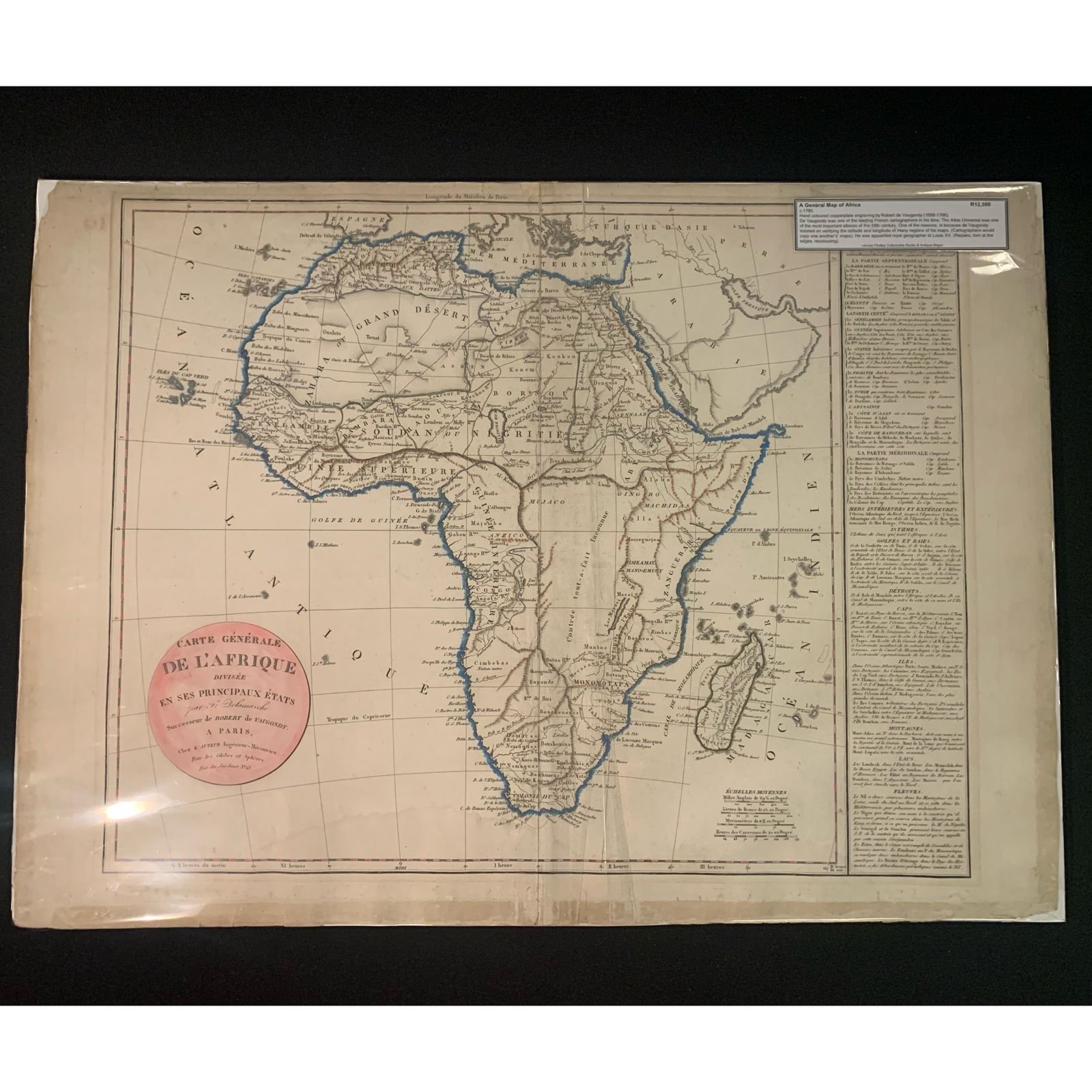
A General Map of Africa by Robert de Vaugondy c.1790 R12,500
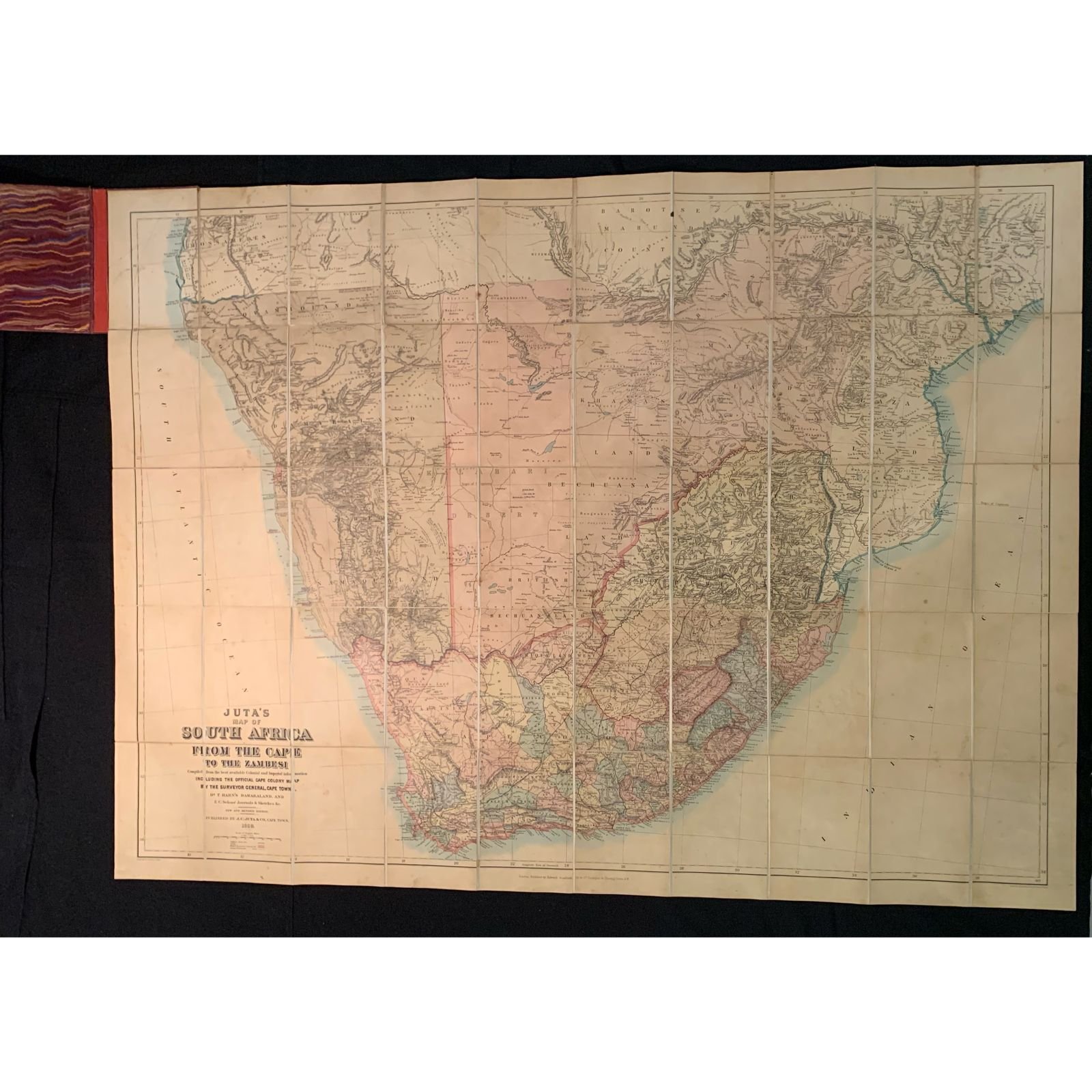
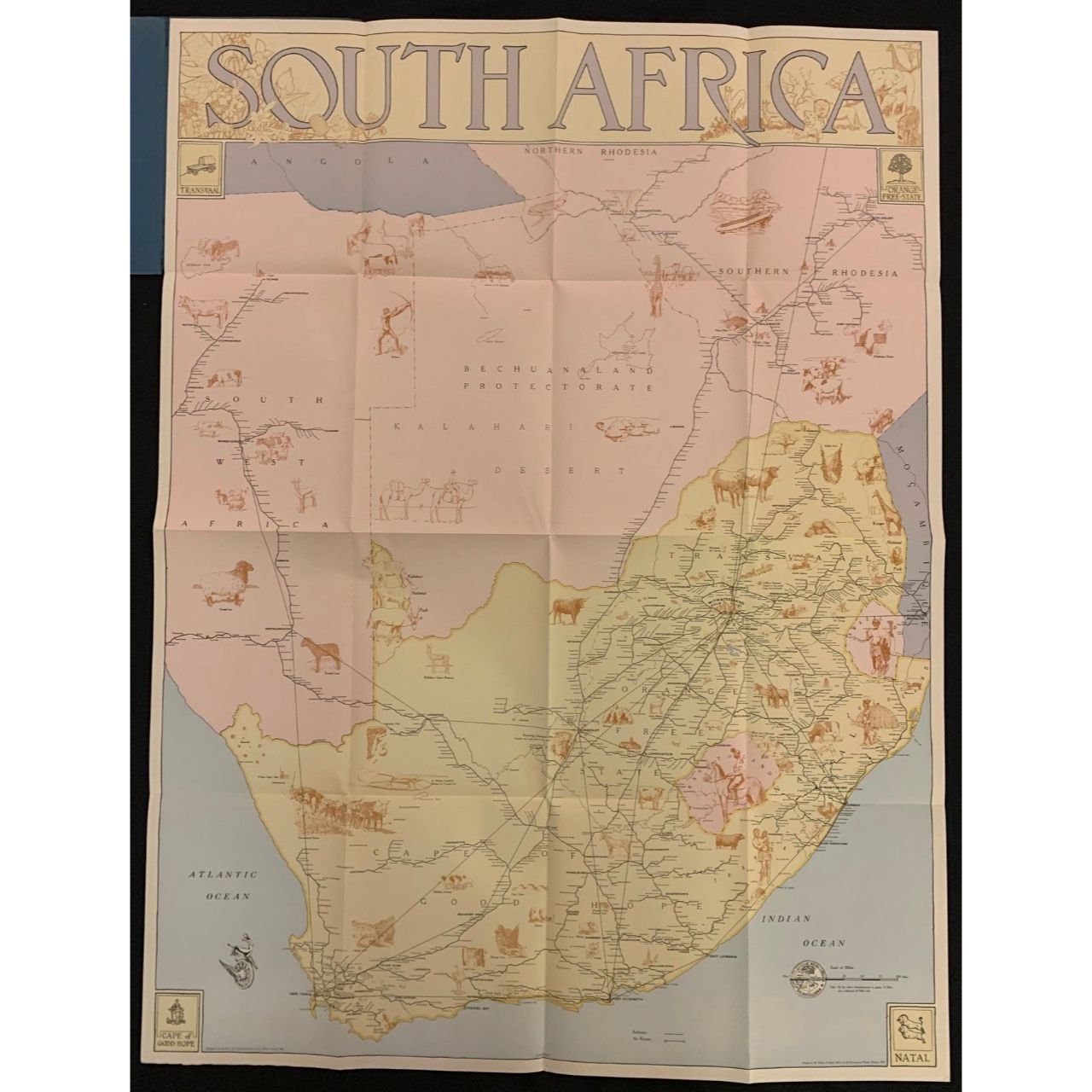
Juta's Map of South Africa 1889 R10,000

A New Map of the Southern Parts of Africa by Emanuel Bowen 1747 R10,000
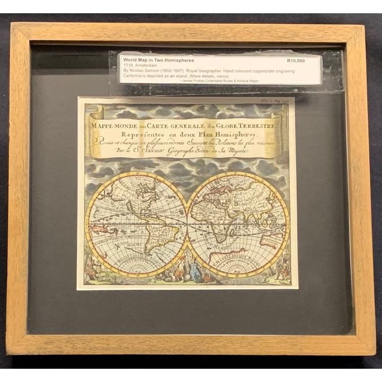
World Map in Two Hemispheres by Nicolas Sanson 1718 R10,000
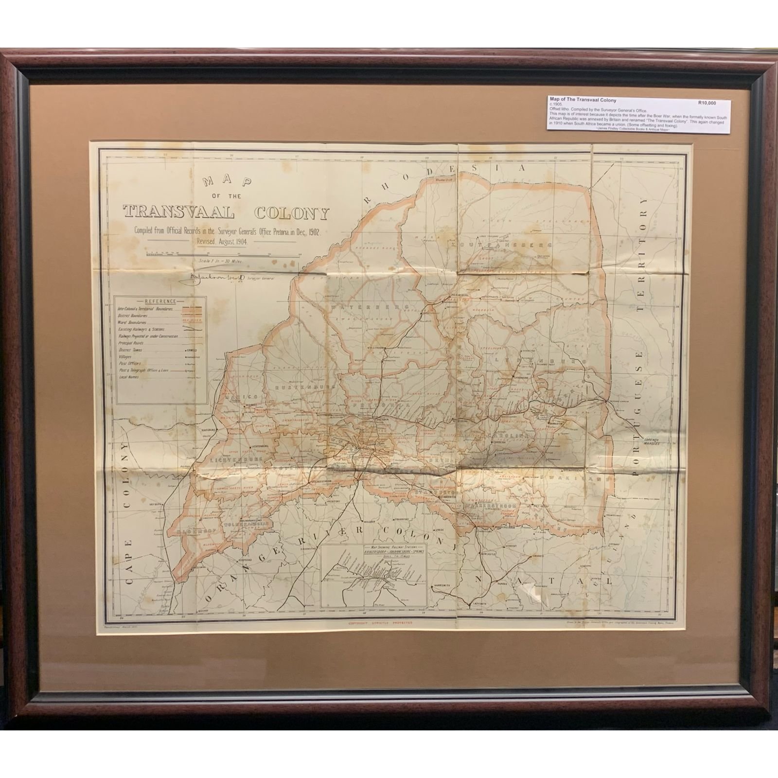
Map of the Transvaal Colony 1905 R10,000
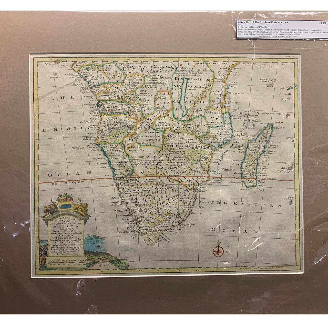
A New Map of the Southern Parts of Africa by Emanuel Bowen 1747 R9,000
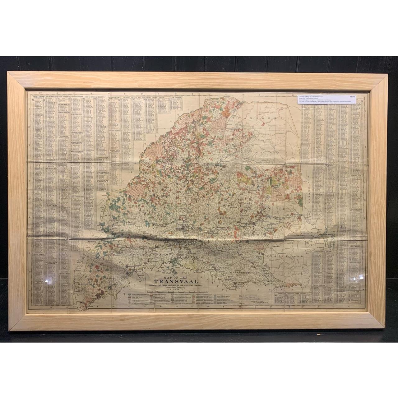
Clevely's Map of the Transvaal 1919 SOLD Nov 25
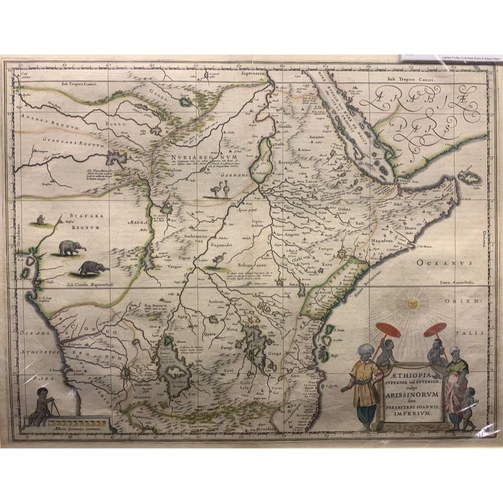
Map of Ethiopia & Abyssinia by Willem Blaeu c.1640 R8,500
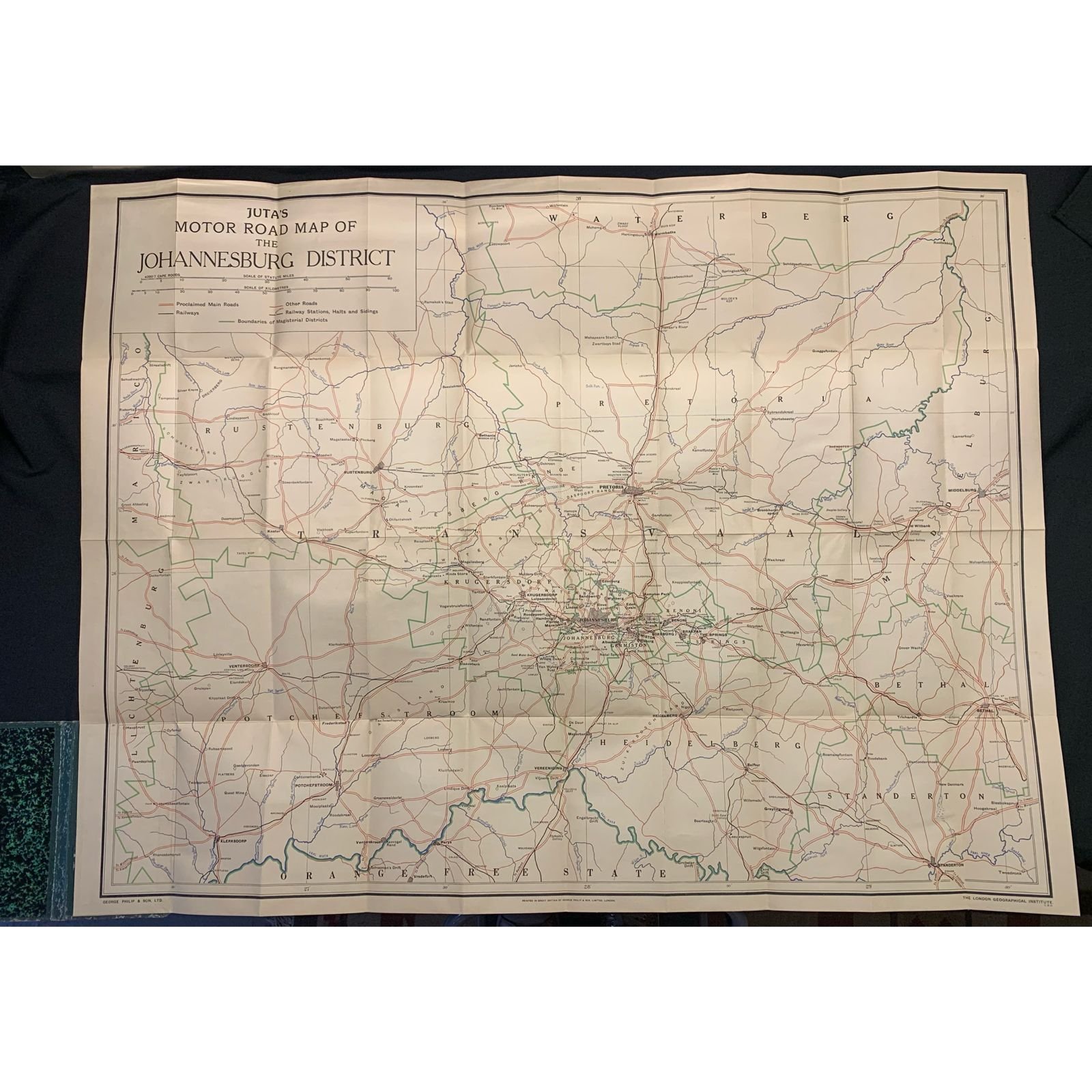
Juta's Motor Road Map of the Johannesburg District c.1930's R8,000

A New Map of Africa c.1580 R7,500
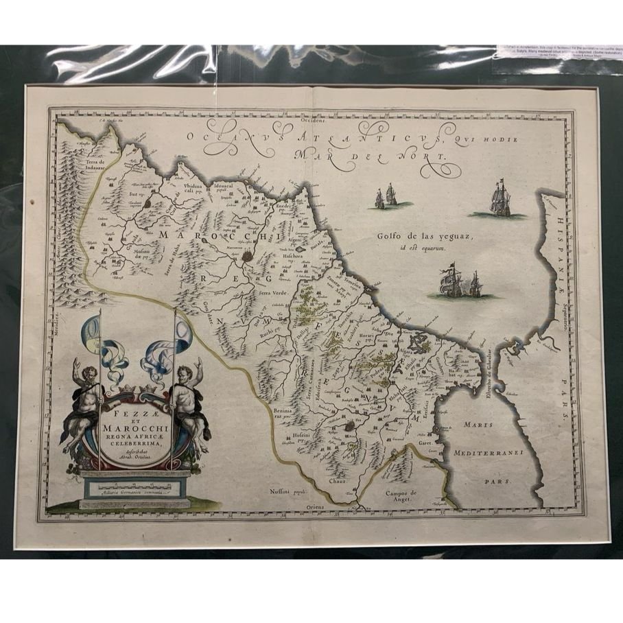
Kingdom of Morocco by Willem Blaeu 1636 R7,500
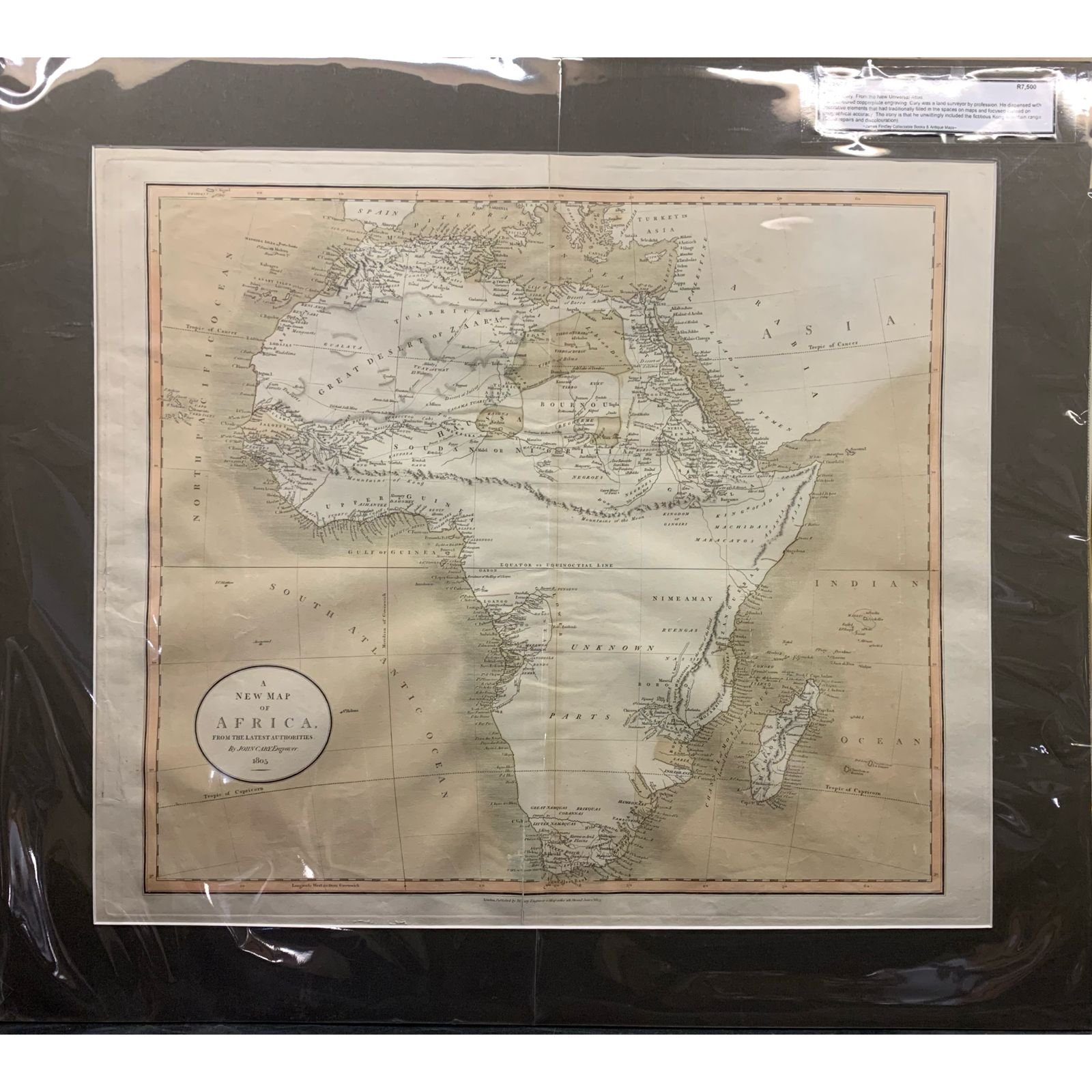
New Map of Africa by John Cary 1805 R7,500
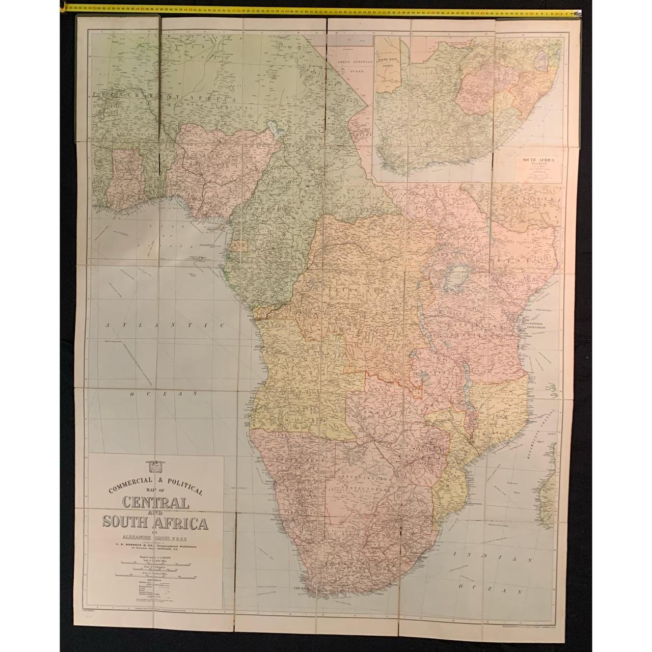
Commercial & Political map of Central and South Africa c.1920 R7,500
Map of Africa 1787 R6,500
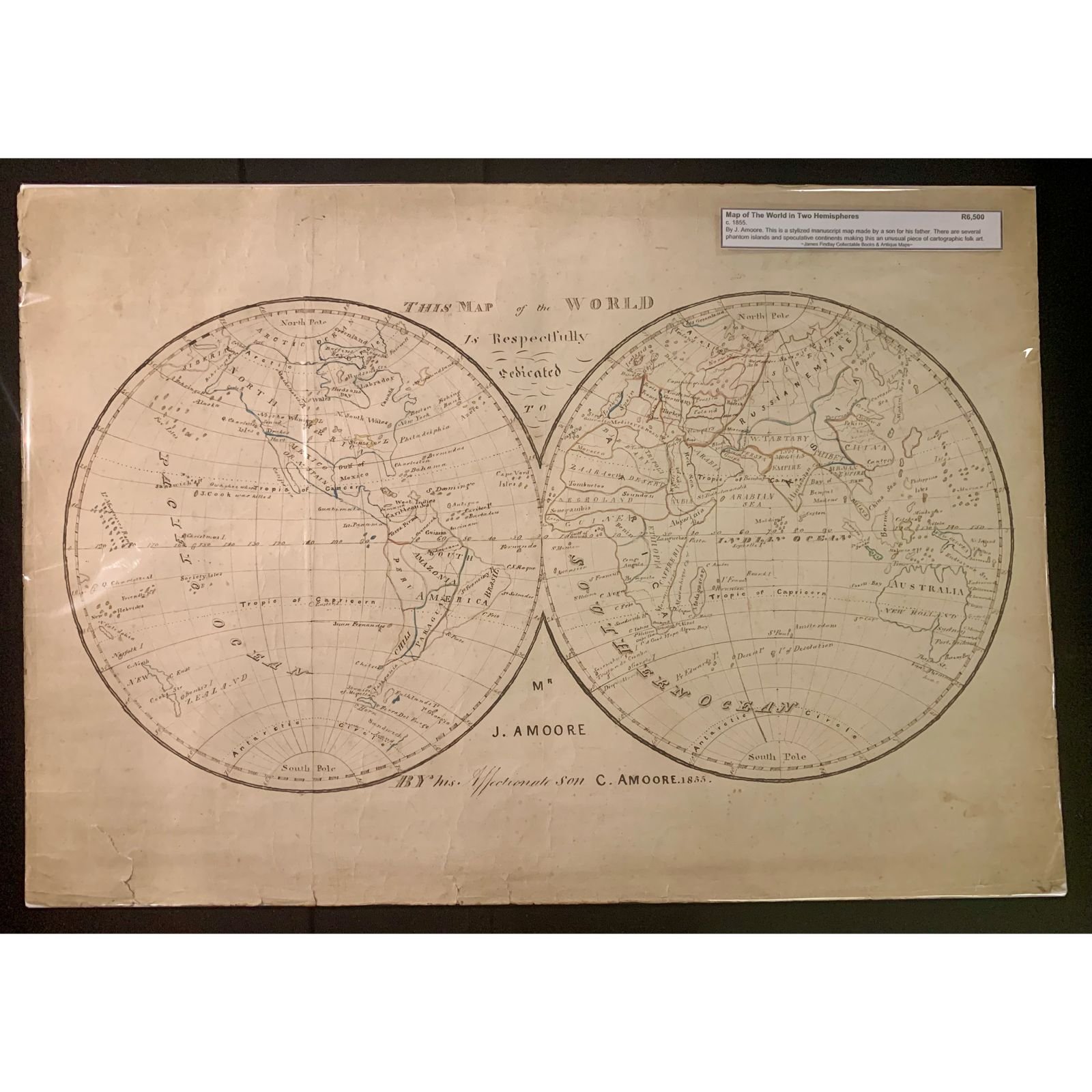
Map of the World in Two Hemispheres 1855 R6,500
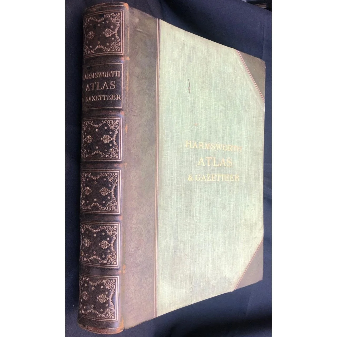
Harmsworth Atlas & Gazetteer (1907) R6,500
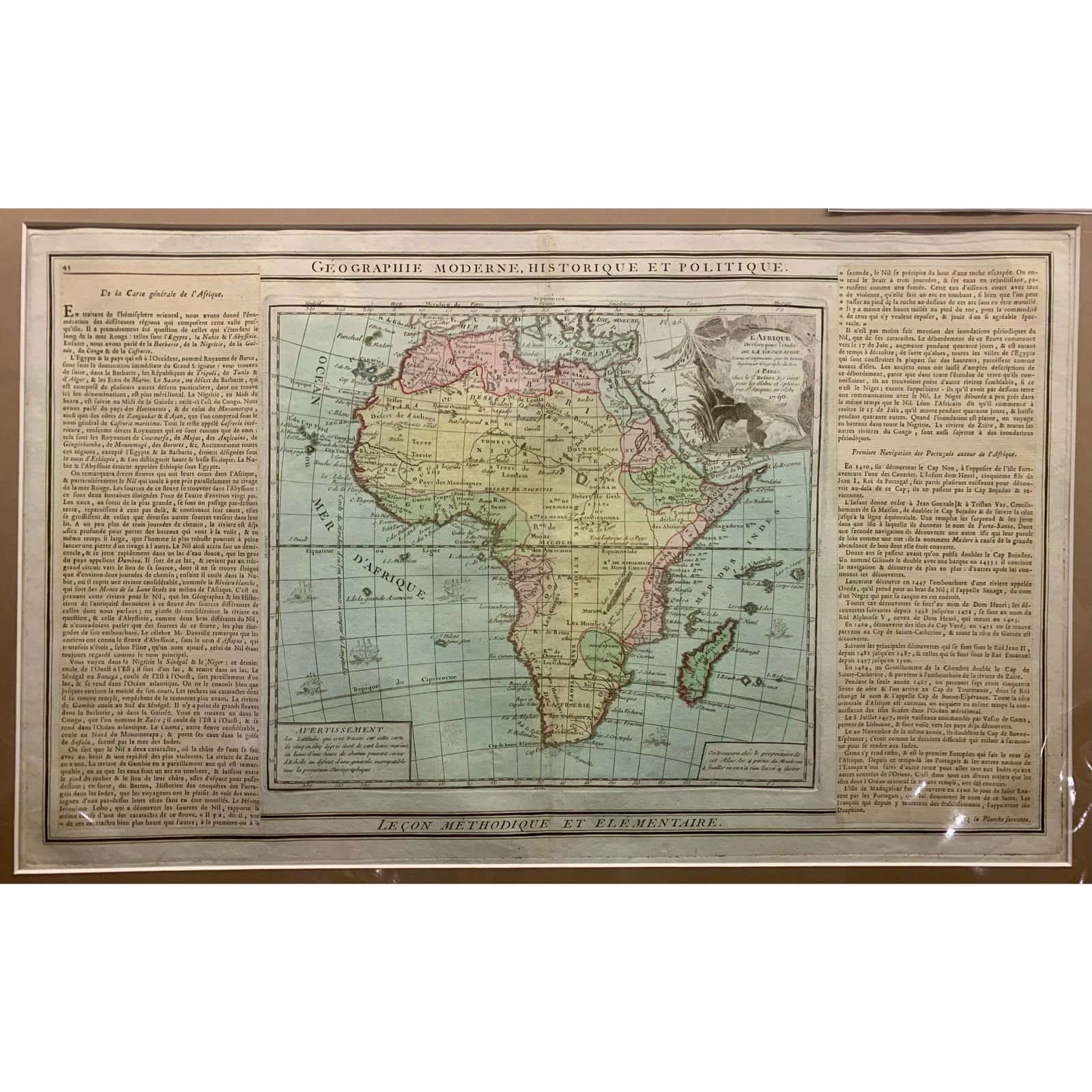
French Map of Africa by Louis Charles Desnos 1790 R6,000
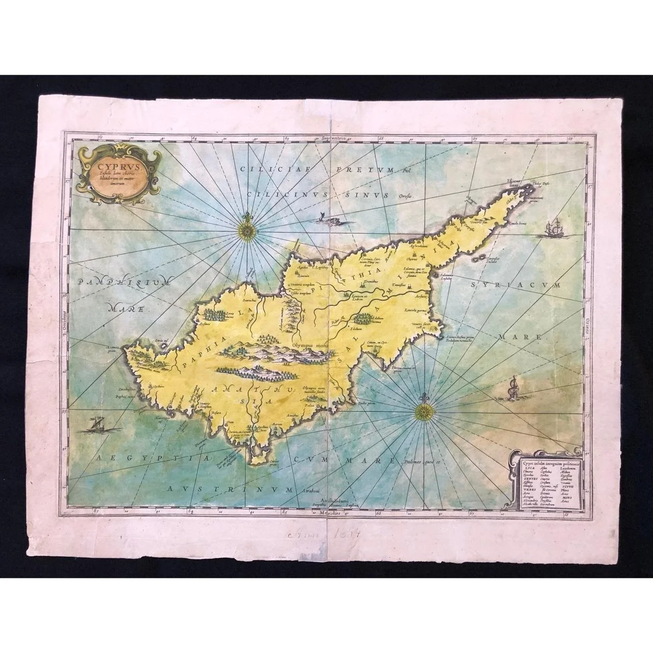
Decorative Map of Cyprus (c.1650) R4,500

Decorative Map of the Roman Empire (1657) R4,500
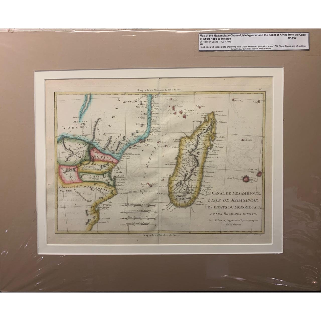
Map of the Mozambique Channel by Rigobert Bonne 1762 R4,000
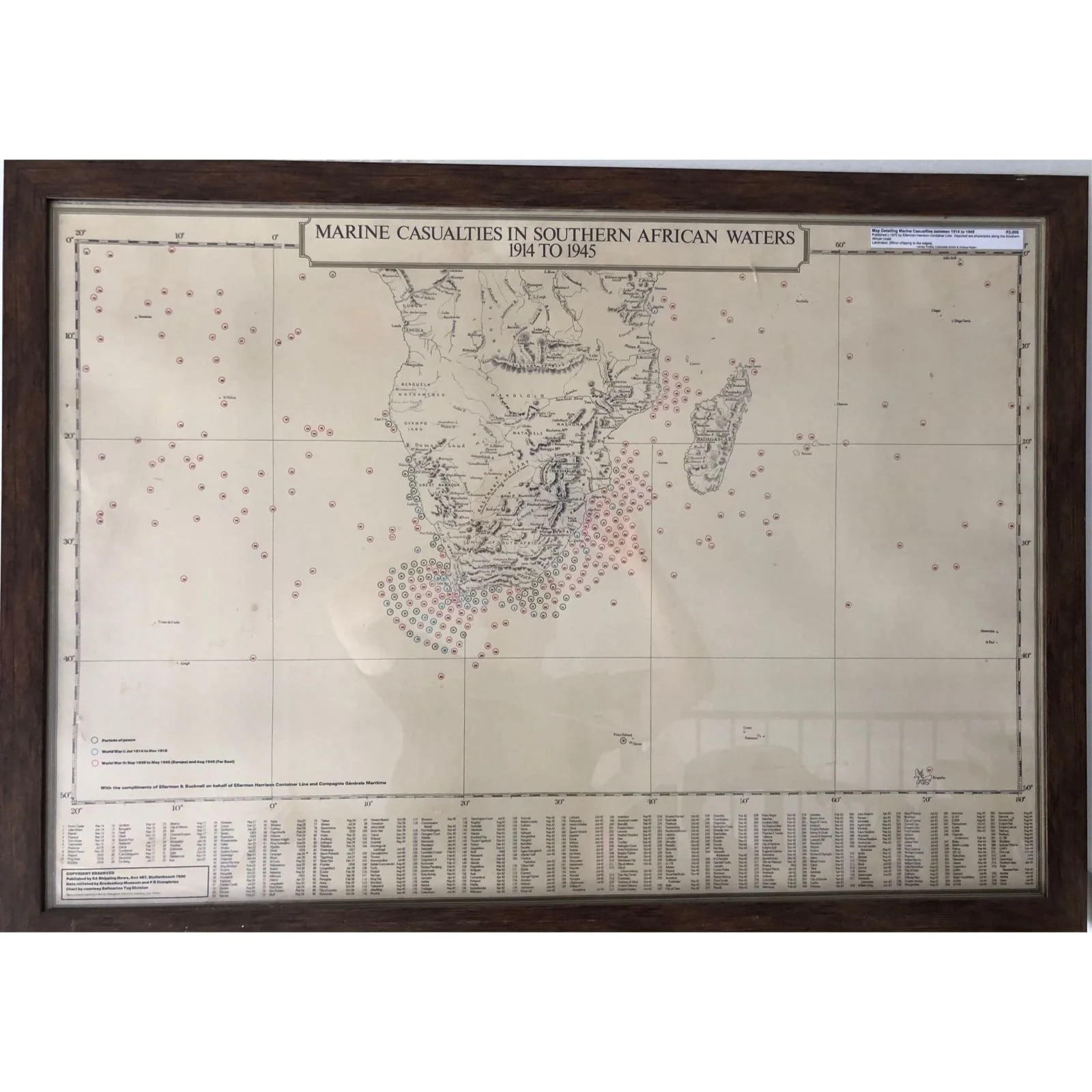
Map Detailing Marine Casualties between 1914 to 1945 R3,500

Map of Southern Africa & Mossel Bay c.1646 R3,500
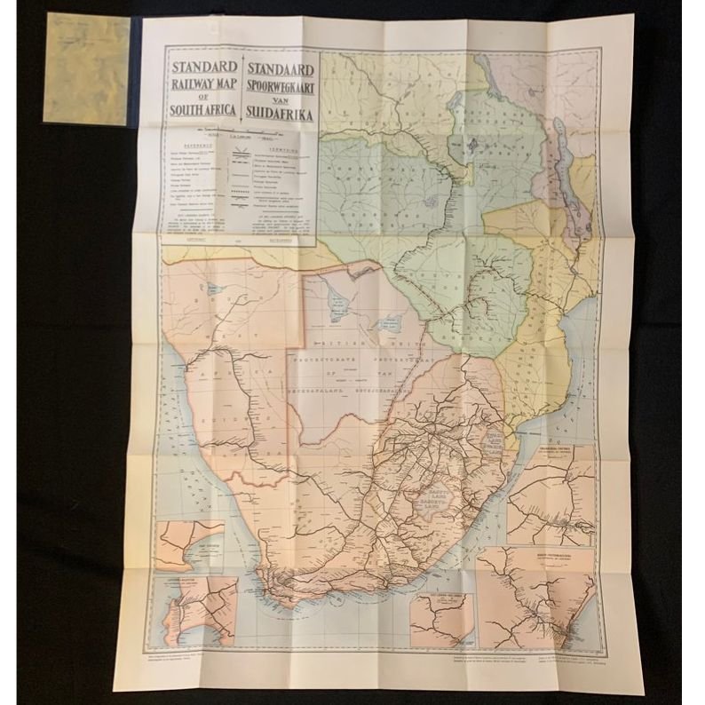
Standard Railway Map of South Africa 1935 R3,500

Map of Guinea, The Kingdoms of Angola, Congo & Hottentots by Rigobert Bonne 1762 R3,500

Map of the Transvaal Colony R3,500

An Accurate Map of Africa 1747 R3,000
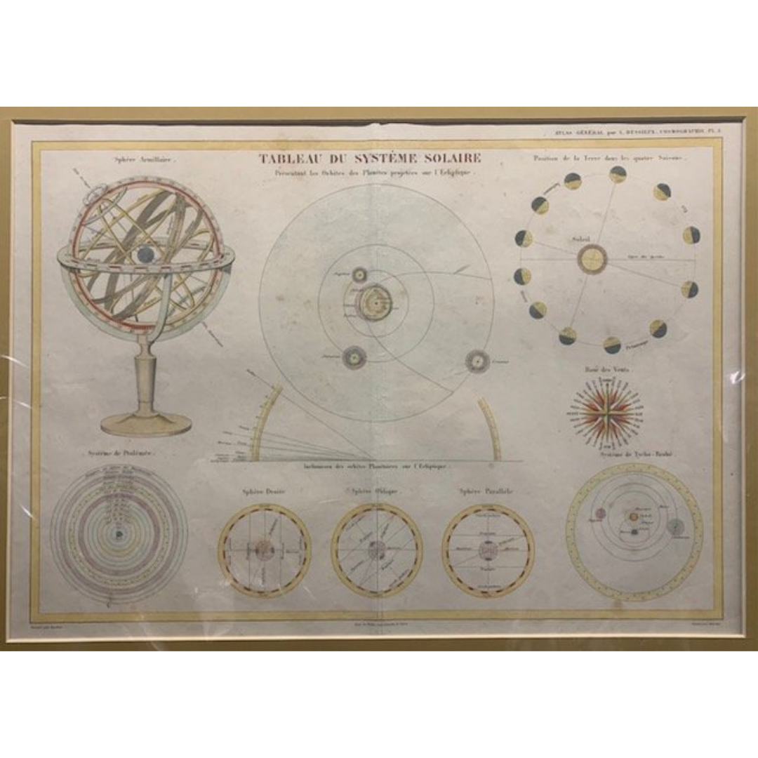
Tableau du Systeme Solaire 1850 R3,000
Annexation of the ZAR c1881 R3,000
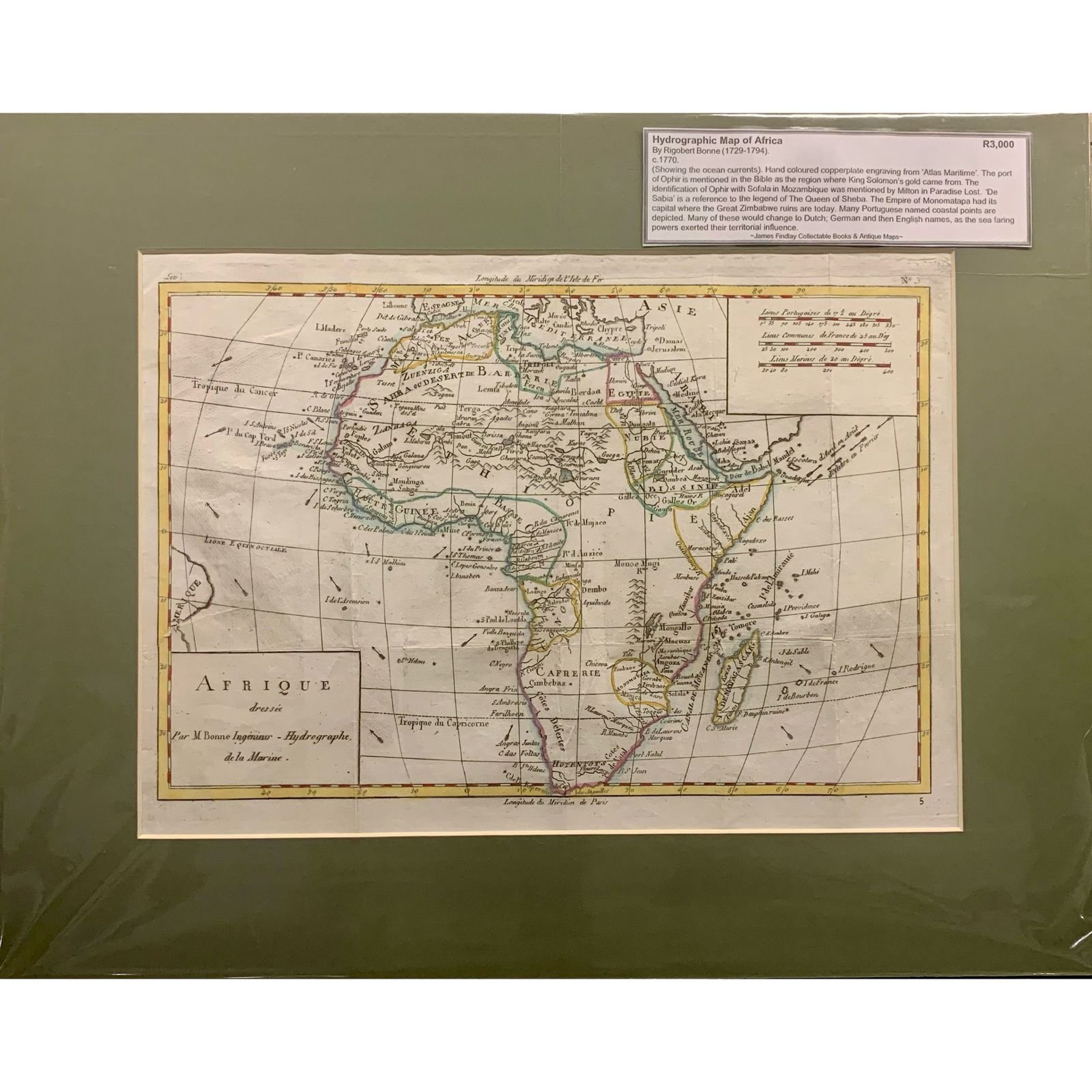
Hydrographic Map of Africa c.1770 R3,000
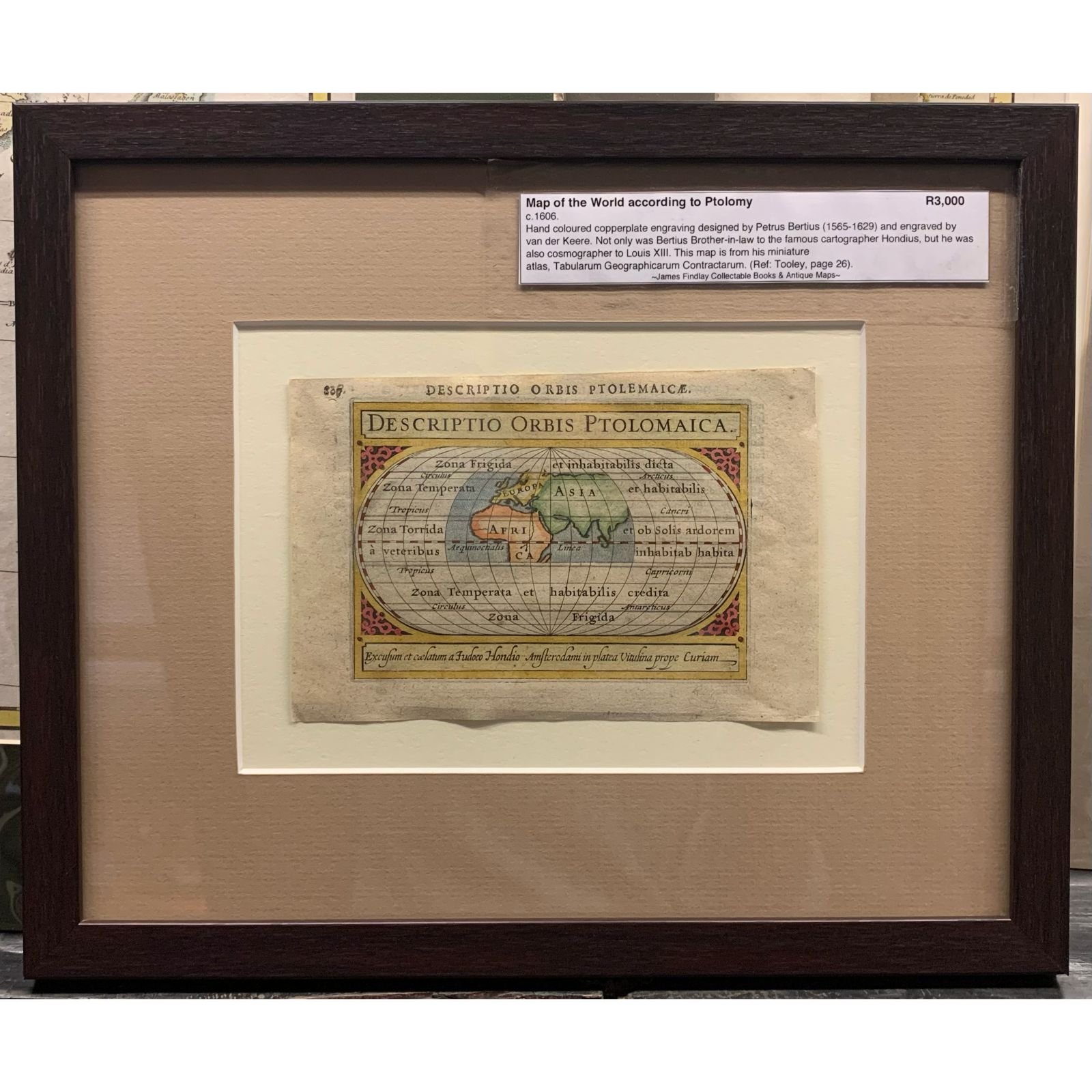
Map of the World according to Ptolomy c.1606 R3,000
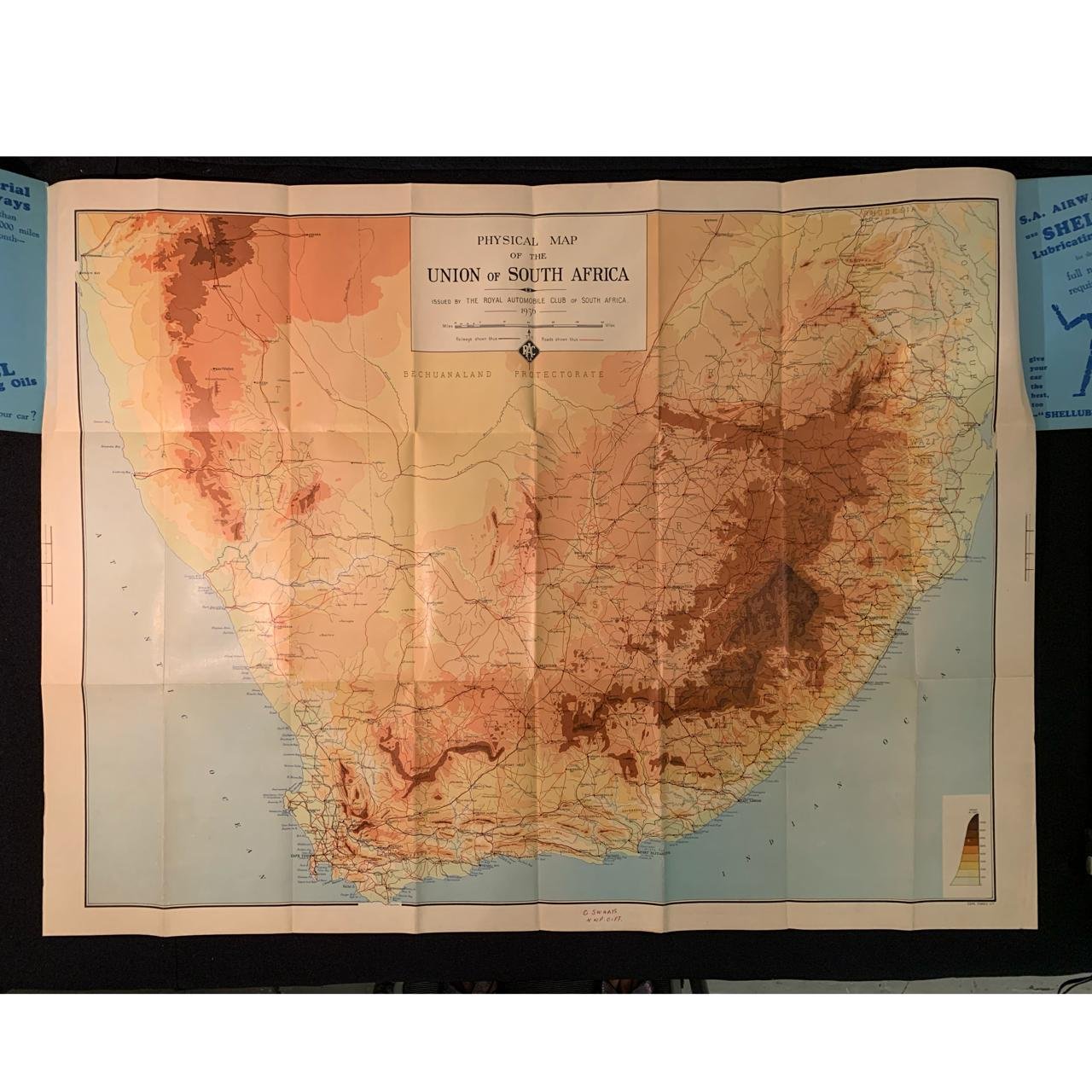
Physical Map of the Union of South Africa 1936 R2,500
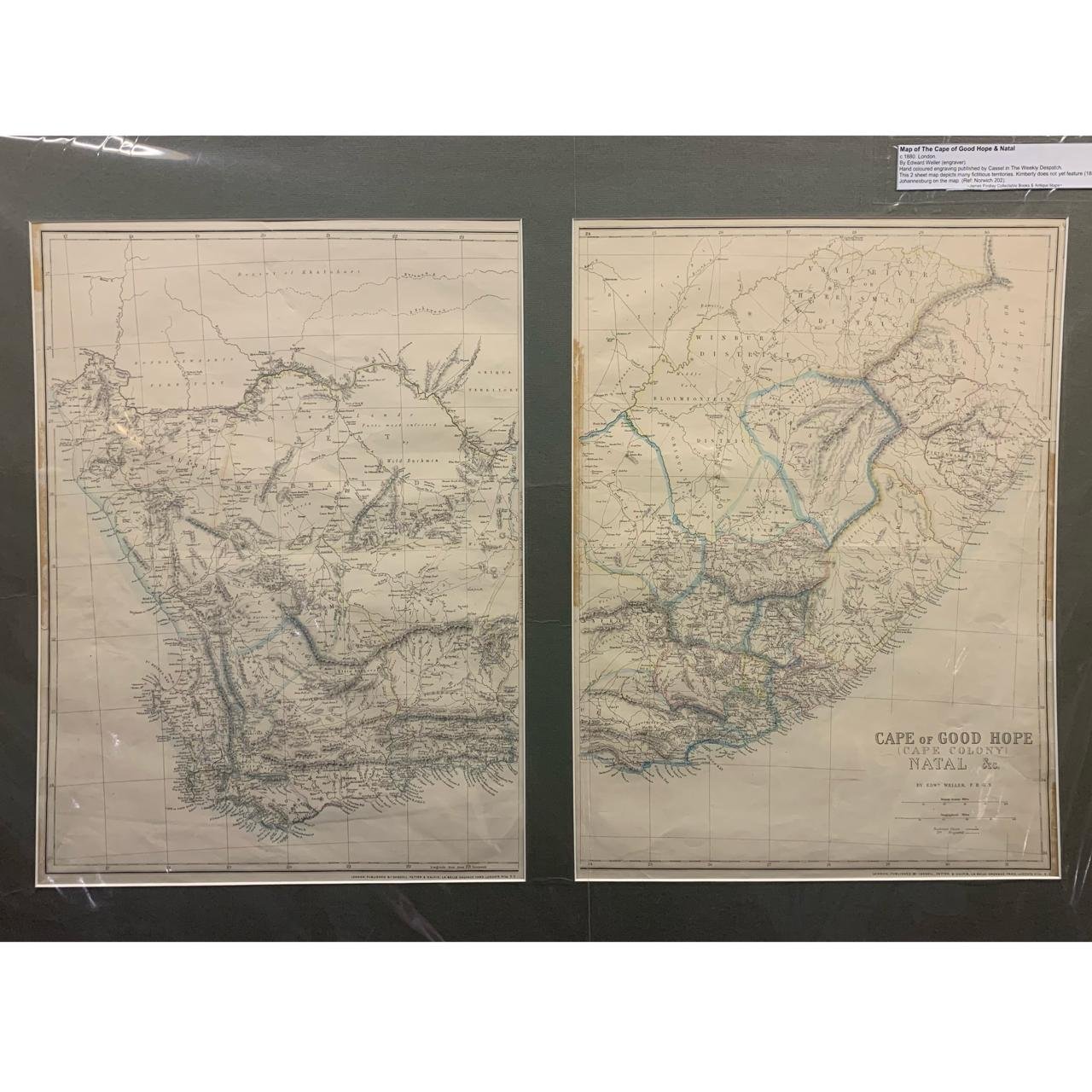
Map of the Cape of Good Hope and Natal c.1880 Sold Sept '25
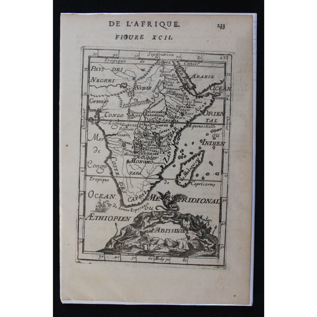
Map of Africa "Abissinie" – Ethiopian Empire c.1685 R2,500

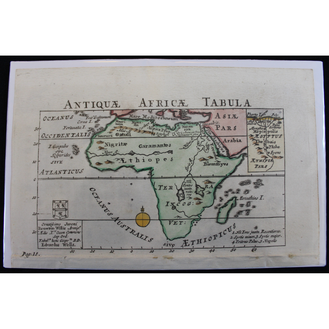
Map of Ancient Africa c.1685 R2,500 Reserved
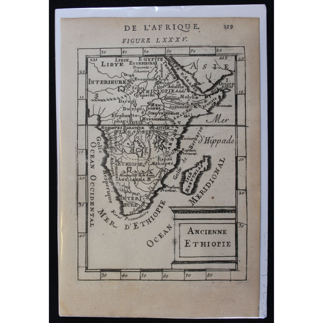
Map of Ancient Ethiopia (Africa) c.1685 R2,500

Map of Monomotapa c.1685 R2,500
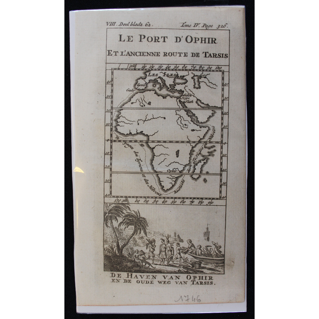
Map of Africa and the Biblical Treasure City of Ophir c.1746 R2,500
Ancient Map of Africa 1704 R2,000
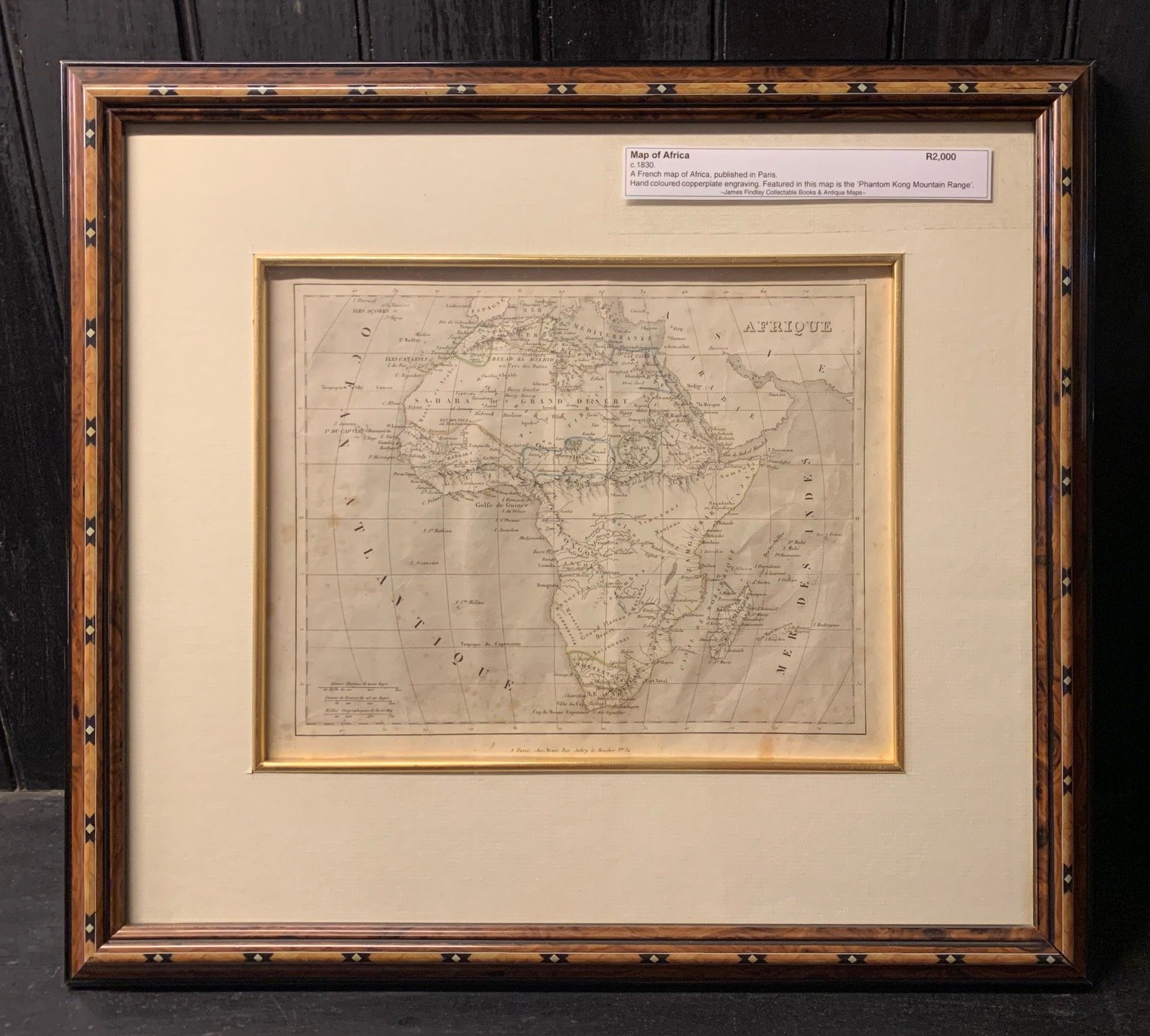
French Map of Africa c.1830 R2,000
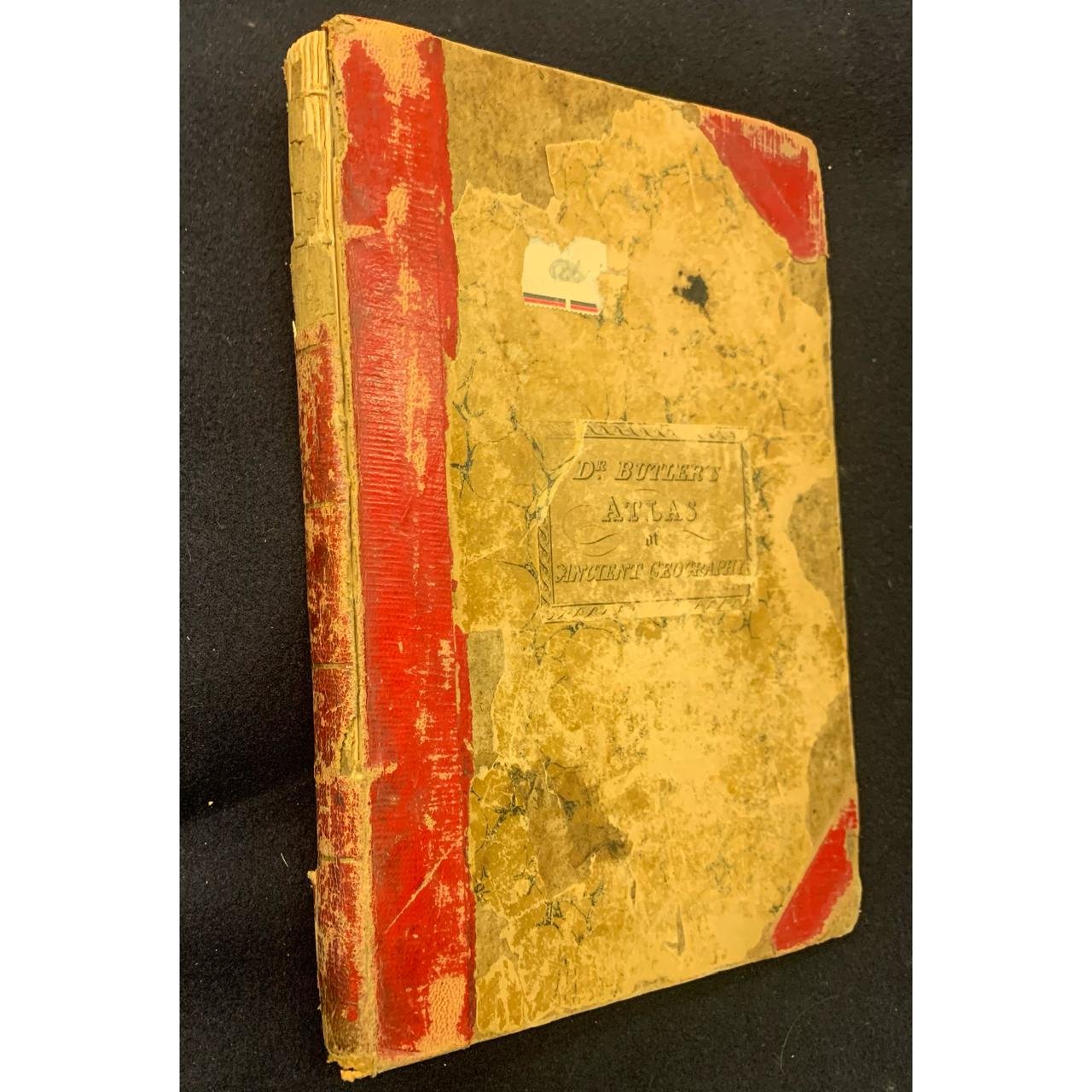
Dr Butler's Atlas of Ancient Geography c.1860 R2,000
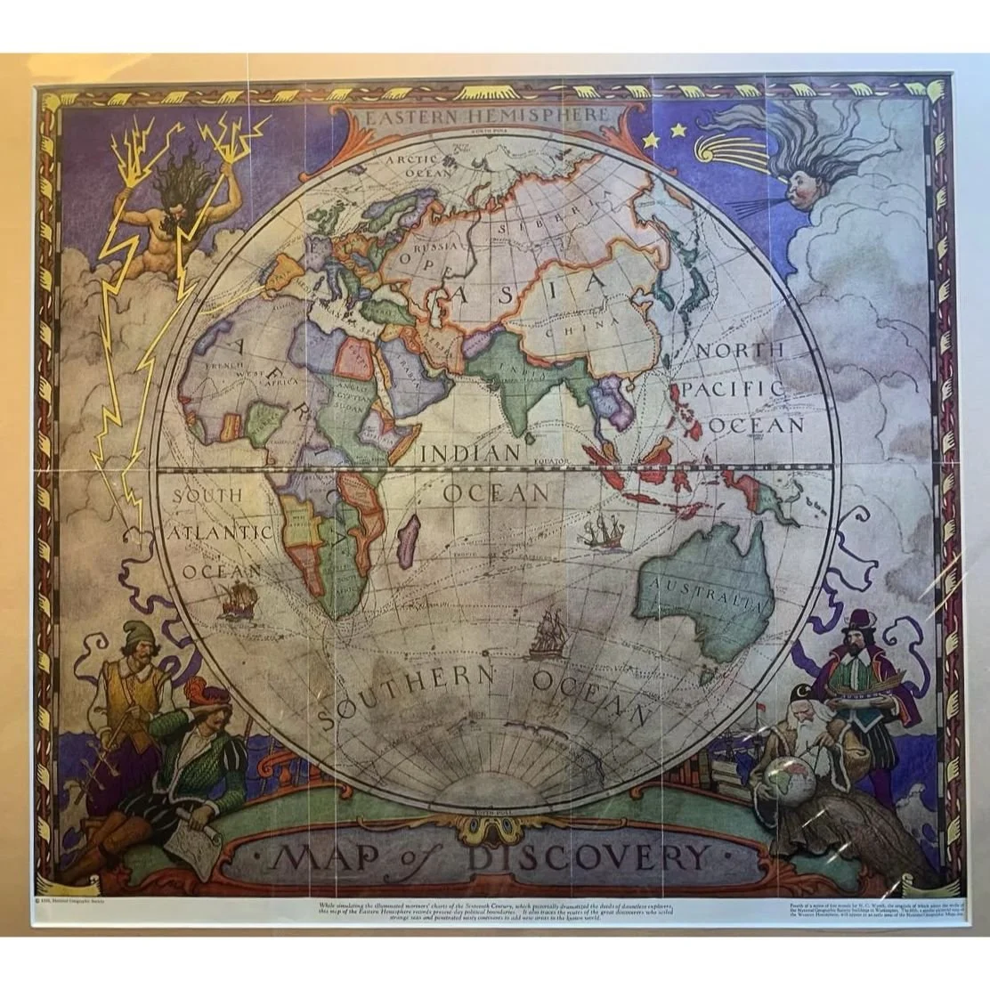
Map of The Eastern Hemisphere c.1928 R2,000
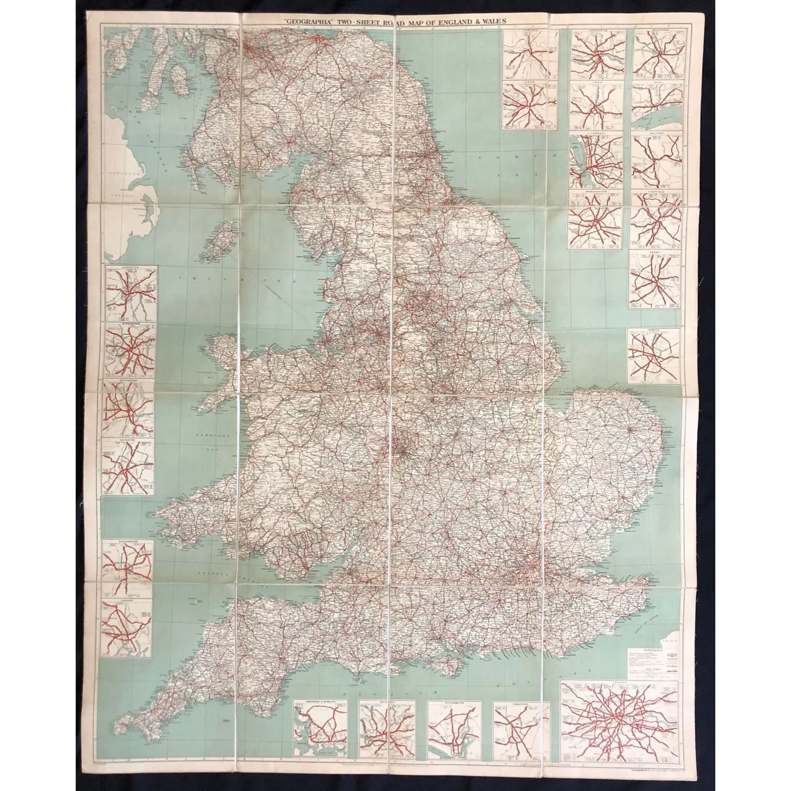
Geographia Two Sheet Road Map of England & Wales R2,000
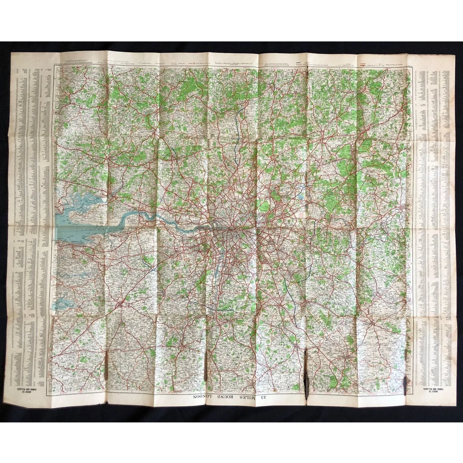
Road Map of London c.1930 R2,000

East Indian Archipelago with Burma and Siam c.1895 R1,500

Armillary Sphere 1776 R1,250
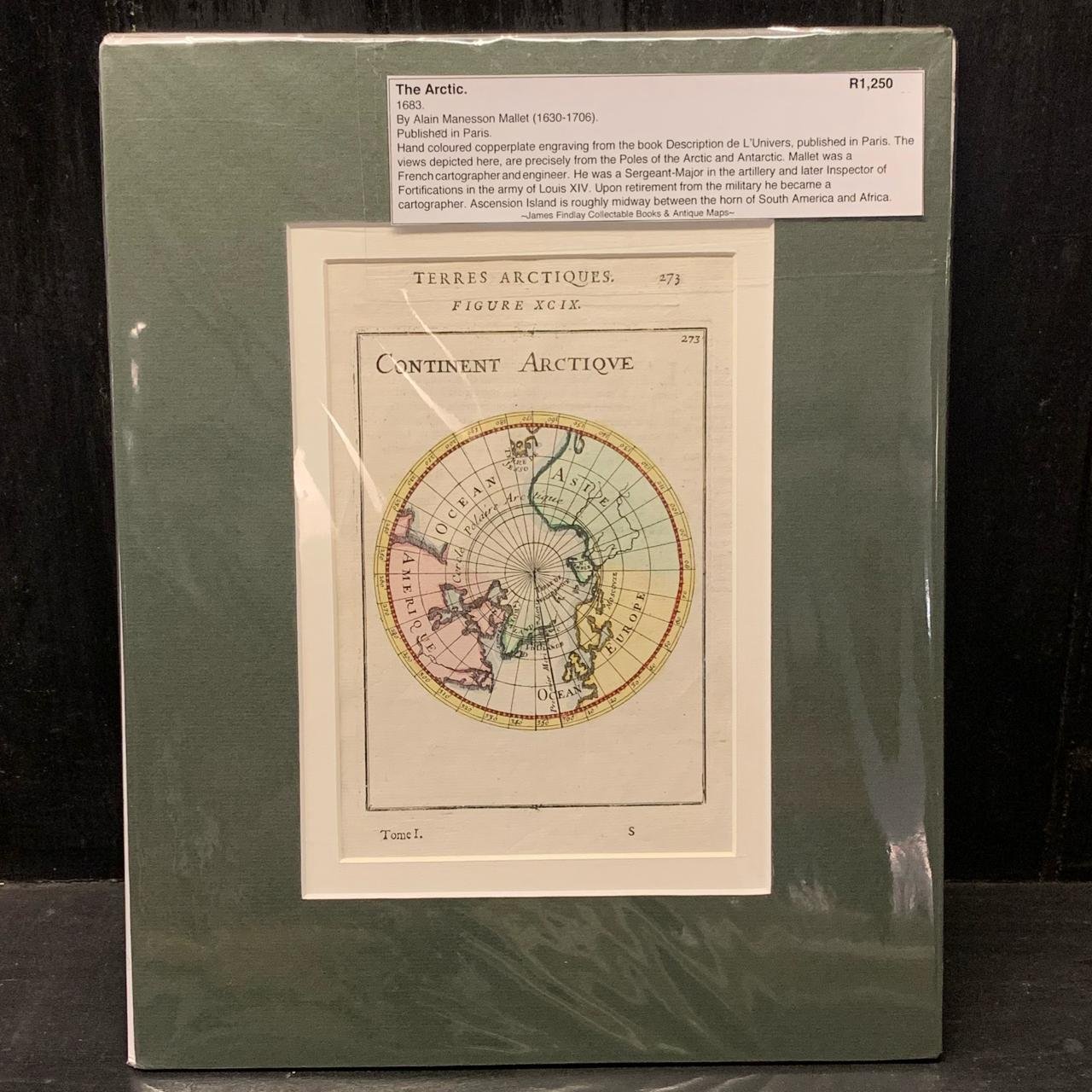
The Arctic 1683 R1,250