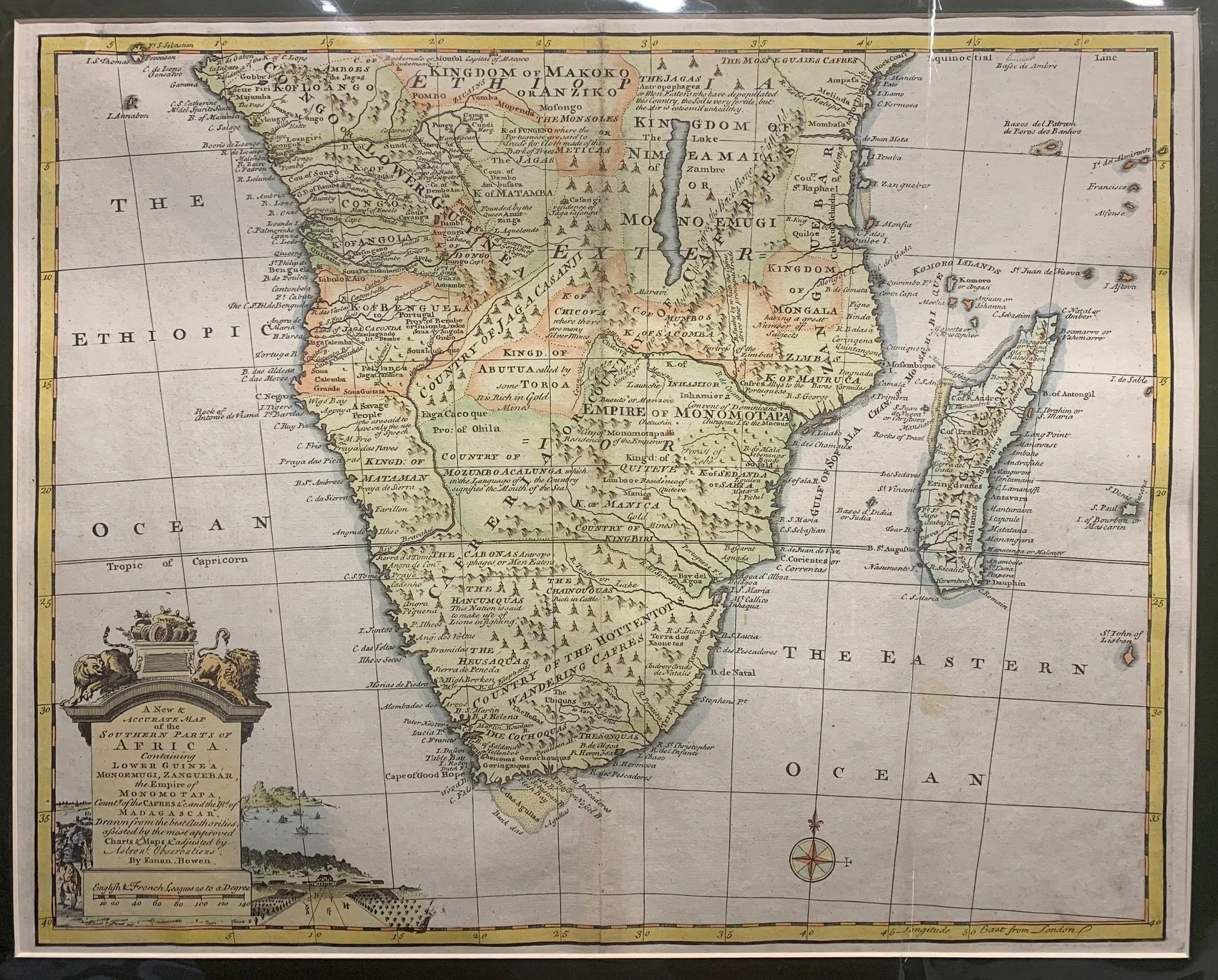
A New Map of the Southern Parts of Africa 1747
By Emanuel Bowen (1694–1767)
Published by William Innys, London. Later version.
Hand-coloured copperplate engraving (later colouring).
Bowen was a leading 18th century Welsh cartographer who could engrave; he also sold maps & prints from his shop in London. This map came from Bowen’s massive Complete Geography with seventy maps, ‘being all new-drawn and engraved according to the latest discoveries and surveys […] for the use of gentlemen, merchants, mariners and others, who delight in history and geography.’
Bowen used the London prime meridian on this map (see bottom right of the Longitude scale), the Greenwich Royal Observatory having been established in 1721.
440mm x 350mm excluding mountboard (unframed)
R10,000