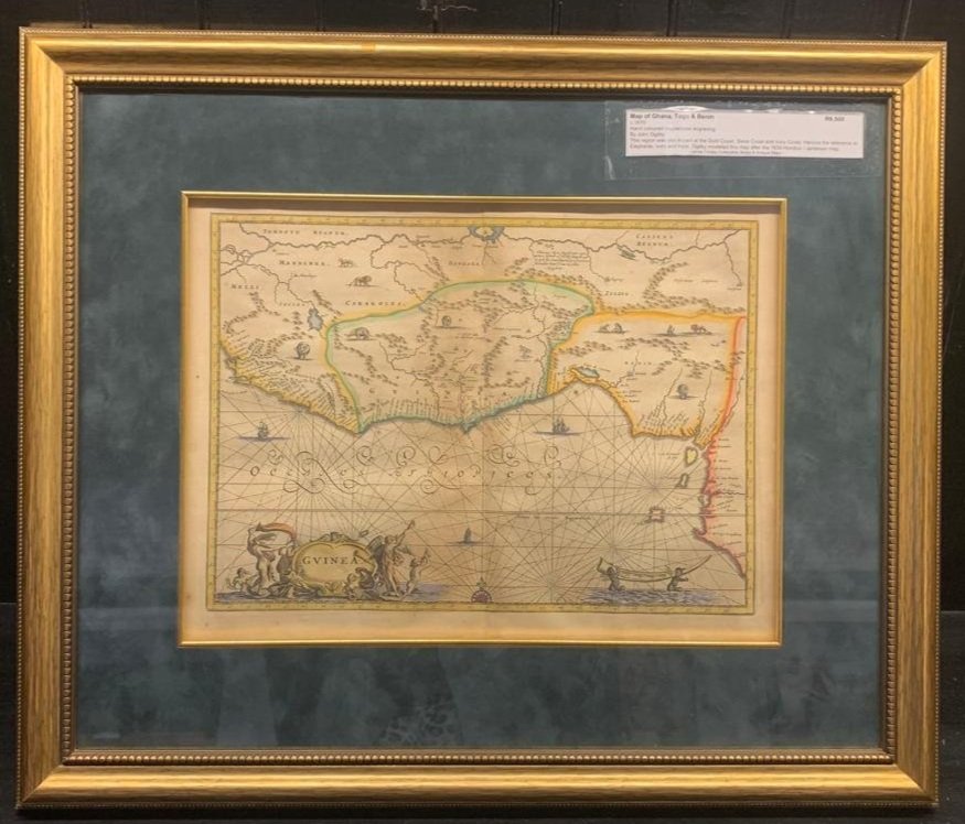
Map of Ghana, Togo and Benin c.1670
Hand-coloured copperplate engraving c.1670
By John Ogilby
This region was also known as the Gold Coast, Slave Coast and Ivory Coast. Hence the reference to elephants, ivory and trade. Ogilby modelled this map after the 1639 Hondius / Janesson map.
600mm x 500mm (framed)
R6,500