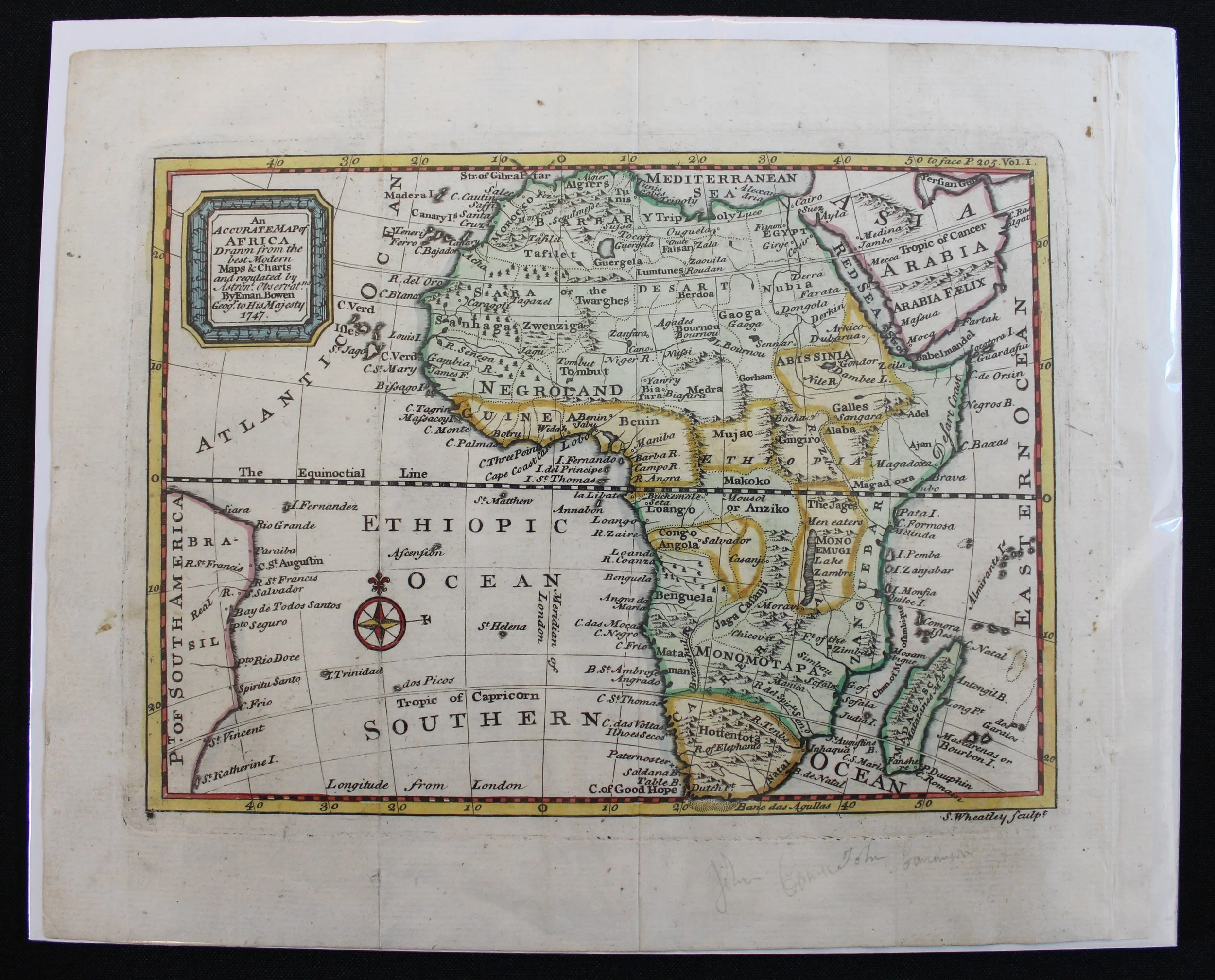
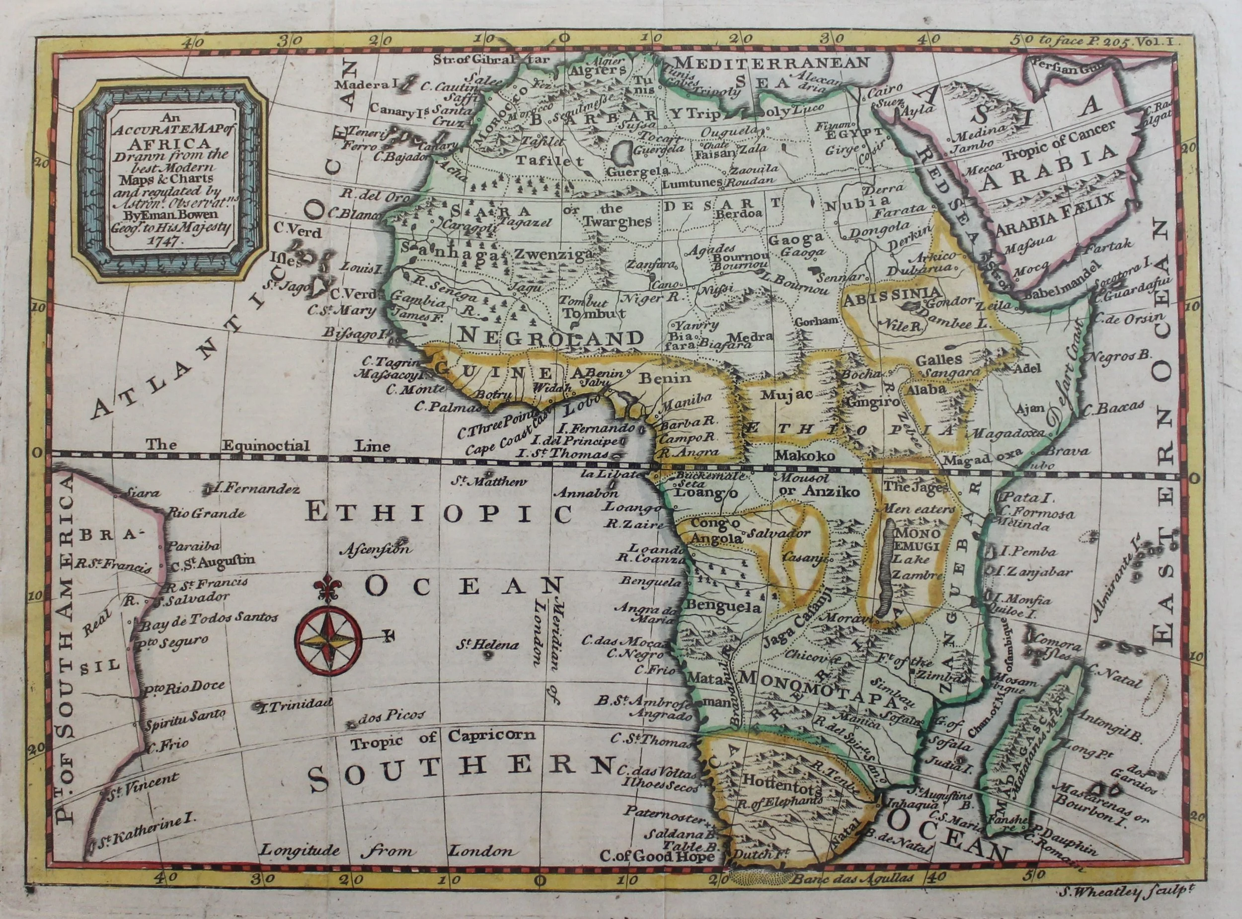
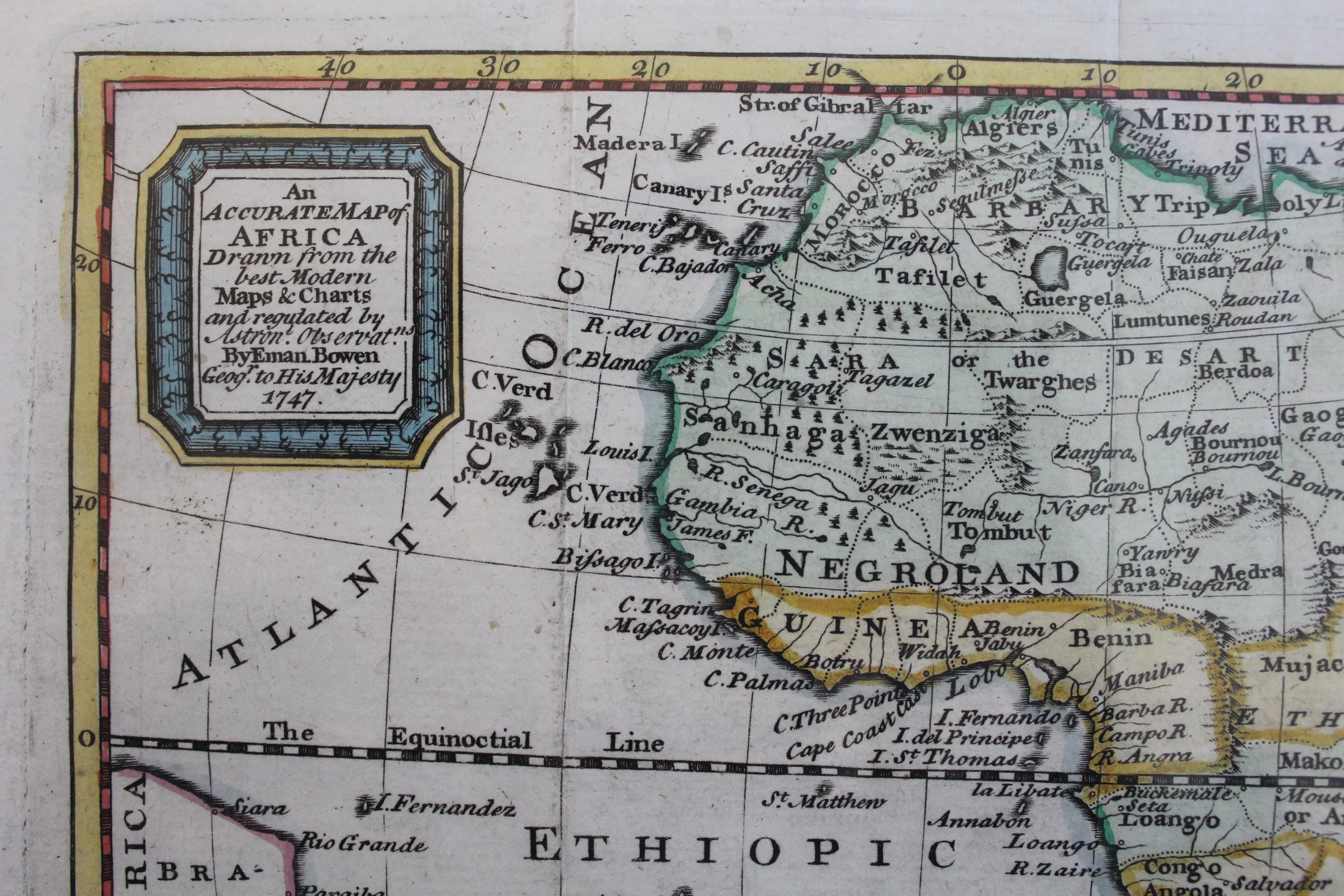
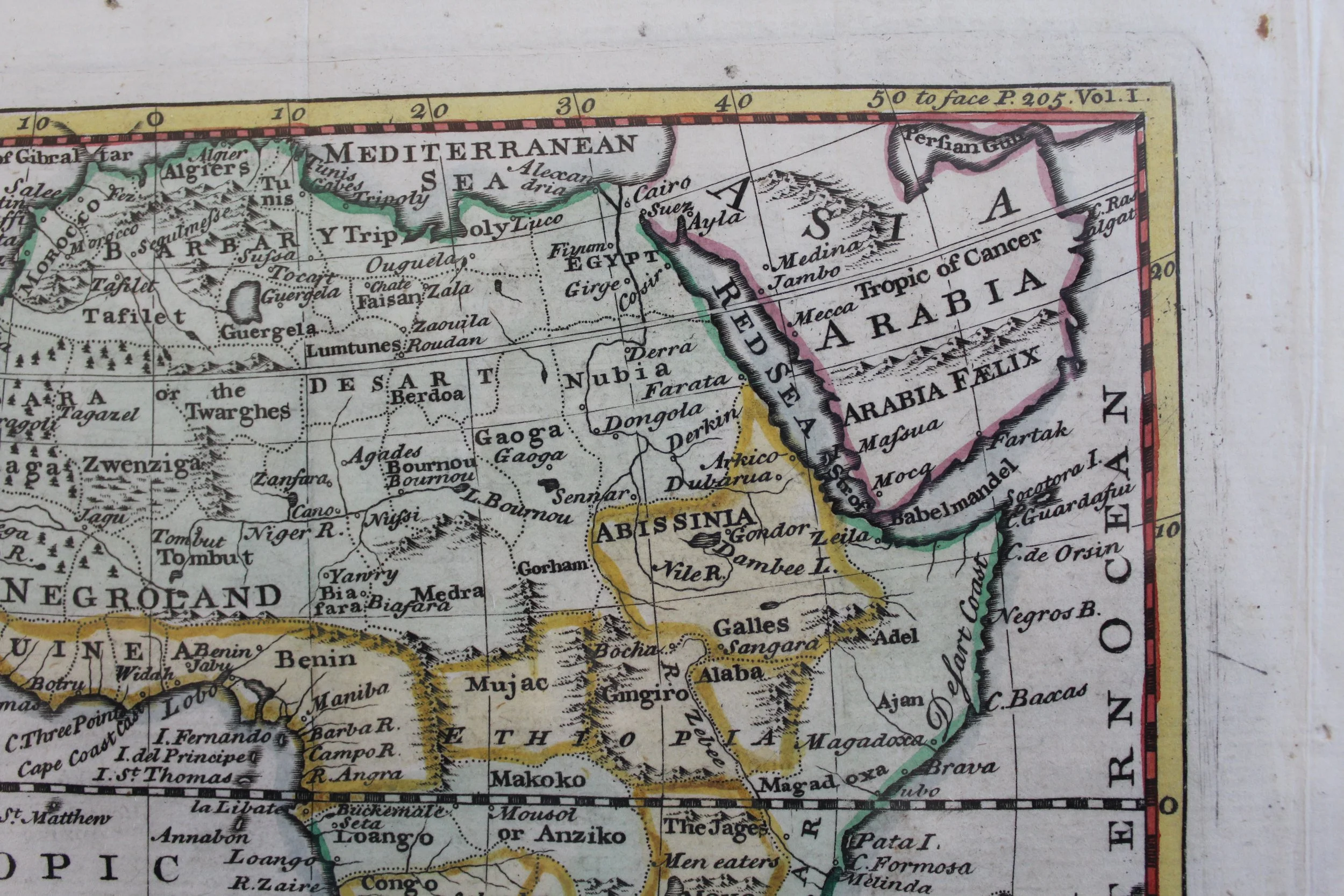
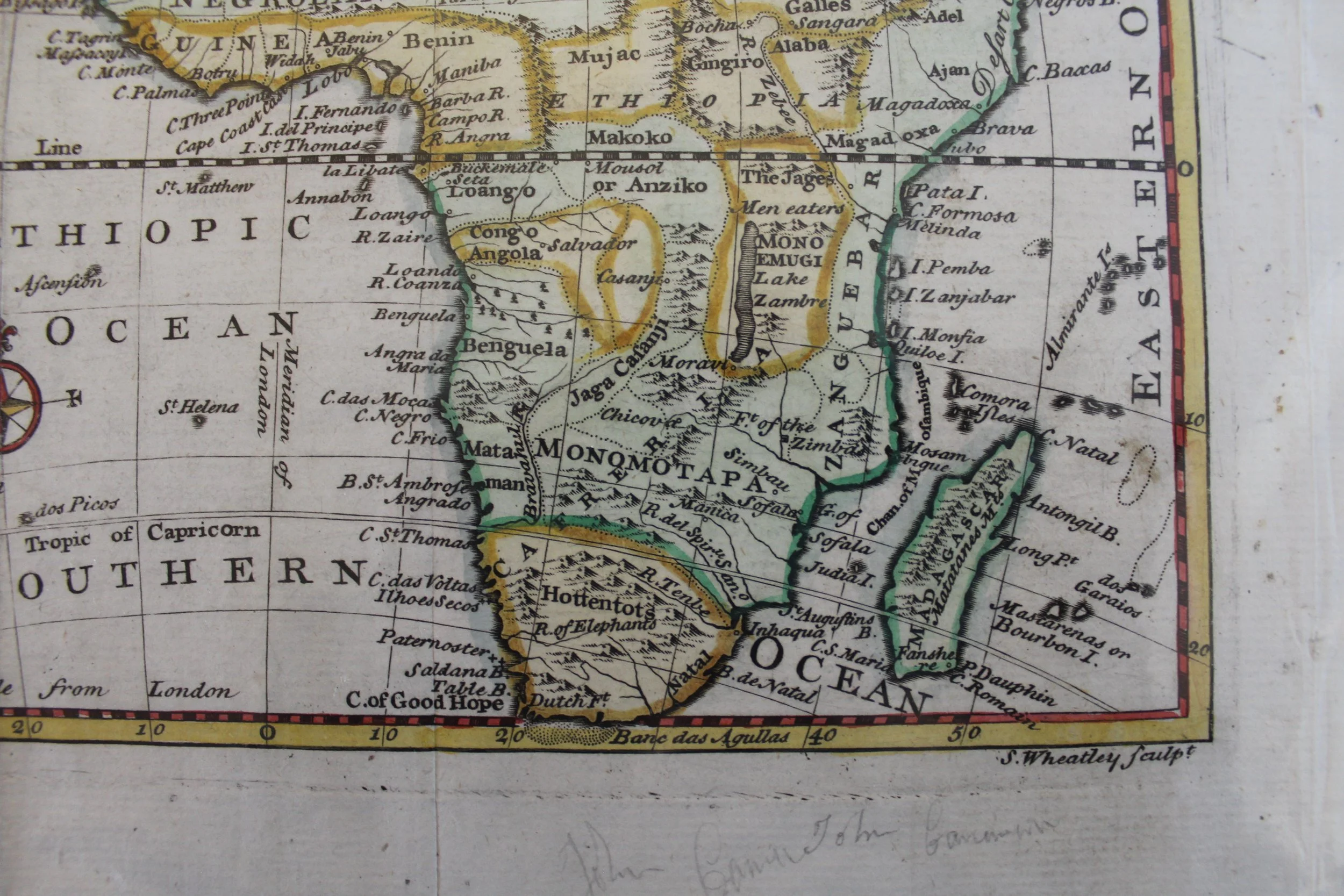
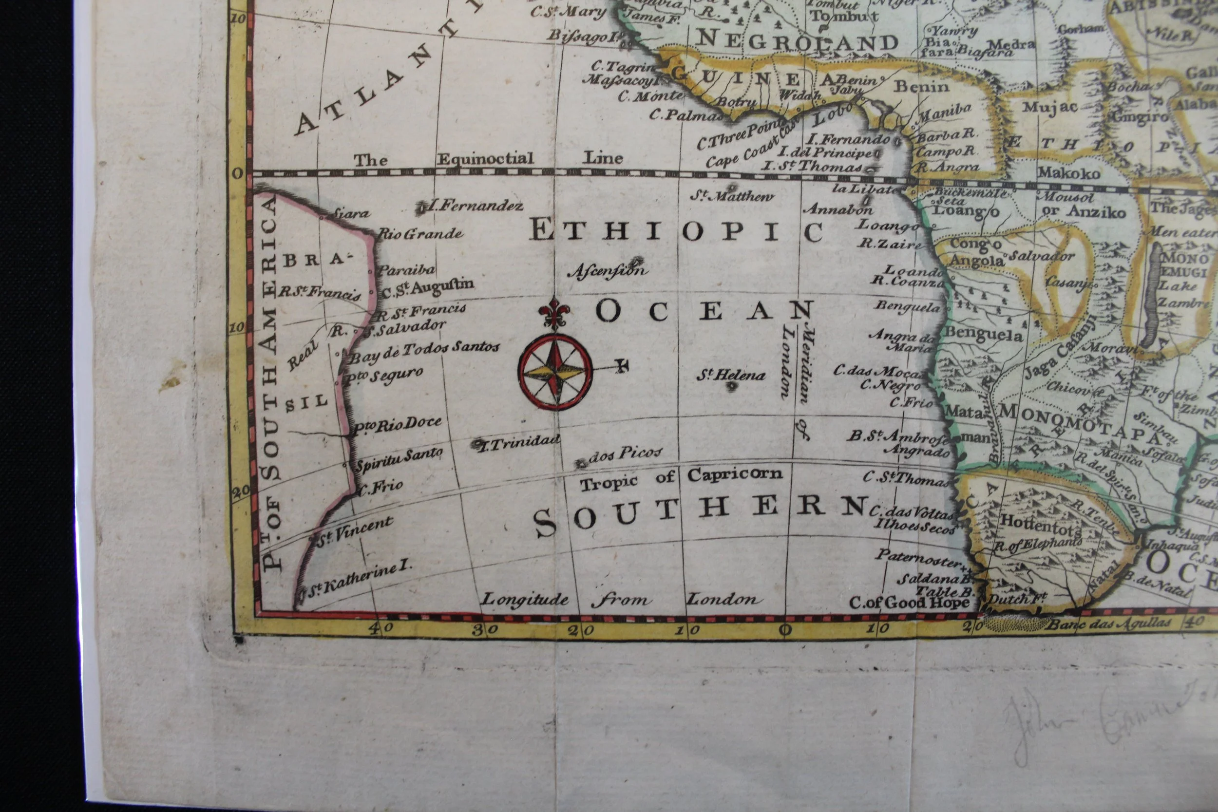
An Accurate Map of Africa
1747
Copperplate engraving by Emanuel Bowen (1694–1767).
Bowen was a leading 18th century English cartographer who could engrave; he also sold maps & prints from his shop in London.
From Bowen's massive Complete Geography with seventy maps, “being all new-drawn and engraved according to the latest discoveries and surveys ... for the use of gentlemen, merchants, mariners, and others, who delight in history and geography”.
This map of Africa seems to be based on the geography of the famous French cartographer, Guillaume Delisle, who, in 1700, broke from the outdated traditional cartography based on Ptolemy and thereby advanced scientific cartography. Kingdoms and Empires of Africa, as they were known or thought to exist at the time, are colourfully illustrated.
Delisle used the Paris prime meridian, but Bowen used London on this map (see bottom right of longitude scale), the Greenwich Royal Observatory having been established in 1675.
Minor foxing, creased along fold lines with some other minor creases.
245 x 202mm
R3,000