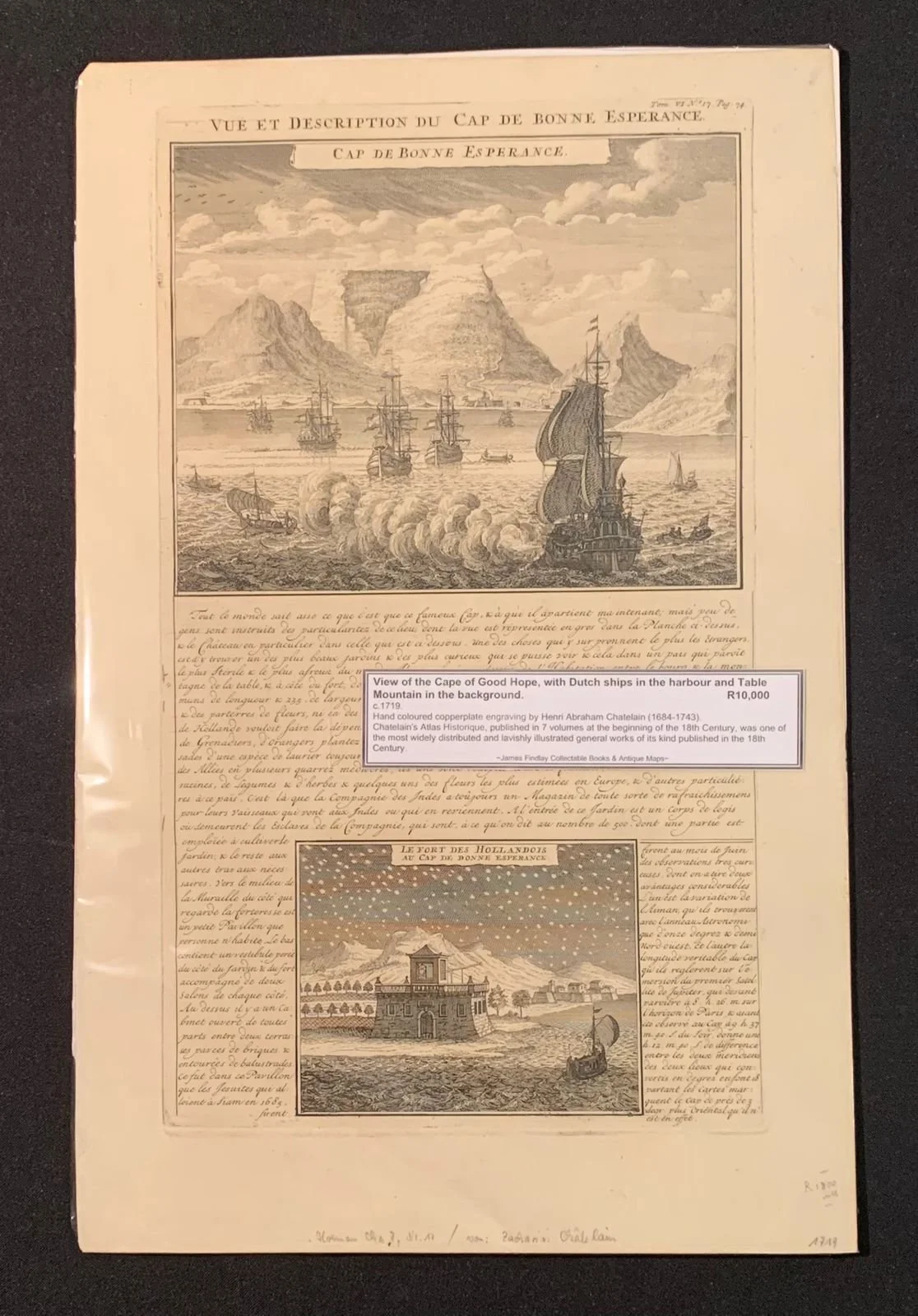
Views of the Cape of Good Hope
With Dutch ships in the harbour and Table Mountain in the background.
By Henri Chatelain
c.1719
Hand-coloured copperplate engraving.
Huguenot pastor Henri Abraham Chatelain (1684–1743) was born in Paris, but moved across Europe as religious hostilities increased under Louis XIV. Chatelain drafted his own original maps, which conveyed the breadth of his historical and geographical knowledge through their ethnographic, heraldic and cosmographic details.
From 1705 to 1720, the Chatelain family published the monumental Atlas historique, ou nouvelle introduction à l’histoire, à la chronologie & à la géographie ancienne et moderne in seven volumes, which included two hundred and eighty-five engraved maps, views, plans, tables, heraldic and genealogical charts. While Henri Chatelain himself was responsible for the plates, the extensive accompanying text was compiled by historian Nicholas Gueudeville-Garillon, and included a supplement by polymath Henri Philippe de Limiers.
283mm x 437mm
R10,000