The Mendelssohn Map Lithographic Requisition - Boer War
These documents reveal a fascinating, behind-the-scenes military and bureaucratic dispute over mapmaking assets during the Anglo-Boer War (1899–1902).
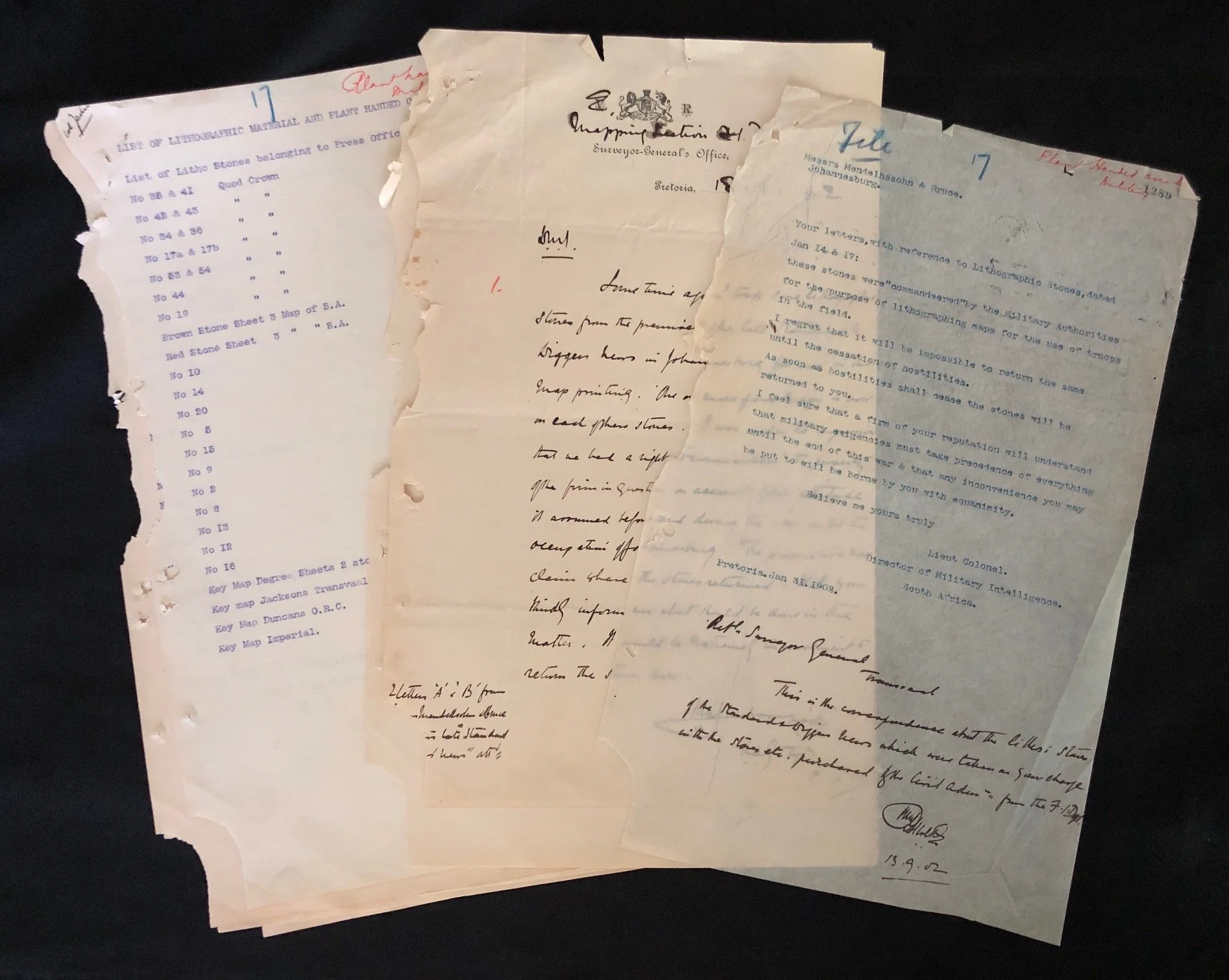
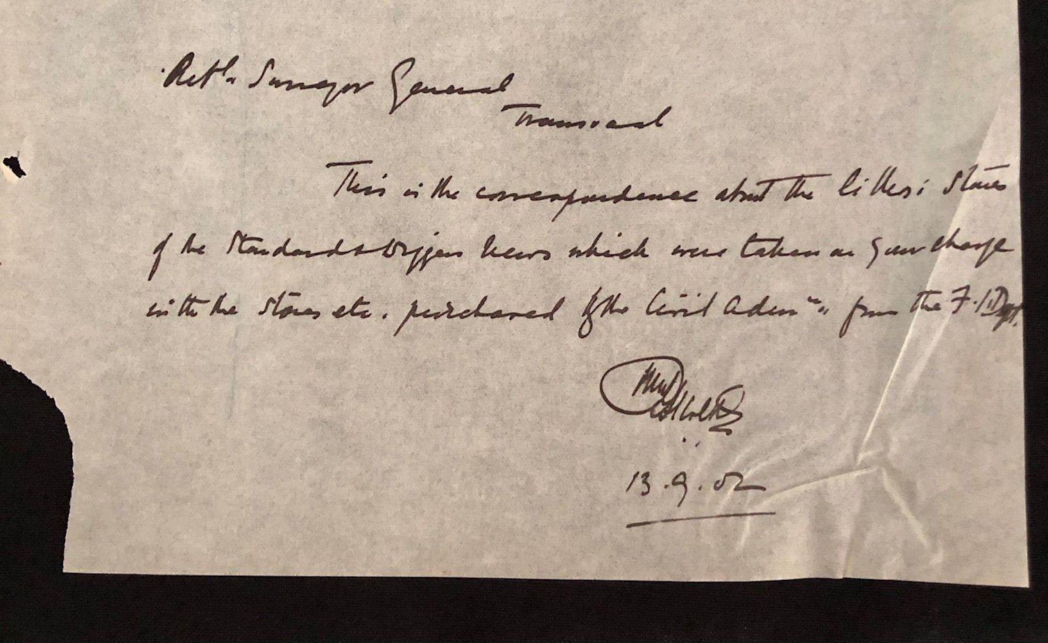
Before modern offset printing, mass map production relied on heavy, high-grade Bavarian limestone blocks (lithographic stones) polished smooth and etched with chemical inks. During wartime, topographically accurate military maps were vital for troop movements. These documents show that the British Field Intelligence Department (F.I.D.) Mapping Section requisitioned ("commandeered") lithographic stones directly from private printing establishments in Johannesburg, specifically Mendelssohn & Bruce (and the late Standard & Diggers News).
The recipient of the letter, Messrs. Mendelssohn & Bruce, was co-founded by Sidney Mendelssohn. Mendelssohn is one of the most famous figures in South African bibliography, best known for compiling the landmark South African Bibliography (1910). His Johannesburg printing firm's equipment was seized by British military intelligence while Johannesburg was under military control.
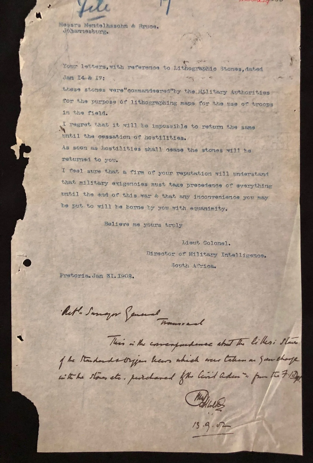
In the letter dated January 31, 1902 (written from Pretoria by the Director of Military Intelligence, South Africa), the British military explicitly refuses to return the lithographic stones:
"I regret that it will be impossible to return the same until the cessation of hostilities... I feel sure that a firm of your reputation will understand that military exigencies must take precedence of everything until the end of this war & that any inconvenience you may be put to will be borne by you with equanimity."
The polite yet firm military bureaucracy essentially tells the prominent firm to wait out the war "with equanimity" while their assets are used for field map printing.
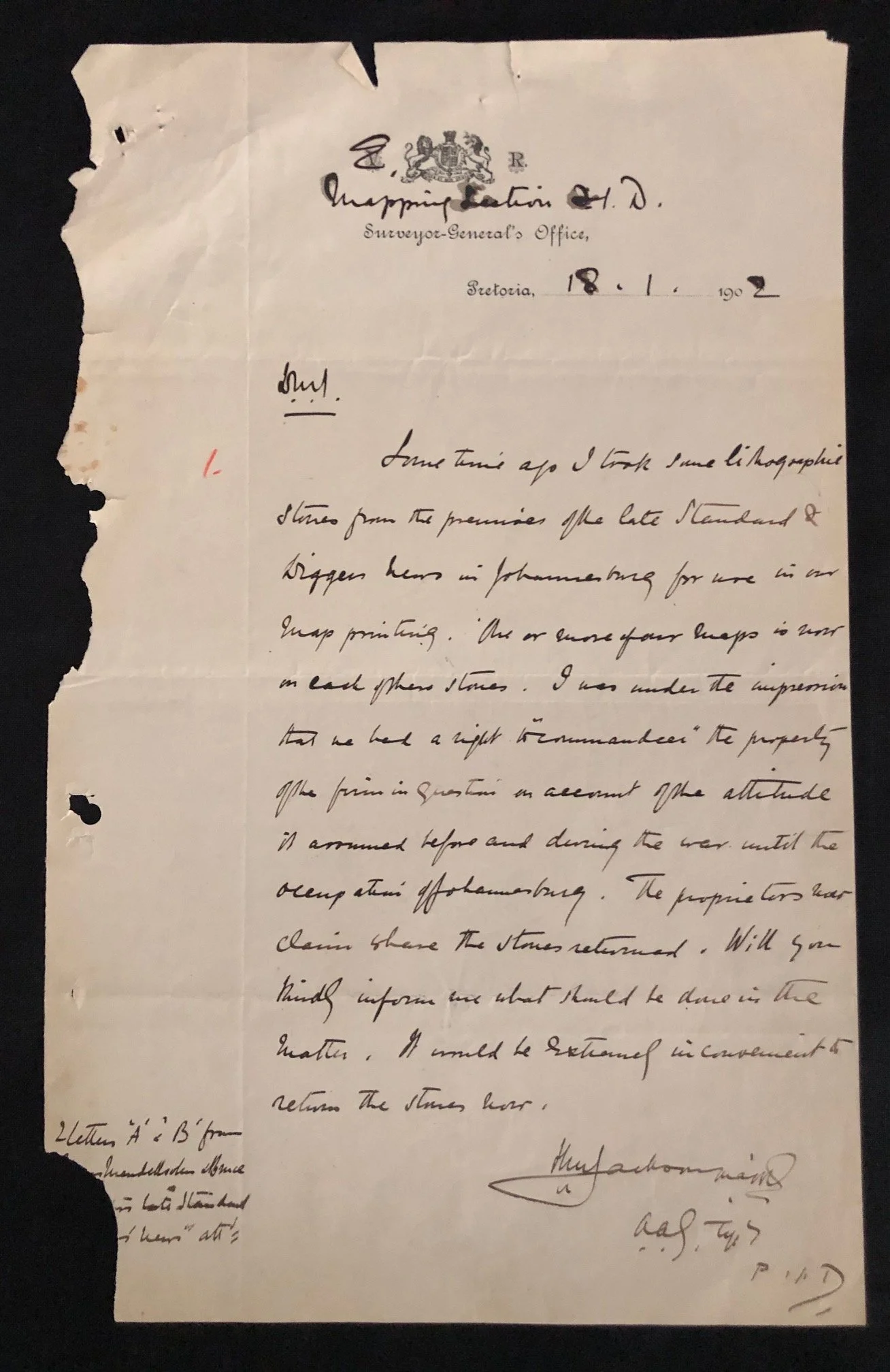
In the accompanying handwritten internal memo from the Mapping Section F.I.D. (dated Jan 18, 1902), the officer notes:
"I was under the impression that we had a right to 'commandeer' the property of the firm in question on account of the attitude it assumed before and during the war until the occupation of Johannesburg."
This highlights how the British intelligence department justified the initial seizure based on political suspicion regarding the firm's perceived Boer sympathies or wartime stance.
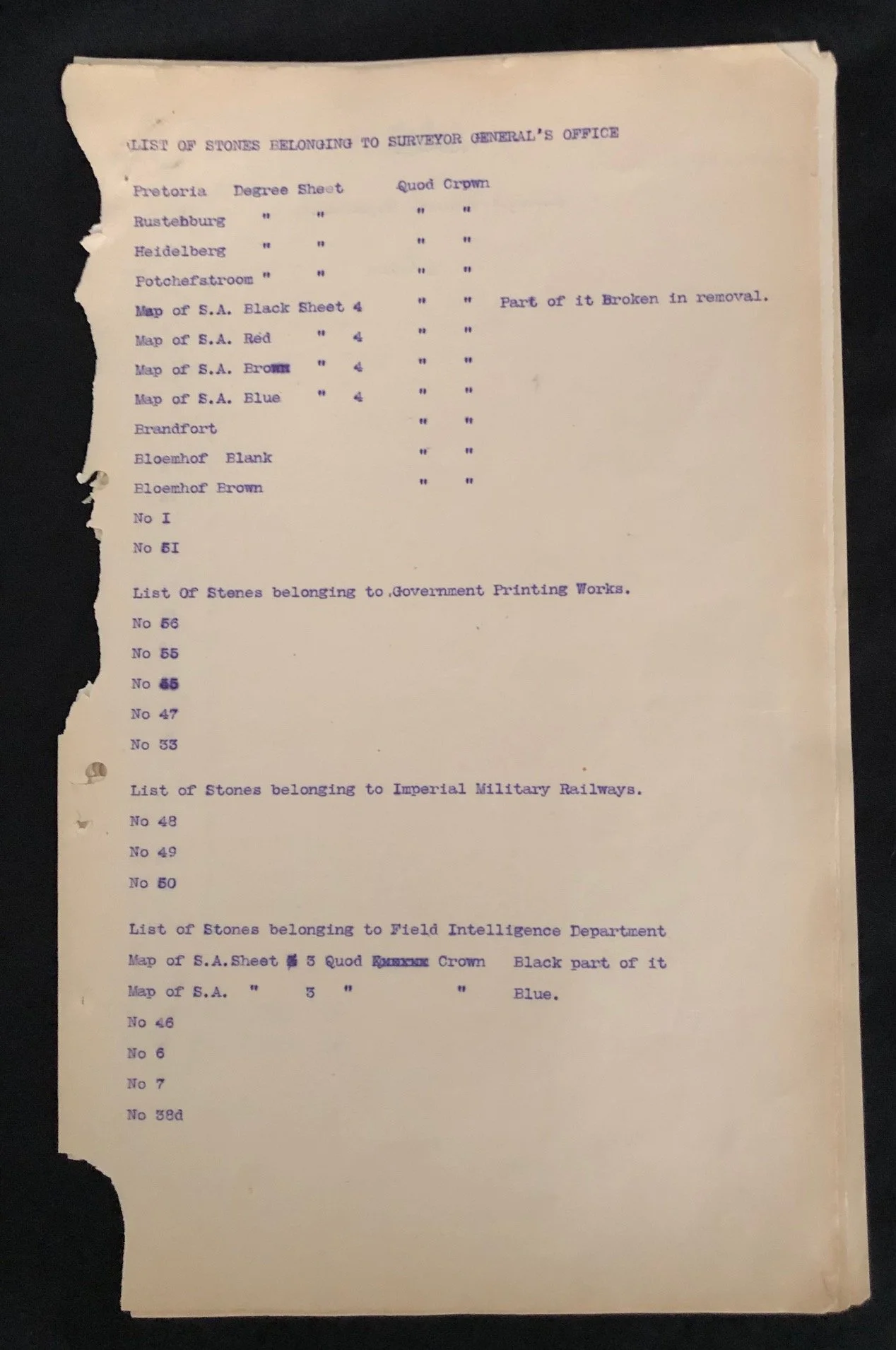
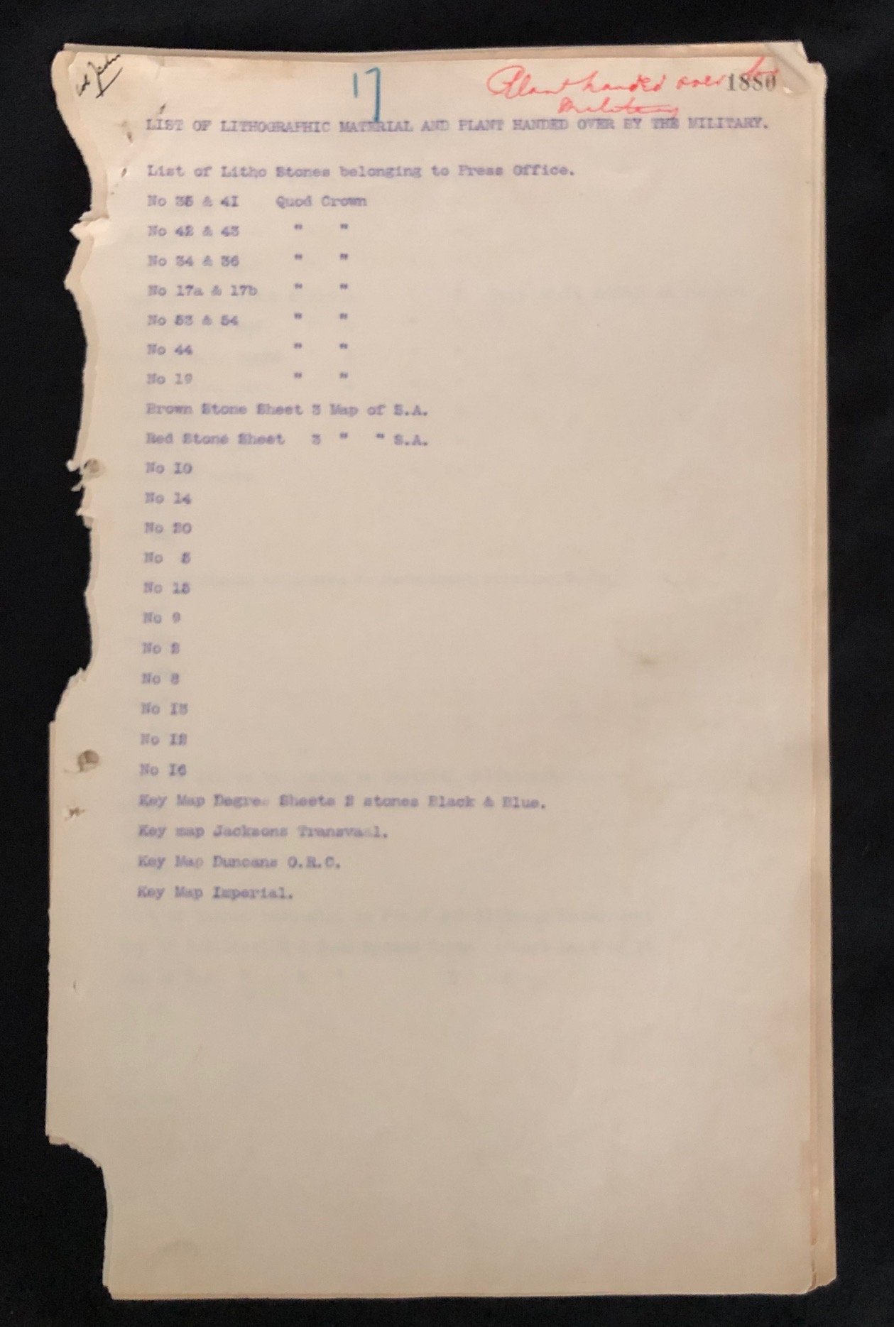
The typed inventory lists reveal exactly what military maps were stored on these seized stones:
Degree Sheets: Pretoria, Rustenburg, Heidelberg, Potchefstroom
Colour Separations: Separate litho stones for Black, Red, Brown, and Blue layers for the Map of S.A.
Key regional maps including Jackson's Transvaal, Duncan's O.R.C. (Orange River Colony), and Imperial maps.
Physical mishaps of field logistics: One entry explicitly notes that a degree sheet stone was "Part of it Broken in removal."
All 9 pages torn and damaged. Sold as a collection, not necessarily complete.
200mm x 330mm
R7,500