Two maps: Allied Propaganda air-dropped in the First World War 1918
These two maps were used for psychological warfare (air-dropped propaganda) from the final weeks of the First World War.
The Strategy: Weaponized Transparency
During the final months of WWI, British and French intelligence realized that the most effective way to break German morale and encourage occupied populations to revolt was simply to tell the truth. By 1918, the German high command was heavily censoring news of their retreats.
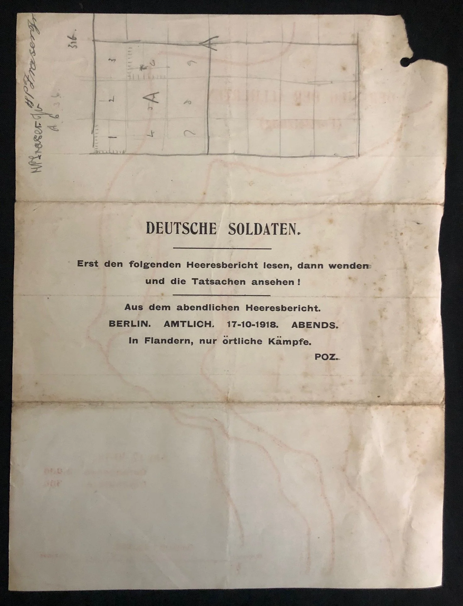
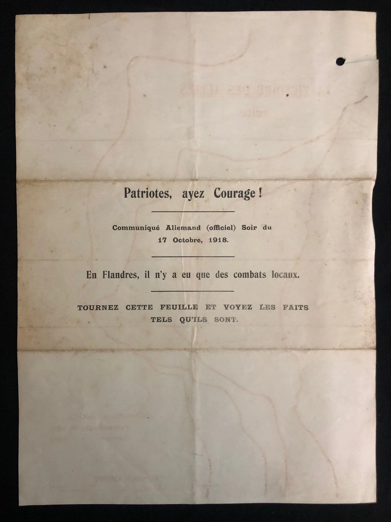
The front of the leaflet targets occupied civilians and demoralized soldiers in Belgium with dark irony:
"Patriots, have Courage! German Communiqué (official) Evening of October 17, 1918: 'In Flanders, there were only local combats.'"
It then instructs the reader: "Turn this sheet over and see the facts as they are."
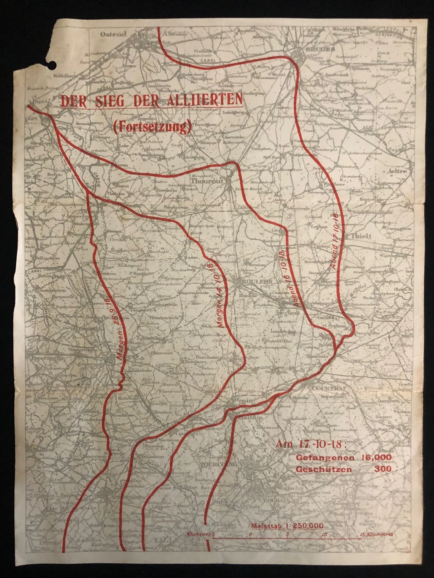
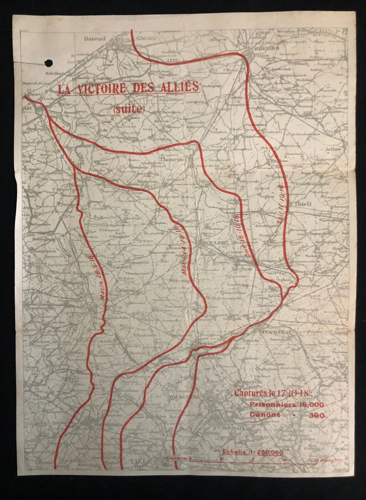
The Map: Visualizing the Collapse
When the reader flips the page, they are confronted with an undeniable, data-driven contradiction of the German report. The map shows the massive progress of the Fifth Battle of Ypres (part of the Allied "Hundred Days Offensive").
The red lines track the stunningly rapid Allied advance through Flanders toward the Dutch border:
Matin 28-9-18: The starting line of the offensive near Ypres.
Matin 14-10-18 & Soin 16-10-18: The rapid breakthrough past Roulers (Roeselare).
Soir 17-10-18: The front line on the exact evening the German military claimed nothing but "local combats" was happening. By this point, the Allies had broken through to the gates of Bruges and Ostend.
To drive the point home, the bottom right lists the devastating cost of that single offensive up to that date: 16,000 prisoners and 300 cannons captured.
Delivery via "Air Mail"
Because these regions were heavily occupied by the German military, these flyers couldn't be distributed by hand. They were printed en masse by Allied forces (likely French or British, given the French text) and dropped over towns, trenches, and supply lines using specialized unmanned propaganda balloons or low-flying aircraft.
Possessing one of these leaflets was strictly forbidden by German authorities; civilians caught with them faced severe penalties, which makes surviving copies particularly scarce. Less than a month after this leaflet was dropped, Germany signed the Armistice on November 11, 1918.
Punch holes, wear to edges, some tears.
Each map: 220mm x 295mm
R1.500