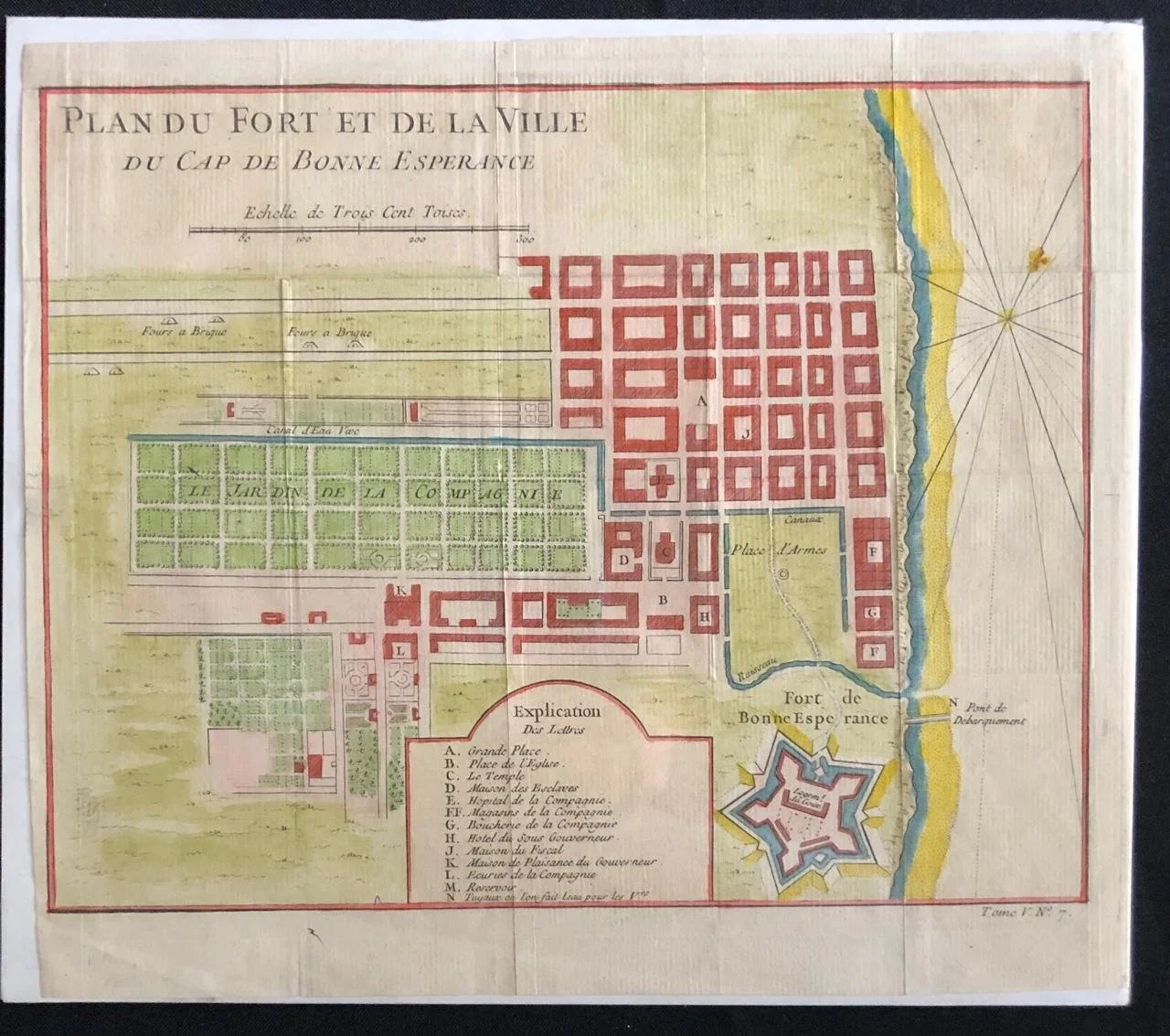
Map of Cape Town & The Fort
By Jacques-Nicolas Bellin (1703-1772).
Hand coloured copperplate engraving.
Plan du Fort et de la Ville du Cap de Bonne Esperance.
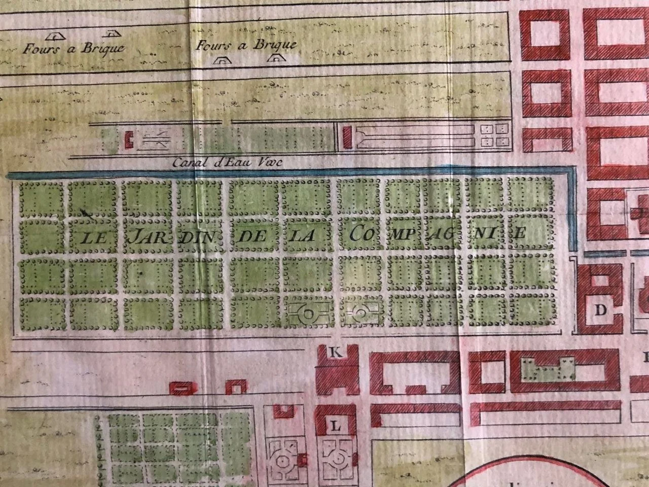
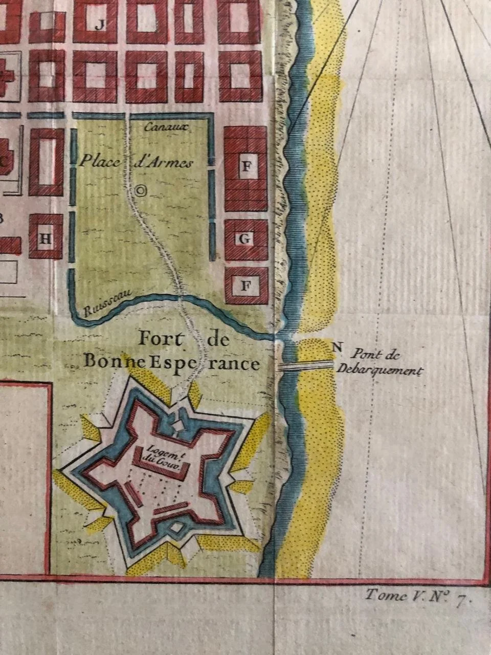
Cape Town in the 18th century was a bustling, strategically vital Dutch East India Company (VOC) outpost, characterized by rapid growth, significant slave populations, cultural fusion, frequent epidemics (especially smallpox), and increasing conflict with Britain, culminating in its first British occupation in 1795, fundamentally changing its status from a simple refreshment station to a contested colonial hub. The settlement grew from a small fort area, with canals, markets (Grand Parade), Company Gardens, and the nascent Bo-Kaap district, becoming a diverse city of Dutch settlers, slaves from Asia/Africa, and political exiles, developing distinct Cape Malay culture through music, food, and architecture.
Jacques-Nicolas Bellin (1703-1772) was among the most important mapmakers of the eighteenth century. In 1721, at only the age of 18, he was appointed Hydrographer to the French Navy. In August 1741, he became the first Ingénieur de la Marine of the Dépôt des cartes et plans de la Marine (the French Hydrographic Office) and was named Official Hydrographer of the French King.
During his term as Official Hydrographer, the Dépôt was the one of the most active centers for the production of sea charts and maps in Europe. Their output included a folio-format sea atlas of France the Neptune Francois. He also produced a number of sea atlases of the world, including the Atlas Maritime and the Hydrographie Francaise. These gained fame and distinction all over Europe and were republished throughout the eighteenth and even in the nineteenth century.
Bellin also produced smaller format maps such as the 1764 Petit Atlas Maritime, containing 580 finely-detailed charts. He also contributed a number of maps for the 15-volume Histoire Generale des Voyages of Antoine François Prévost.
Bellin set a very high standard of workmanship and accuracy, cementing France's leading role in European cartography and geography during this period. Many of his maps were copied by other mapmakers across the continent.
280mm x 250mm
R3,000