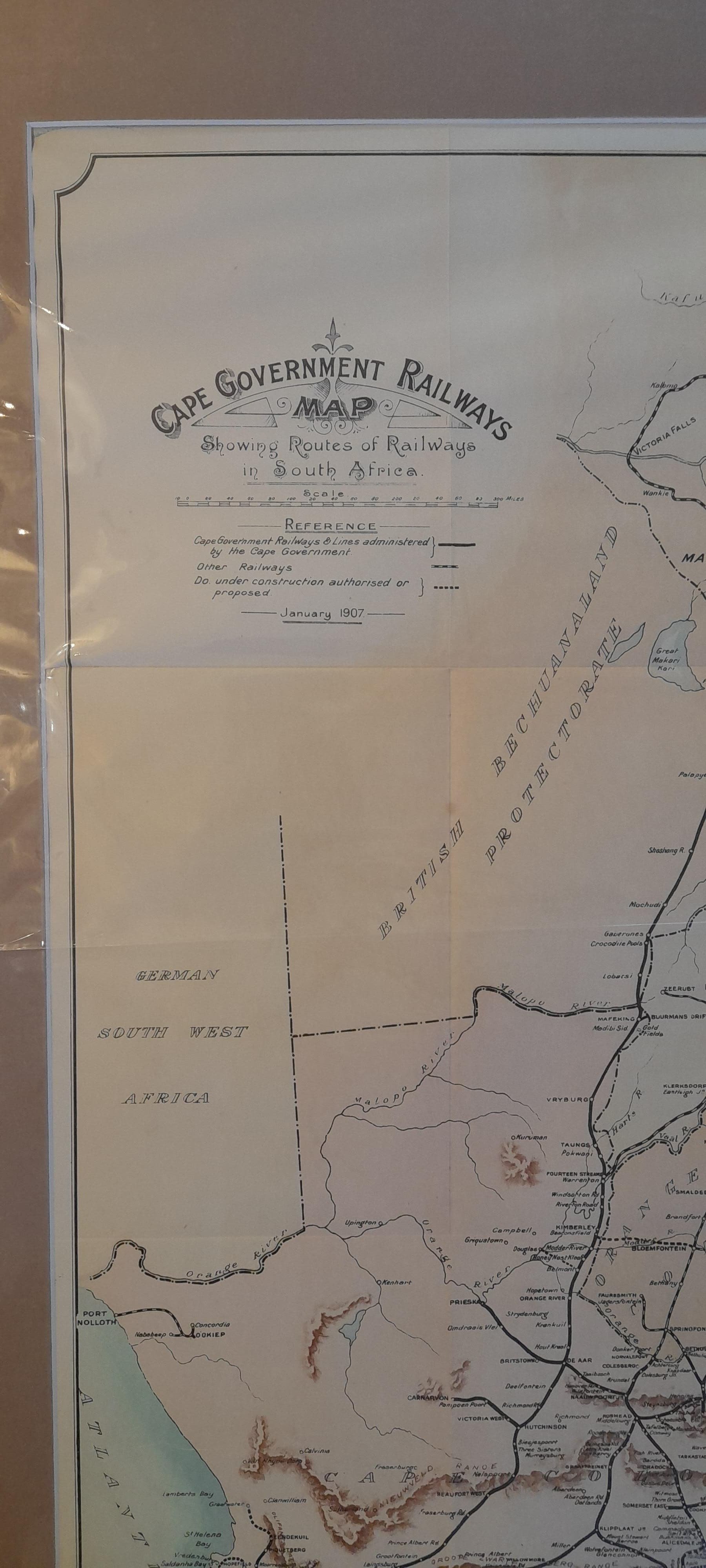
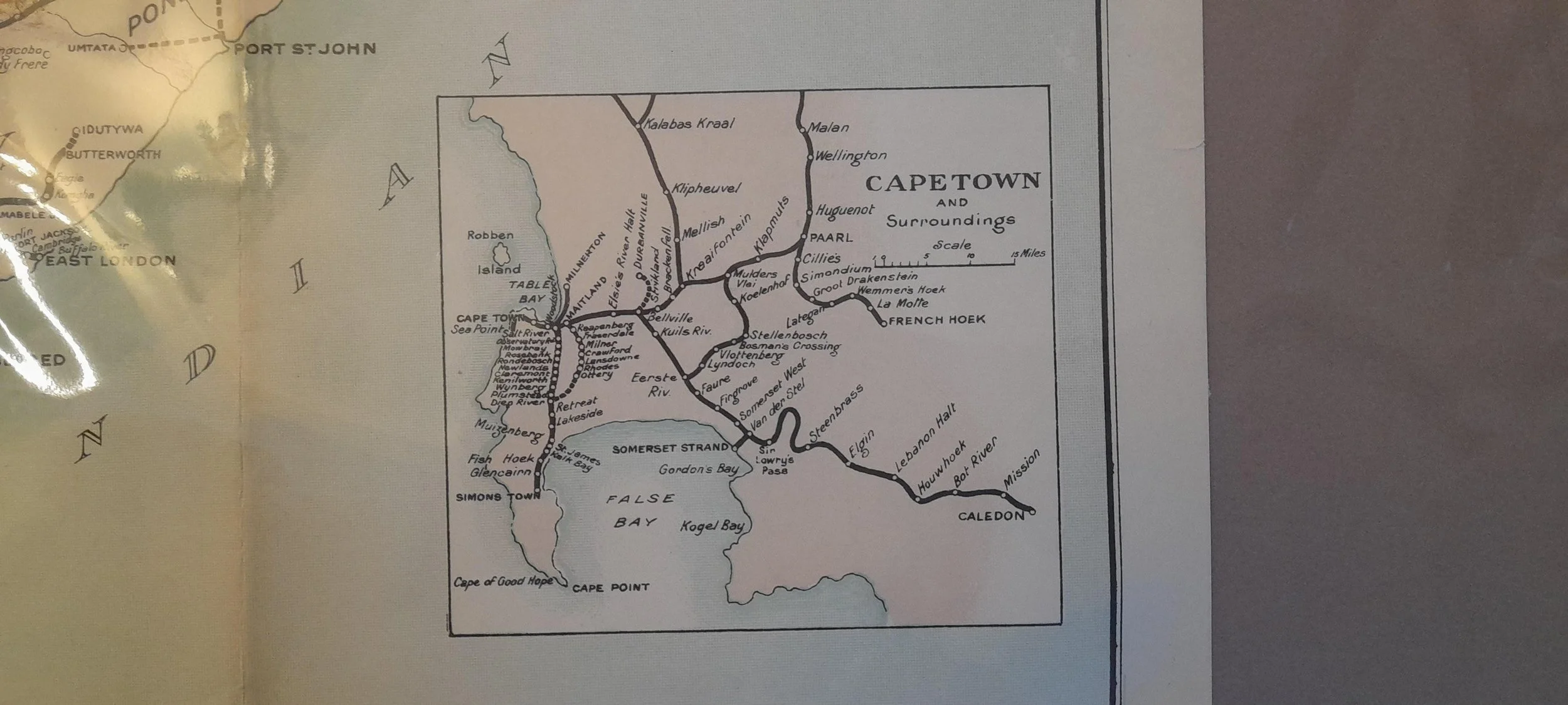
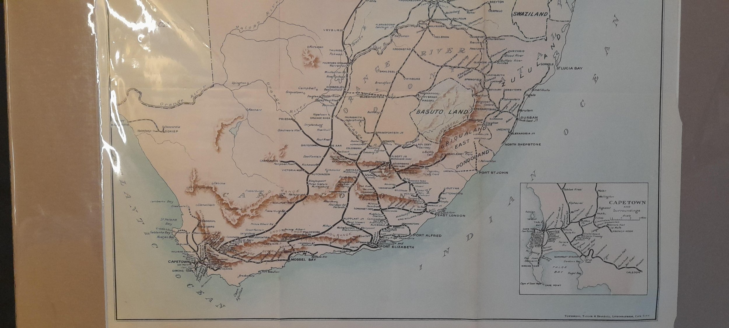
Cape Government Railway Map of Southern Africa c.1907
Offset-litho printing by the government printer.
This fold-out map would have come from a government blue book.
Printed in Cape Town.
See German South West Africa and various other colonial territories.
640mm x 500mm excluding mountboard, unframed.
R3,500