The Report of the Railway - Beira, Mashonaland and Rhodesia, large foldout map (1926)
The Report of the General Manager for the Railway Financial Year Ended 30th September, 1925, and containing the spectacular folding map. This is a primary source documenting the industrial, logistical, and geopolitical backbone of colonial Central Africa.
Published in Bulawayo in 1926 by the Argus Printing and Publishing Company, this document covers the Beira and Mashonaland and Rhodesia Railways (BMRR). Here are the most historically significant aspects of this report and its map:
The Lifeline to the Sea: The Beira Corridor
The map clearly illustrates a crucial geopolitical reality of the era: landlocked Southern and Northern Rhodesia (modern-day Zimbabwe and Zambia) were entirely dependent on finding an outlet to the ocean that bypassed South African ports.
The line snaking eastward to the port of Beira in Portuguese East Africa (now Mozambique) was the absolute economic lifeline for the region. Completed under immense engineering difficulties in the 1890s through malaria-ridden lowlands, this route allowed Rhodesian chrome, tobacco, and maize to reach global markets efficiently. This 1925 report captures the system at a peak of post-WWI economic expansion.
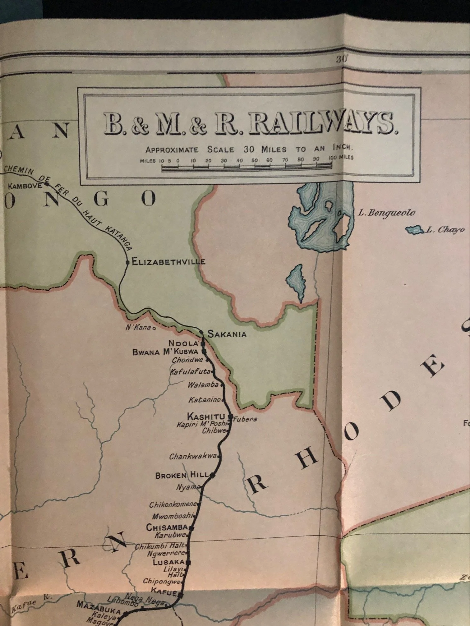
The Copperbelt Boom and the Northern Extension
If you look closely at the top of the railway map, the line extends straight up through Northern Rhodesia, passing through Broken Hill (Kabwe) and terminating at Sakania on the border of the Belgian Congo (Katanga).
The mid-1920s marked the precise moment when the massive commercial potential of the Central African Copperbelt was being realized. The railway was vital for hauling heavy machinery up into the interior and transporting copper ore out. The system functioned as a fascinating cross-border colonial consortium, heavily tied to Cecil Rhodes's British South Africa Company (BSAC) legacy, even after Southern Rhodesia achieved responsible self-government in 1923.
A Complex Web of Joint Administration
The small sub-text at the center of the cover notes an important logistical arrangement: "(Including the working of the Vryburg-Bulawayo Section of the Rhodesia Railways administered by the South African Railways)."
This reflects a fascinating compromise in regional transport history. The tracks running north from Vryburg (in the northern Cape) through the Bechuanaland Protectorate (now Botswana) to Bulawayo were owned by the Rhodesia Railways but practically operated and maintained by the South African Railways (SAR). This joint administration highlights how deeply interconnected the economies of Southern Africa remained, despite political borders and growing independent identities among the territories.
Blue book size: 215mm x 360mm
Map size: 700mm x 900mm
Paper wrappers worn and creased at the edges.
R3,000