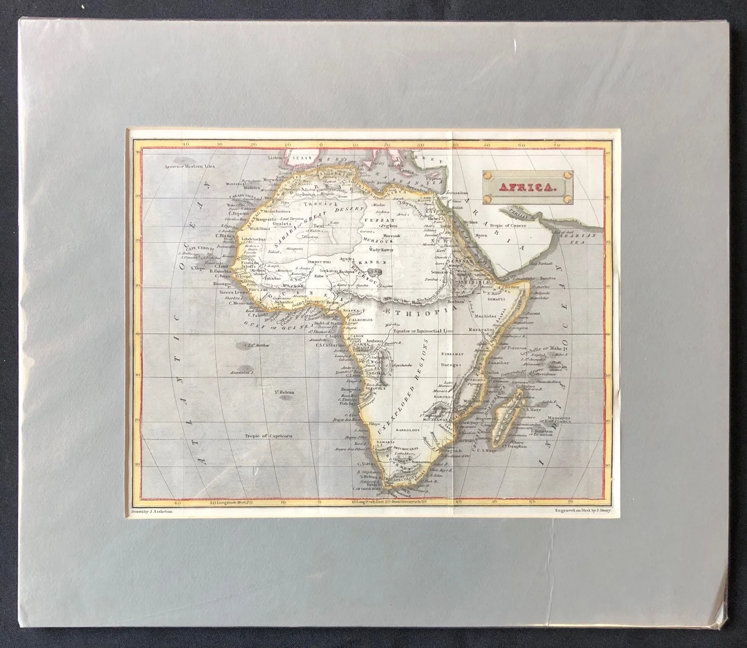
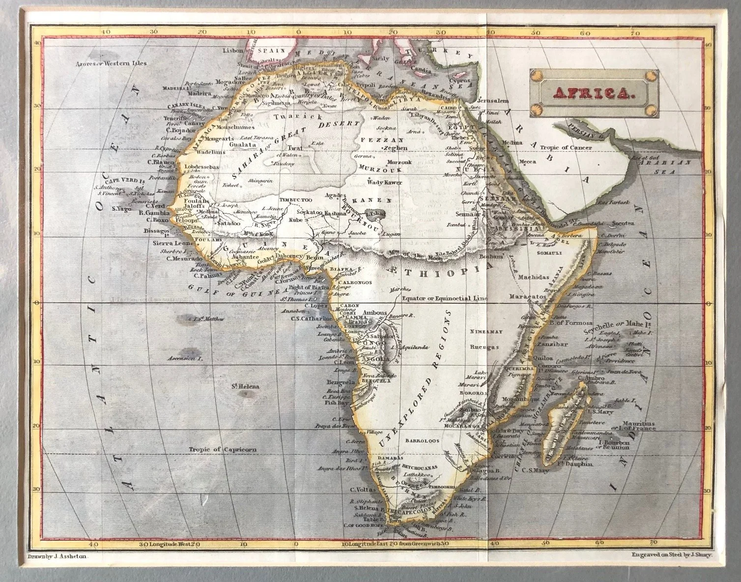
Map of Africa by J. Assheton and engraved by J. Shury (c.1830)
This map, drawn by J. Assheton and engraved on steel by J. Shury in the early 19th century (circa 1820s–1830s), captures a unique moment in geographic history when mapmakers strictly partitioned what they knew from what they refused to invent.
The Literal "Unexplored Regions"
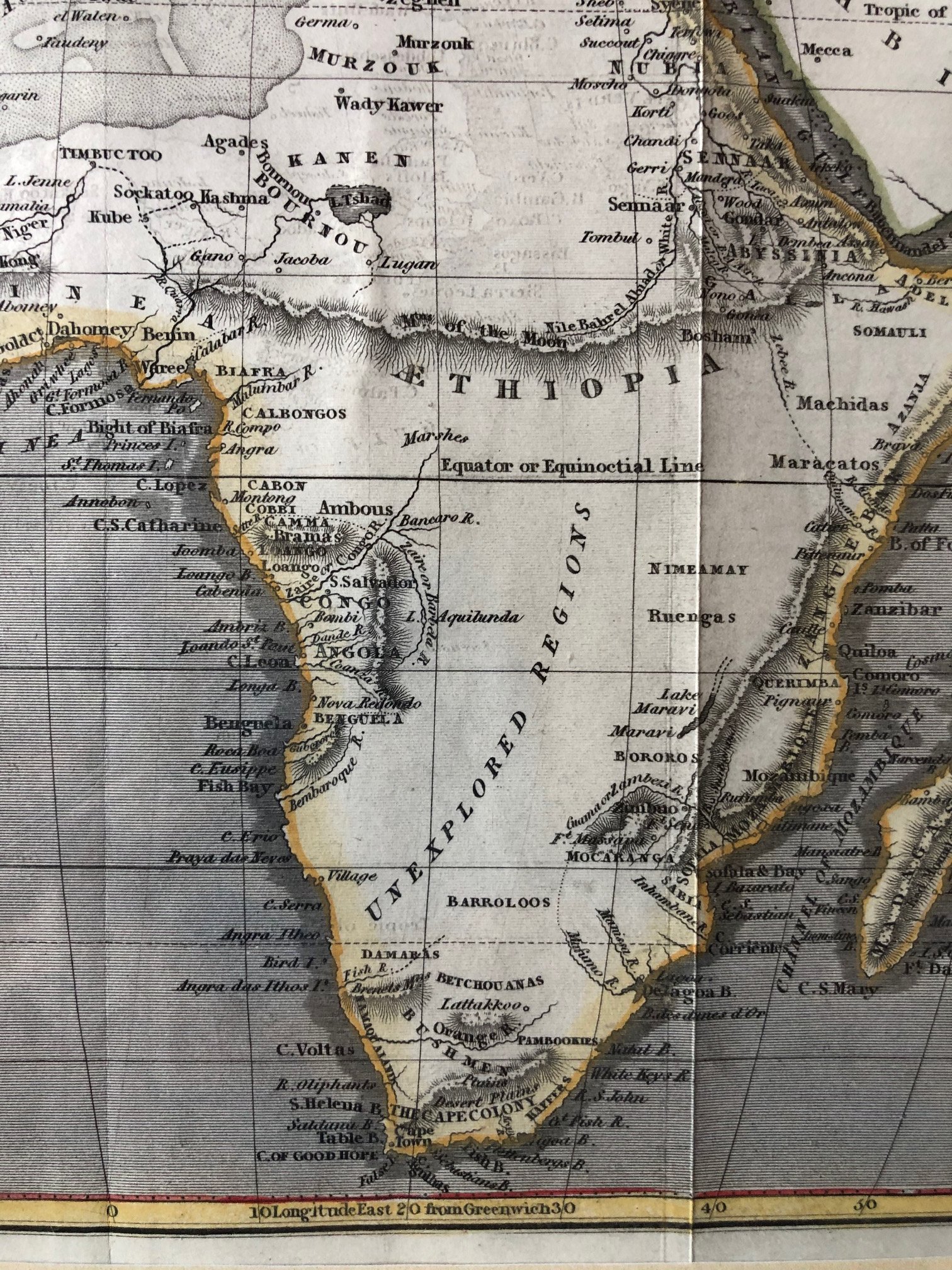
The most striking feature of this map is the massive, completely blank territory in the southern interior boldly labeled "UNEXPLORED REGIONS."
Following the scientific standards established by Enlightenment cartographers, 19th-century mapmakers preferred total emptiness over speculative myths. Rather than filling the centre of the continent with fictitious kingdoms or the legendary dual lakes of Ptolemy, the mapmaker left a massive geographic void.
It serves as a stark visual testament to how little Europeans knew about the interior of Africa just decades before the mid-19th-century expeditions of explorers like Livingstone, Stanley, and Speke.
Steel Engraving: A Technological Leap
The fine notation in the bottom right corner reads "Engraved on Steel by J. Shury."
For centuries, maps were printed using soft copper plates, which wore down quickly and produced a limited number of crisp prints before needing to be recut. The introduction of steel plate engraving in the 1820s revolutionized the print industry.
Steel was much harder, allowing for incredibly fine, precise linework (evident in the detailed coastal names and neat hachures along the coastlines) and permitting publishers to print thousands of identical, high-quality maps for an expanding, data-hungry global middle class.
The Curious Persistence of the "Mountains of the Moon"
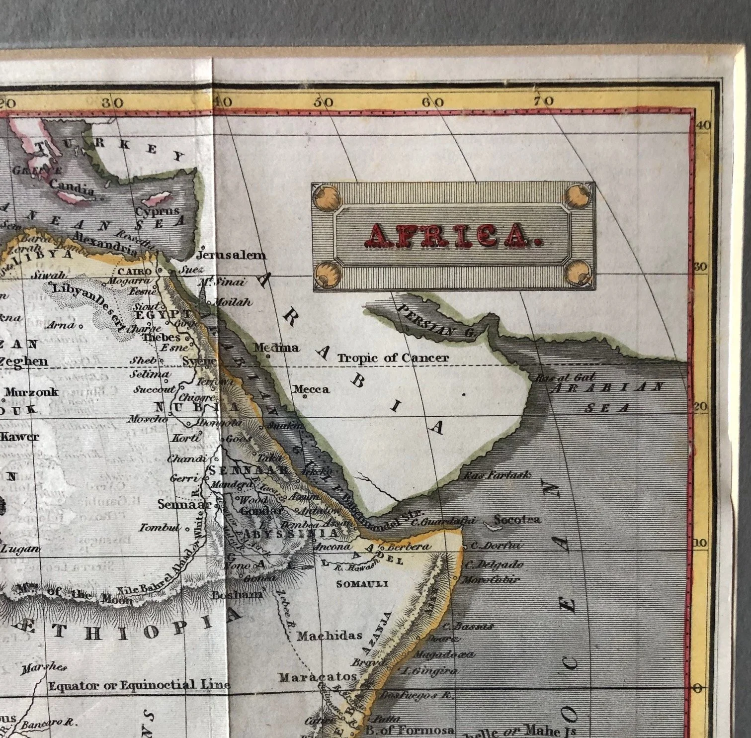
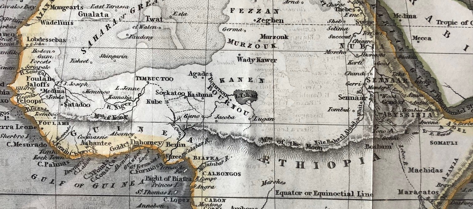
While the mapmaker was rigorous enough to label the south as unexplored, they couldn't entirely shake historical tradition in East Africa. Just south of Abyssinia (Ethiopia), you can see the "Mts. of the Moon" (Mountains of the Moon) stretching horizontally across the continent. This ancient geographical feature—first proposed by Ptolemy as the snowy source of the Nile—continued to linger on commercial maps as a theoretical boundary line long after other ancient myths had been discarded.
Also featured are the phantom, Kong Mountain Range in West Africa through to East Africa.
275mm x 220mm
Hand coloured engraving. Minor creasing.
R2,500