"Carte Générale de l'Afrique," by French geographer Beaupré (1830s)
This map, titled "Carte Générale de l'Afrique," was drawn by the French geographer Beaupré and published in Paris during the 1830s. It stands as a brilliant snapshot of European geographical knowledge during a critical transitional era—just after the foundation of early geographical societies but decades before the late-19th-century "Scramble for Africa."
Institutional Alignment with the World's Oldest Geographical Society
Right below Beaupré’s name in the cartouche, the text reads: "...d'après les Mémoires de la Société Géographique" (according to the memoirs of the Geographical Society).
The Société de Géographie de Paris, founded in 1821, was the world's very first geographical society. Its early mission was to move cartography away from artistic guesswork and toward empirical science. This map is a direct commercial manifestation of the society’s early attempts to compile data strictly from verified explorers' journals rather than copying antiquated charts.
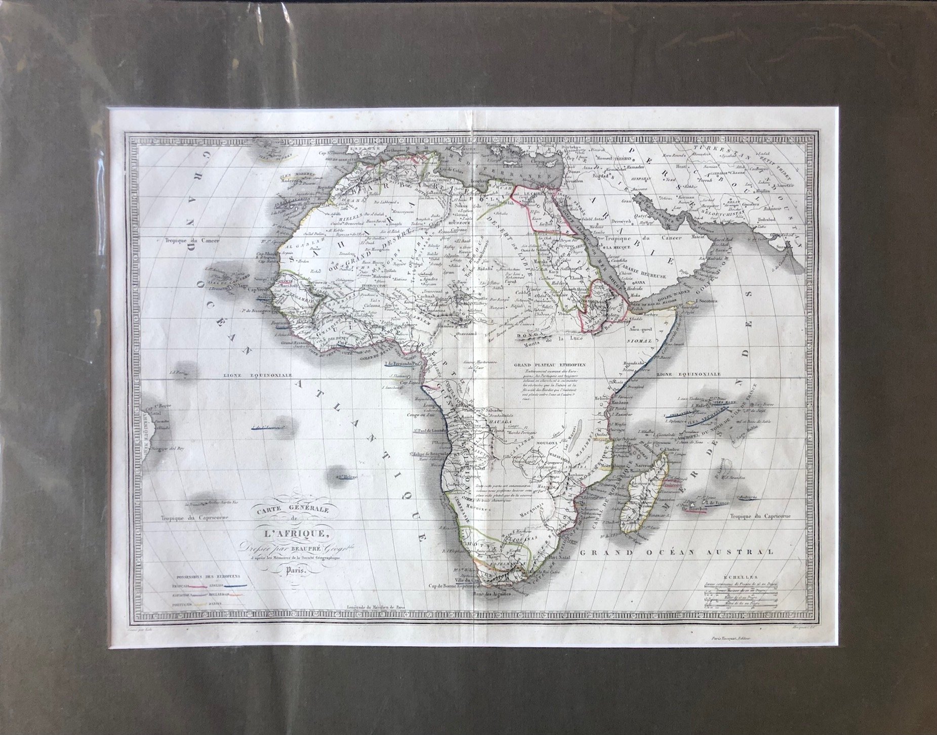
Radical Scientific Honesty: The Explanatory "Blank Spaces"
During the 18th and early 19th centuries, cartographers often filled unexplored spaces with speculative mountain ranges, hypothetical rivers, or decorative illustrations. Beaupré took the opposite approach, utilizing a style known as "honest cartography."
The interior of the continent is left strikingly blank, punctuated instead by blocks of explanatory text acknowledging European ignorance:
In East-Central Africa, below the "Grand Plateau Éthiopien," the text explicitly notes that the region is “Entièrement inconnu des Européens...” (Entirely unknown to Europeans).
Further south toward the center, another block states that the vast interior is “entièrement inconnue aux géographes” (entirely unknown to geographers).
Lingering Cartographic Myths
Despite trying to remain strictly scientific, Beaupré's map still reveals how deep-seated certain ancient geographical myths were. In the center of the continent, you can spot the "Monts de la Lune" (Mountains of the Moon) and the "Donga" range.
Dating back to the ancient Greek geographer Ptolemy, the Mountains of the Moon were long rumored to be the legendary, snow-capped source of the Nile River. This map catches European cartography in mid-evolution: discarding centuries of rumors in the blanks, yet still clinging to legendary landmarks where exploration had not yet definitively disproved them.
The phantom “Kong Mountains” feature in West Africa.
Brazil is too close to Africa?
Signed on June 7, 1494, the Treaty of Tordesillas was an agreement between Spain and Portugal that divided the newly discovered lands outside Europe between the two nations along a meridian 370 leagues west of the Cape Verde islands. Lands to the west went to Spain, and lands to the east went to Portugal
405mm x 305mm
Minor wear and markings; slight spotting top left.
R3,000