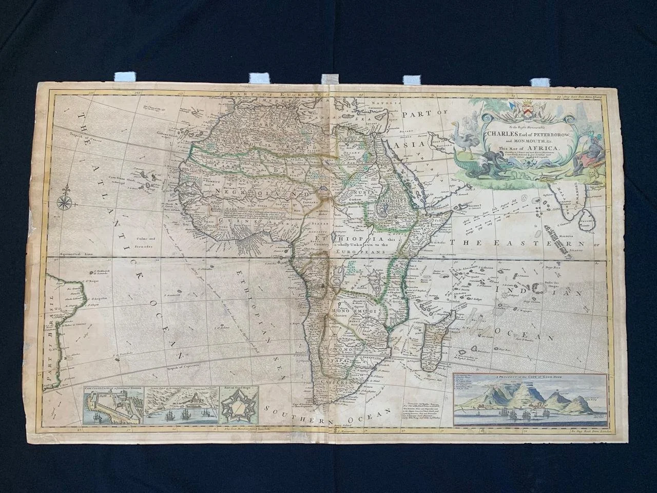
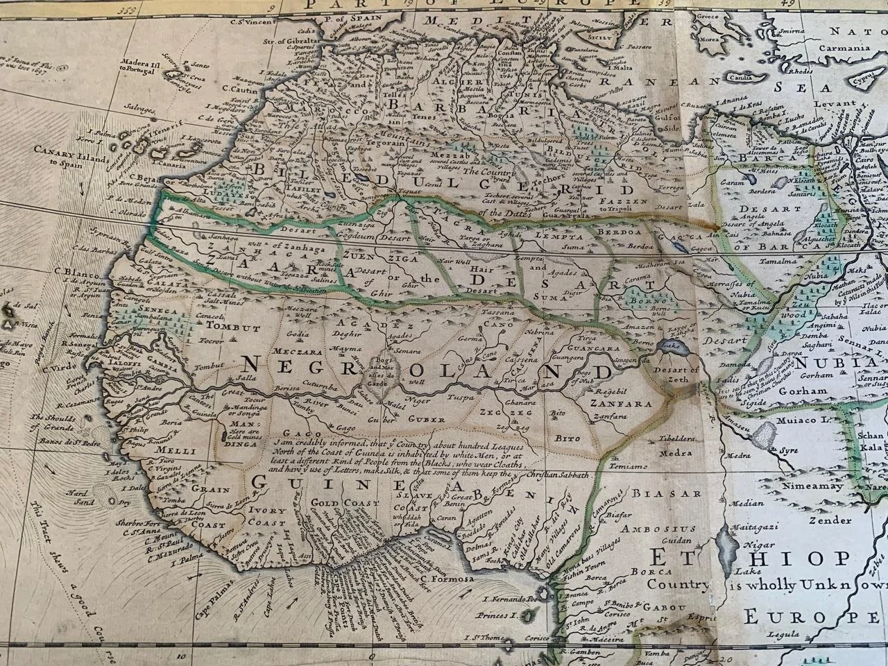
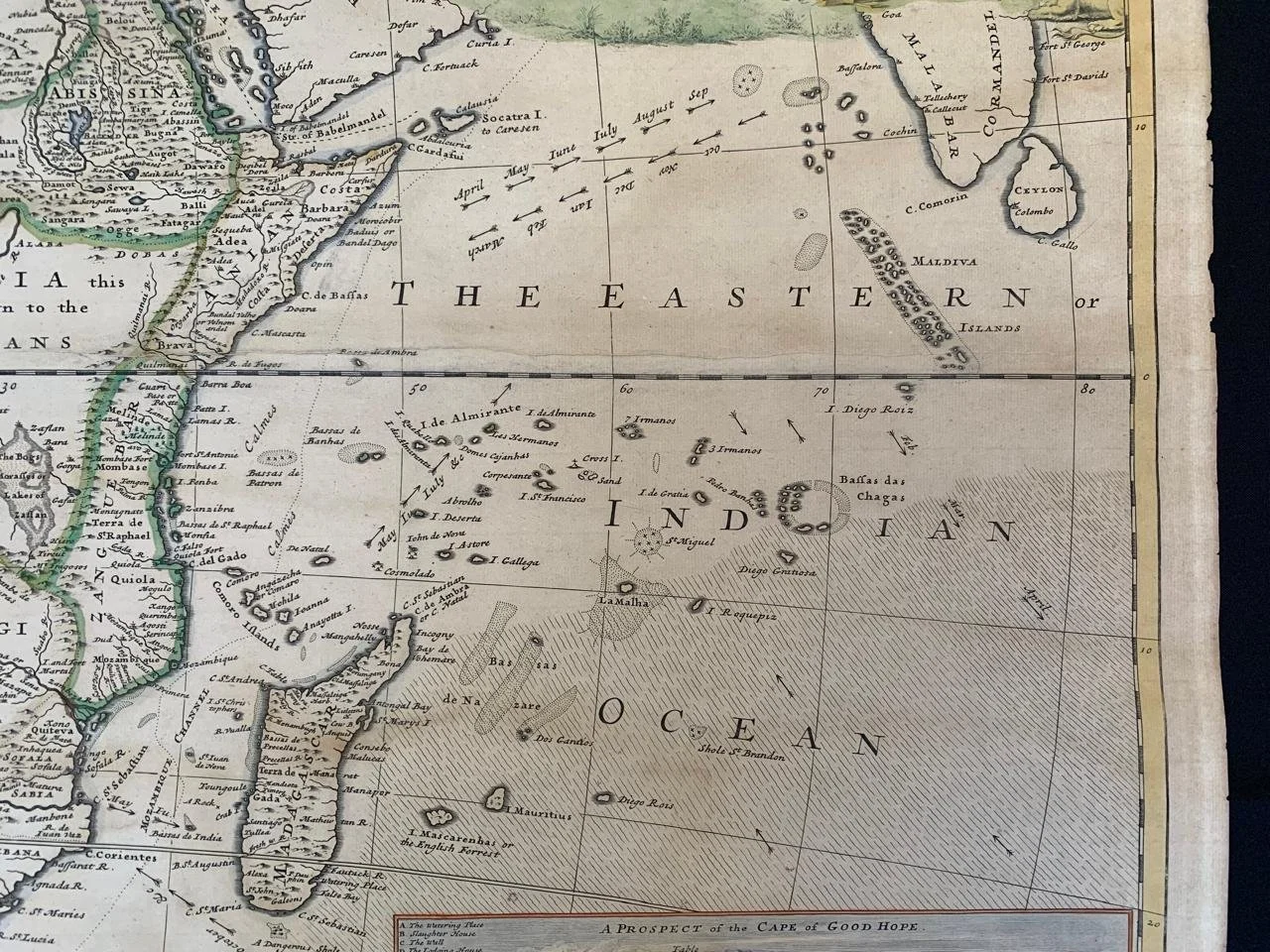
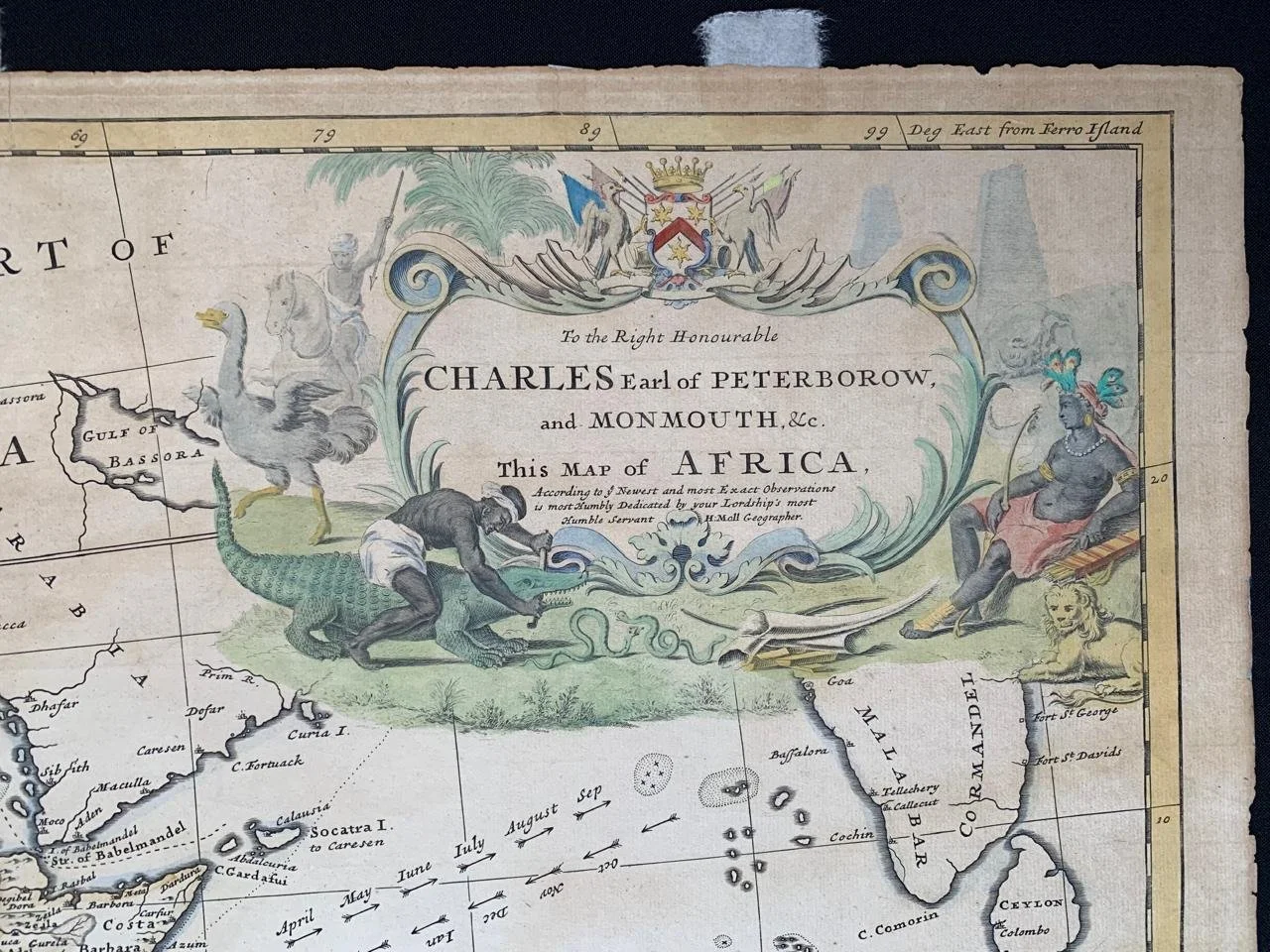
Herman Moll Map of Africa (c.1720)
By Herman Moll (1654-1732).
Hand coloured copperplate engraving.
Published in London, ca. 1720.
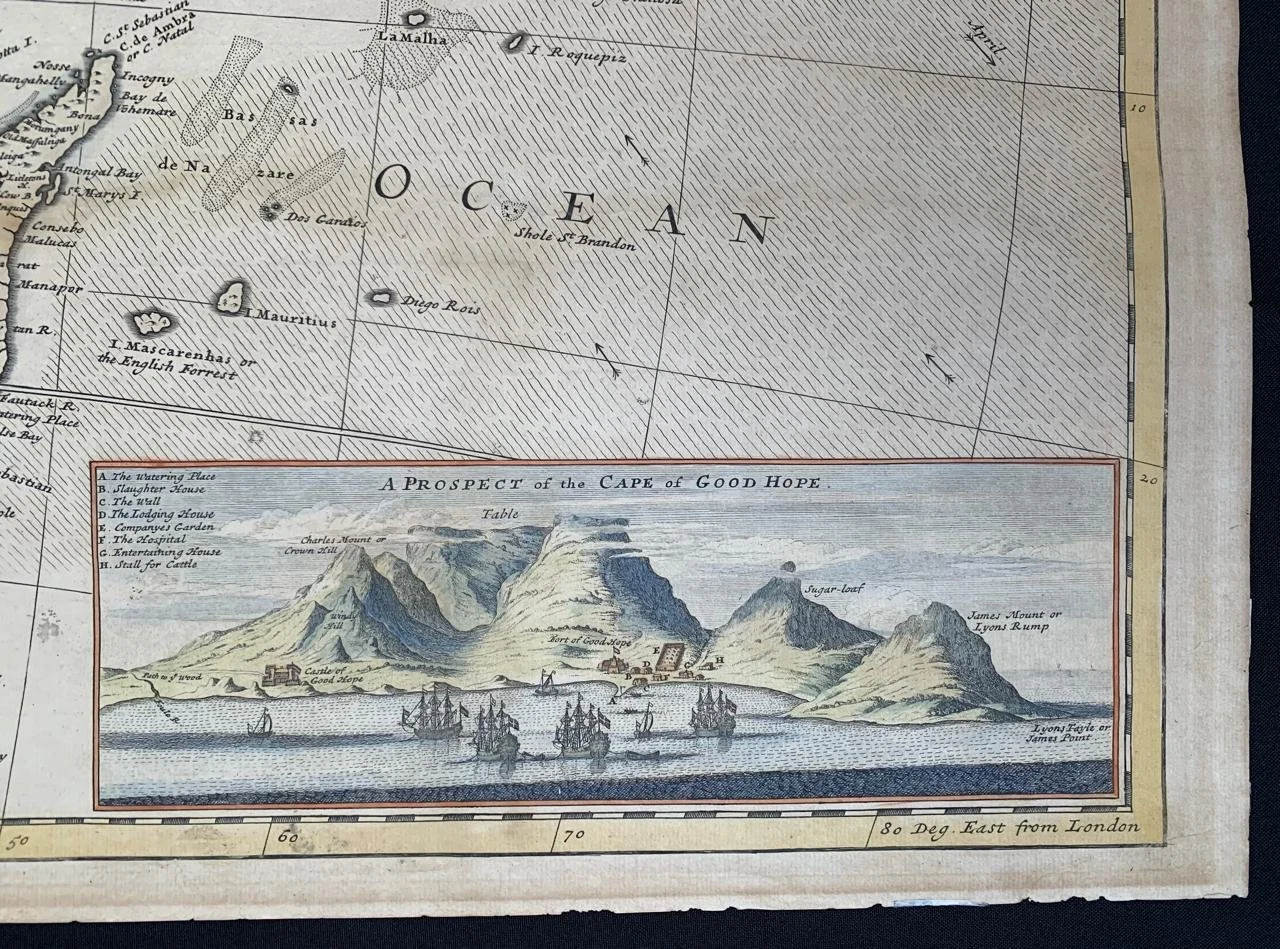
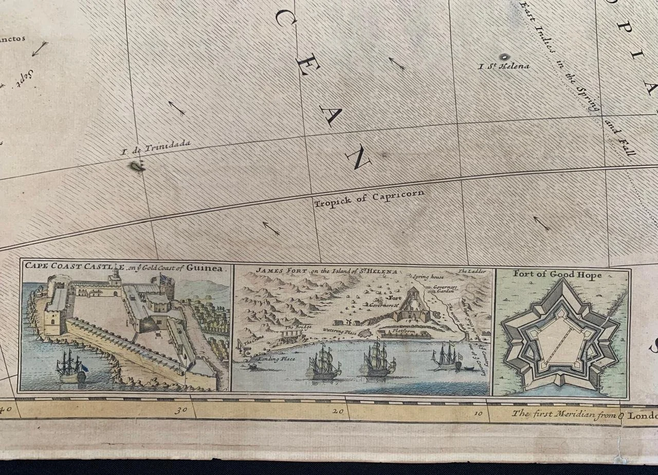
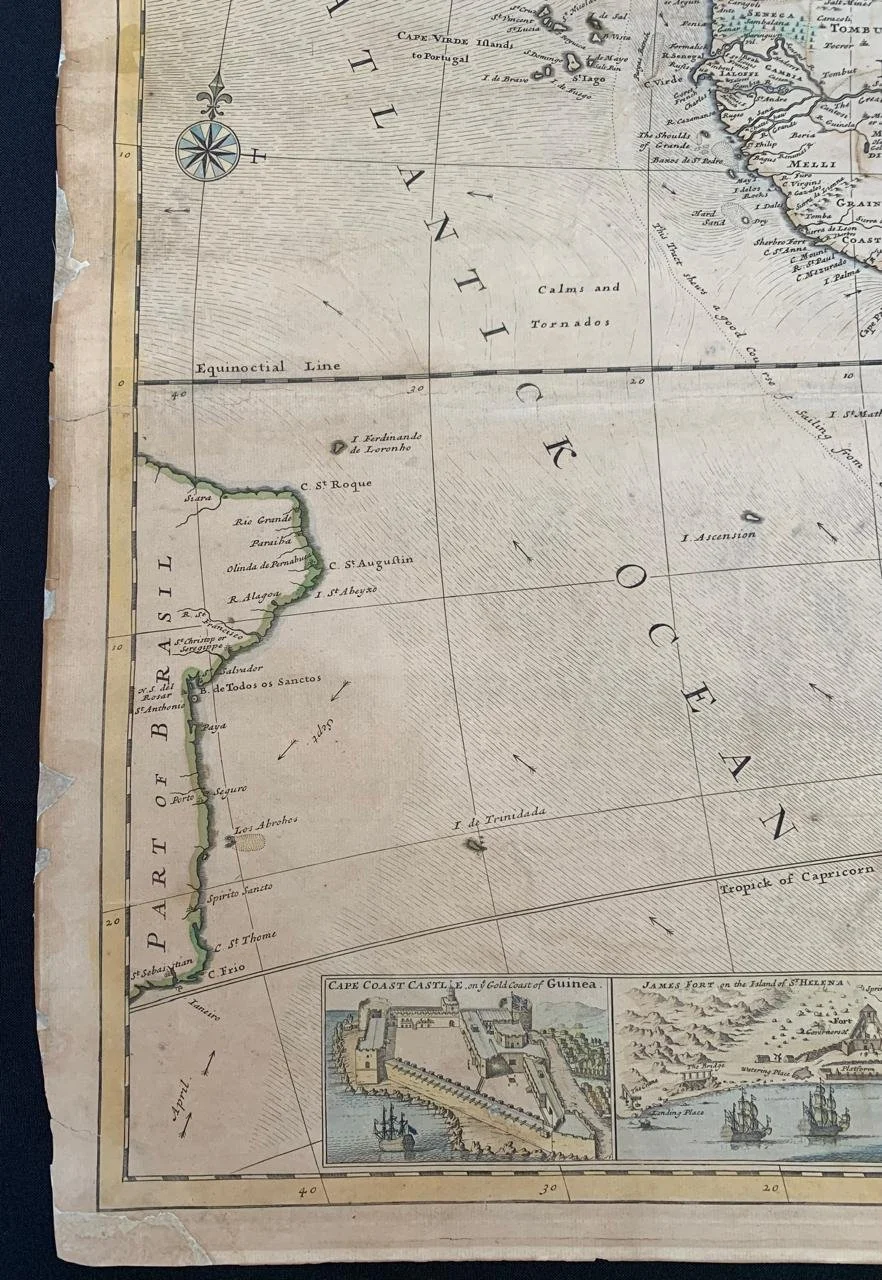
With an elaborate dedication cartouche reading "To the right honourable Charles, Earl of Peterborow and Monmouth, etc. This map of Africa according to ye newest and most exact observations is most humbly dedicated by your Lordship's most humble Servant, H. Moll, Geographer." With inset illustrations of major cities in Africa, titled "Cape Coast Castle on ye Gold Coast of Guinea," "James Fort on the Island of Helena," "Fort of Good Hope," and "A Prospect of the Cape of Good Hope," which includes labelled place-names in the city.
Some mellowing and restoration.
1005mm x 610mm
R45,000