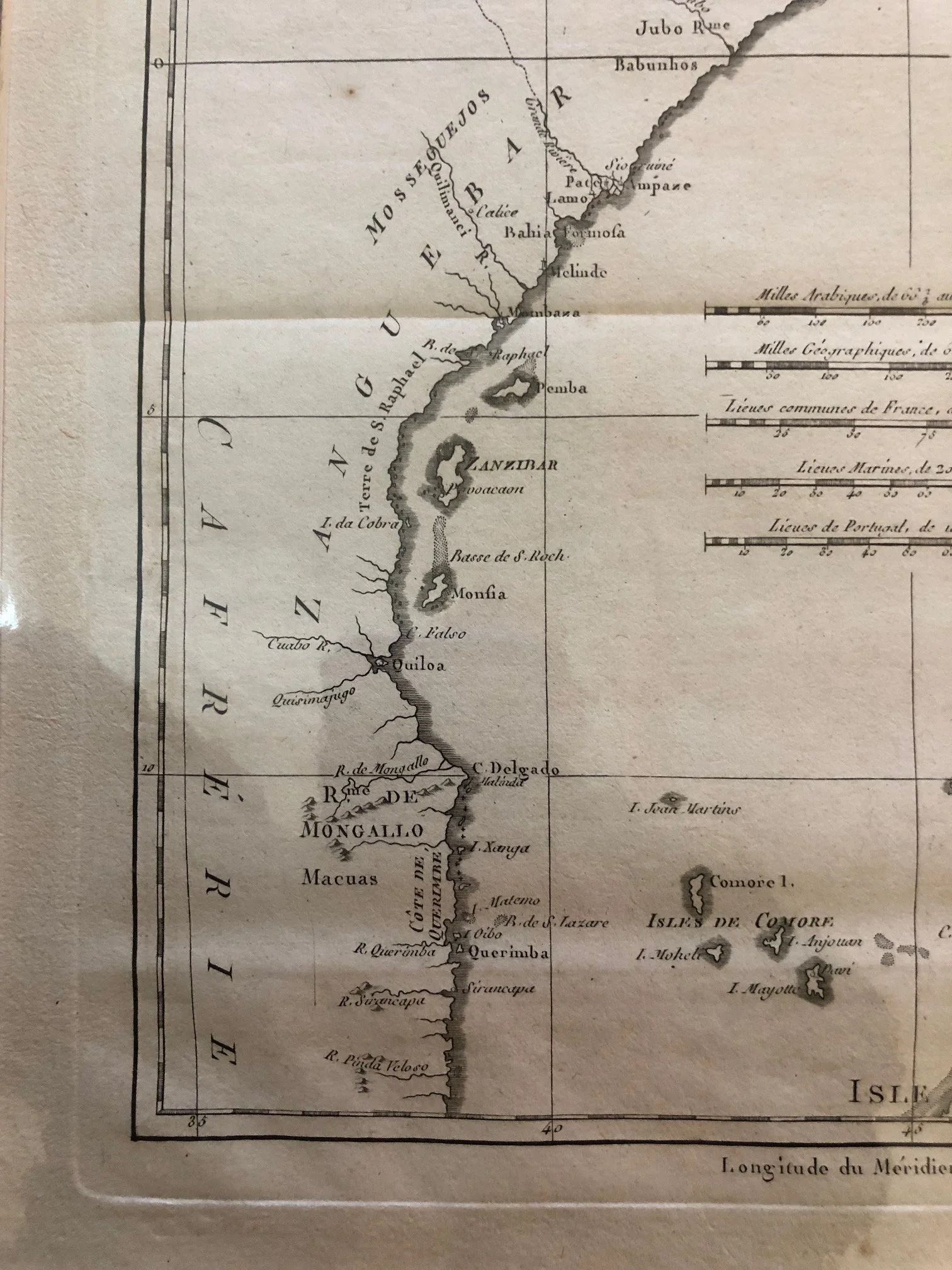
The Horn of Africa and the Swahili Coast c.1780
This is a brilliant copperplate engraving by Rigobert Bonne (1727–1794), the highly influential Ingénieur-Hydrographe de la Marine (Chief Hydrographer to the French Navy).
Published in Paris around 1780 (often featured in Guillaume Raynal’s monumental Histoire Philosophique et Politique...), this map covers the Horn of Africa and the Swahili Coast, stretching from Yemen down to the northern tip of Madagascar.
The Cartography of Enlightenment "Restraint"
Bonne was a pioneer of the late 18th-century French school of cartography, which championed scientific accuracy and empirical skepticism.
• Notice the vast, completely blank spaces in the interior ("Machidas", "Maracato").
• Unlike earlier 16th and 17th-century mapmakers who suffered from horror vacui (fear of empty spaces) and filled the African interior with imaginary lakes, speculative mountain ranges, and mythical kingdoms like Prester John, Bonne left it blank. If French mariners hadn't surveyed it or verified it on the ground, it didn't go on the map.
The Legacy of the Silk & Spice Trade: "Zanguebar" and "Adel"
The nomenclature on this map captures a deeply layered history of Afro-Asian trade before the heavy hand of 19th-century European high imperialism:
• Le Royaume d’Adel (Adal Sultanate): Located around the Horn of Africa and present-day Djibouti/Somalia. By 1780, the great multi-ethnic Adal Sultanate had long fractured, but its name remained on European charts as a geographical legacy of a powerful Islamic trading empire that had once rivaled Ethiopia.
• Zanguebar (The Swahili Coast): Derived from the Arabic Zanj-bar (meaning "Coast of the Blacks"). This coast was a vibrant, cosmopolitan network of Swahili city-states—including Pate, Melinde (Malindi), Mombaze (Mombasa), and Zanzibar—all clearly marked.The Shadow of the Omani Empire
Look closely at the islands of Zanzibar, Monfia (Mafia), and Quiloa (Kilwa). In 1780, this entire coastline was undergoing a massive geopolitical shift. The Portuguese, who had dominated the coast since Vasco da Gama's arrival, had been systematically pushed out of the northern Swahili coast by the Omani Sultanate. By the time Bonne engraved this map, Zanzibar was rapidly becoming the primary Omani stronghold in East Africa, setting the stage for the Sultan of Oman to permanently move his entire capital from Muscat to Zanzibar in the 1830s to control the lucrative trade in cloves, ivory, and slaves.
The Prime Meridian Confusion
Take a look at the very top and bottom borders of the map:
• The top reads: Longitude du Méridien de l’Isle de Fer (Meridian of El Hierro in the Canary Islands).
• The bottom reads: Longitude du Méridien de Paris.
This dual-notation catches 18th-century navigation in a transition phase. For centuries, European nations used El Hierro as the standard "neutral" Prime Meridian because it was the westernmost point of the known Old World (avoiding nationalistic biases). However, by the late 1700s, France was aggressively promoting the Paris Meridian (running through the Paris Observatory) to standardize their naval charts. Bonne politely includes both scales here, giving French captains a bridge between old international conventions and new national standards.
300mm x 405mm
R2,750