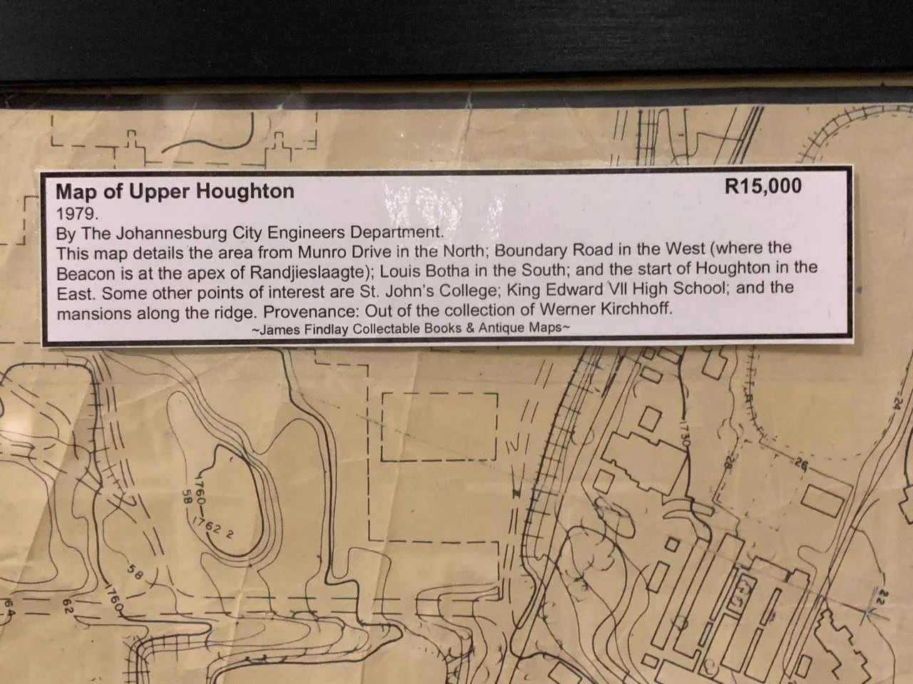
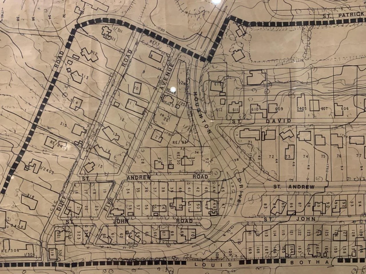
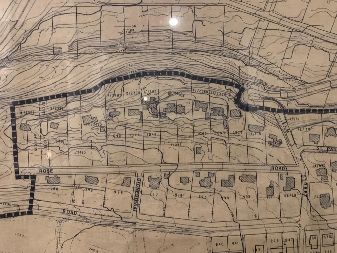
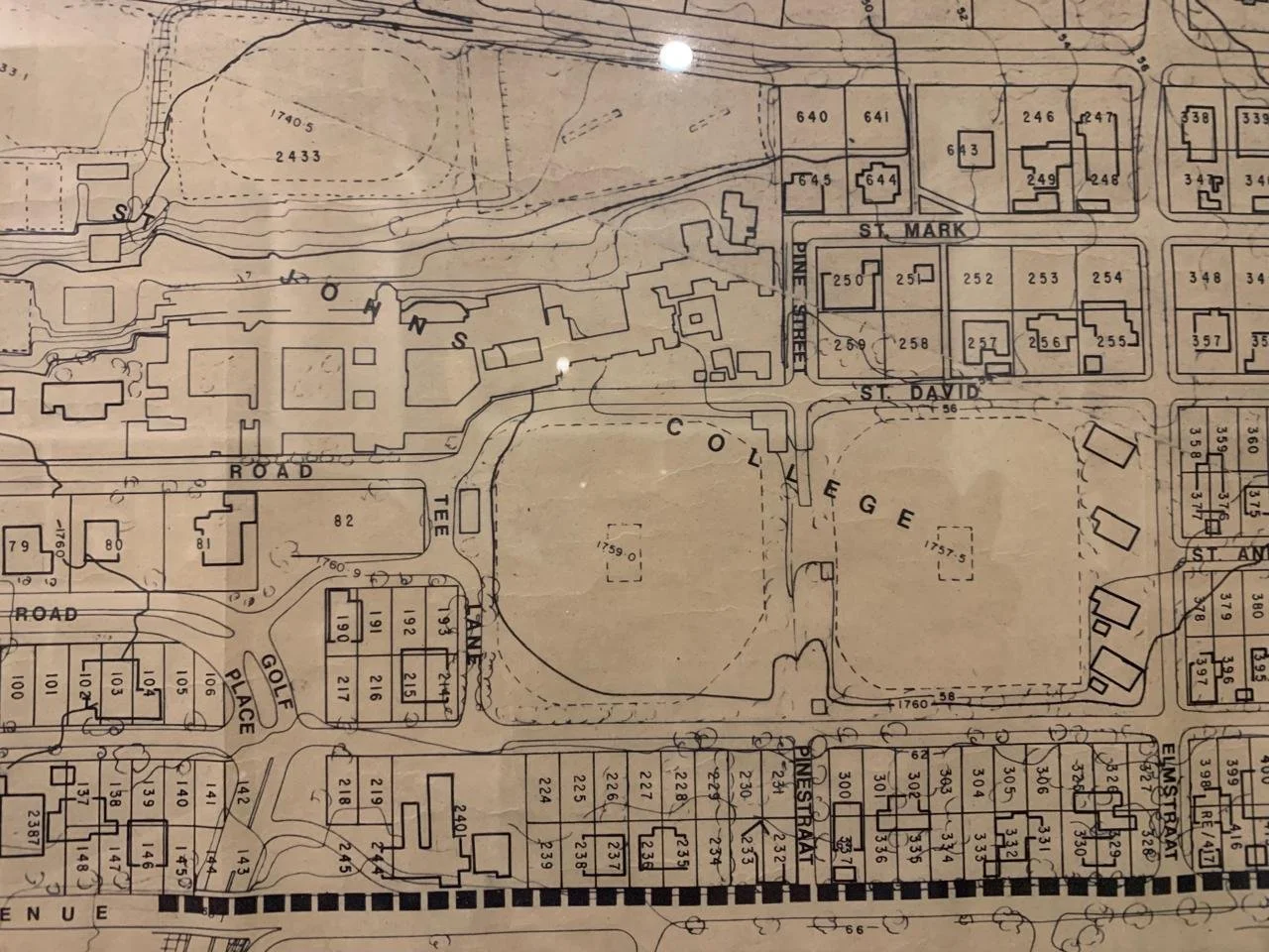
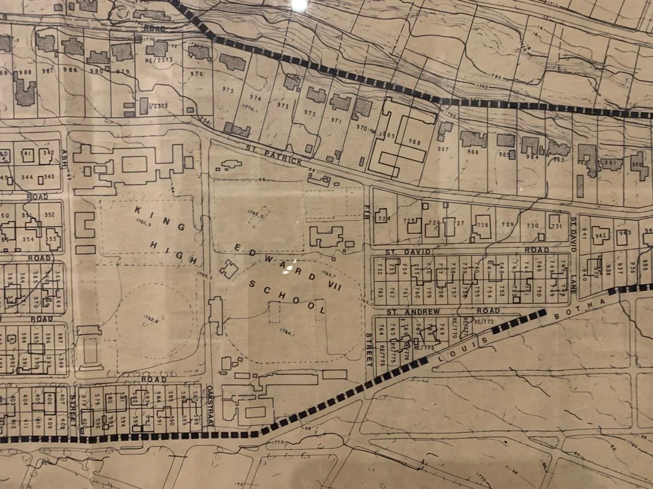
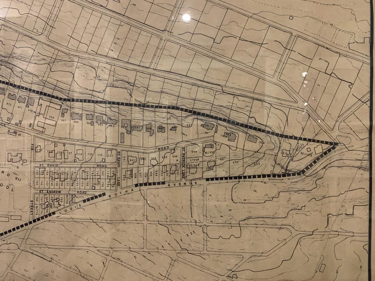
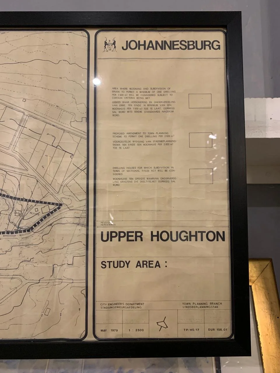
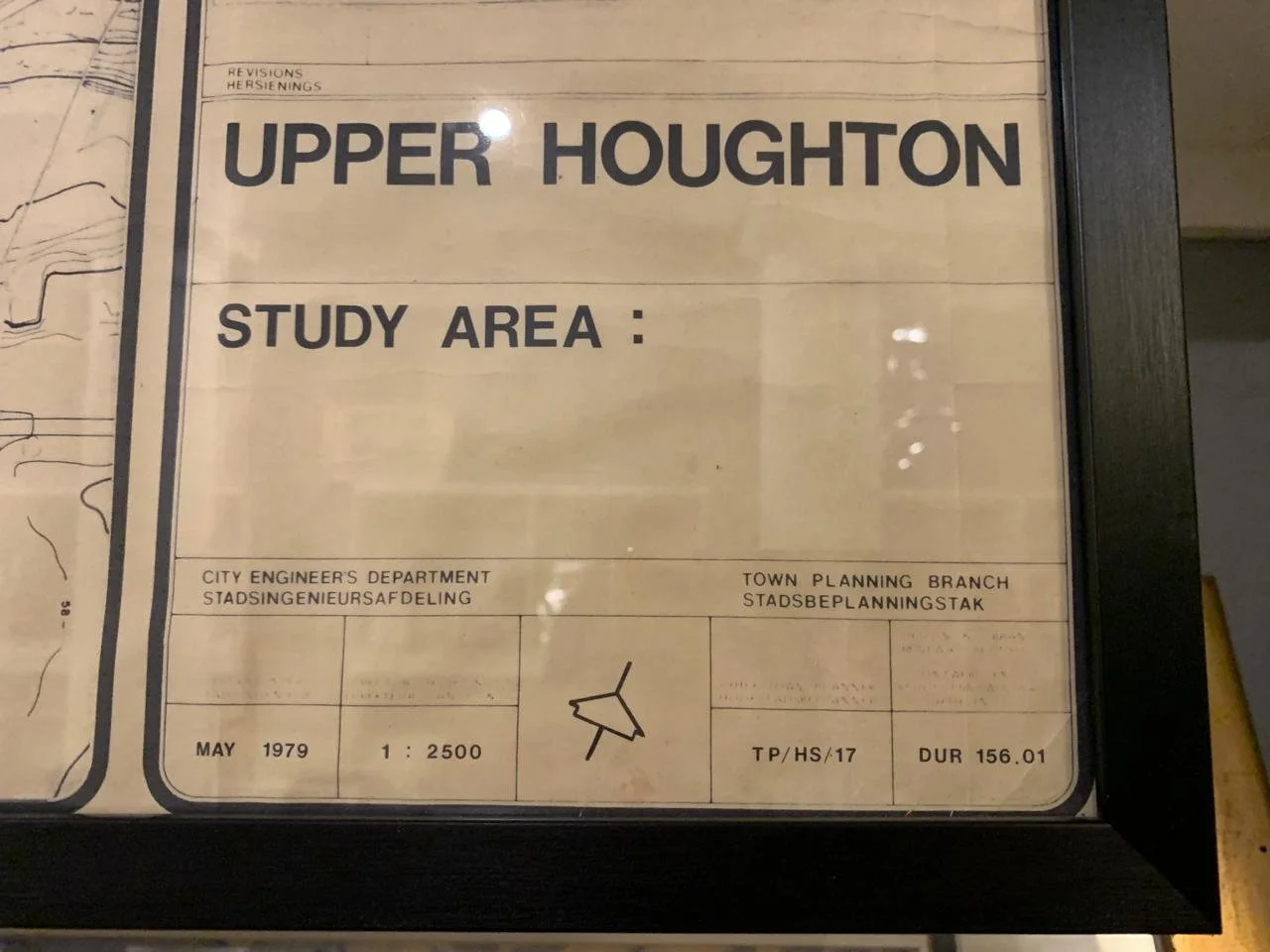
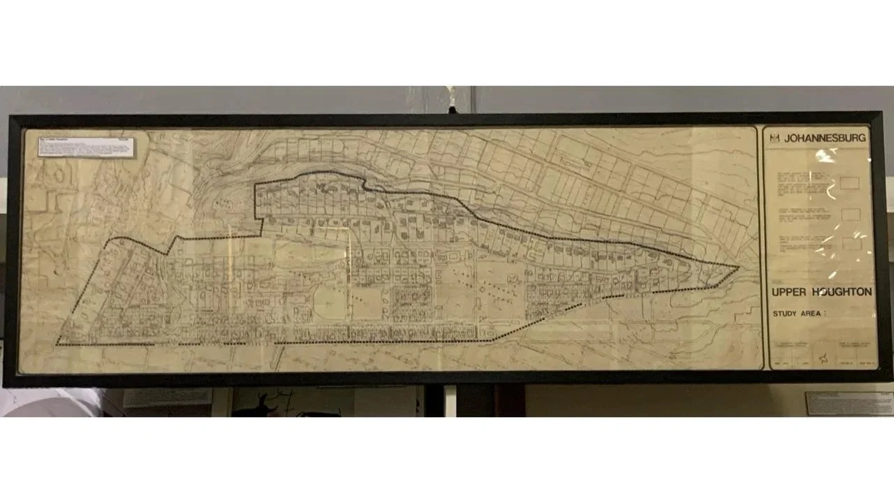
Map of Upper Houghton
1979
By the Johannesburg City Engineering Department.
Provenance: out of the collection of Werner Kirchhoff “Surveyor of distinction and an early pioneer of South African satellite geodesy”
1443mm x 449mm framed.
R7,500
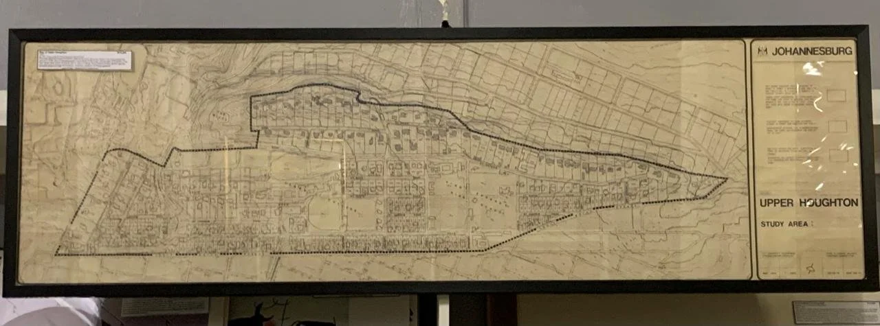
1979
By the Johannesburg City Engineering Department.
Provenance: out of the collection of Werner Kirchhoff “Surveyor of distinction and an early pioneer of South African satellite geodesy”
1443mm x 449mm framed.
R7,500