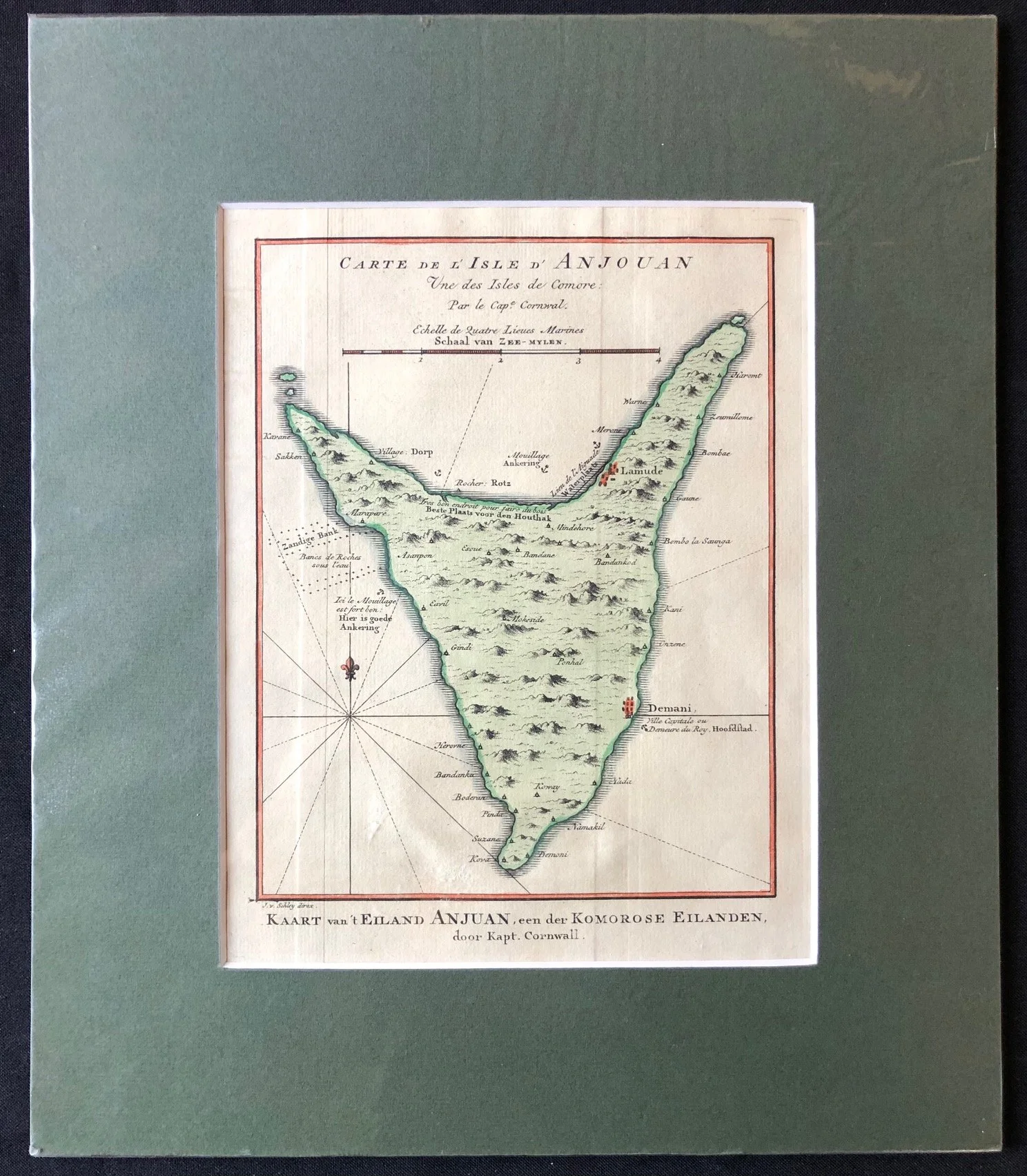
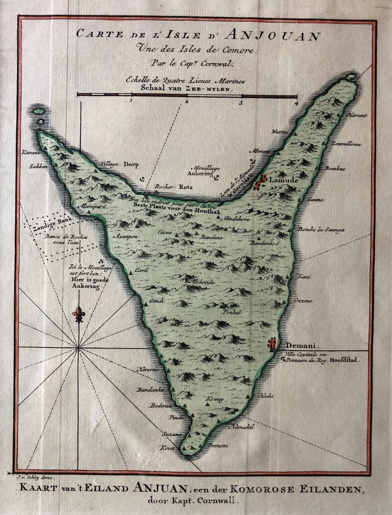
Map of Johanna, one of the principal islands of the Comoros (c.1750)
An 18th-century hand coloured copperplate engraving of the island of Anjouan (historically known to European sailors as Johanna), one of the principal islands of the Comoros archipelago in the Indian Ocean.
Engraved by the prominent Dutch artist Jakob van der Schley (working under the direction of French hydrographer Jacques-Nicolas Bellin), it was published around 1748–1749 for the Dutch edition of Abbé Prévost’s monumental travel compendium, Histoire Générale des Voyages (Historische Beschryving der Reizen).
The Critical Gateway of the East India Route
In the 17th and 18th centuries, Anjouan occupied a massively important strategic bottleneck for European maritime powers. Ships navigating the "Inner Passage" through the Mozambique Channel on their way to India or the East Indies desperately needed a mid-ocean stopover.
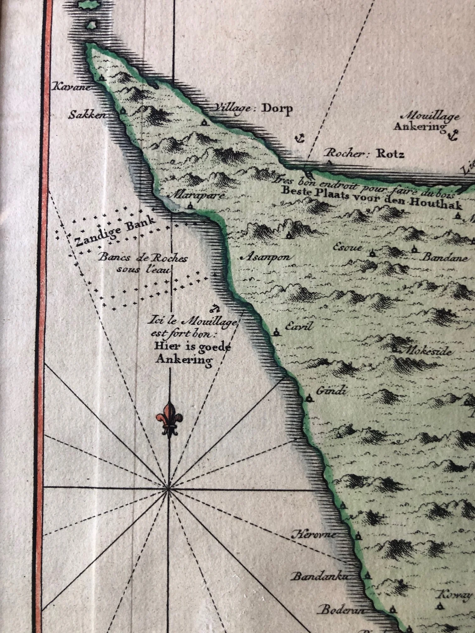
As explicitly noted in both French and Dutch on the left flank of the island text:
"Ici le Mouillage est fort bon / Hier is goede Ankering" (Here the anchorage is very good).
Because of its safe bays, fresh water, and abundant tropical fruit, it became a lifeline for scurvy-ridden crews.
Bilingual Production Politics
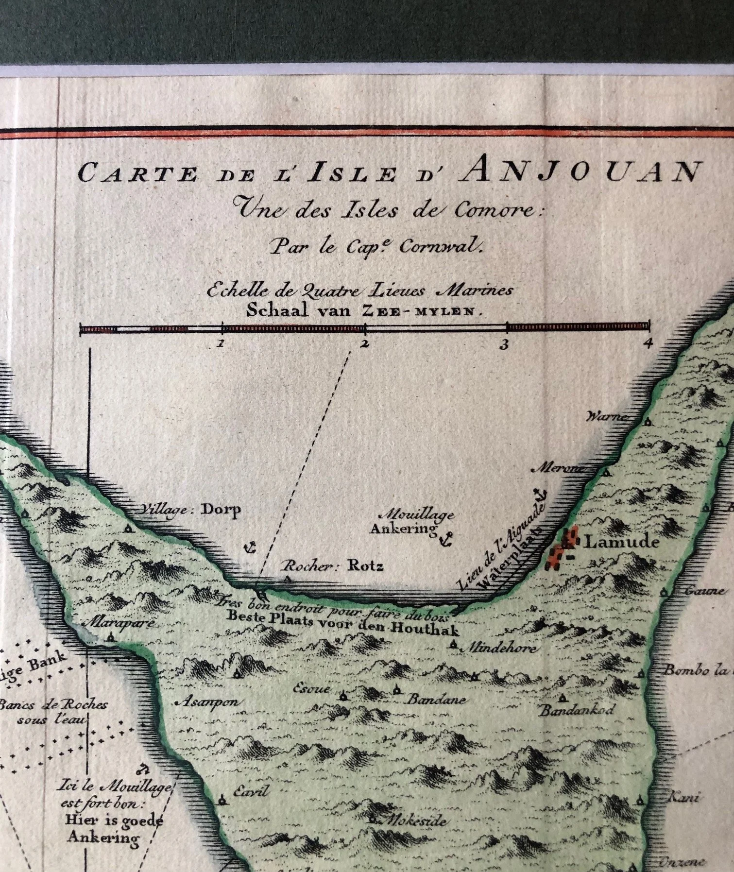
The map features dual French and Dutch titles and annotations. This text overlay highlights the mid-18th-century publishing landscape, where Dutch publishers like Pieter de Hondt routinely acquired French hydrographic plates (in this case, from Bellin's workshops) and meticulously translated the topographical data to sell to the highly lucrative, map-obsessed Dutch merchant class.
The "Watering Place" and Colonial Logistics
On the upper-right coastline, you can spot the label:
"Lieu de l'Aiguade / Waterplaats"
This marks the location where English and Dutch East Indiamen would roll their heavy wooden casks ashore to gather fresh mountain water. Next to it, the text reads:
"Tres bon endroit pour faire du bois / Beste Plaats voor den Houthak"
These annotations essentially transformed the map into a practical instruction manual for ship captains looking to restock timber for cooking and repairs before facing the long, unpredictable voyage across the Indian Ocean.
Captain Cornwall's Hydrographic Footprint
The map credits the original hydrographic survey to a "Captain Cornwall." British captains of this era frequently shared or published their charts upon returning to European ports. These journals and coastal profiles were quickly copied, translated, and integrated across national lines by state hydrographers, illustrating how maritime intelligence was shared internationally despite constant imperial rivalries.
Plate size: mm190 x 230mm
R1,000