"A New Correct Mapp of Calbar River..." (Biafra Slave Trade) by John Churchill (1704)

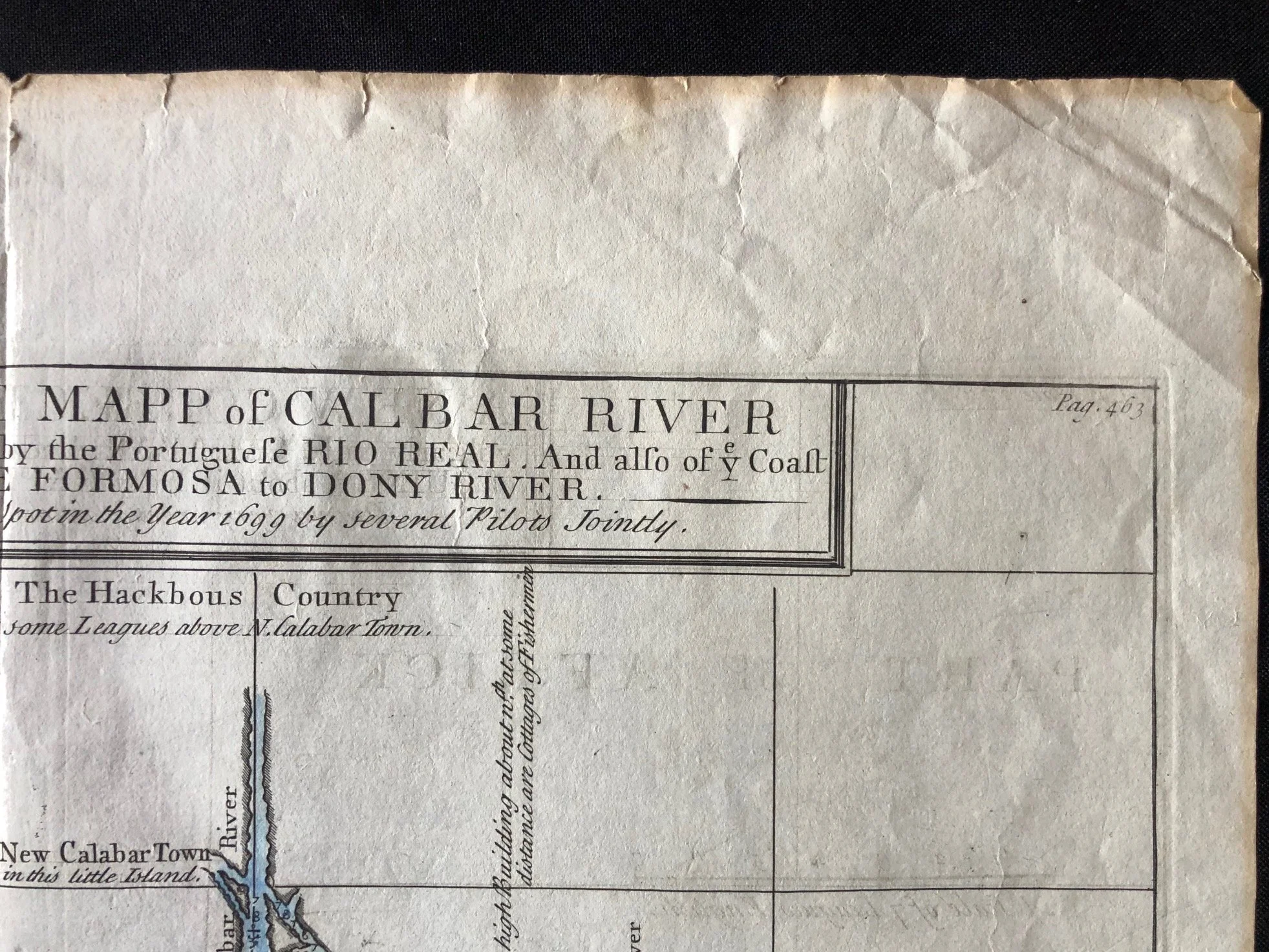
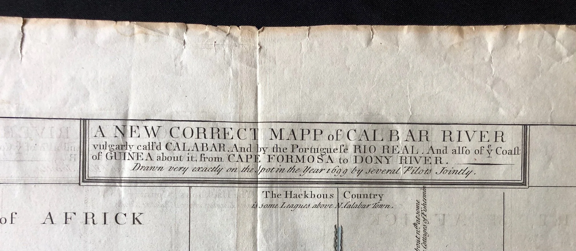

Sea chart published in London as part of Awnsham and John Churchill’s monumental Collection of Voyages and Travels (first issued in 1704). It is based on a hydrographic survey drawn "very exactly on the Spot in the Year 1699 by several Pilots Jointly."
A Blueprint of the Transatlantic Slave Trade
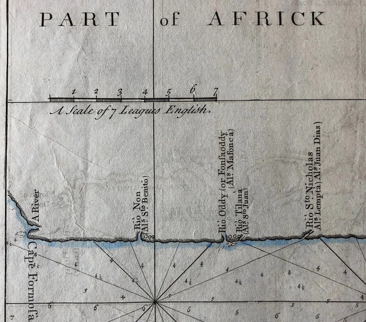
While presented as a standard maritime chart, this map functions as a literal infrastructure layout for the transatlantic slave trade at its turn-of-the-century peak. The region depicted—the Bight of Biafra (labeled here as the "Bite of Guinea" or "Part of the Ethiopick Gulph")—was one of the most heavily trafficked slave-exporting coasts in African history.
Locations marked with precise soundings and river entrances, such as New Calabar Town, Old Calabar River, and the Town of Bandy (Bonny), were major trading hubs where European slave vessels anchored for weeks to purchase captive Africans from local merchant elites.
The Legacy of the 1699 Dragon Voyage
The specific date in the title—1699—links this map directly to the voyage of the English slave ship Dragon, commanded by Captain James Barbot. Barbot wrote an extensive journal detailing his trade negotiations with King William of Bonny and the rulers of Calabar. The "several Pilots" mentioned in the cartouche were the EIC and Royal African Company navigators who mapped these treacherous mangrove swamps and shallow estuaries to ensure future slave ships wouldn't run aground on the lethal sandbars explicitly dotted at the mouth of the river.
A Record of Changing Imperial Names
The text in the title box offers an excellent lesson in toponymy (the study of place names) and the transition of maritime power. It notes the river is "by the Portuguese Rio Real." This honors the 15th- and 16th-century Portuguese explorers who originally charted the area. By the time this map was engraved in London, British dominance in the slave trade had eclipsed the Portuguese, resulting in the anglicized names ("Calabar" and "Bandy") that would dominate 18th-century mercantile ledgers.
400mm x 340mm
Copperplate engraving. Worn and creased. Later hand colouring.
R1,250