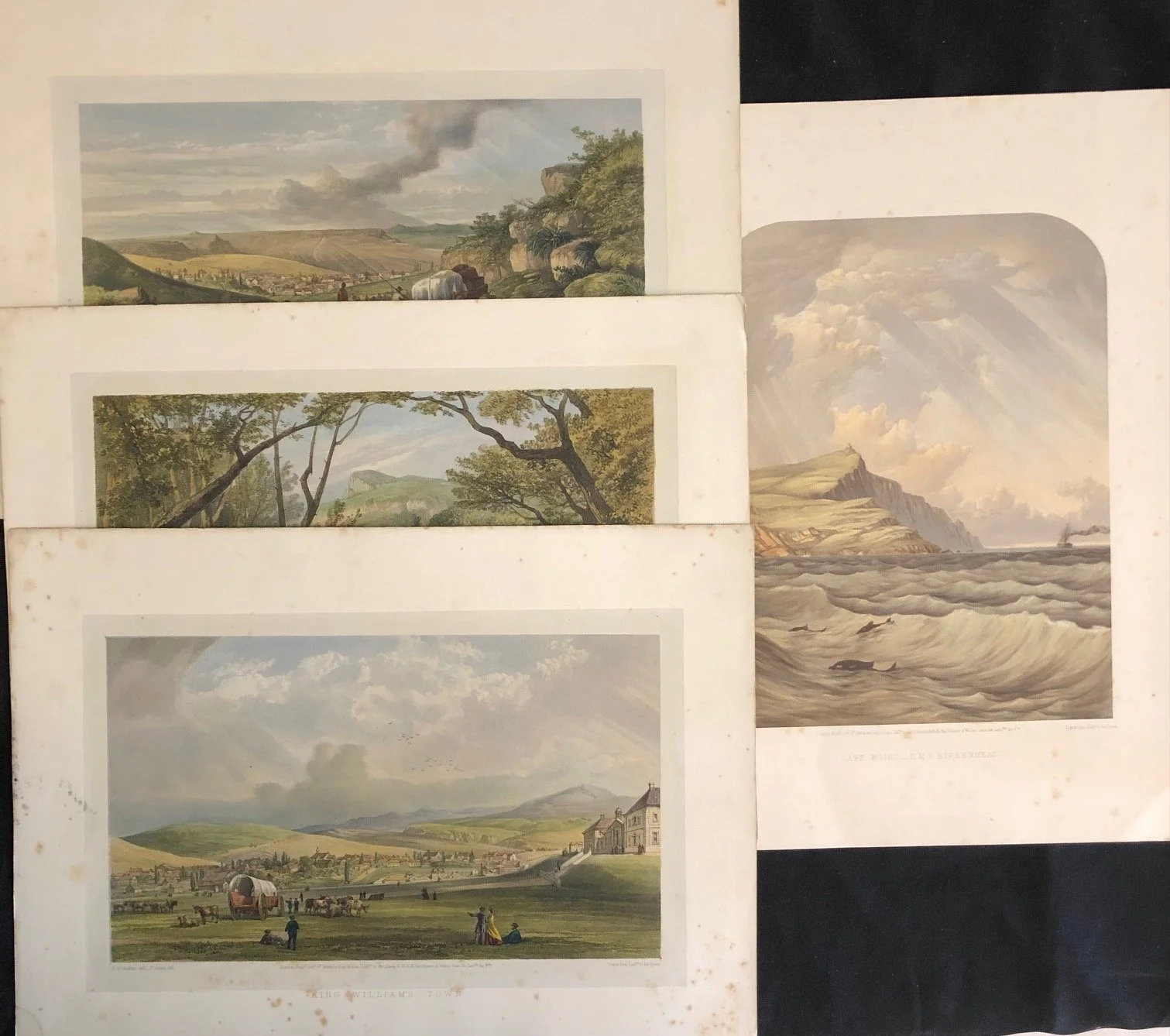
Four Hand Coloured Lithographs after Thomas William Bowler (1865)
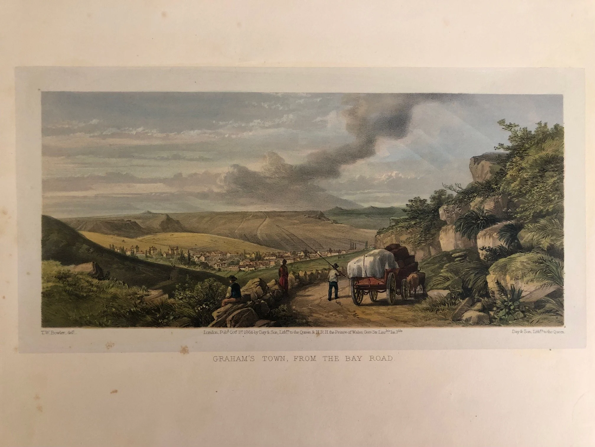
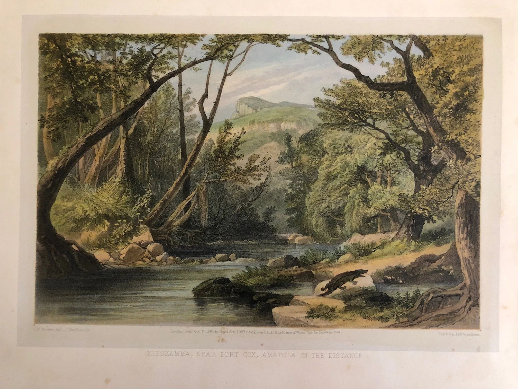
4 x Hand Coloured Lithographs after Thomas William Bowler. From the book: The K* Wars and the British Settler Garrisons (1865).
While the publication date printed on the bottom of the plates reads October 1st, 1864, the complete volume containing 20 plates was issued in London by the renowned lithographers Day & Son in 1865, with historical text by William Rodger Thomson.
The Historical Context Behind the Two Views
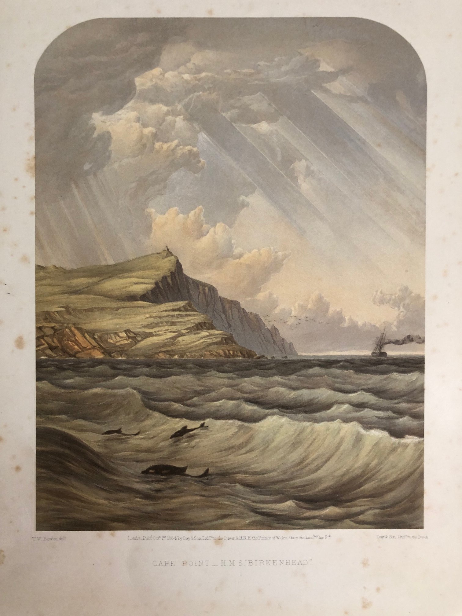
"Cape Point — H.M.S. 'Birkenhead'"
While the title explicitly invokes the legendary and tragic wreck of the troopship HMS Birkenhead, there is a fascinating historical anachronism at play here:
The Reality: The Birkenhead famously struck a rock and sank off Danger Point (near Gansbaai)—nearly 100 kilometers east of Cape Point—in the early hours of February 26, 1852. It is the disaster that gave the world the "Birkenhead Drill" ("women and children first").
Bowler’s Composition: Bowler didn't paint the actual wreck in real-time. Instead, he captures the iron-hulled steam frigate steaming past the dramatic cliffs of Cape Point prior to her doom, or perhaps as an idealized, haunting tribute. The presence of the newly constructed Cape Point Lighthouse (commissioned in 1860, visible atop the peak) proves the view was composed years after the disaster. The churning sea, the rays of dramatic light cutting through the clouds, create an immense sense of Romantic foreboding.
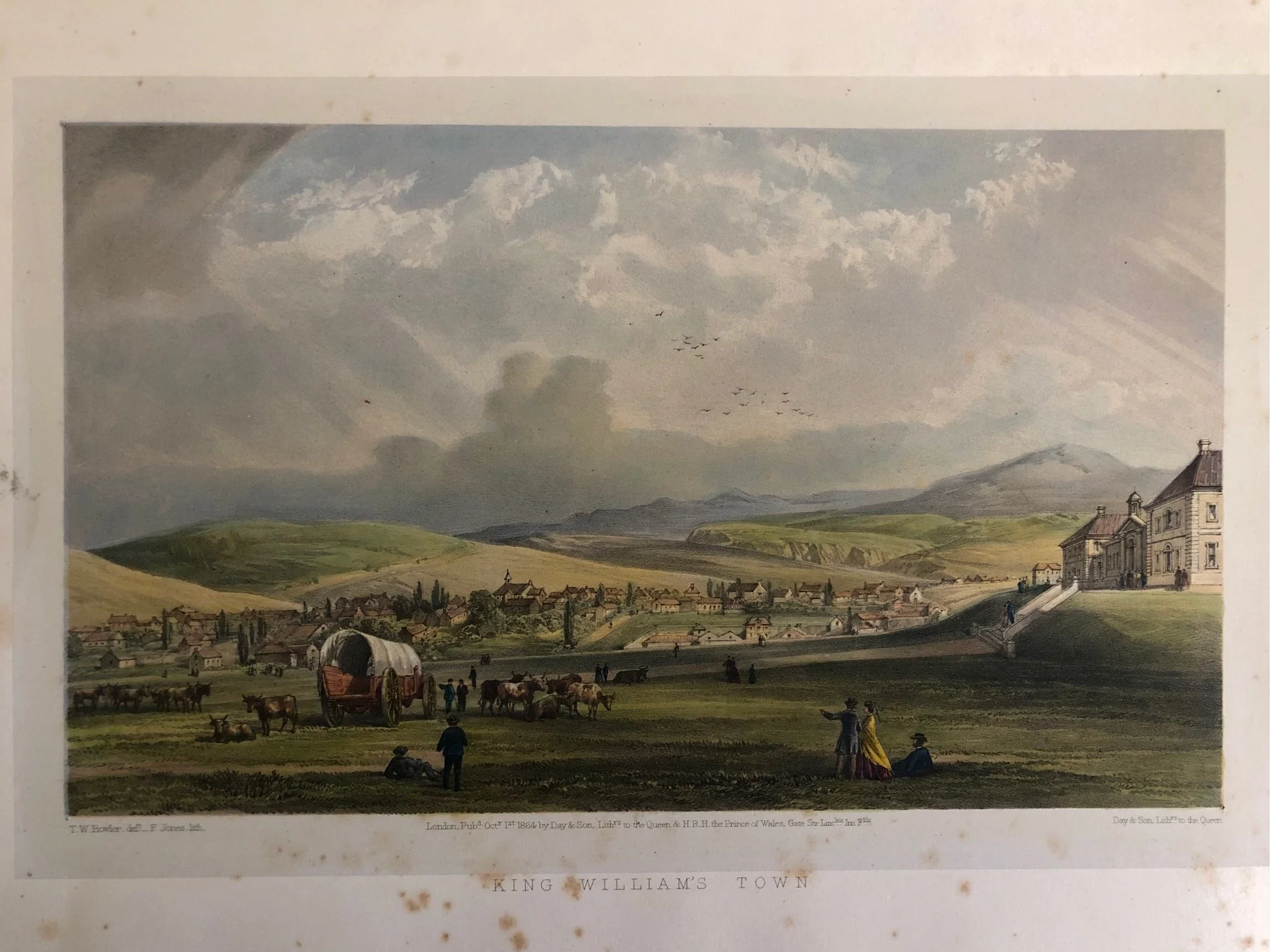
Plate II: "King William’s Town"
The Frontier Hub: Established as a military headquarters during the Frontier Wars (specifically the War of the Axe and the War of Mlanjeni), King William’s Town was the capital of the short-lived crown colony of British Kaffraria.
The Architecture of Control: On the right, Bowler meticulously details the newly built, imposing public buildings and military hospital. In the foreground, he juxtaposes the old frontier reality—an ox-wagon and grazing cattle—with neatly dressed colonial figures looking out over a rapidly growing, structured settlement. It is an image designed to project imperial order, progress, and stability to an anxious British public following decades of brutal frontier conflicts.
The Artistic Partnership: Bowler and the Masters of Stone
The technical execution of these plates represents the absolute zenith of 19th-century lithography.
Look closely at the bottom left of the King William’s Town plate: it reads "T.W. Bowler, delt. — F. Jones, lith." * Bowler provided the original, luminous watercolors from his travels, but he lacked the specialized equipment at the Cape to print them at this scale. He sent them to London to Day & Son (Lithographers to the Queen).
Master lithographers like Frank Jones meticulously copied Bowler’s work onto the lithographic limestone blocks. The exquisite handling of the sky, the subtle tonal gradations of the tinted background, and the sharp foreground details show why Day & Son were considered the finest in the world at capturing atmospheric weather patterns—something Bowler was obsessed with portraying.
The Tragic Backstory of the Portfolio
Historically, this specific portfolio was meant to be Bowler's crowning financial and professional achievement, but it ultimately ruined him.
Bowler traveled extensively through the Eastern Cape frontier to capture these scenes firsthand. However, by the time the book was published in London in 1865, the Cape economy was locked in a severe economic depression. The subscription list failed to materialize the profits he desperately needed.
Compounded by lawsuits, a fierce public dispute with the authorities over a railway artwork, and his own notoriously prickly temperament, the financial failure of his grand portfolios eventually forced him to leave the Cape in debt. He died in England in 1869, just a few years after these magnificent views were pulled from the presses.
Page size: 370mm x 280mm
Some scattered foxing.
R3,000 (for 4).