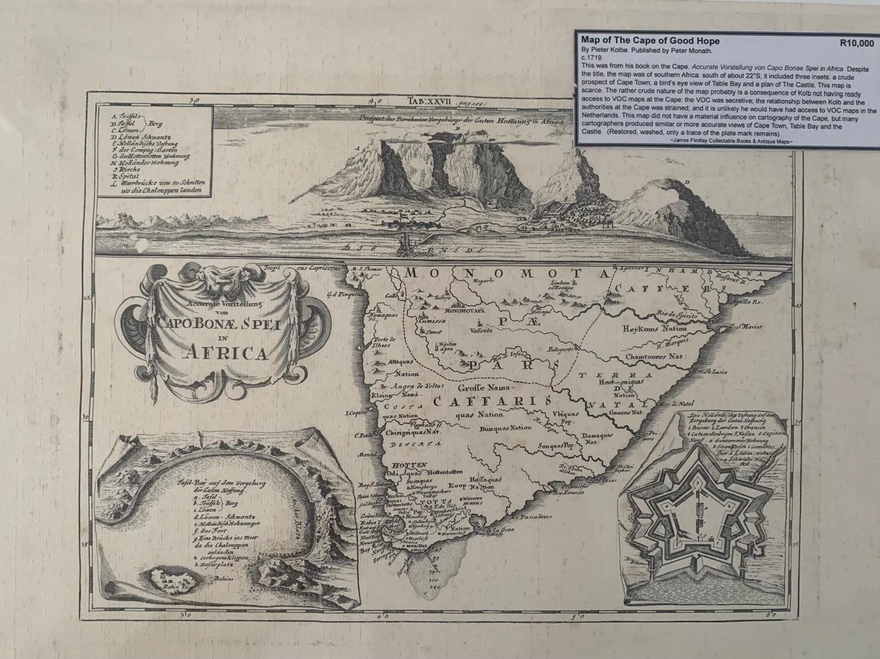
Kolbe Map of the Cape of Good Hope
By Pieter Kolbe. Published by Peter Monath.
c. 1719.
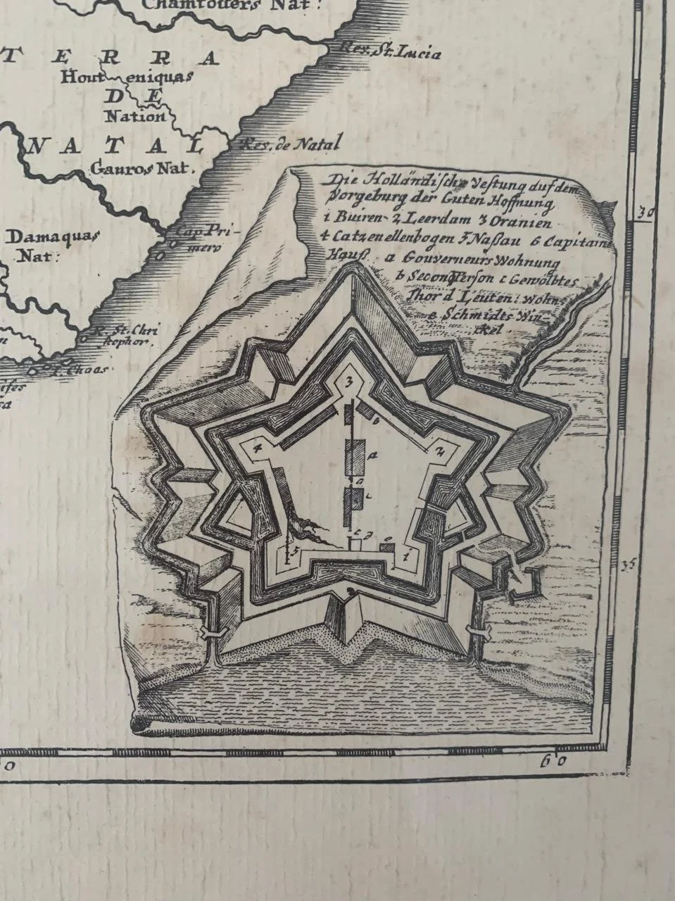
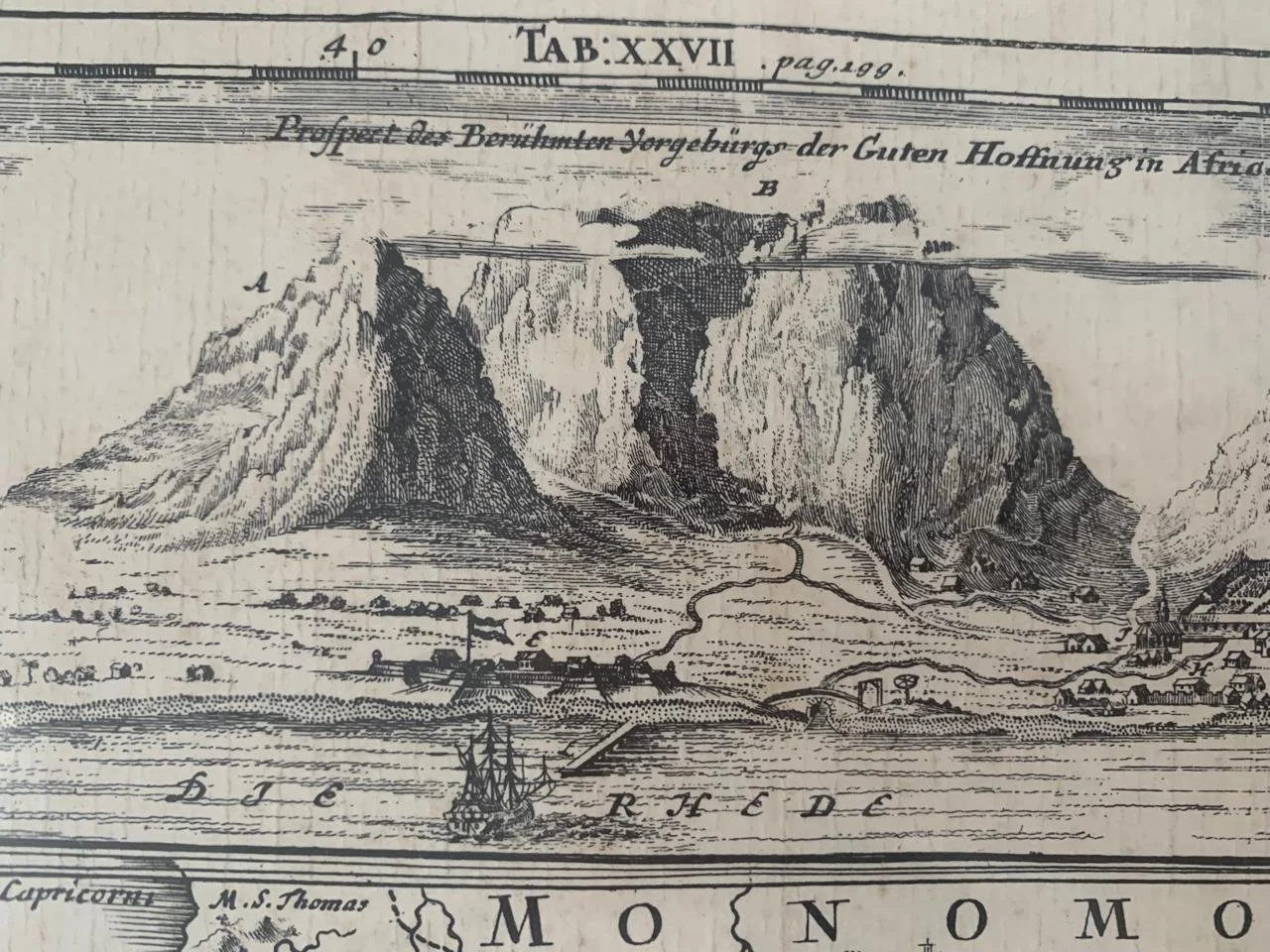
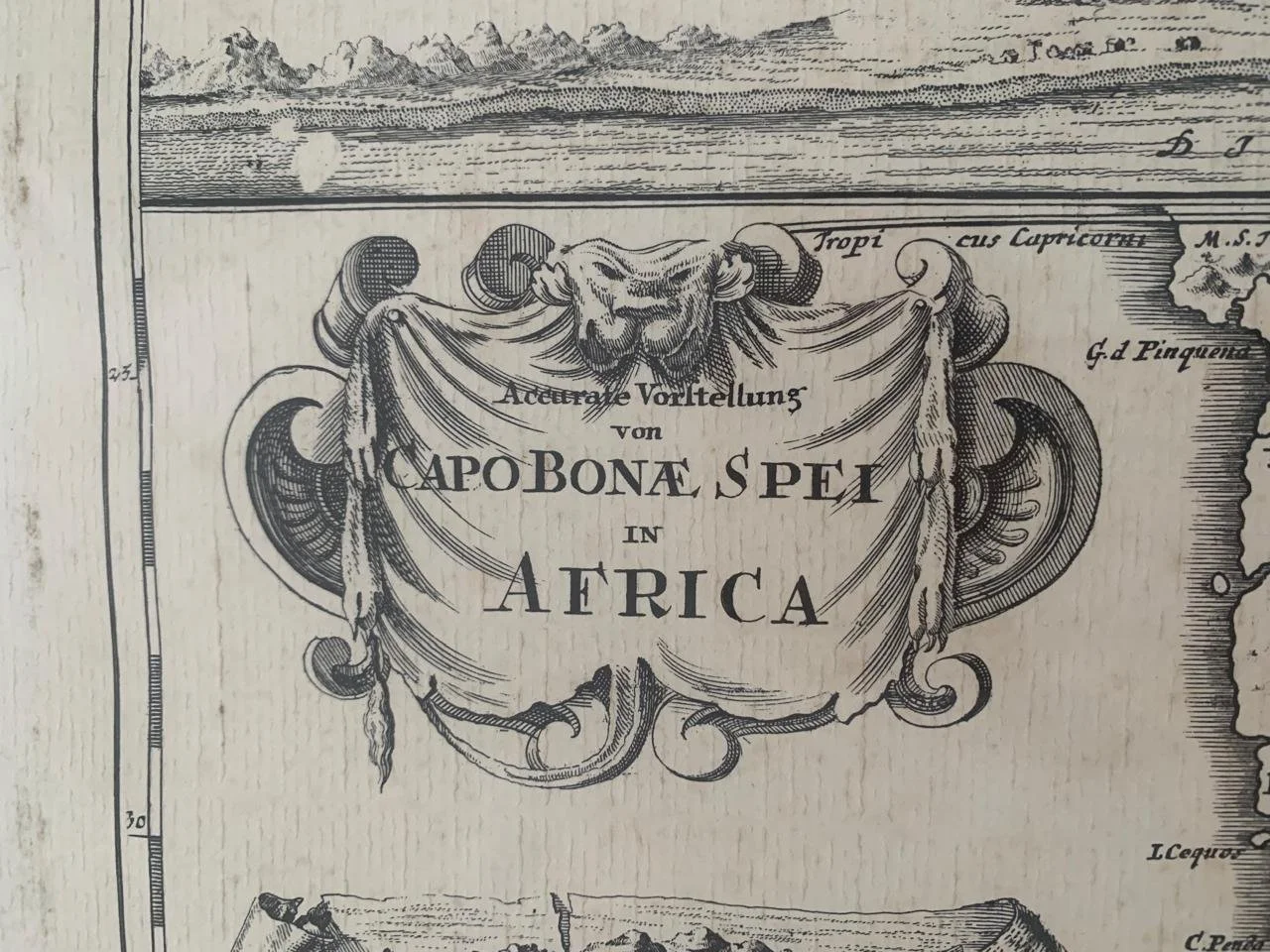
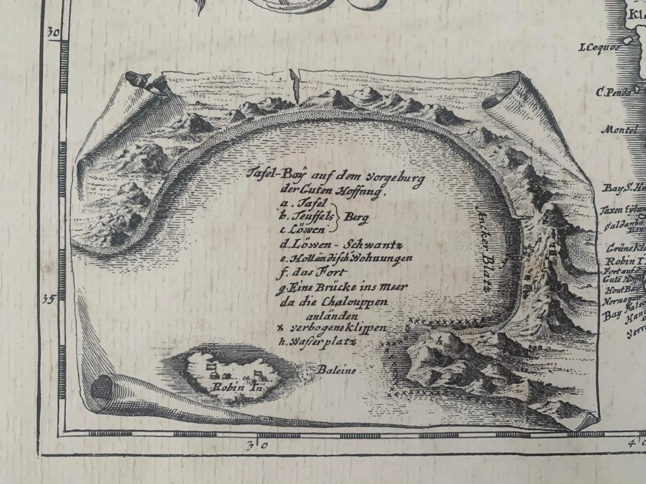
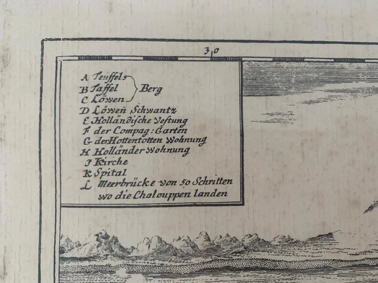
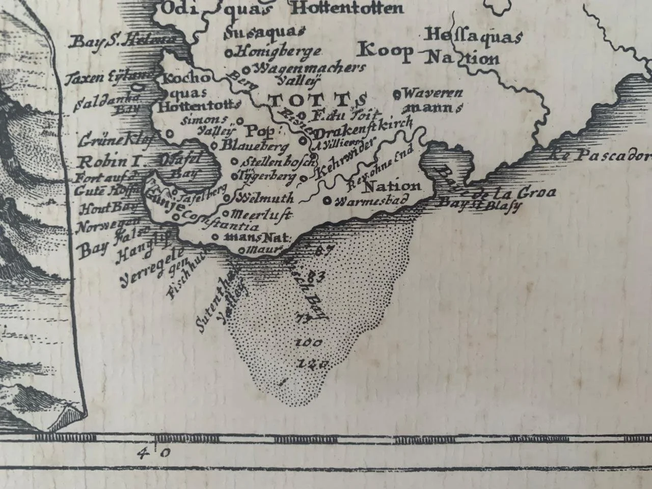
This map was from his book on the Cape; Accurate Vorstellung von Capo Bonae Spei in Africa. Despite the title, the map was of Southern Africa: south of about 22°S; it included three insets: a crude prospect of Cape Town; a bird's eye view of Table Bay and a plan of The Castle. This map is scarce. The rather crude nature of the map probably is a consequence of Kolbe not having ready access to VOC maps at the Cape: the VOC was secretive; the relationship between Kolbe and the authorities at the Cape was strained; and it is unlikely he would have had access to VOC maps in the Netherlands. This map did not have a material influence on the cartography of the Cape, but many cartographers produced similar or more accurate views of Cape Town, Table Bay and the Castle.
Restored, washed, only a trace of the plate mark remains.
500mm x 405mm
Sold Feb ‘26