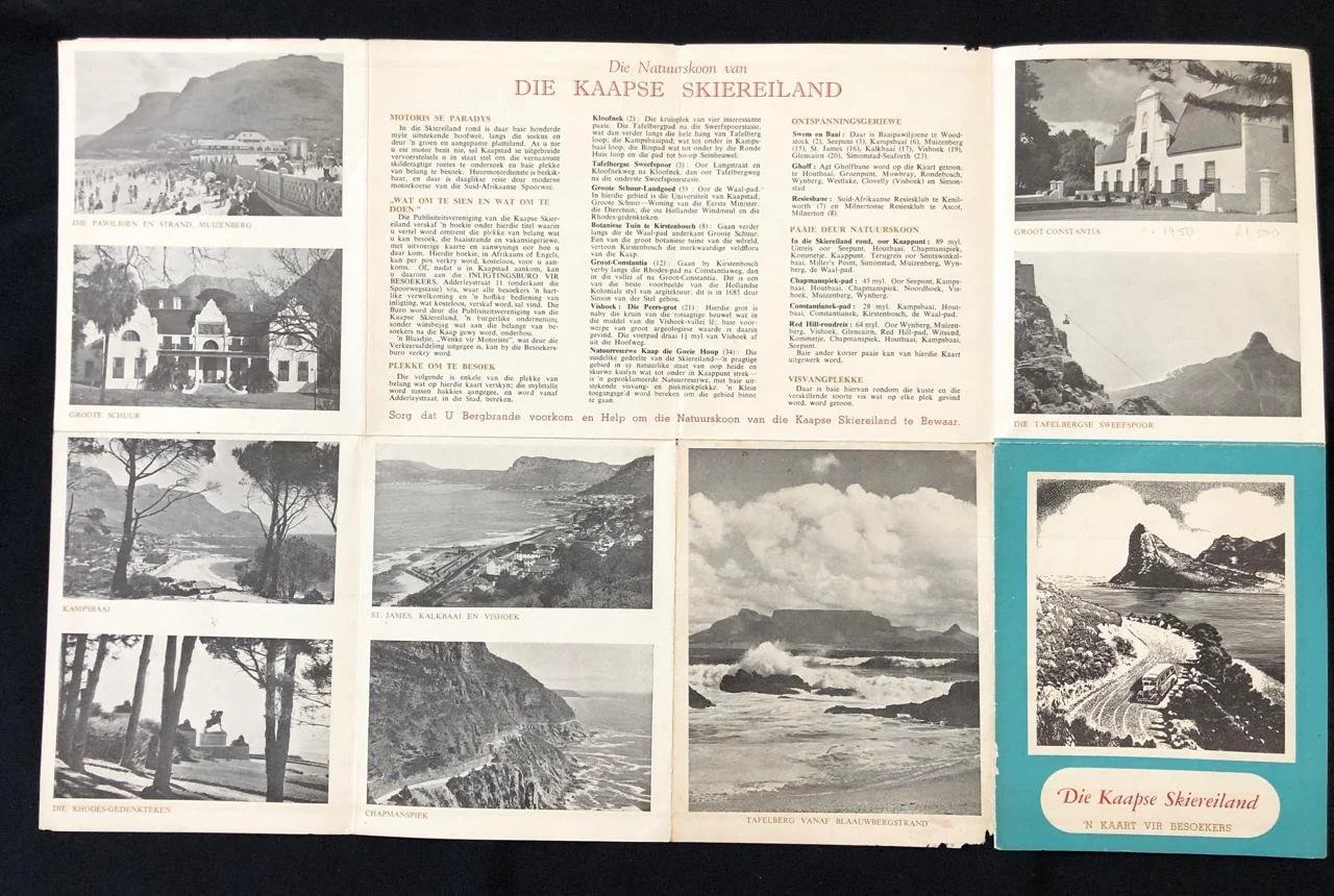
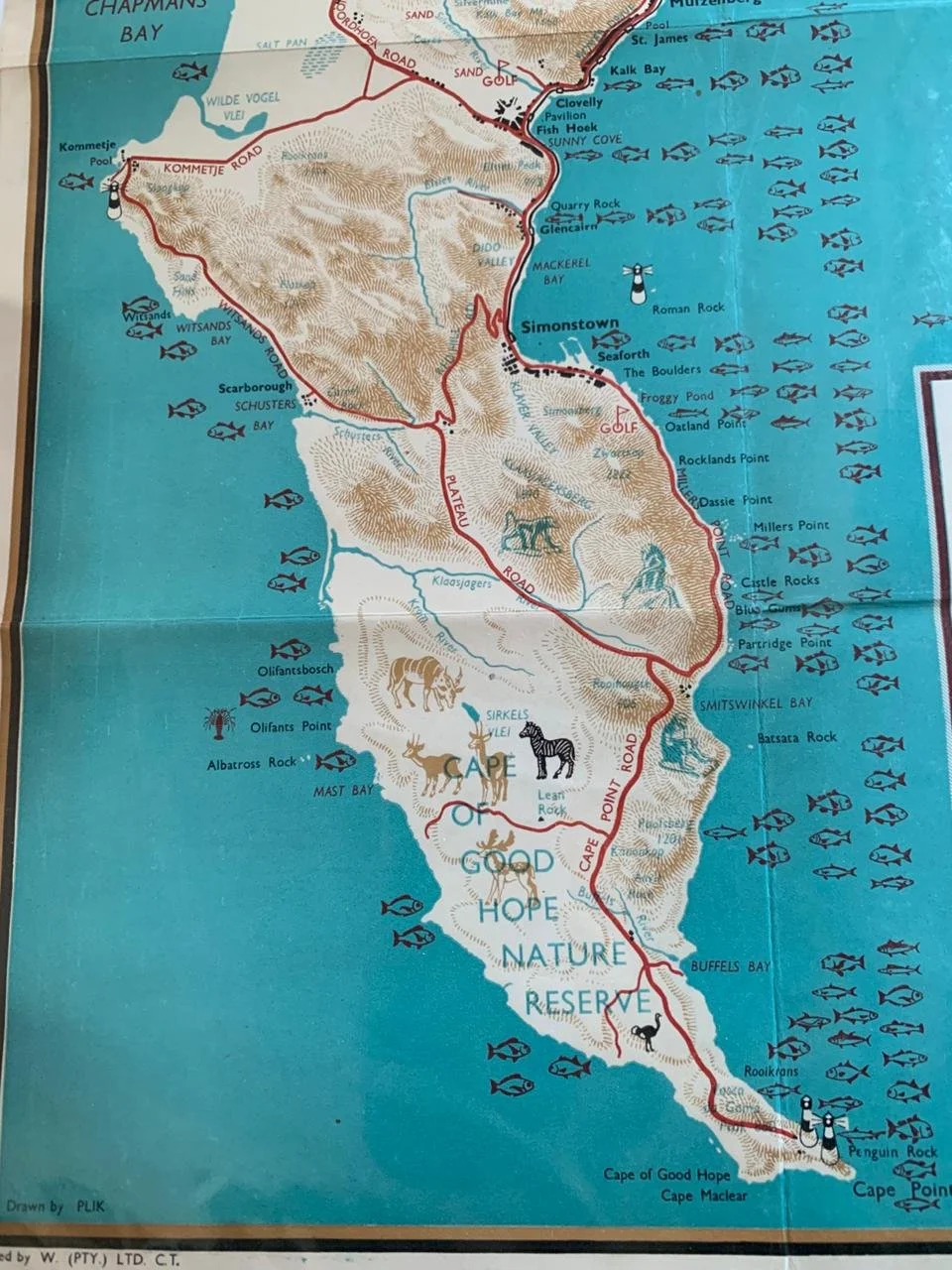
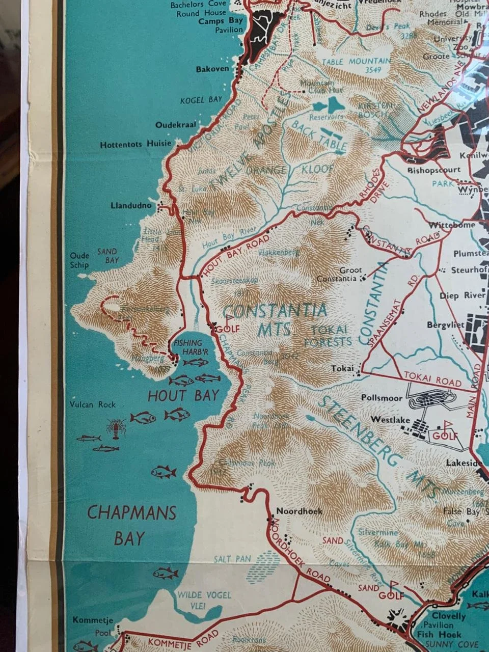
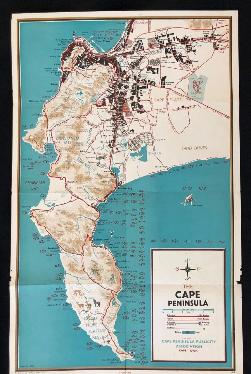
Map of The Cape Peninsula
1949
Published by the Cape Peninsula Publicity Association, Cape Town.
Depicted are streets, railways, suburbs, fishing spots and other sports activities.
320mm x 510mm
Sold
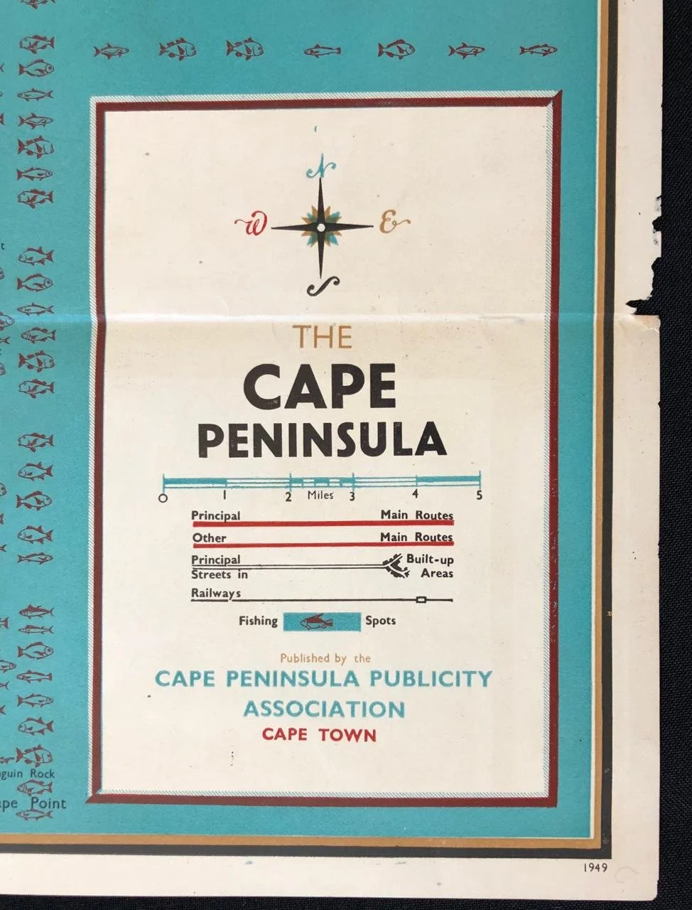
1949
Published by the Cape Peninsula Publicity Association, Cape Town.
Depicted are streets, railways, suburbs, fishing spots and other sports activities.
320mm x 510mm
Sold