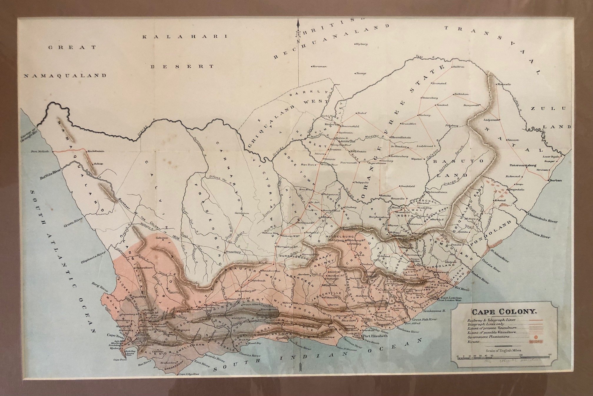
Map of the Cape Colony (1886)
Chromolithograph.
This is a fascinating historical snapshot of Southern Africa from a very specific and turbulent window in time.
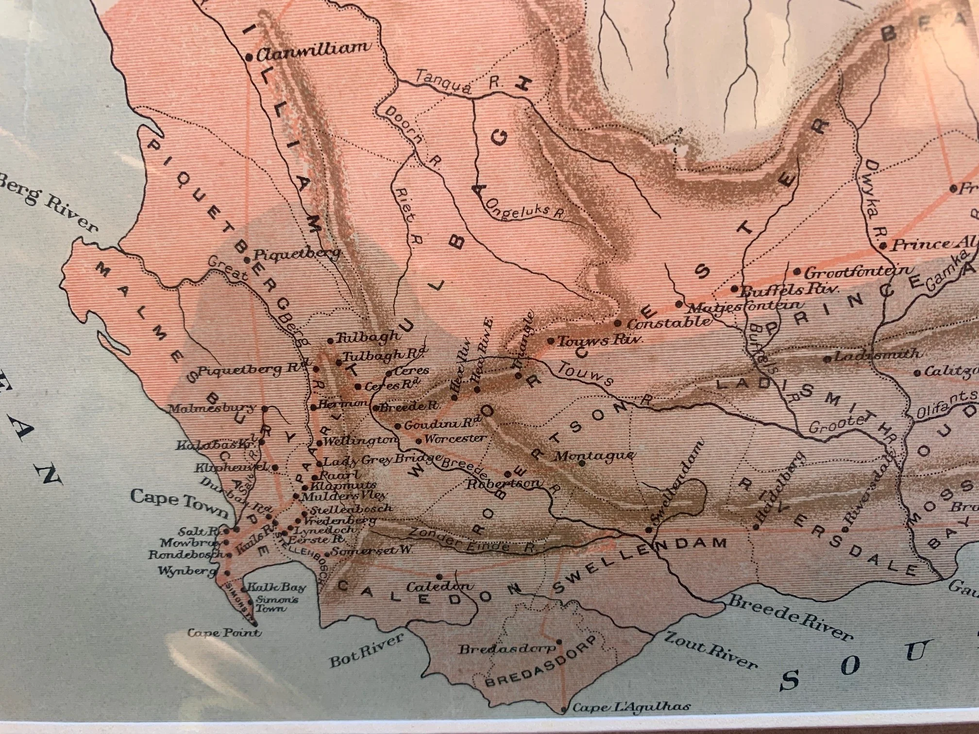
1. A Blueprint for Wine: The Viticulture Focus
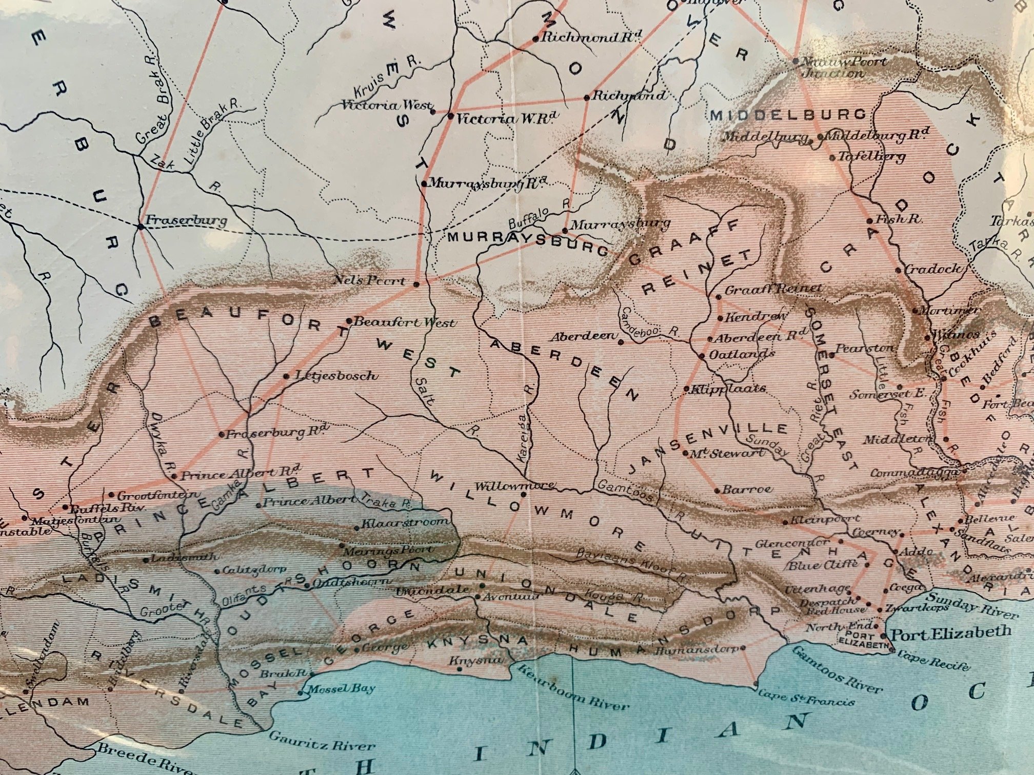
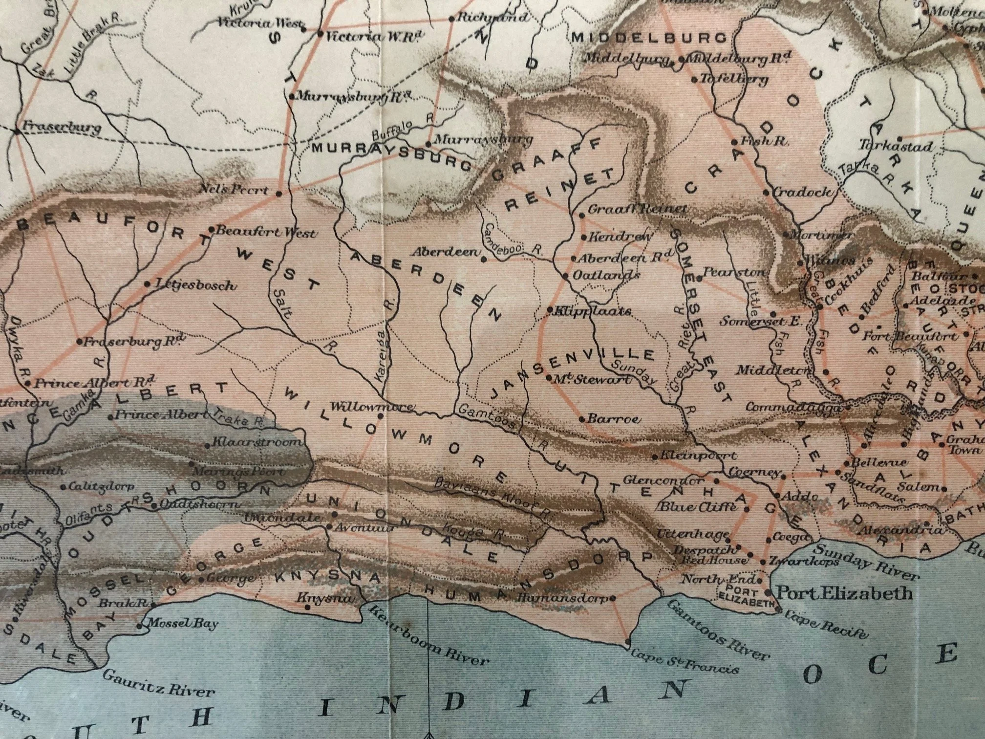
One of the unique aspects of this map is in the legend: it maps the "Extent of present Viticulture" and "Extent of possible Viticulture." This map wasn't just for general geography; it was an economic assessment tool. By the late 19th century, the Cape wine industry—which had suffered heavily from the devastating Phylloxera insect plague in the 1880s—was trying to rebuild and expand. The shaded pinkish regions tracking along the mountain ranges show exactly where the colonial government believed the perfect microclimates and terroirs lay, mapping out the future of South Africa’s world-famous wine regions.
2. 1886 and the Discovery of Gold
This map comes out of the book: "1886 Official Handbook." This map sits precisely on a massive geopolitical fault line.
In 1886, gold was discovered on the Witwatersrand in the South African Republic (labeled "Transvaal" at the top right).
• Notice how sparse the infrastructure (railways and telegraph lines) looks heading north.
• Just after this map was produced, the scramble to connect the Cape Colony's ports (Cape Town, Port Elizabeth, and East London) to the newly exploding goldfields of Johannesburg turned into an all-out railway race. This map captures the region right before gold completely transformed its economy and infrastructure.
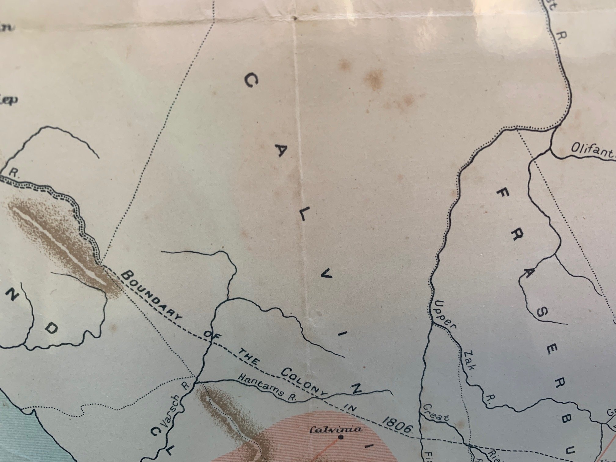
3. The Imperial Tug-of-War: British Bechuanaland
At the very top of the map, you can see "British Bechuanaland" (created in 1885) and the "Orange Free State." The borders shown here highlight the British Empire's strategy of encirclement. By establishing British Bechuanaland, the British effectively blocked the Boer republics (the Orange Free State and Transvaal) from expanding westward, keeping them boxed in. This geopolitical tension eventually boiled over into the Second Boer War (1899–1902).
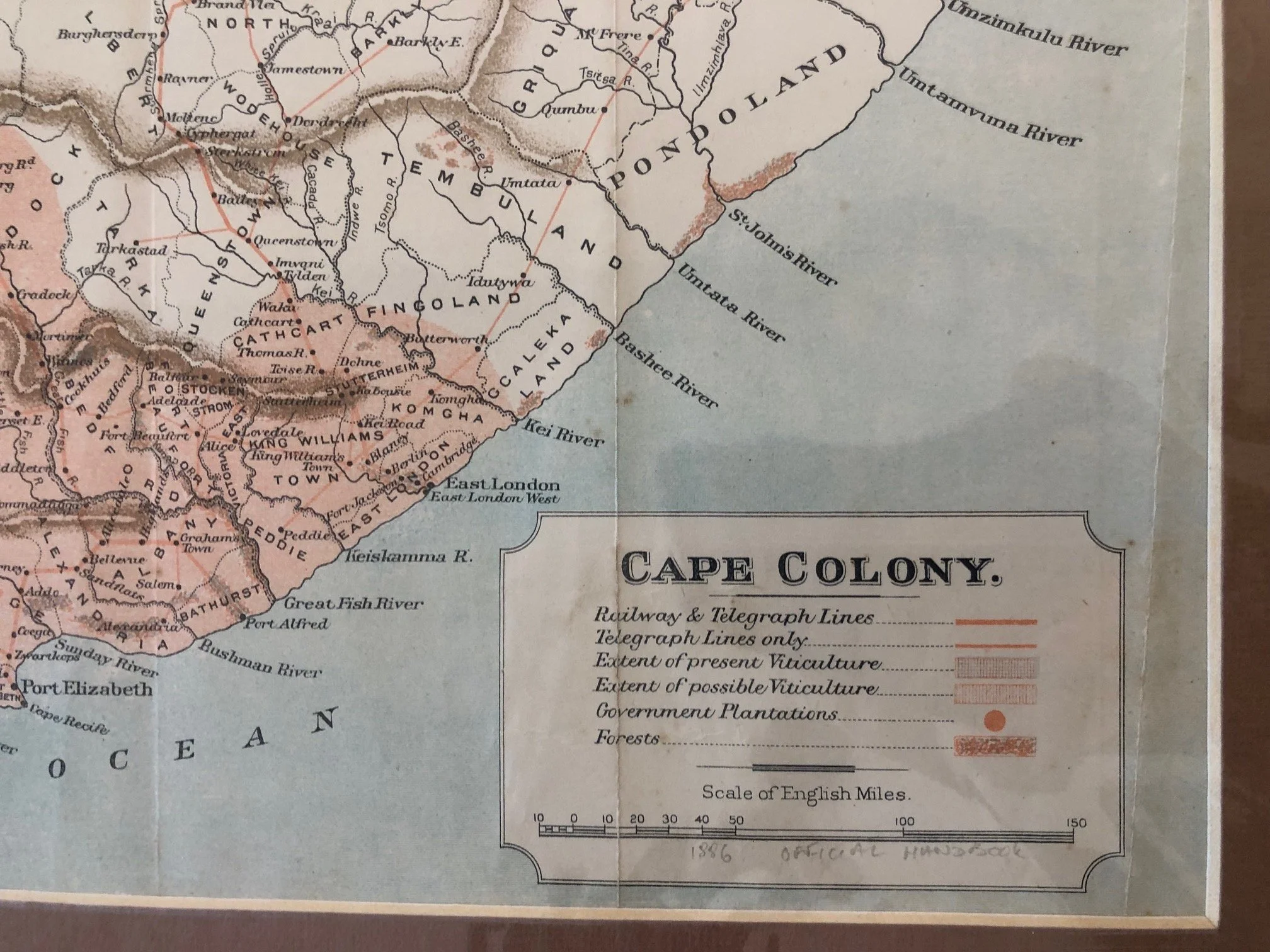
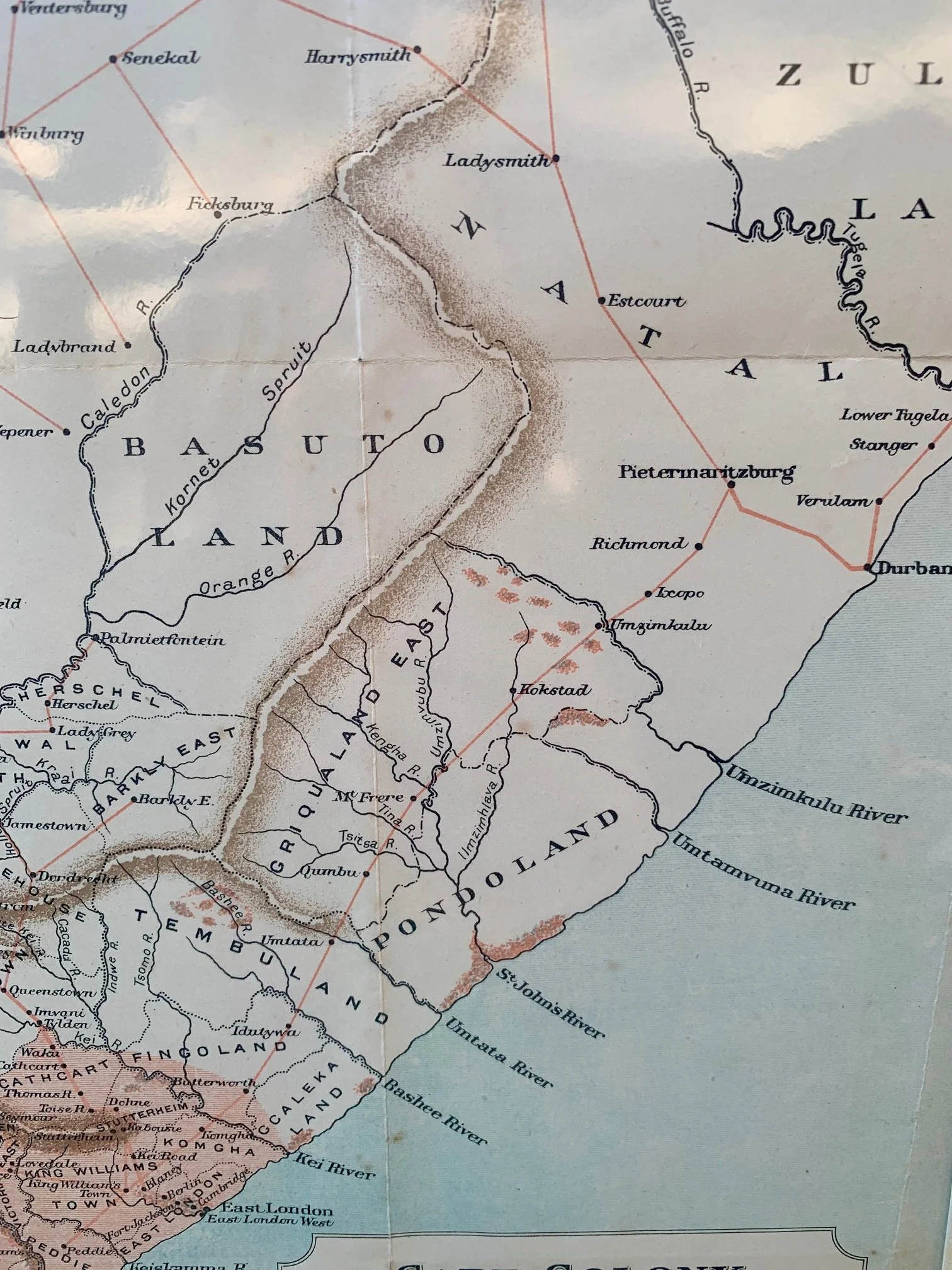
4. Independent "Pondoland"
While neighboring regions like Tembuland, Fingoland, and Griqualand East had already been progressively annexed or brought under Cape colonial administrative control by 1886, Pondoland stands out. It was one of the very last independent African Kingdoms on the eastern coast, successfully resisting formal annexation by the Cape Colony until 1894. This map catches it in its final decade of independence.
Some tears and light foxing.
465mm x 310mm
R1,250