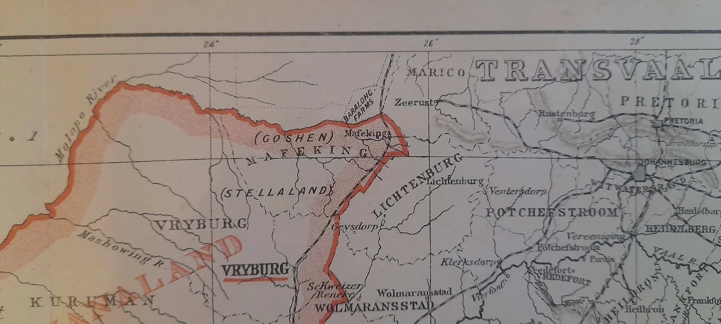
Map of The Cape Colony 1908
Chromolithograph
Note Bechuanaland and Griqualand, now part of Gauteng.
The short-lived Boer Republics of Goshen and Stellaland are also depicted.
293mm x 250mm excluding mountboard, unframed.
R1,000


Chromolithograph
Note Bechuanaland and Griqualand, now part of Gauteng.
The short-lived Boer Republics of Goshen and Stellaland are also depicted.
293mm x 250mm excluding mountboard, unframed.
R1,000