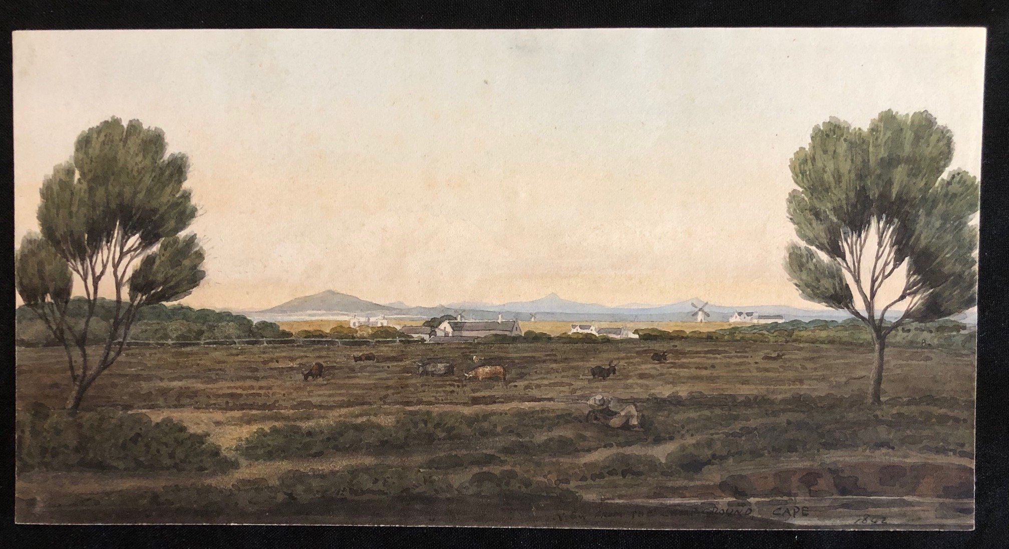
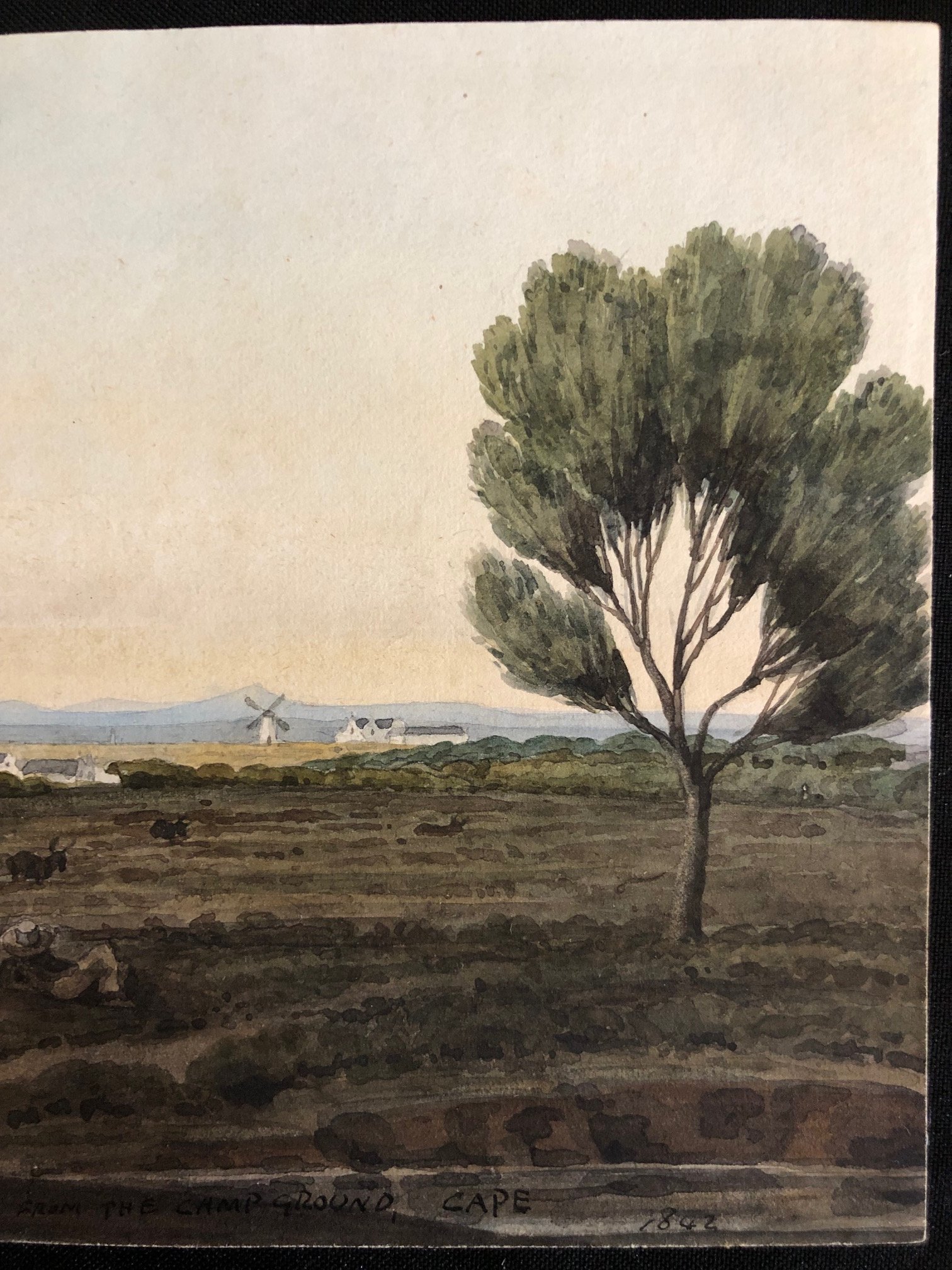
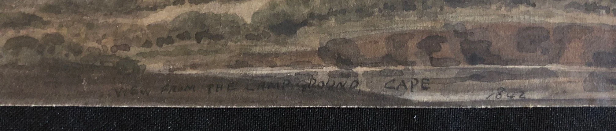
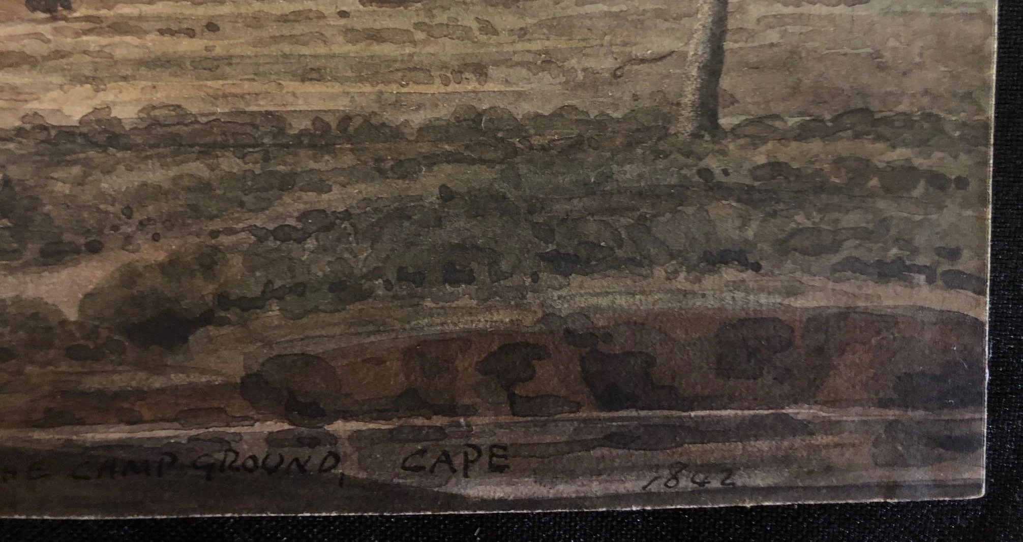
View from the Camp Ground, Cape (1842)
Unsigned
Attributed to South African, Charles Davidson Bell (1813-1882)
Watercolour on paper.
Charles Bell, who usually worked in watercolour was an accomplished artist. He was also a designer, a land surveyor and a director of companies, amongst other activities, was a prominent and respected individual in mid-nineteenth-century Cape Town.
Because Charles Bell was an amateur rather than a professional artist, he usually retained his work and seldom offered it for sale. This would account for the rarity of his paintings in private hands and for the comprehensive holdings of the UCT Bell Heritage Trust and Museum Africa.
Dated: 1842.
Artist: Unattributed 19th-century colonial hand (stylistically reminiscent of topographical artists active in the Cape at the time, such as Thomas Bowler, Charles Bell, or their contemporaries/students).
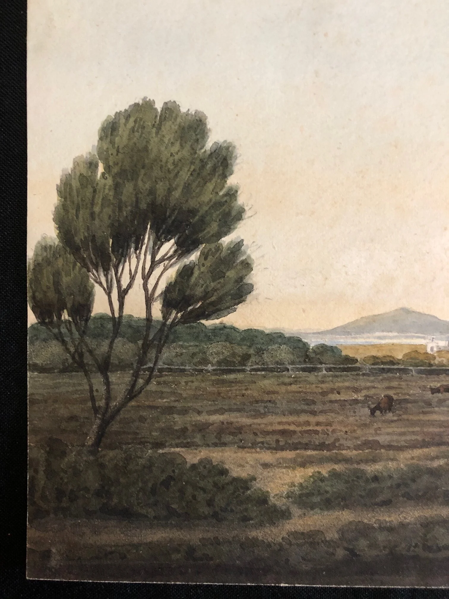
The Foreground & Figures: The foreground depicts the characteristic low scrub and sandy soil of the Cape Peninsula commonage. In the center-right foreground, a lone figure wearing a wide-brimmed colonial straw hat is resting or observing the landscape.
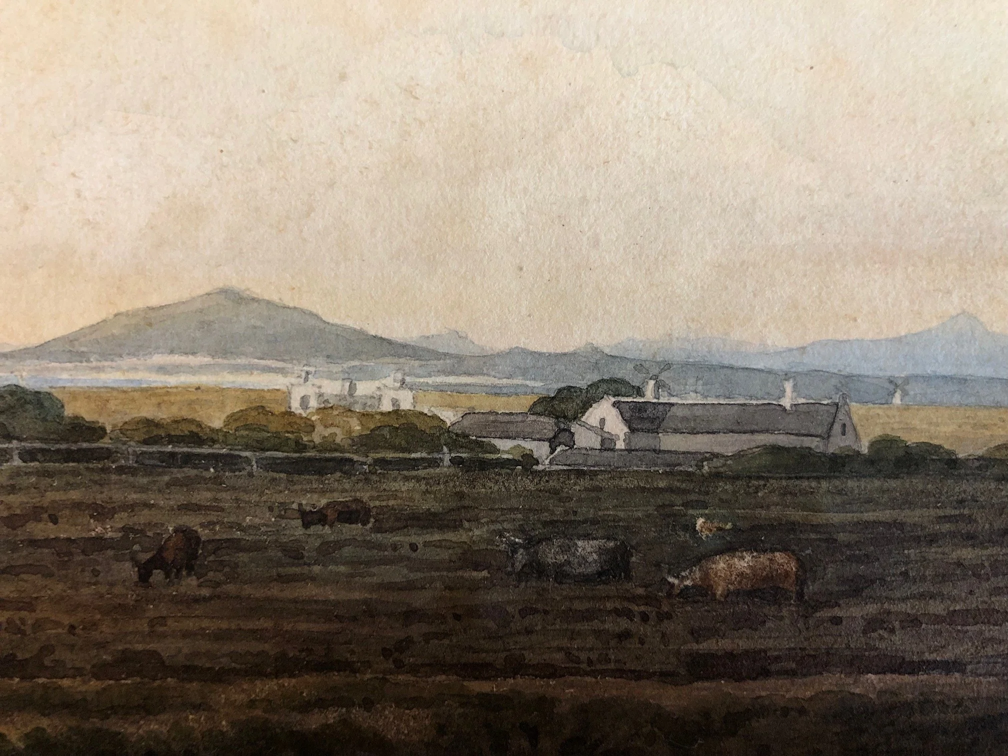
Pastoral Landscape: A herd of cattle is scattered across the middle distance, grazing on the open flats. This highlights the area’s primary use during the 1840s as grazing land for local estates and milk farms.
Early Colonial Architecture & Windmills: In the mid-ground, several low-slung, white-walled Cape Dutch style cottages and outbuildings with dark thatched roofs are visible.
Crucially, at least three traditional windmills are dotted along the horizon line to the right. Windmills were prominent landmarks along the Liesbeek and Black River areas (such as the famous Mostert's Mill, Nieuweland mills, and those towards Salt River/Maitland), used for milling grain for the growing Cape colony.
The Background: The horizon transitions into the soft blue silhouettes of distant mountains, likely the Tygerberg hills or the Stellenbosch/Hottentots Holland range across False Bay.
By 1842, the Camp Ground area was transitioning from a purely military outpost into an elite residential and agricultural suburb for wealthy Cape merchants and civil servants. This artwork captures that precise window: a serene, pastoral landscape before the rapid expansion of the railway (1860s) and suburban sub-division forever altered the rural character of the southern suburbs.
The inclusion of multiple windmills makes it a fantastic topographical record of early Cape industrial and agricultural infrastructure.
This positions the scene directly in what is today Rondebosch/Newlands in Cape Town, looking across the vast, low-lying Cape Flats toward the distant Hottentots Holland or Tygerberg mountain ranges. During the early to mid-19th century, the "Camp Ground" (originally used as a military camping site by both Dutch and British forces) was a largely open, pastoral commonage.
This distinctive, blocky, upright architectural lettering is highly characteristic of one particular 19th-century Cape figure: Charles Davidson Bell (1813–1882).
While Thomas Bowler is the most famous landscape painter of this era, he almost universally favored a fluid, cursive, copperplate script for his pencil and ink captions. In contrast, the neat, penciled or inked block capitals seen here are a classic hallmark of Bell's technical and artistic hand.
Why Charles Bell is the Primary Candidate
1. The Lettering Style
The "G", "R", and "C": Look closely at the wide, open crescent of the C, the distinctively squared geometry of the G, and the straight, low-slung leg of the R. These are the precise drafting capitals Bell used on his official surveys, maps, and field sketches.
The Amperand and Punctuation: The slight, confident commas and the specific spacing of the date (1842) match his personal notebooks and watercolor annotations perfectly.
Professional Habit: As a trained surveyor, Bell routinely used clean, legible block capitals rather than cursive to ensure names and locations on sketches wouldn't be misread by engravers or cartographers.
2. Biographical Context (1842)
The date 1842 fits perfectly into a significant window of Charles Bell's life and work in Cape Town:
In 1840, Bell was appointed Assistant Surveyor-General of the Cape Colony. His daily professional duties involved mapping, surveying, and assessing land grants, commonages, and boundary lines across the Cape Peninsula.
He spent an immense amount of time traversing the Camp Ground, Rondebosch, and the Liesbeek River valley during the early 1840s to settle land boundary disputes and document the changing landscape.
He was famously prolific, carrying small sketchbooks and loose sheets of paper into the field to capture landscapes, local architecture, and character studies while out on survey assignments.
293mm x 150mm
R20,000