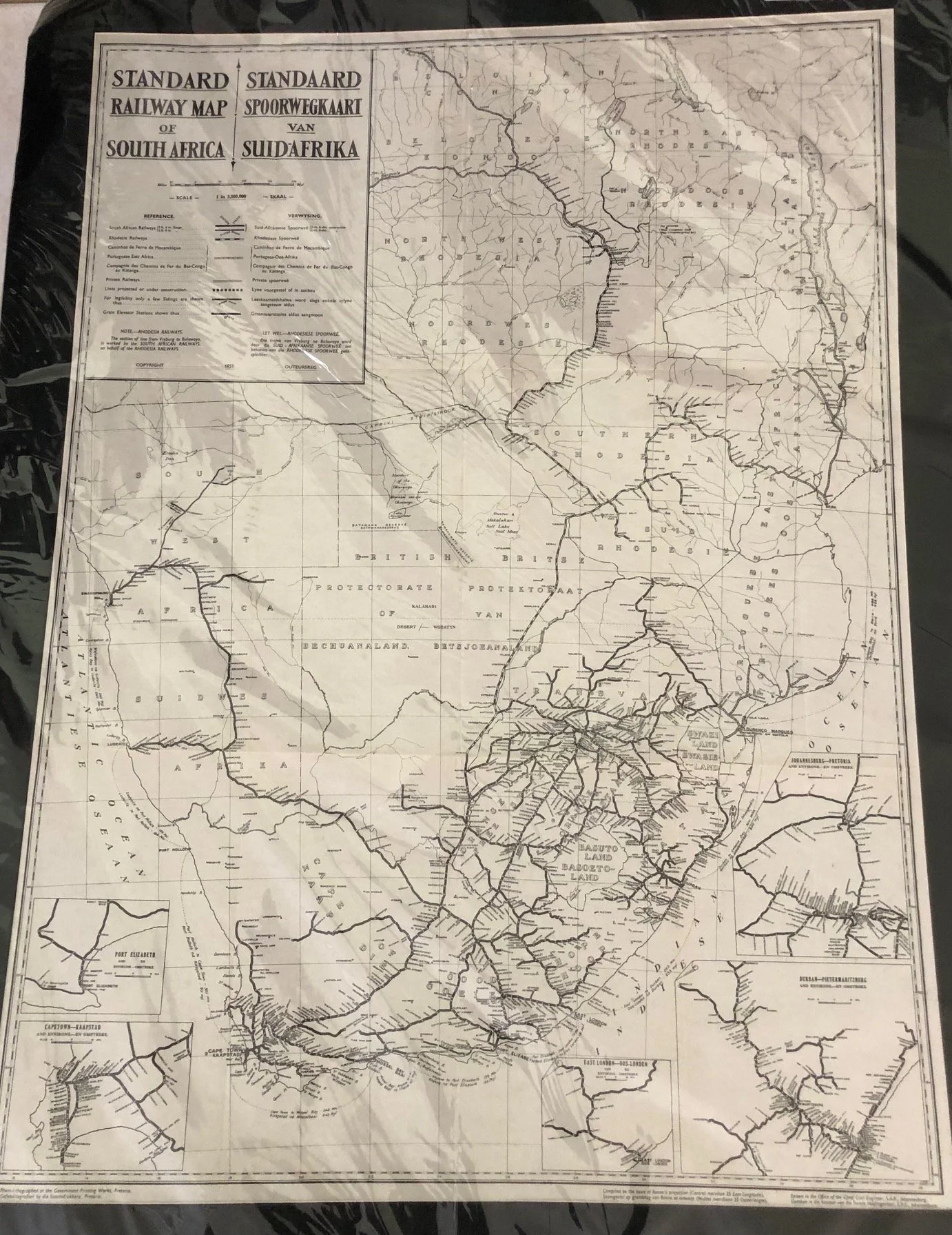
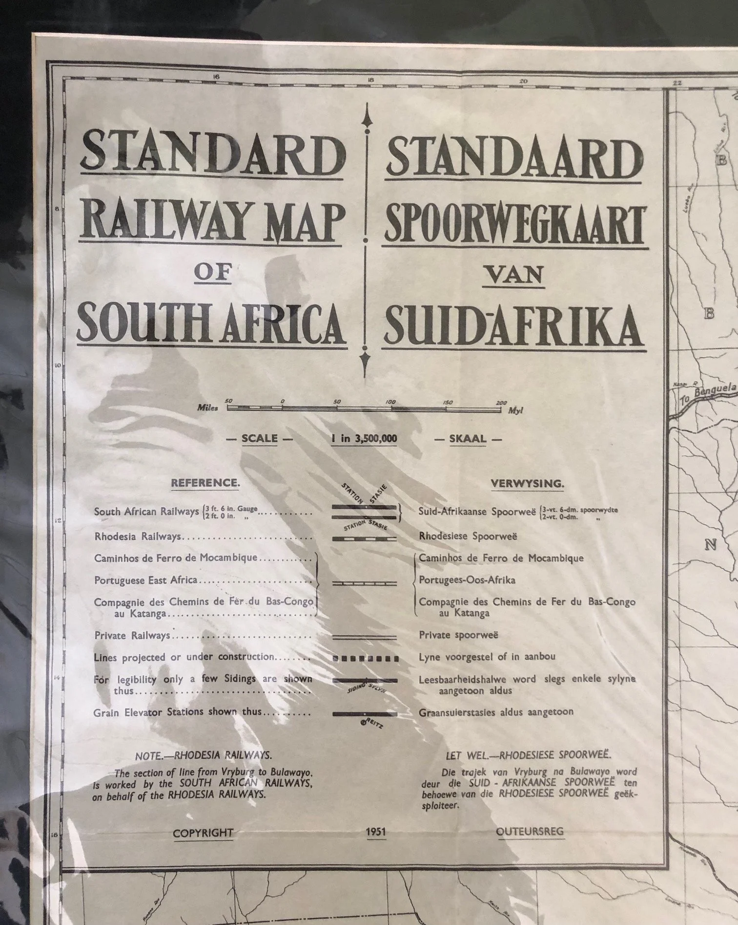
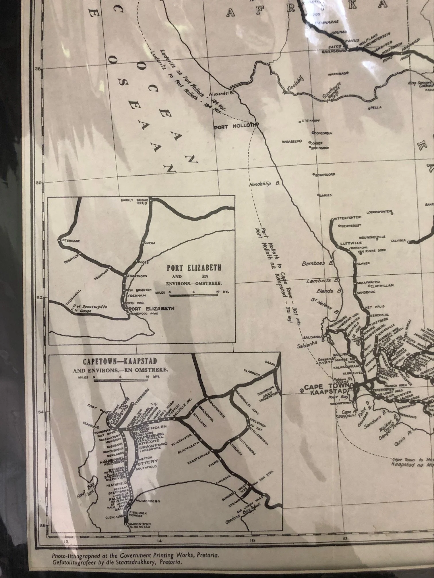
Standard Railway Map of South Africa / Standaard Spoorwegkaart van Suid-Afrika (1951)
A bilingual, detailed overview of the extensive rail network across Southern Africa during the post-WWII era.
Lithograph by the Government Printing Works, Pretoria.
Compiled in the Office of the Chief Civil Engineer, S.A.R. (South African Railways), Johannesburg.
A fascinating "snapshot" of the geopolitical landscape of the early 1950s. While titled "of South Africa," it covers a significantly broader region, extending into several territories that were then under various colonial and administrative mandates:
• Bechuanaland Protectorate (now Botswana)
• South West Africa (now Namibia), which was administered by South Africa at the time.
• Southern and Northern Rhodesia (now Zimbabwe and Zambia).
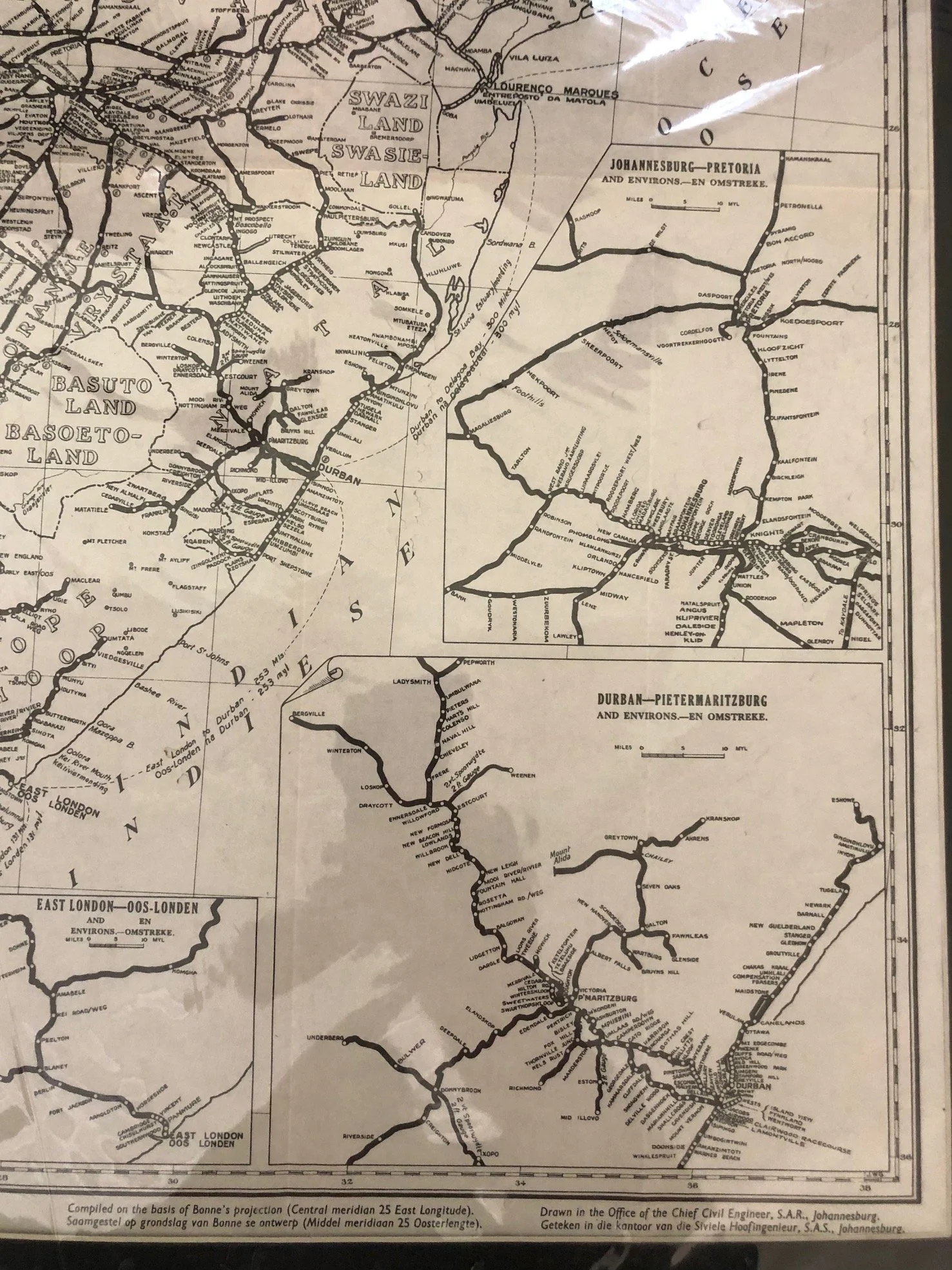
• Portuguese East Africa (now Mozambique).
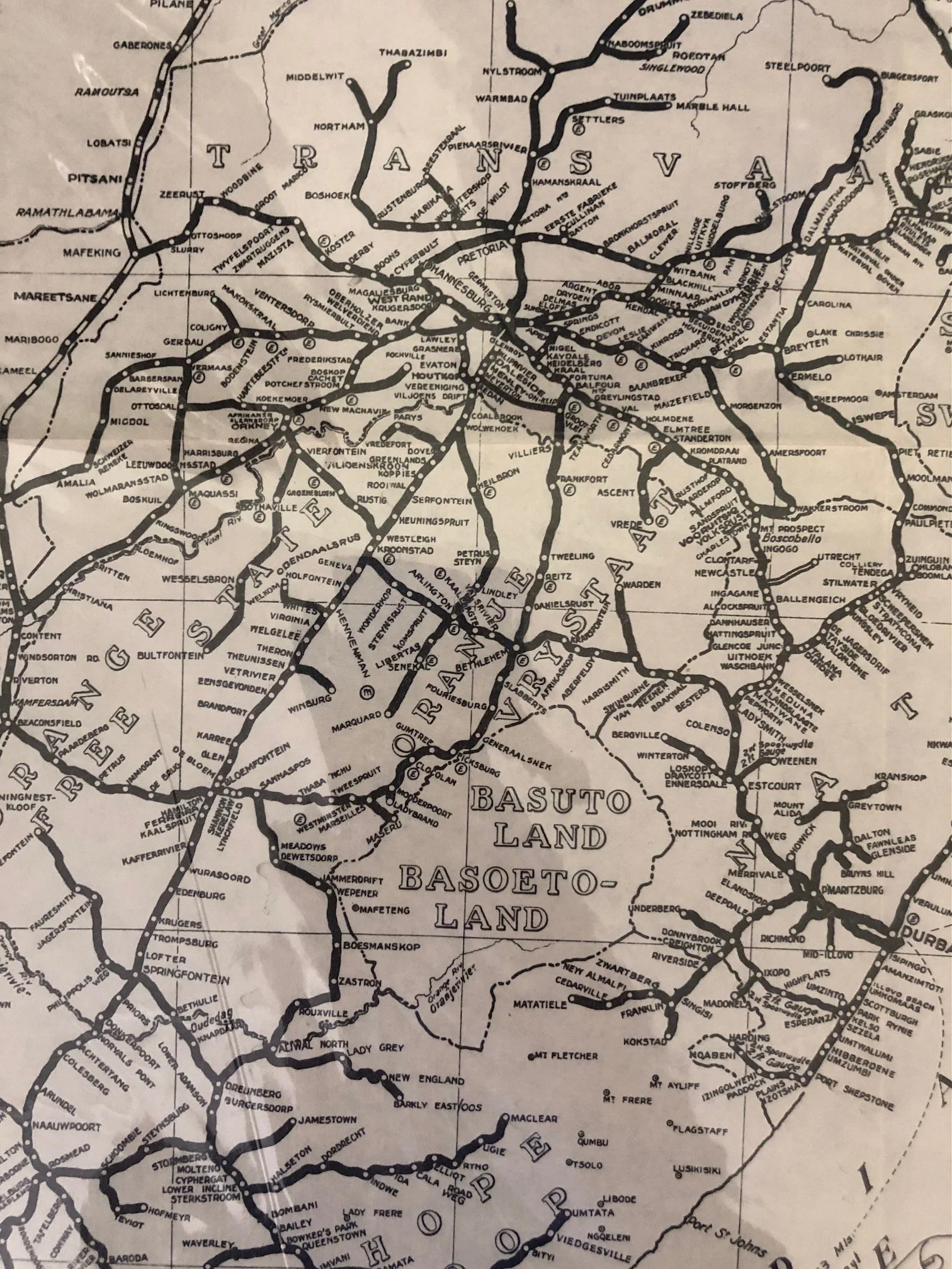
• Basutoland and Swaziland (now Lesotho and Eswatini).
The legend distinguishes between South African Railways (noting both the standard \bm{3' 6"} gauge and \bm{2' 0"} narrow gauge), Rhodesia Railways, and private lines.
A unique feature in the legend is the inclusion of "Grain Elevator Stations," highlighting the railway's primary role in the agricultural economy of the region.
The bottom of the map features detailed inset maps for major urban and industrial hubs, including Cape Town, Port Elizabeth, Durban-Pietermaritzburg, and East London.
There is a specific "Note" regarding the line from Vryburg to Bulawayo, clarifying that while it belonged to Rhodesia Railways, it was operated by South African Railways—a key detail for regional logistics of the period.
The glare is from a protective plastic sleeve.
950mm x 700mm
R2,500