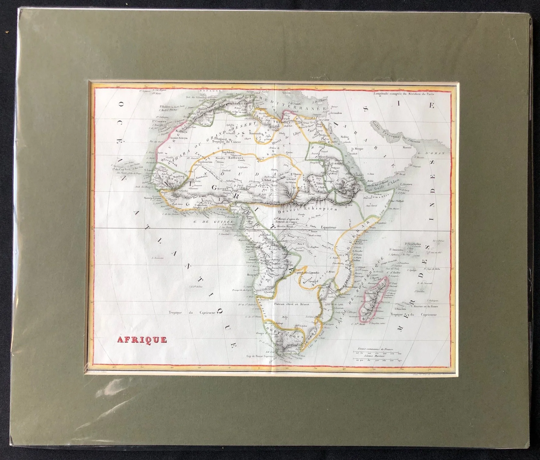
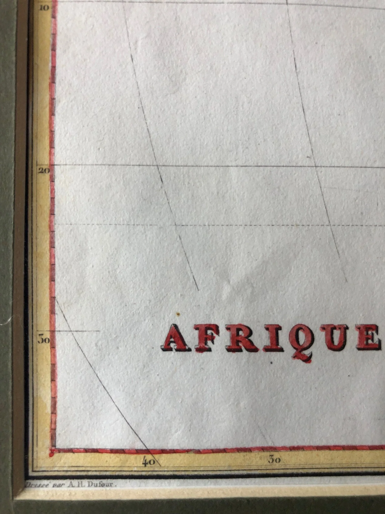
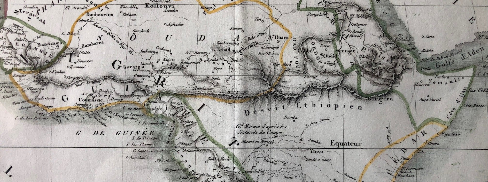
French Map of Africa "AFRIQUE" (1830s)
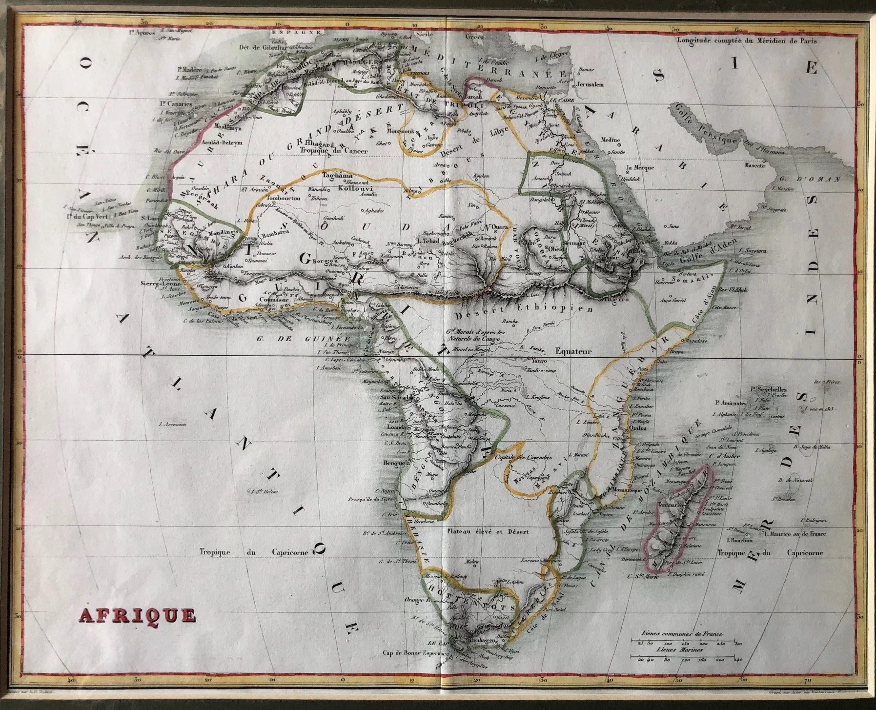
This French map of Africa, titled simply "AFRIQUE" and dating from the 1820s or 1830s, offers a fascinating look at how 19th-century cartographers attempted to bridge the gap between known coastal geography and the mysterious, unmapped interior.
The map showcases several compelling historical elements, particularly in its depiction of interconnected mountain systems.
The Great Mountain Wall: Merging Kong and the Moon
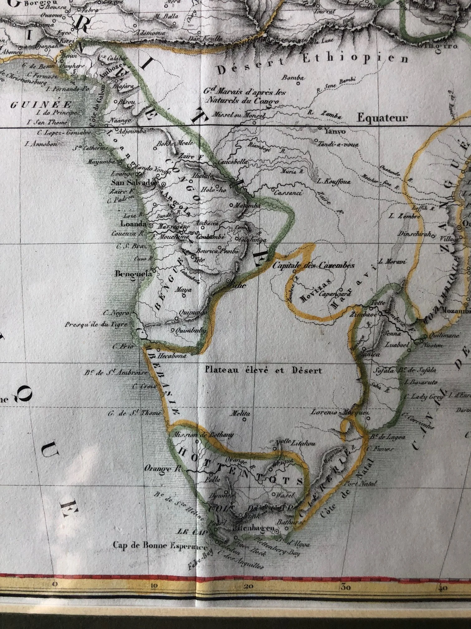
In the detailed view of West and Central Africa, you can see a colossal, unbroken mountain range running horizontally across the entire width of the continent. This represents a highly influential geographic theory of the early 19th century: the conceptual merger of the Kong Mountains (Mts de Kong, visible just north of Guinea and the Ivory Coast) with the ancient, mythical Mountains of the Moon (Mts de la Lune, positioned further east near the headwaters of the Nile).
The Kong Mountains: First popularized by British cartographer James Rennell in 1798, the Kong Mountains were a purely fictional range believed to stretch across West Africa, acting as a massive wall that dictated the flow of the Niger River.
The Unified Range: Mapmakers of this era hypnotized themselves into believing that the Kong Mountains didn't just stop in West Africa, but extended thousands of miles eastward to link directly with Ptolemy's ancient Mountains of the Moon. This created a single, continent-spanning spine that effectively divided the Islamic kingdoms of the "Soudan" and the Sahara from the entirely unknown southern half of the continent. It wasn't until the late 1880s that explorers finally proved this gargantuan mountain wall was entirely imaginary.
Speculative Hydrology: "Gd. Marais d'après les Naturels du Congo"
Just south of that massive mountain spine, near the equator, the map features a highly intriguing note: "Gd. Marais d'après les Naturels du Congo" (Great Marsh according to the natives of the Congo).
Long before Europeans like Henry Morton Stanley actually navigated the Congo River system to map its true course, rumors filtered to the coast via African traders about vast inland waters, wetlands, and massive lakes.
Rather than leaving the space completely blank, the French mapmaker captured these indigenous oral accounts by sketching an speculative, ambiguous marshland—a tentative placeholder for what the world would later recognize as the massive Congo River Basin and the African Great Lakes.
Political Boundaries of the "Soudan"
The hand-coloured borders across the northern belt reflect an intricate mapping of indigenous empires and trading states prior to European colonization. Regions like Bambarra, Kano, Bornou, and Dar Four (Darfur) are outlined prominently. This highlights a period when European knowledge of the African interior was largely confined to tracking the major trans-Saharan caravan routes and the major commercial empires of the Sahel, long before the late-19th-century colonial scramble arbitrarily rewrote the political map of the continent.
270mm x 210mm
Hand coloured engraving.
R2,250