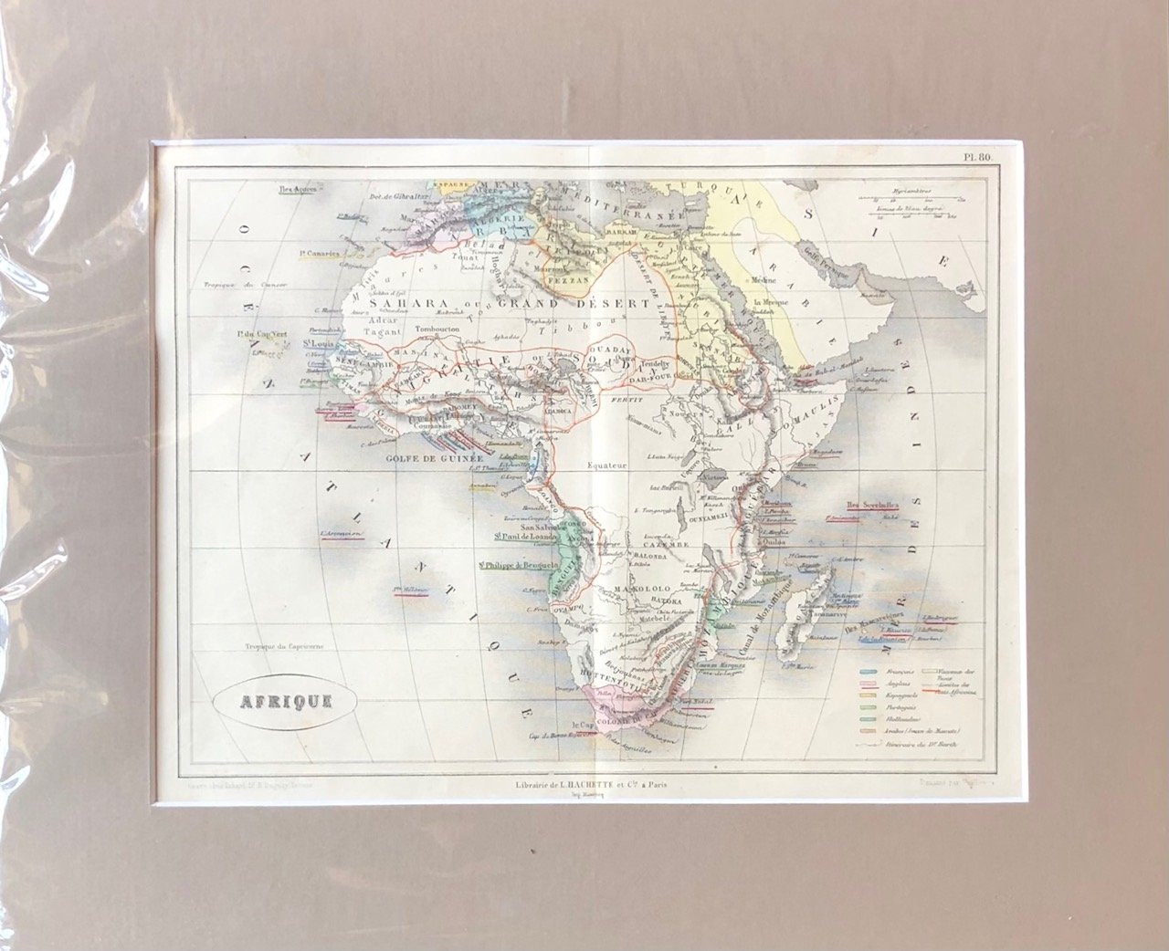
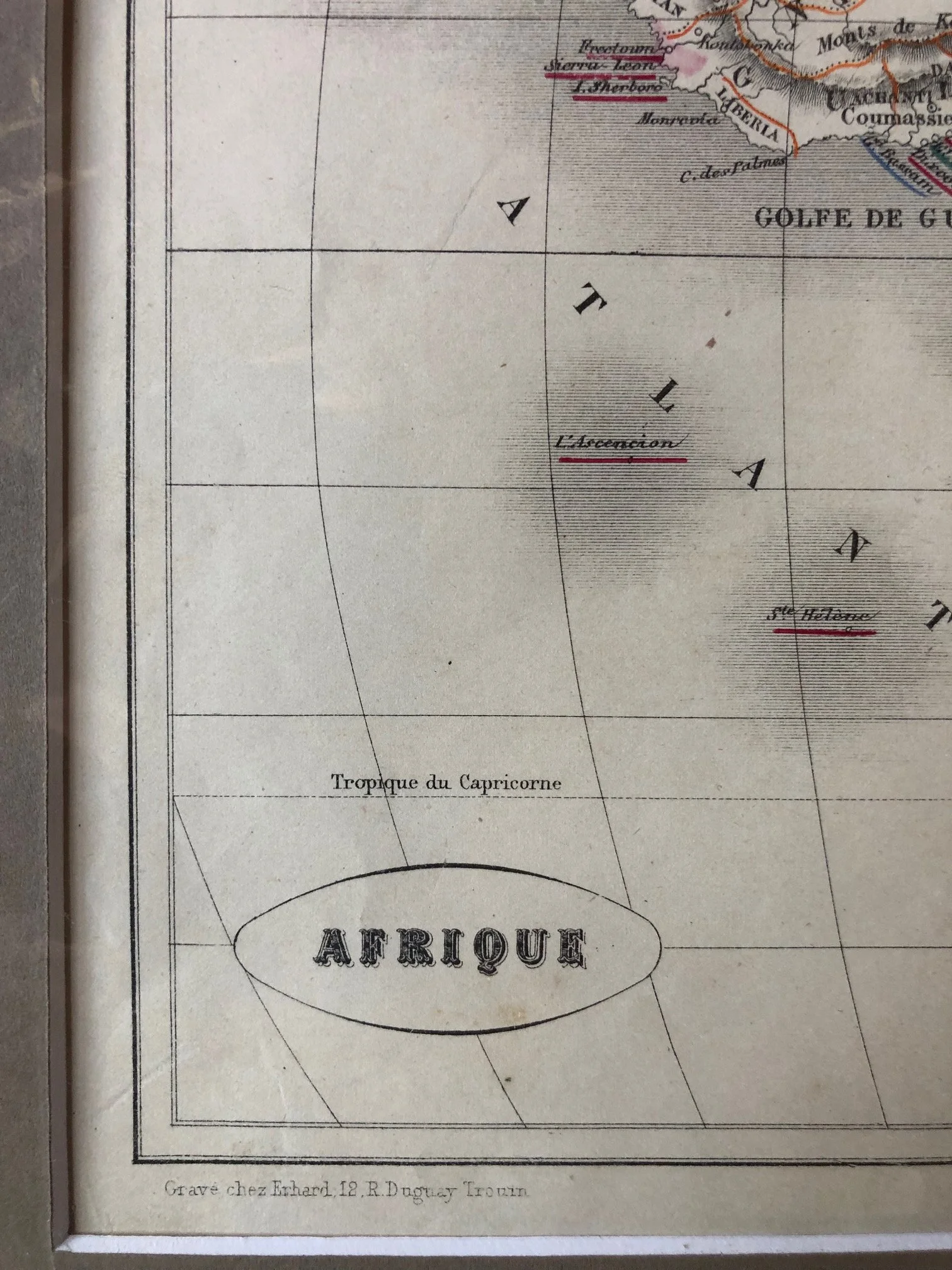
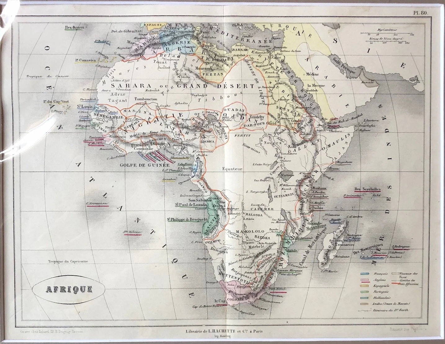
French Map of Africa published by Librairie de L. Hachette (1860s)
This map, published in Paris by the renowned educational house Librairie de L. Hachette captures Africa during a fascinating transitional period in cartography—likely the early 1860s.
It catches the continent right on the cusp of major interior exploration, combining groundbreaking new discoveries with persistent geographic myths.
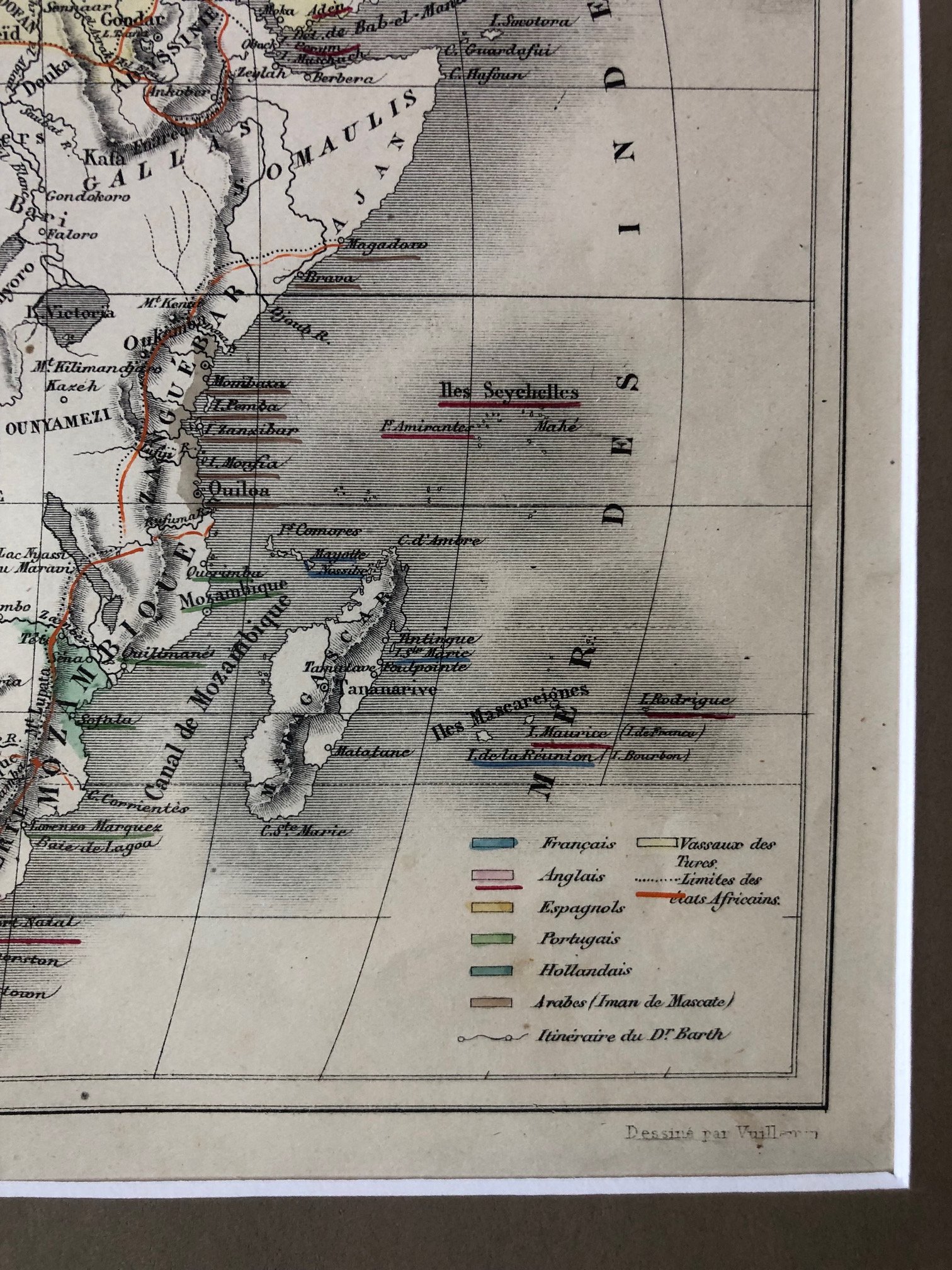
The Route of Dr. Heinrich Barth
Note the legend in the bottom right corner the last entry reads: "Itinéraire du D^r Barth" (Route of Dr. Barth).
The History: Heinrich Barth was a pioneering German explorer who undertook a massive, five-year expedition (1850–1855) through North and West Africa on behalf of the British government.
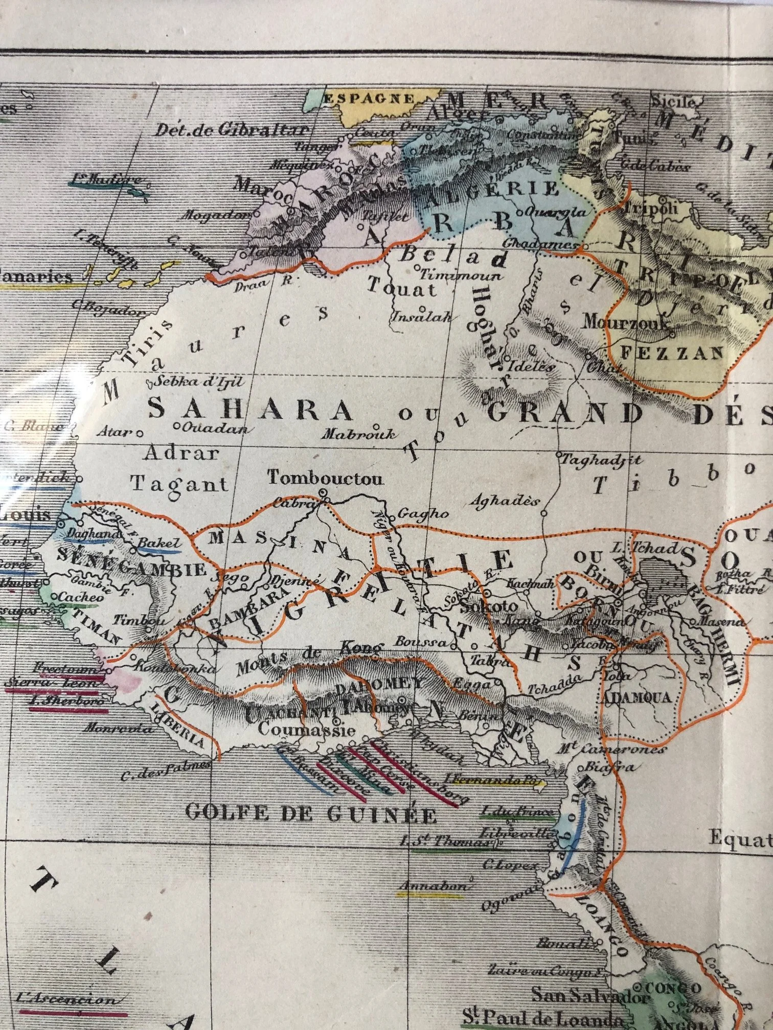
On the Map: you can see the results of his meticulous documentation. Places like Sokoto, Kano, Tombouctou (Timbuktu), and the kingdom of Bornou around Lac Tchad are mapped with far greater precision than on earlier charts. Barth was one of the first Europeans to provide a highly detailed, scientific account of these powerful Sahelian empires.
The Preservation of the Fictional "Monts de Kong"
Despite the updated information from Dr. Barth's travels, this map still retains one of history’s greatest geographic blunders. Running horizontally across West Africa right under the word Nigritie, you can see the beautifully engraved Monts de Kong (Mountains of Kong).
The Irony: While explorers were successfully filling in the blanks of the interior, European mapmakers still blindly copied this entirely imaginary, continent-spanning mountain range from one another. It would take another two decades before French explorer Louis-Gustave Binger traveled the region in the late 1880s and definitively proved they did not exist.
The Emergence of the Great Lakes
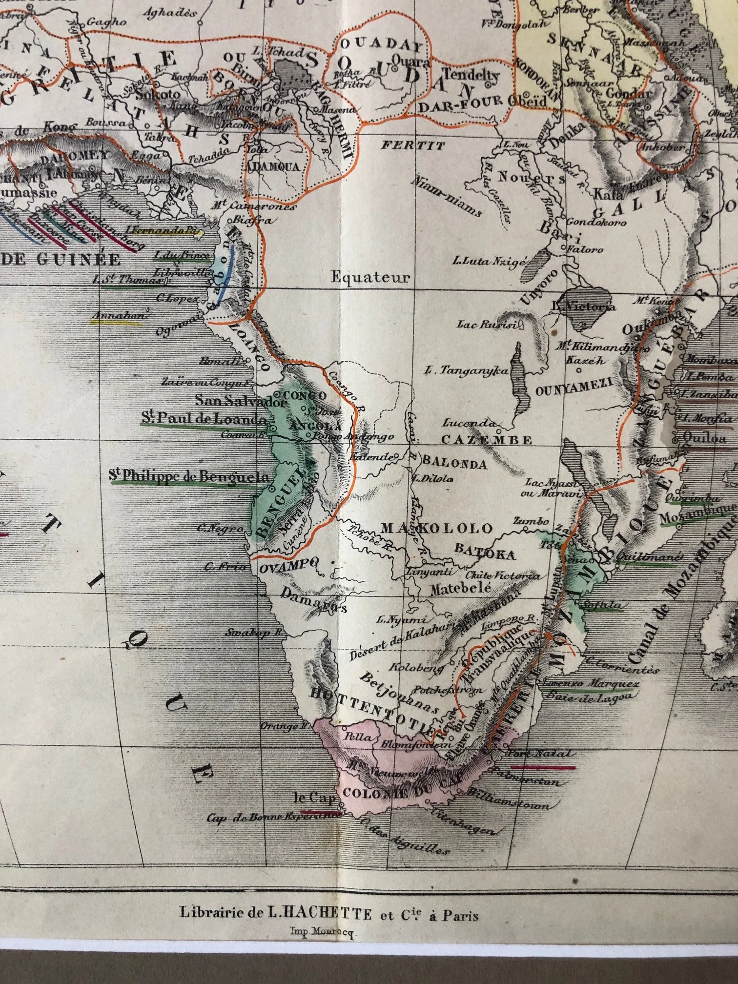
In the eastern portion we see the initial, tentative mapping of the African Great Lakes, including L. Tanganyika and N'yanza (labeled with an alternative reference to L. Victoria).
The History: This marks the exact era of the famous British expeditions led by Richard Burton, John Hanning Speke, and David Livingstone. Speke first sighted Lake Victoria in 1858 and claimed it as the source of the Nile. The inclusion of these lakes, still somewhat misshapen compared to modern geography, shows a mapmaker rapidly updating their plates as fresh expedition reports arrived in Europe.
Southern Africa’s Boer Republics
Looking at the southern portion, the map highlights the changing geopolitical landscape of the region. Just north of the Colonie du Cap (Cape Colony), it explicitly marks out the République Trans-Vaalienne (Transvaal Republic) and the État Libre d'Orange (Orange Free State). These independent republics were established by the Voortrekkers in the 1850s.
280mm x 215mm
Hand coloured engraving. Some light stains on the paper.
R2,000