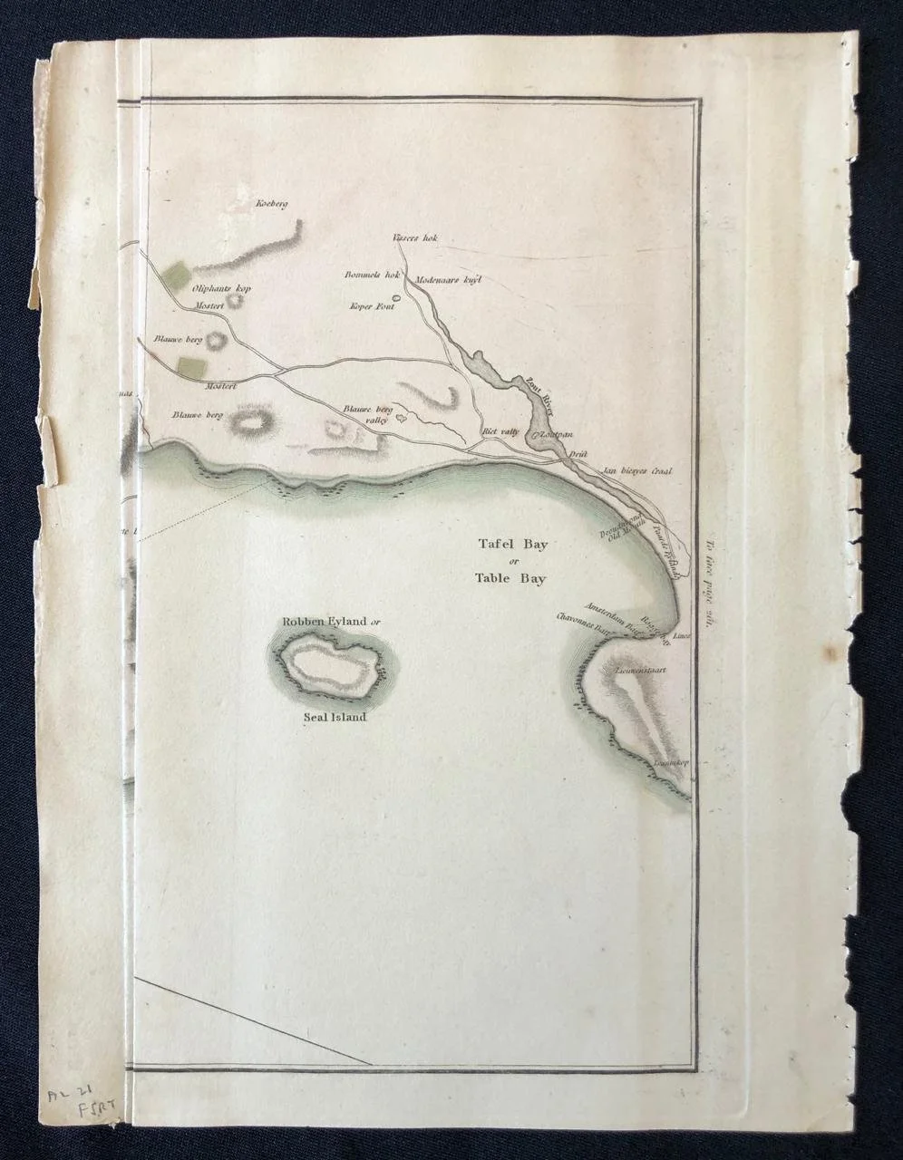
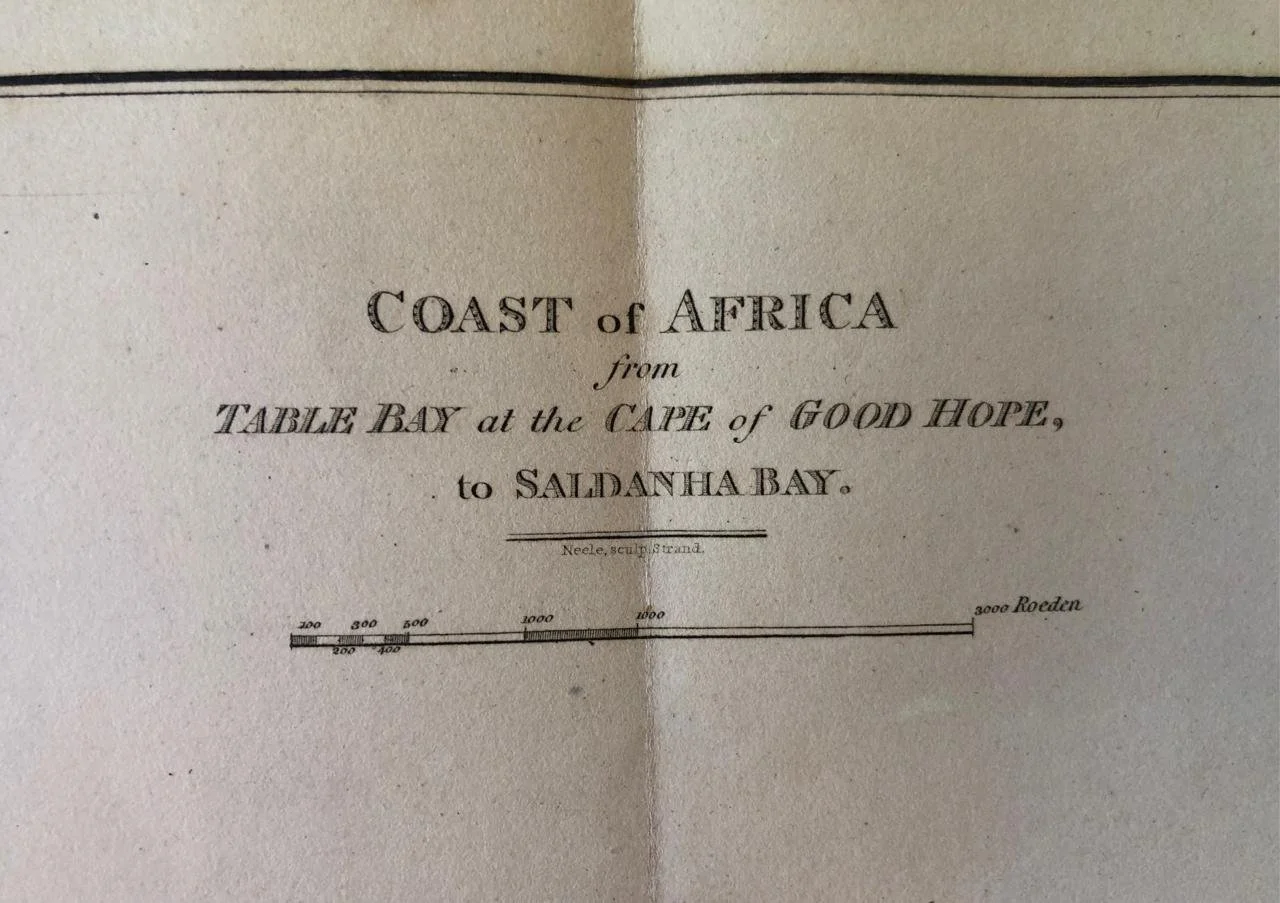
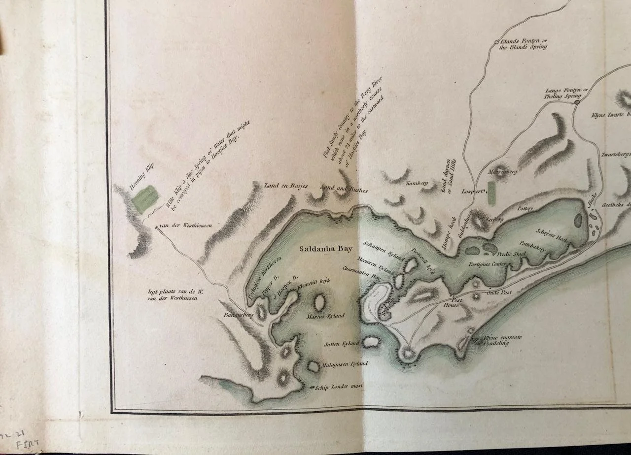
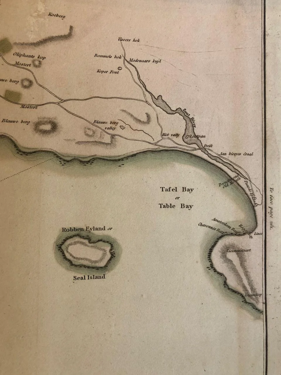
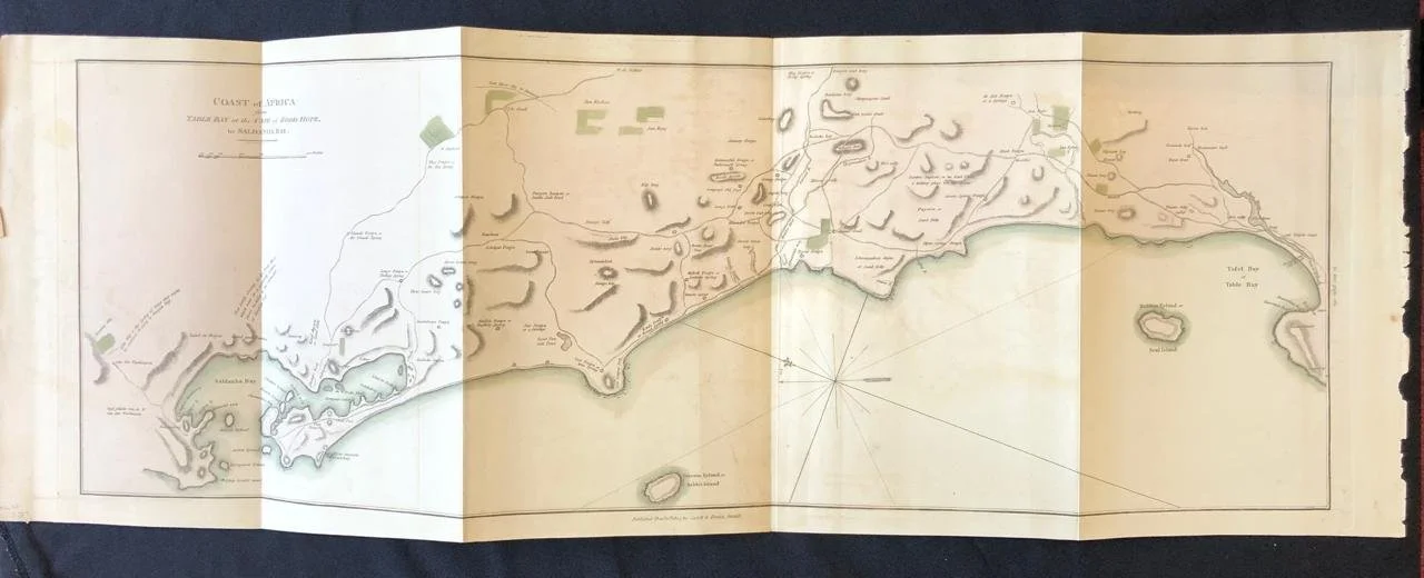
Chart of Table Bay to Saldanha Bay (1805)
By John Barrow (1764-1848).
Published 1805.
Hand coloured copperplate engraving from John Barrow's 'Travels into The Interior of Southern Africa'. It was around this time that the Royal Navy, for the first time, compiled scientific data of the coastline to be used in sea charts. This map was the most comprehensive and accurate map of the area at the time.
Cape Town was under the control of the Batavian Republic at the time (a French Vassal). In 1806 a year after the publication of this book, Cape Town became part of the British Empire.
790mm x 280mm
R6,500